2023 Vol. 42, No. 2
Display Method:
2023, 42(2): 1-2.
Abstract:
2023, 42(2): 1-16.
doi: 10.1007/s13131-022-2076-3
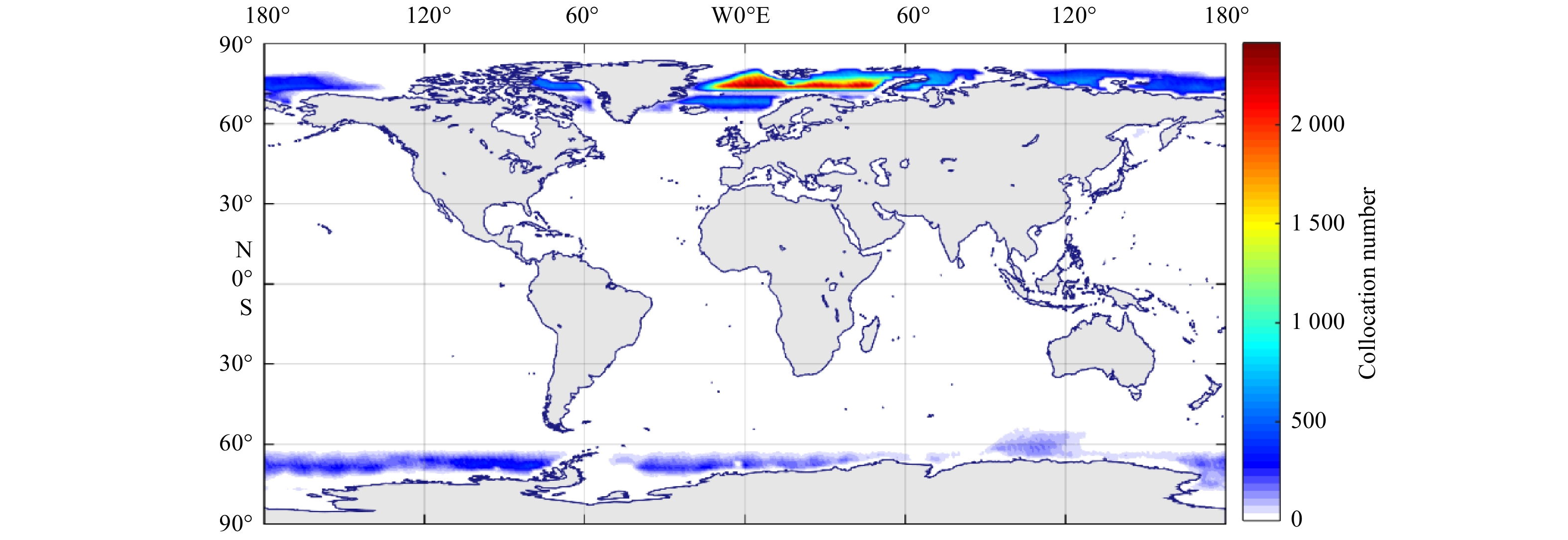
Abstract:
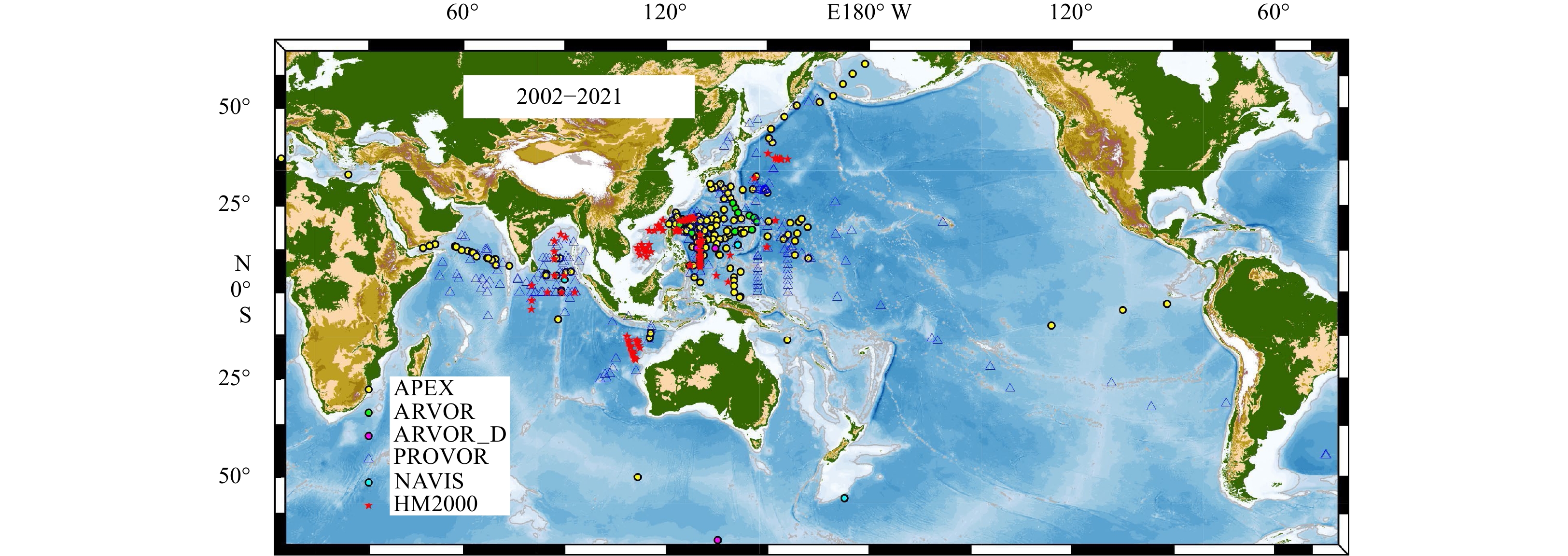
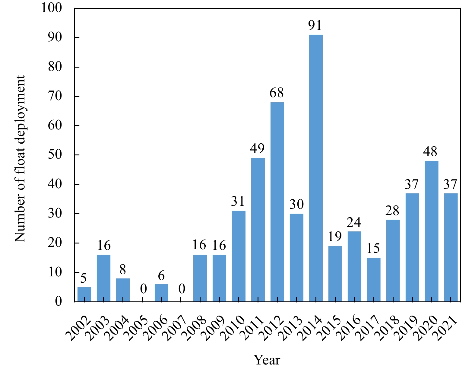
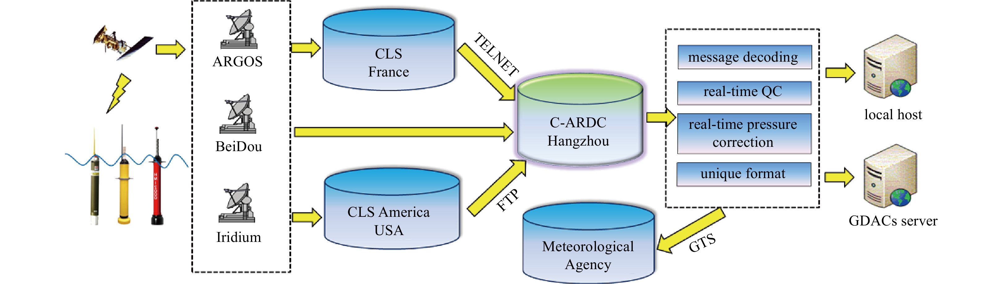
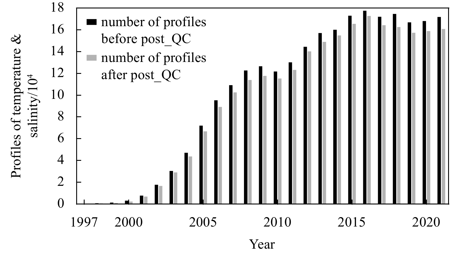
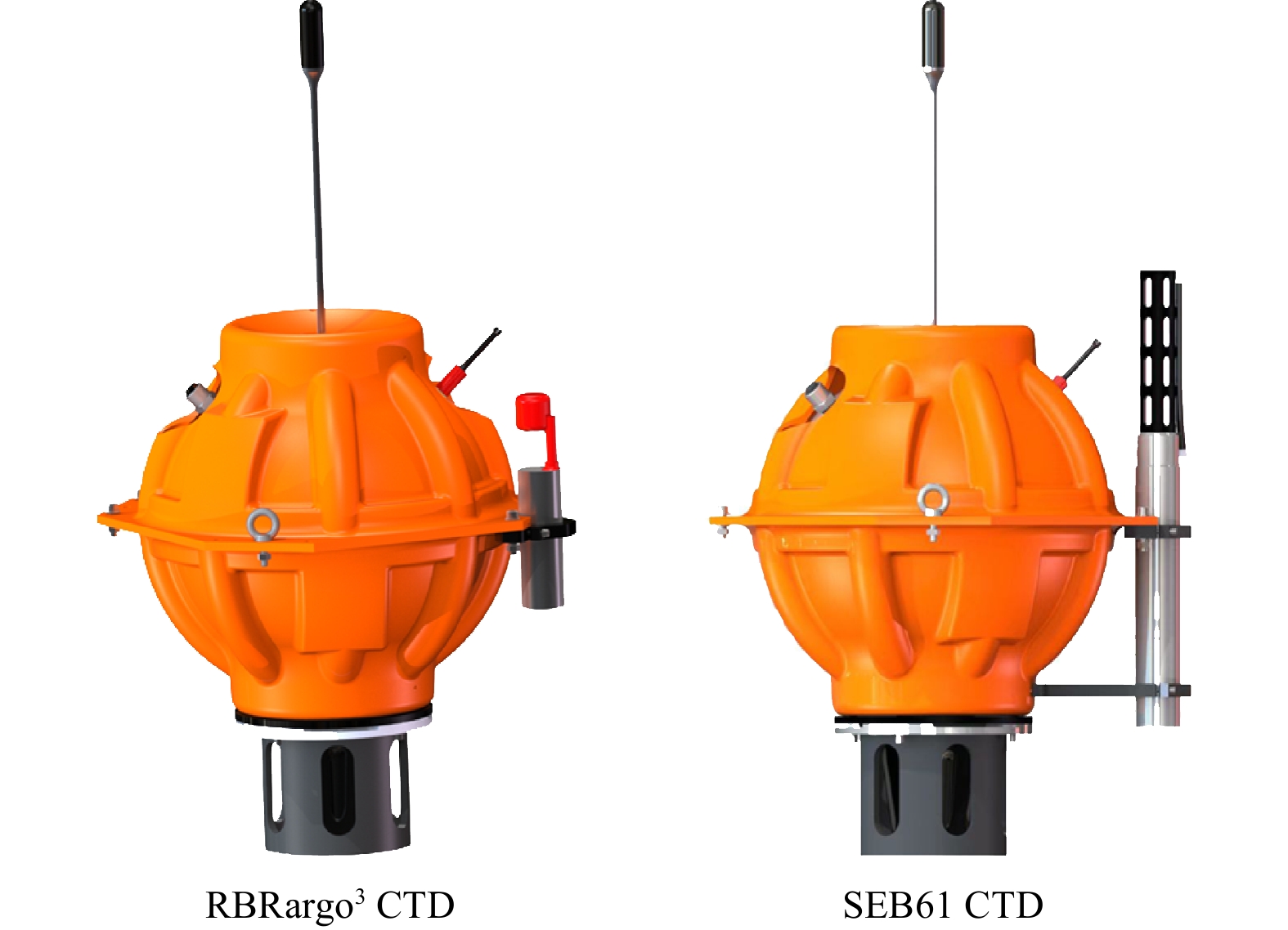
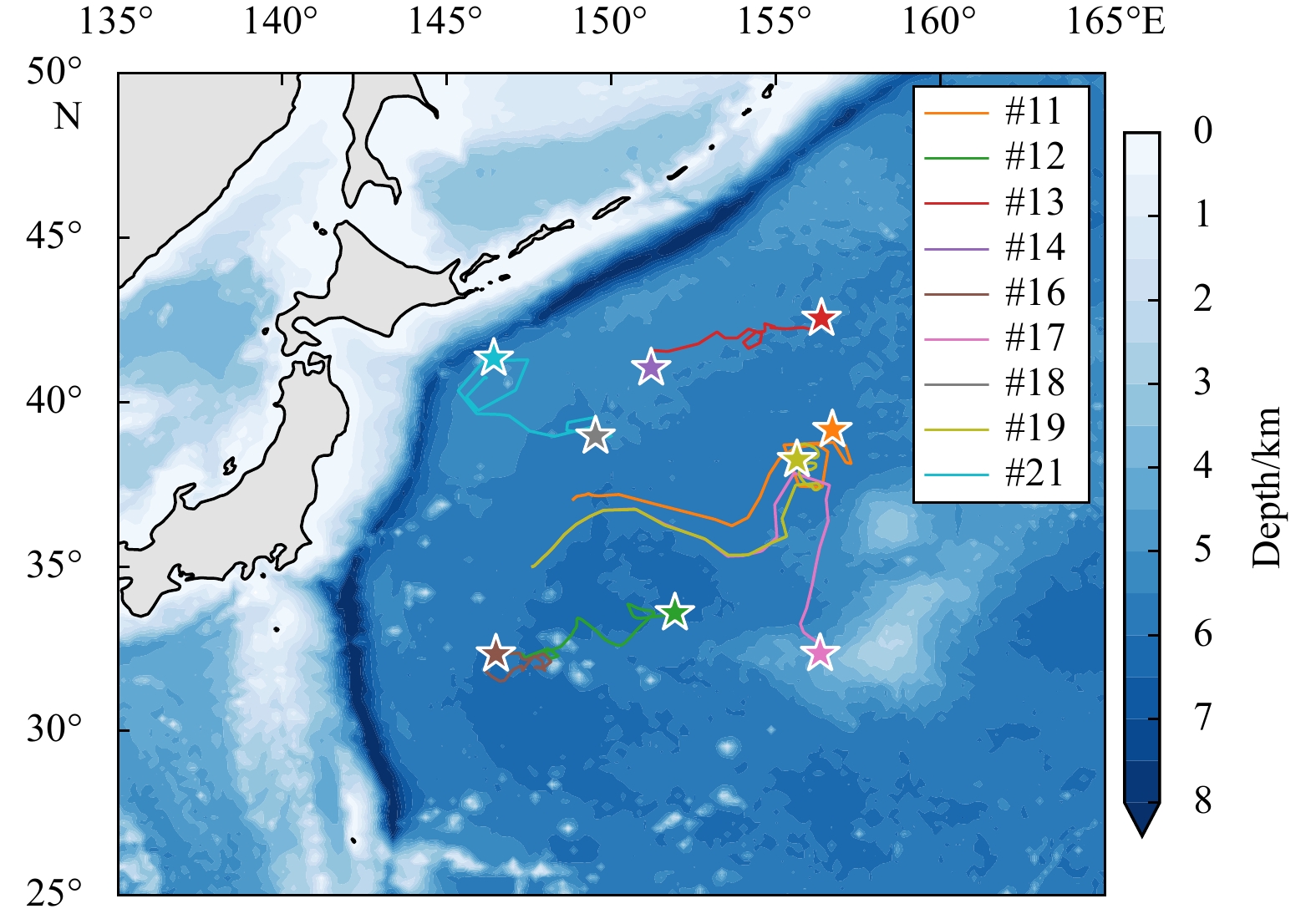
The international Argo program, a global observational array of nearly 4 000 autonomous profiling floats initiated in the late 1990s, which measures the water temperature and salinity of the upper 2 000 m of the global ocean, has revolutionized ocean...
The international Argo program, a global observational array of nearly 4 000 autonomous profiling floats initiated in the late 1990s, which measures the water temperature and salinity of the upper 2 000 m of the global ocean, has revolutionized ocean...


2023, 42(2): 17-28.
doi: 10.1007/s13131-021-1964-2
Abstract:
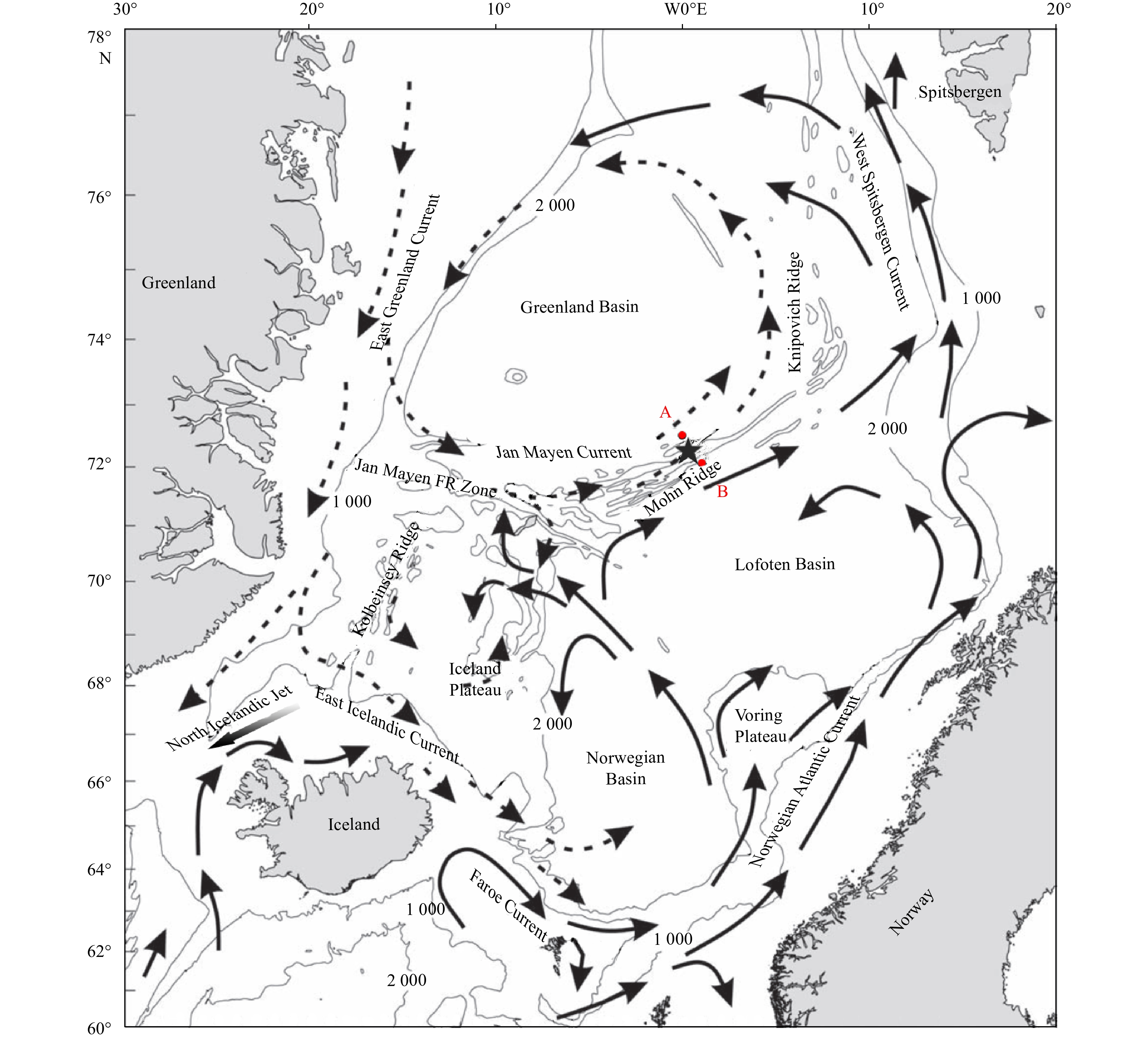
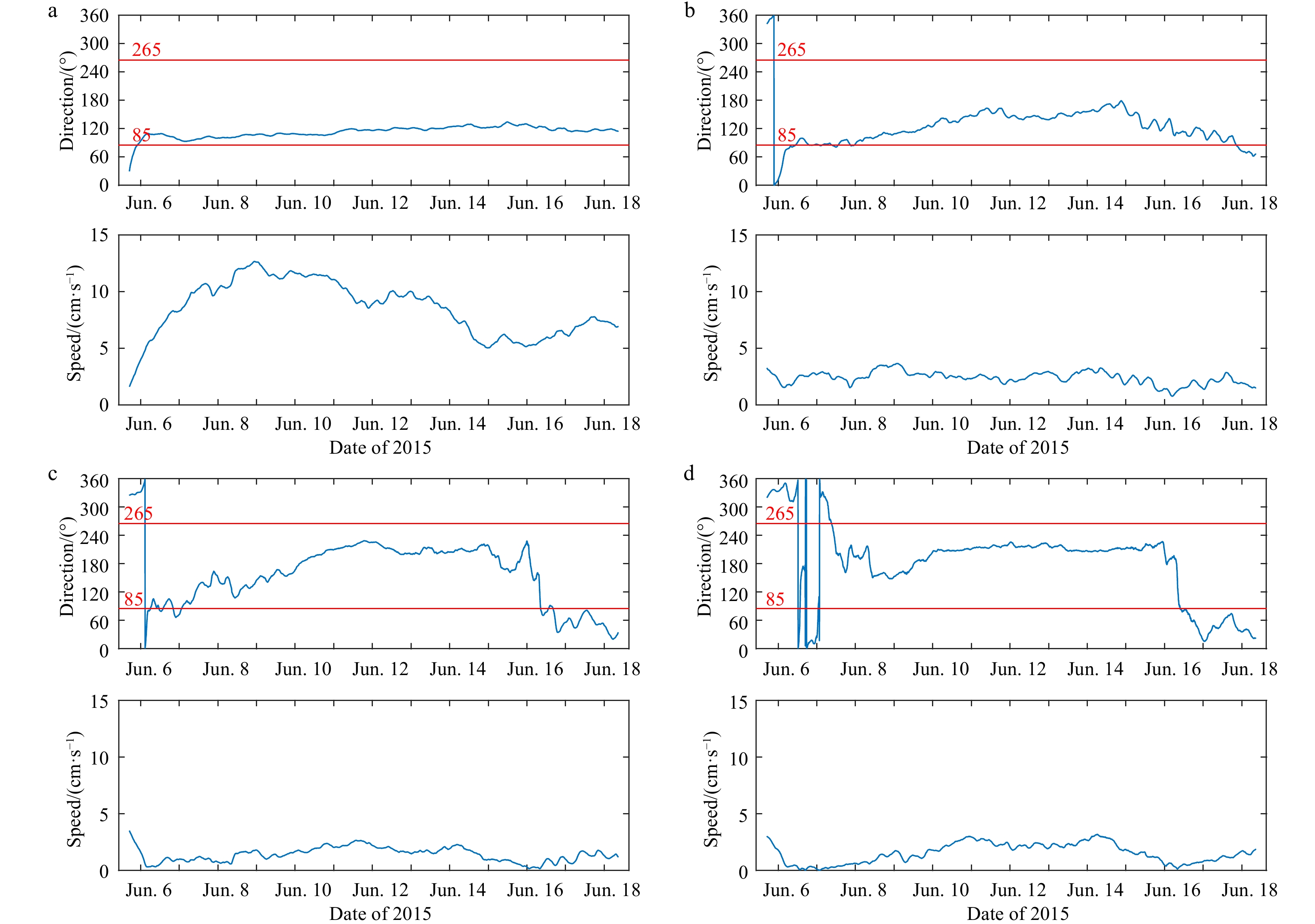
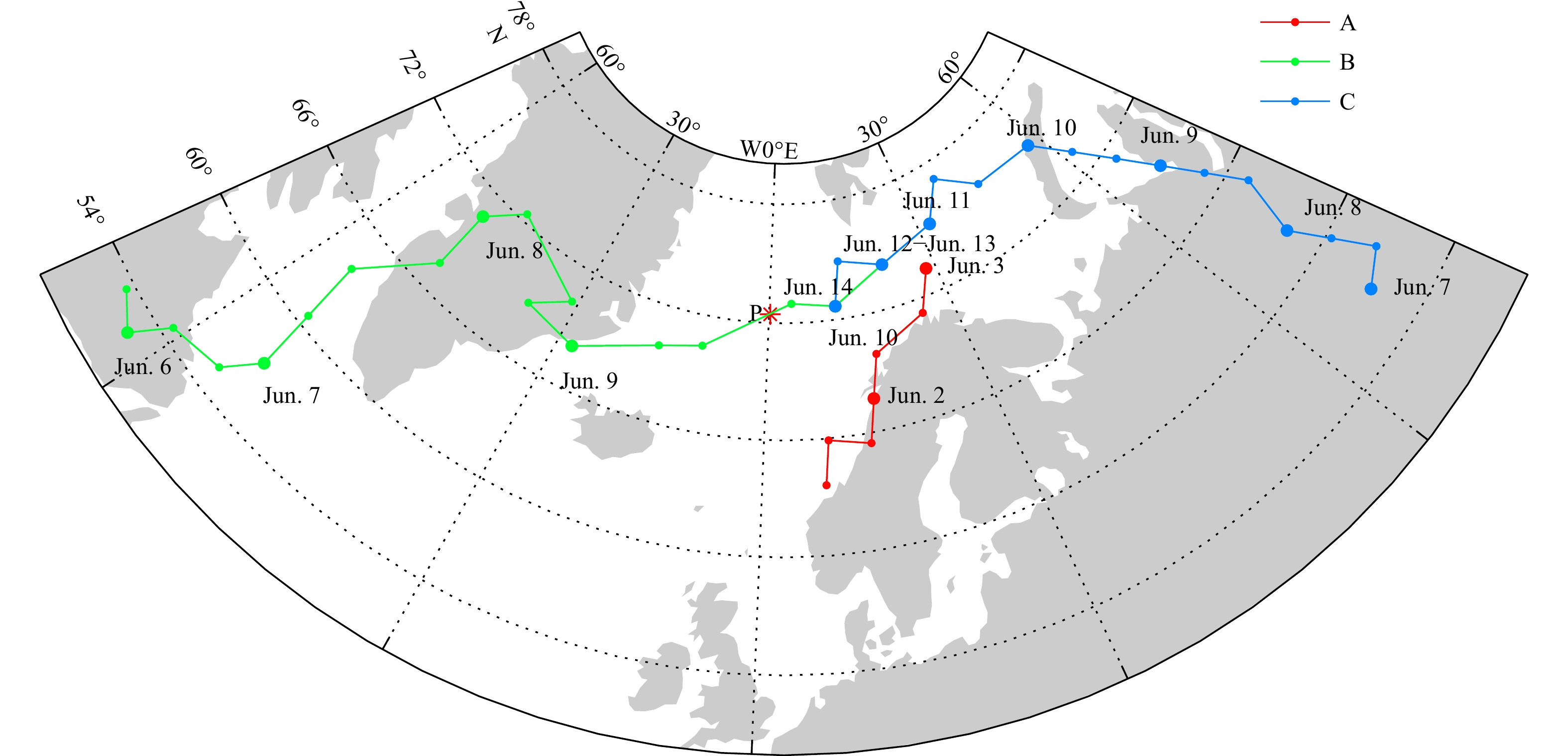
The Mohn Ridge separates the Greenland Sea and the Lofoten Basin. Previous studies identified the export across the Mohn Ridge (EMR) from the Greenland Basin into the Lofoten Basin using water mass analysis and the tracer diffusion method, but there ...
The Mohn Ridge separates the Greenland Sea and the Lofoten Basin. Previous studies identified the export across the Mohn Ridge (EMR) from the Greenland Basin into the Lofoten Basin using water mass analysis and the tracer diffusion method, but there ...


2023, 42(2): 29-43.
doi: 10.1007/s13131-022-2068-3
Abstract:
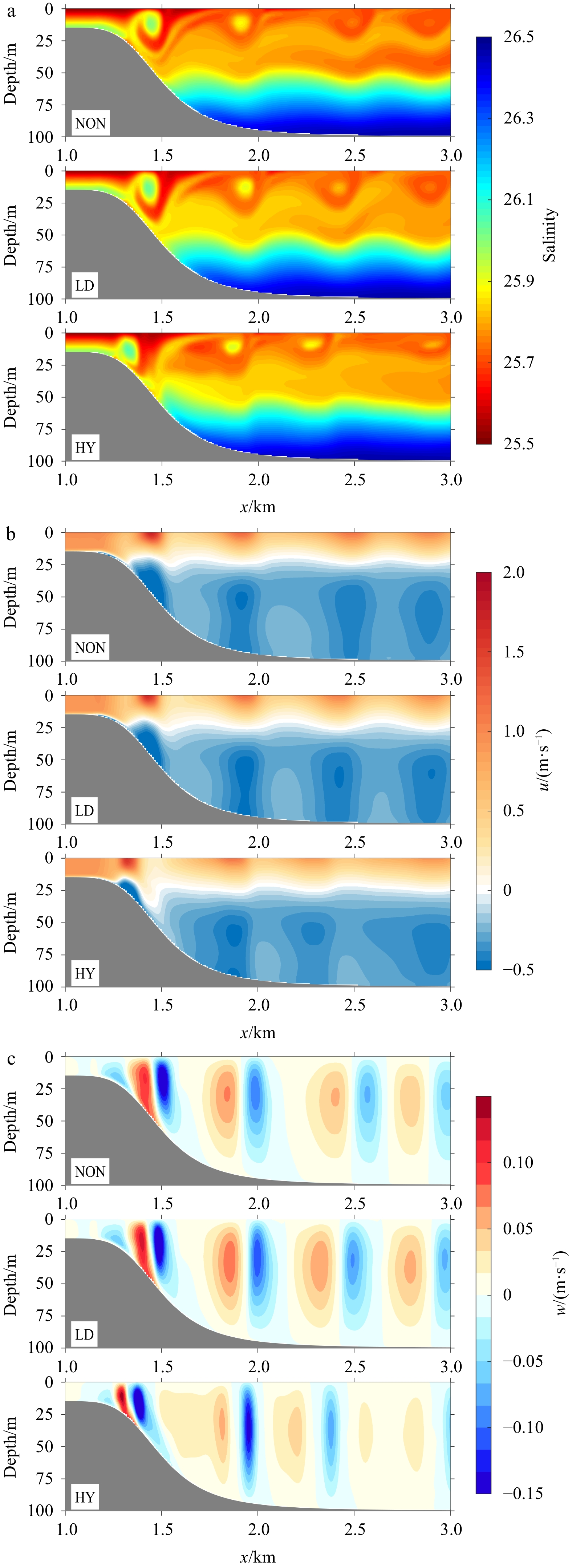
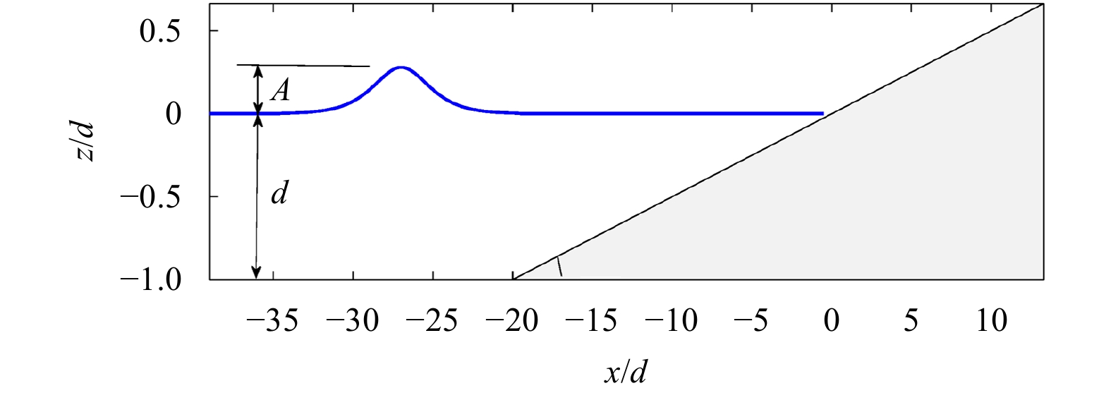
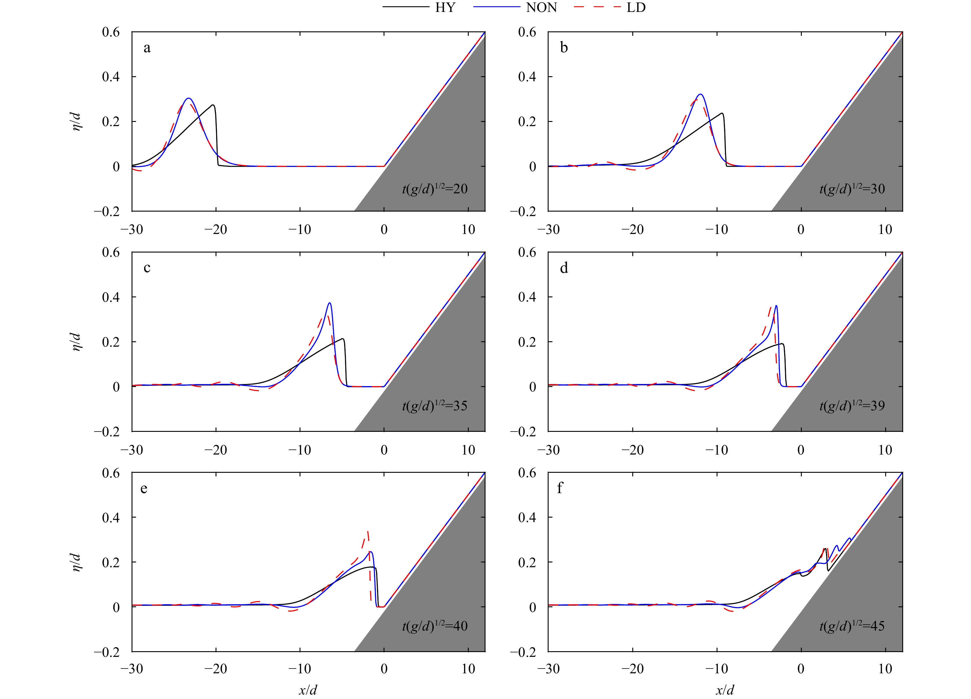
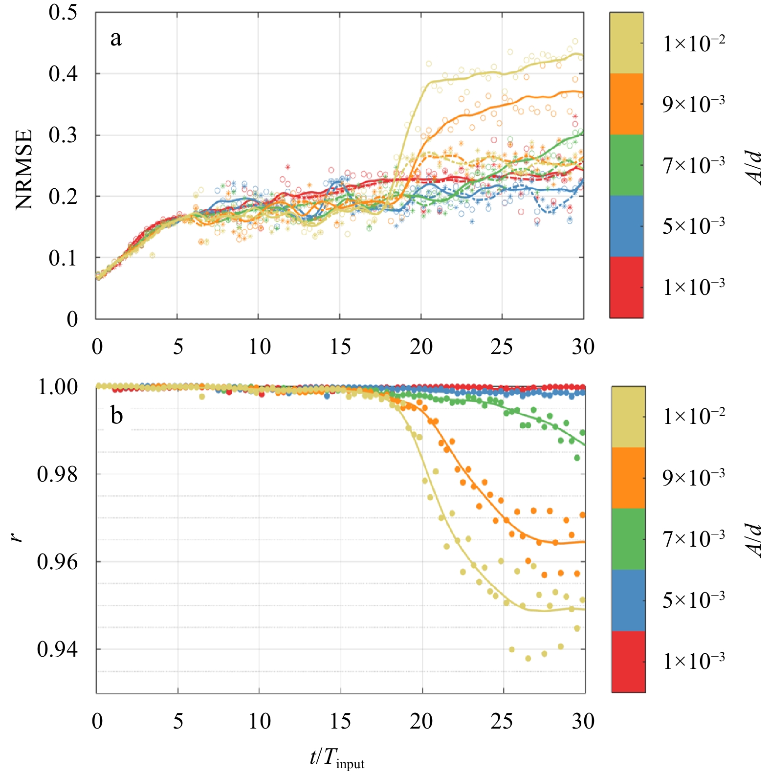
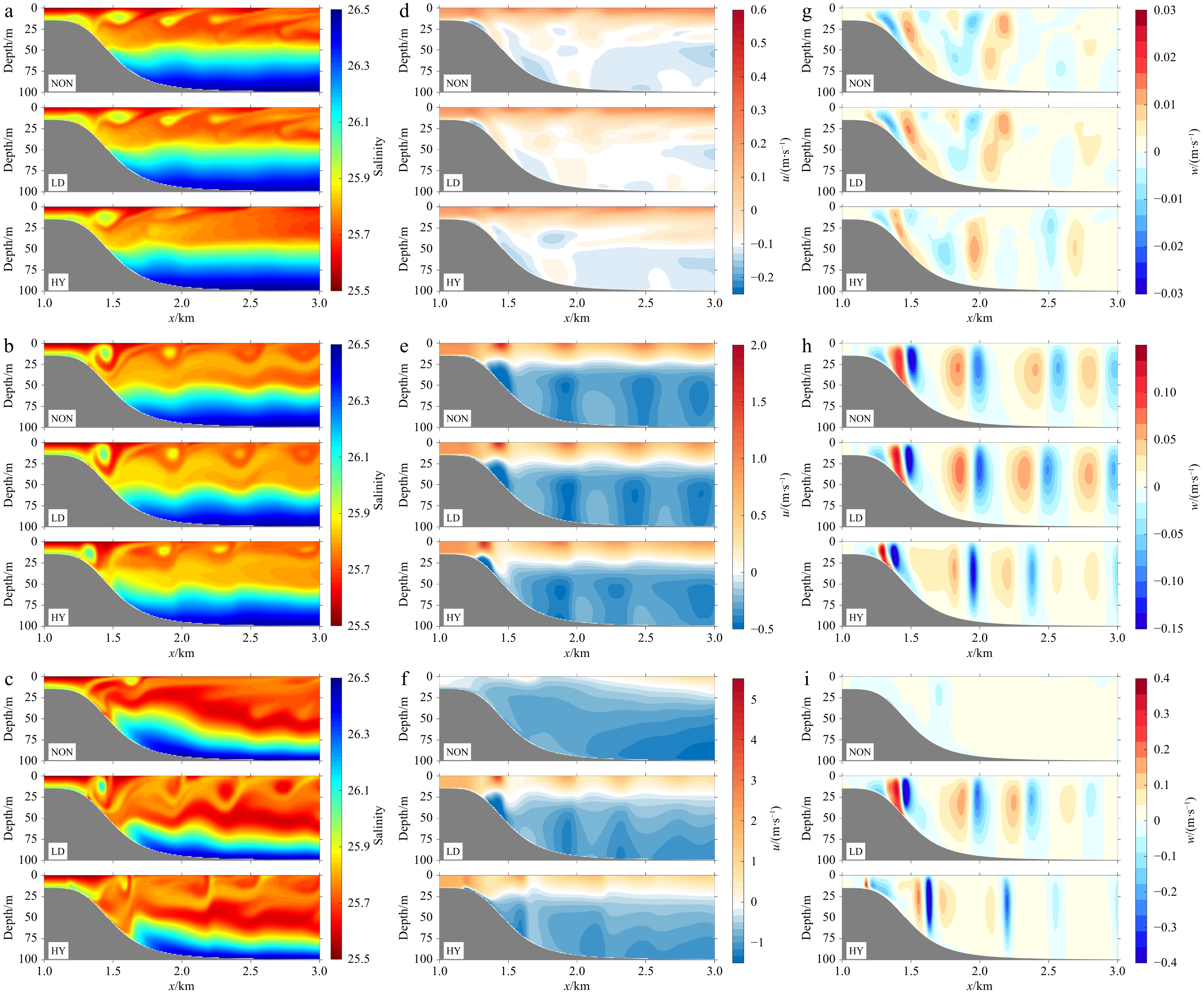
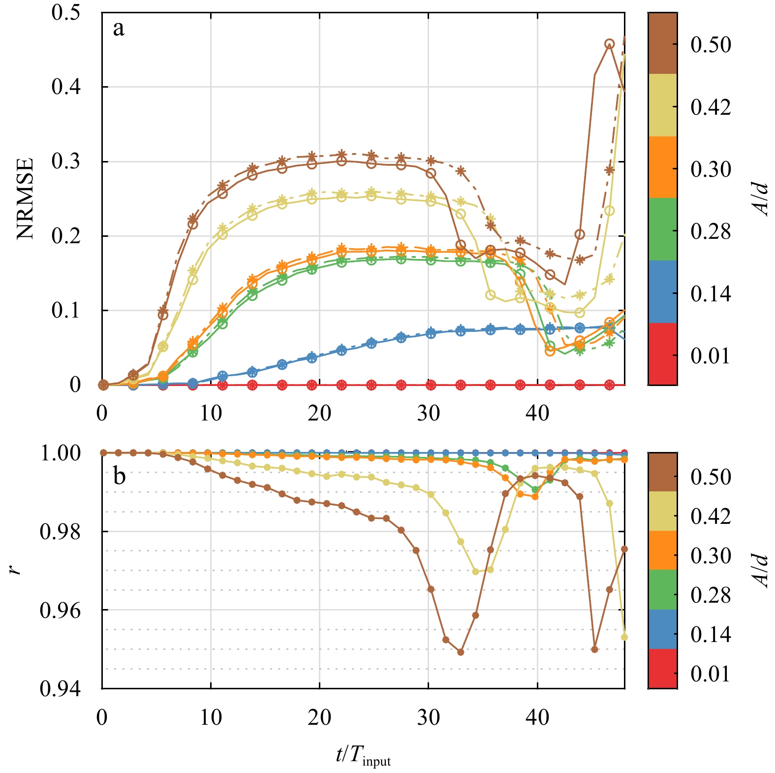
This paper examines the simplification strategy of retaining only the nonhydrostatic effect of local acceleration in a three-dimensional fully nonhydrostatic model regarding the submesoscale wave phenomenon in the ocean. Elaborate scale analysis of t...
This paper examines the simplification strategy of retaining only the nonhydrostatic effect of local acceleration in a three-dimensional fully nonhydrostatic model regarding the submesoscale wave phenomenon in the ocean. Elaborate scale analysis of t...


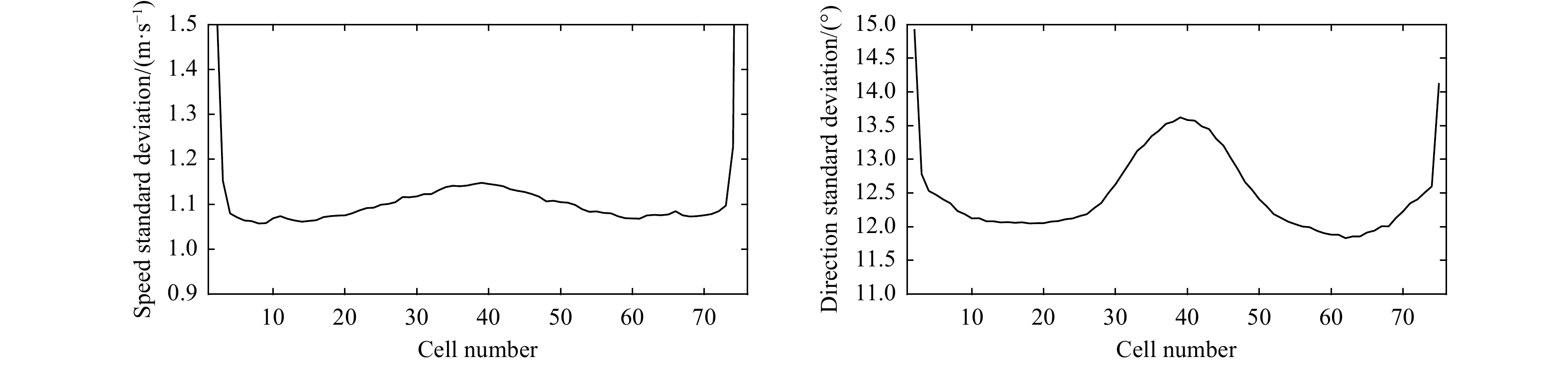
2023, 42(2): 44-55.
doi: 10.1007/s13131-021-1976-y
Abstract:
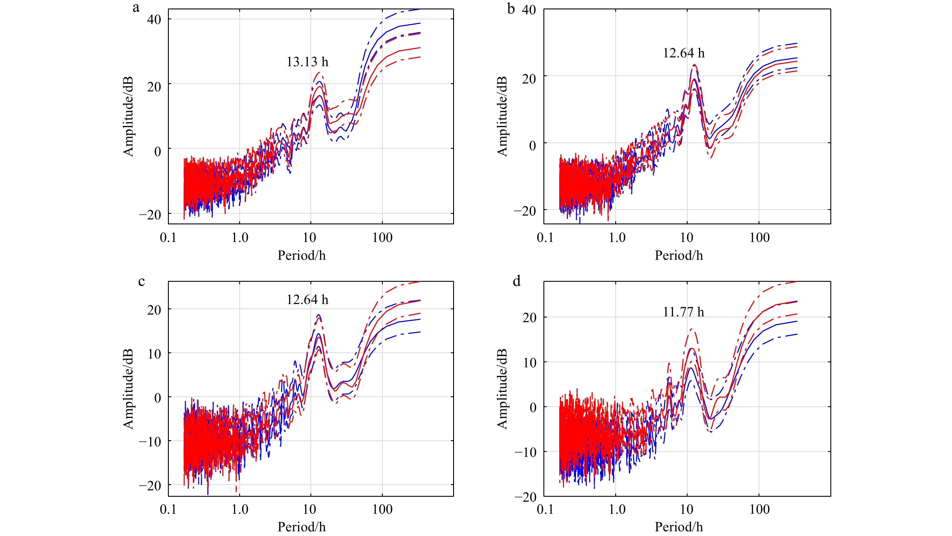
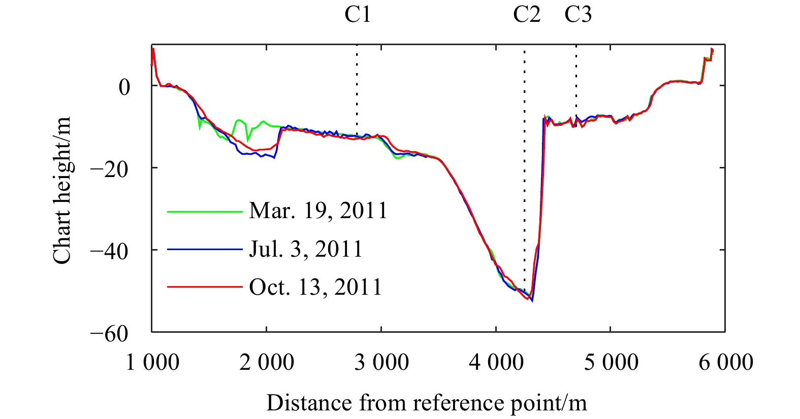
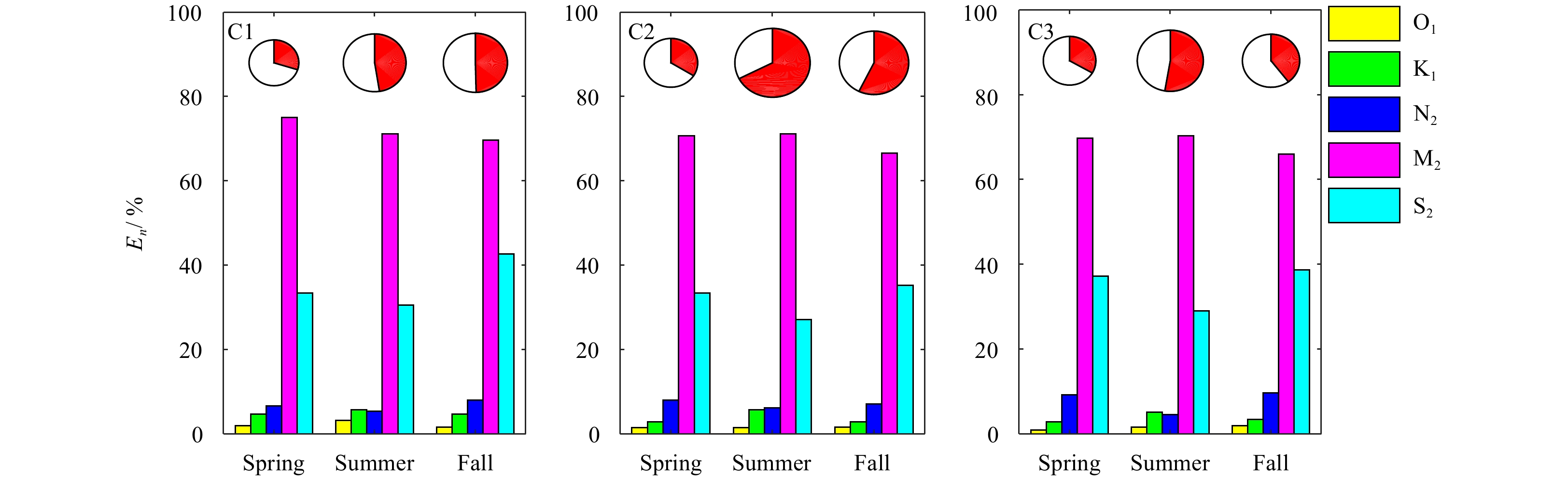
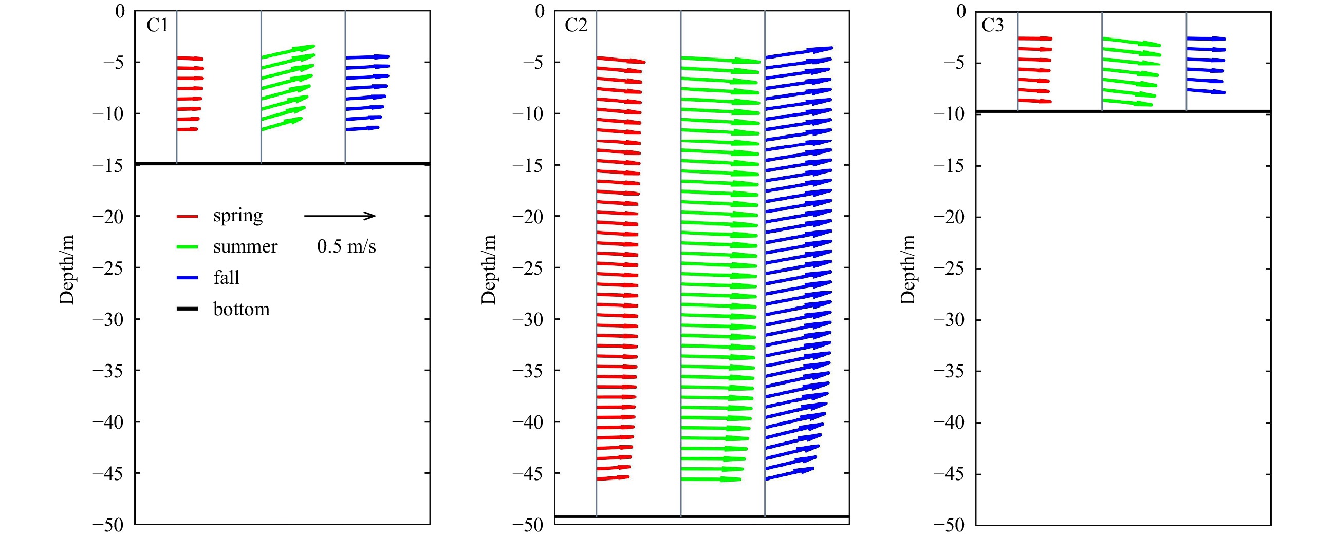
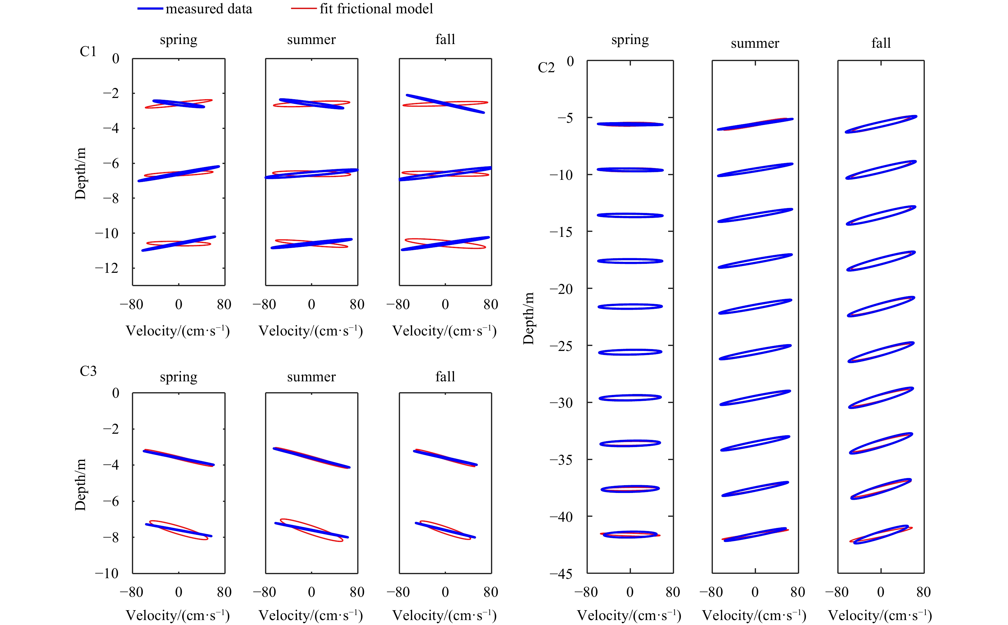
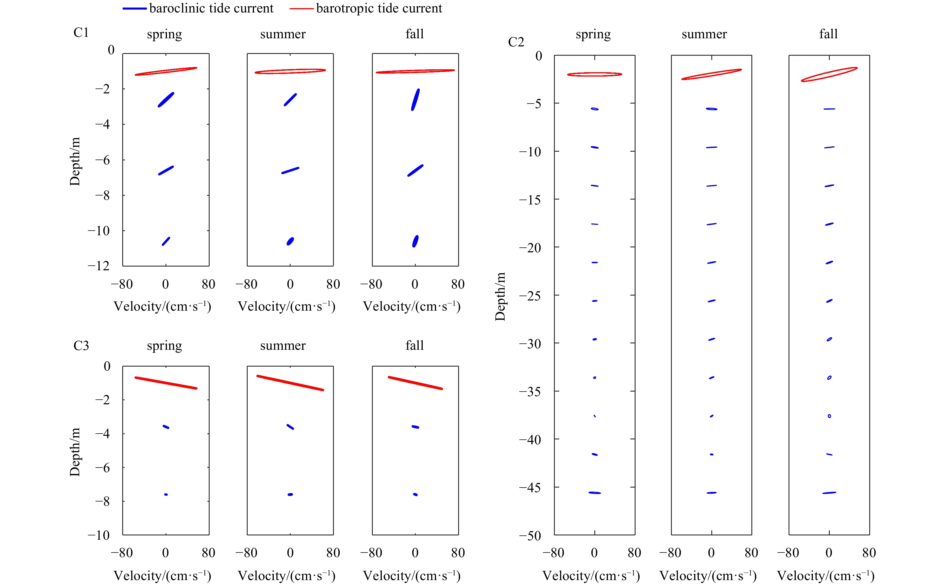
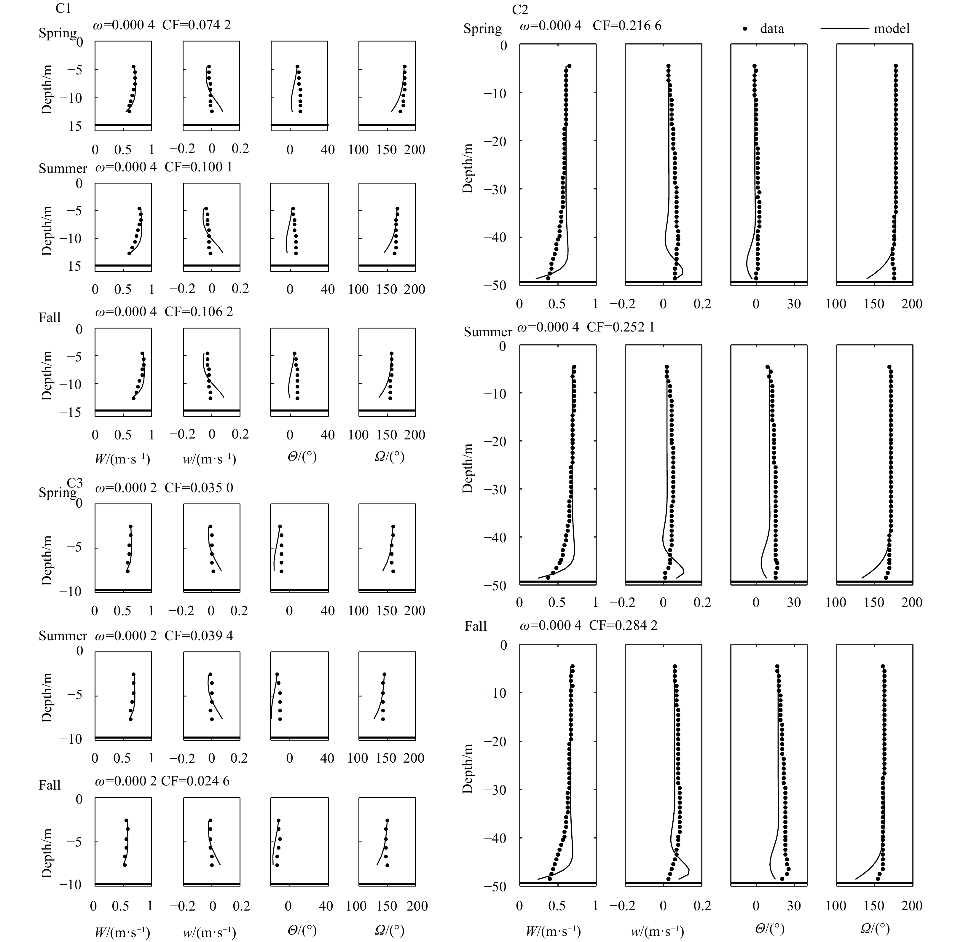
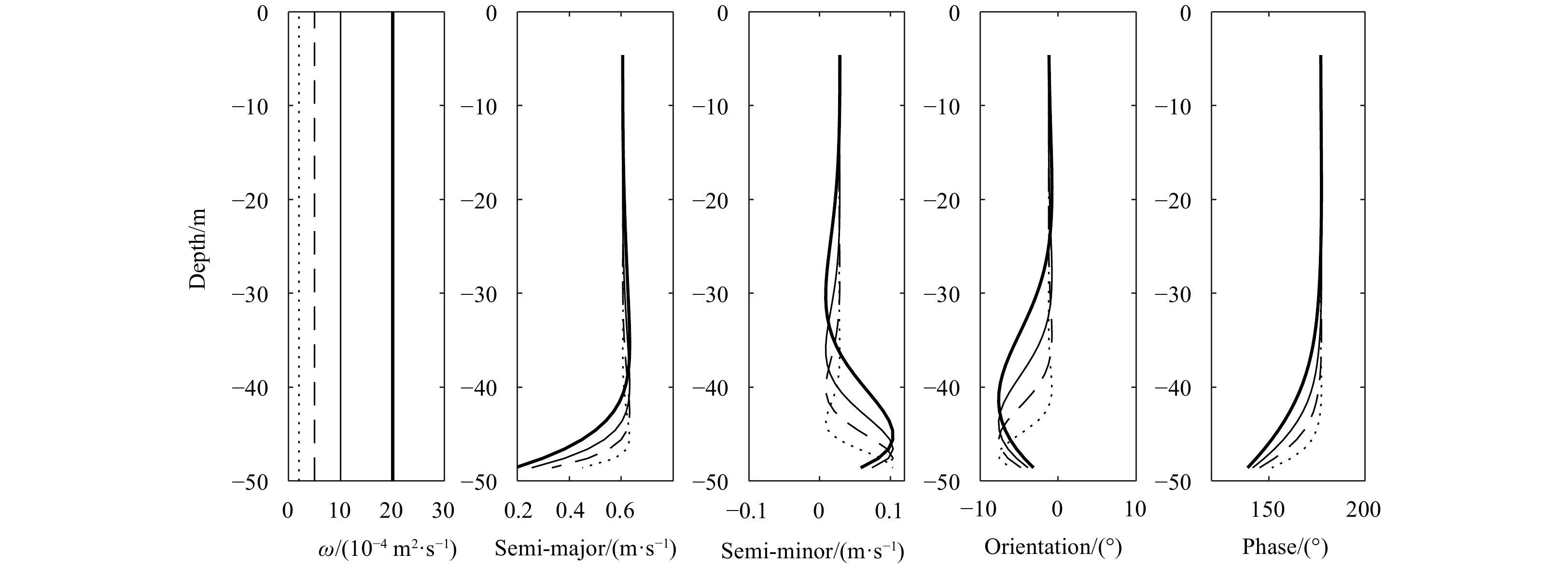
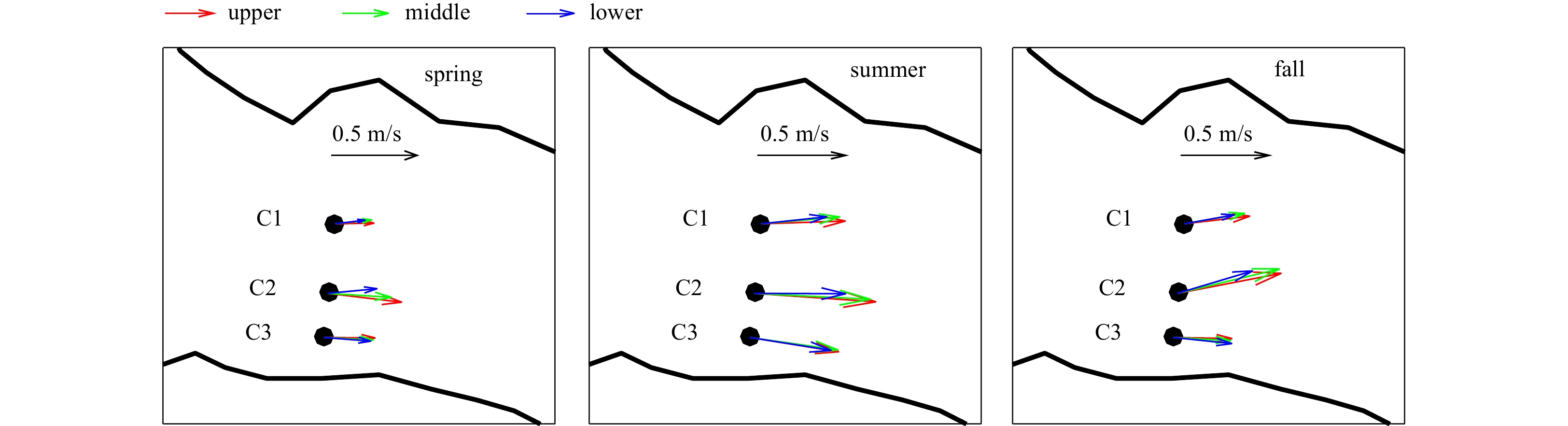
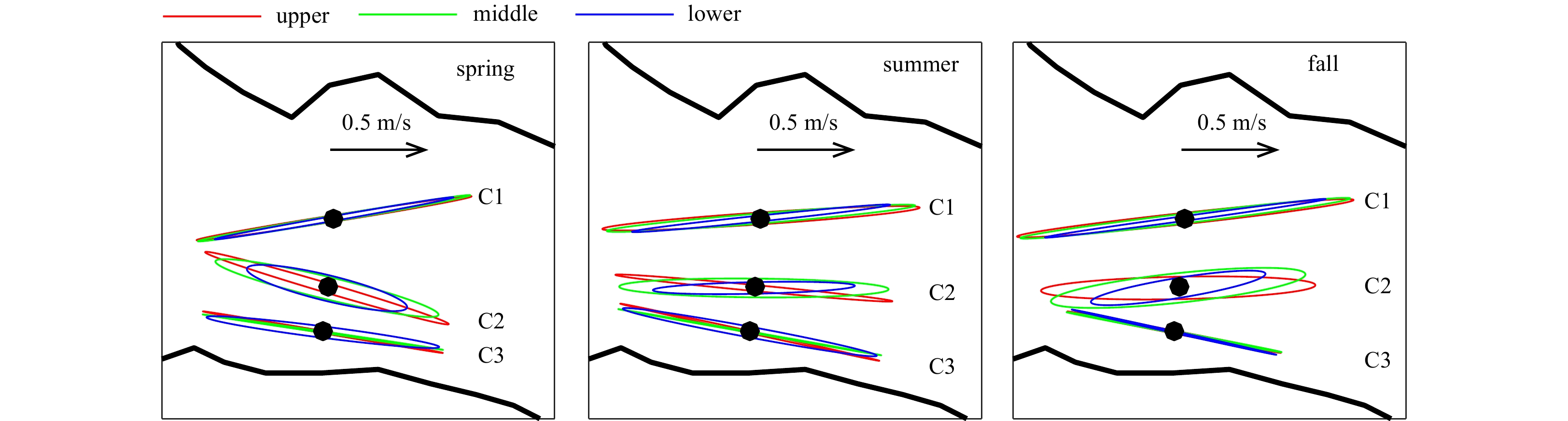
Three long-term fixed acoustic Doppler current profilers were first used for investigating the vertical structure of tidal currents in Xuliujing Section of Changjiang River Estuary. Moreover, three different periods (spring, summer and fall) were als...
Three long-term fixed acoustic Doppler current profilers were first used for investigating the vertical structure of tidal currents in Xuliujing Section of Changjiang River Estuary. Moreover, three different periods (spring, summer and fall) were als...


2023, 42(2): 56-64.
doi: 10.1007/s13131-022-2072-7
Abstract:
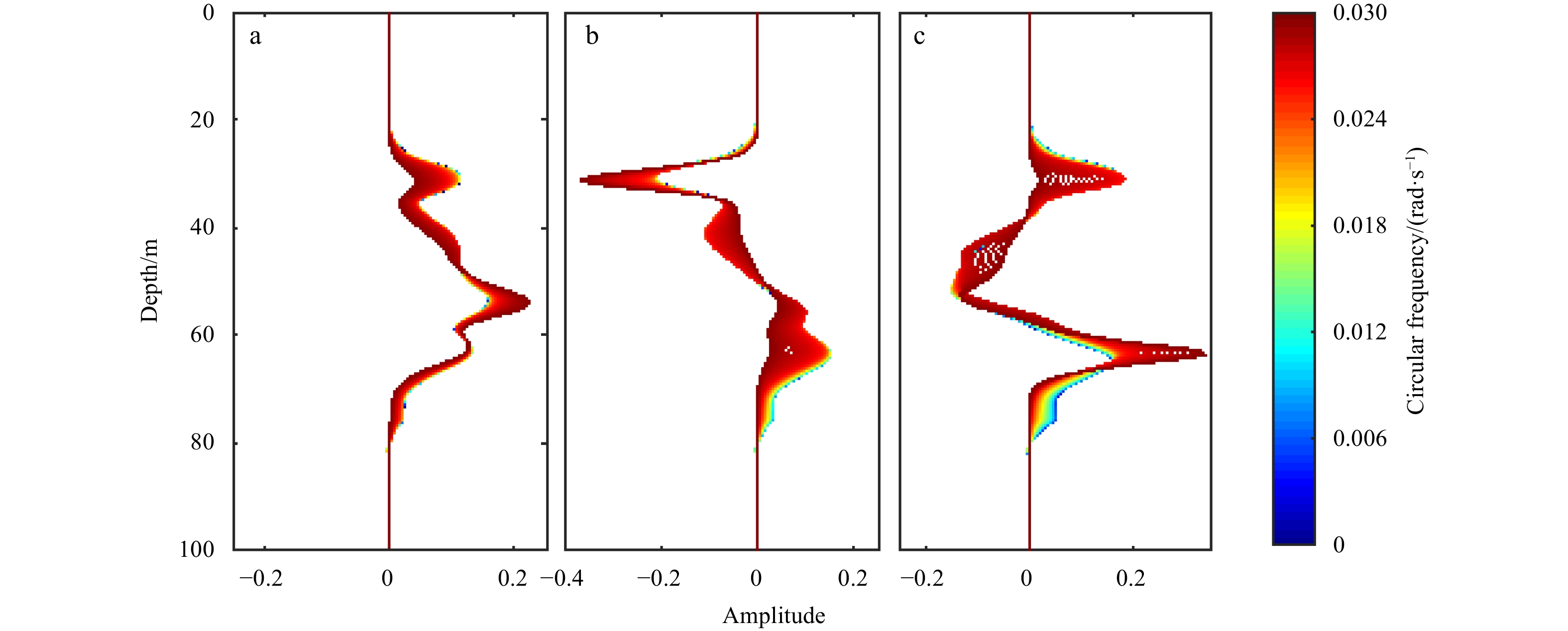
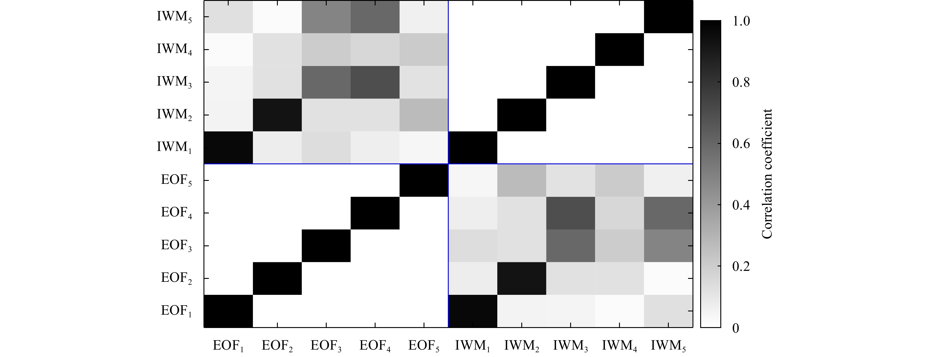
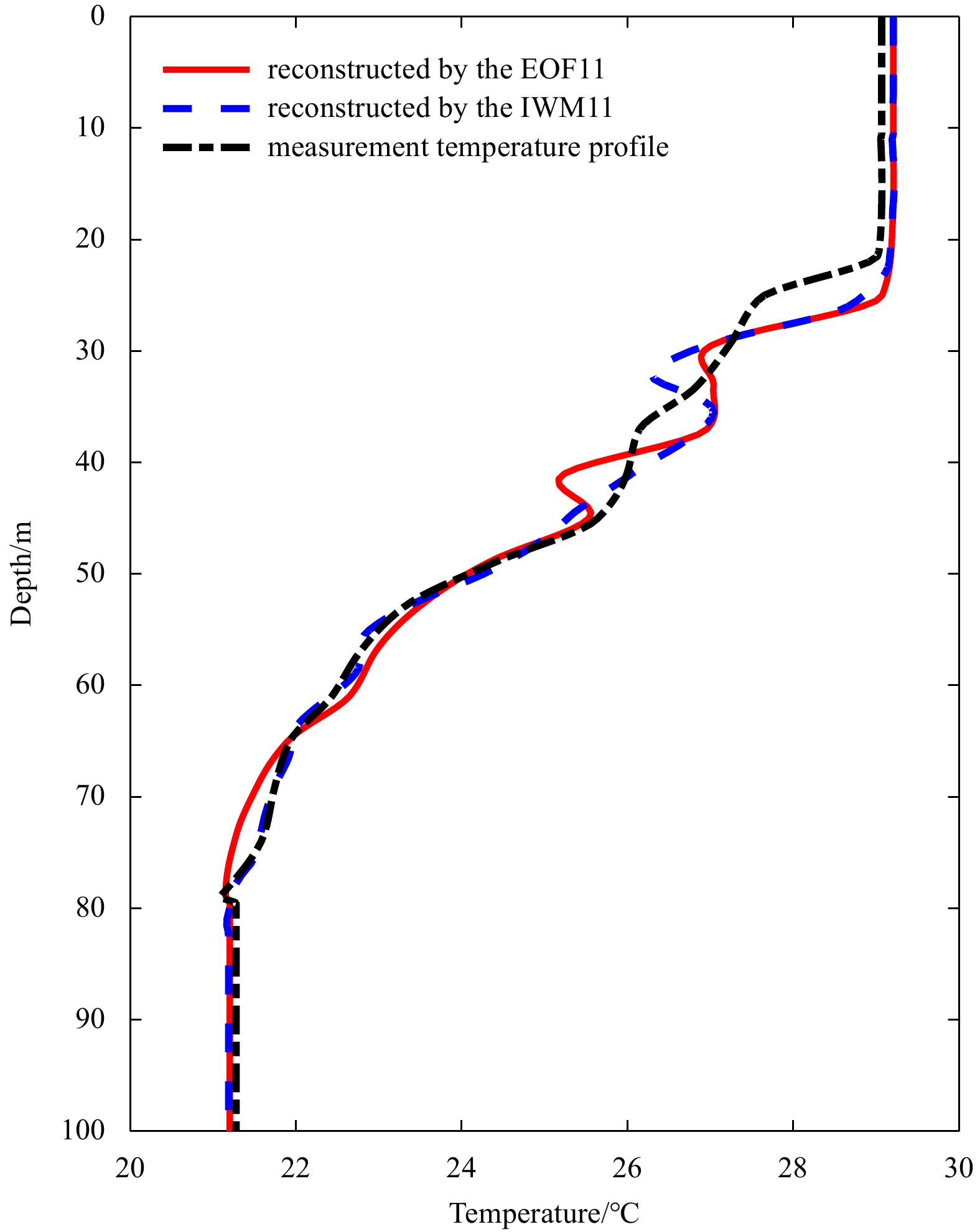
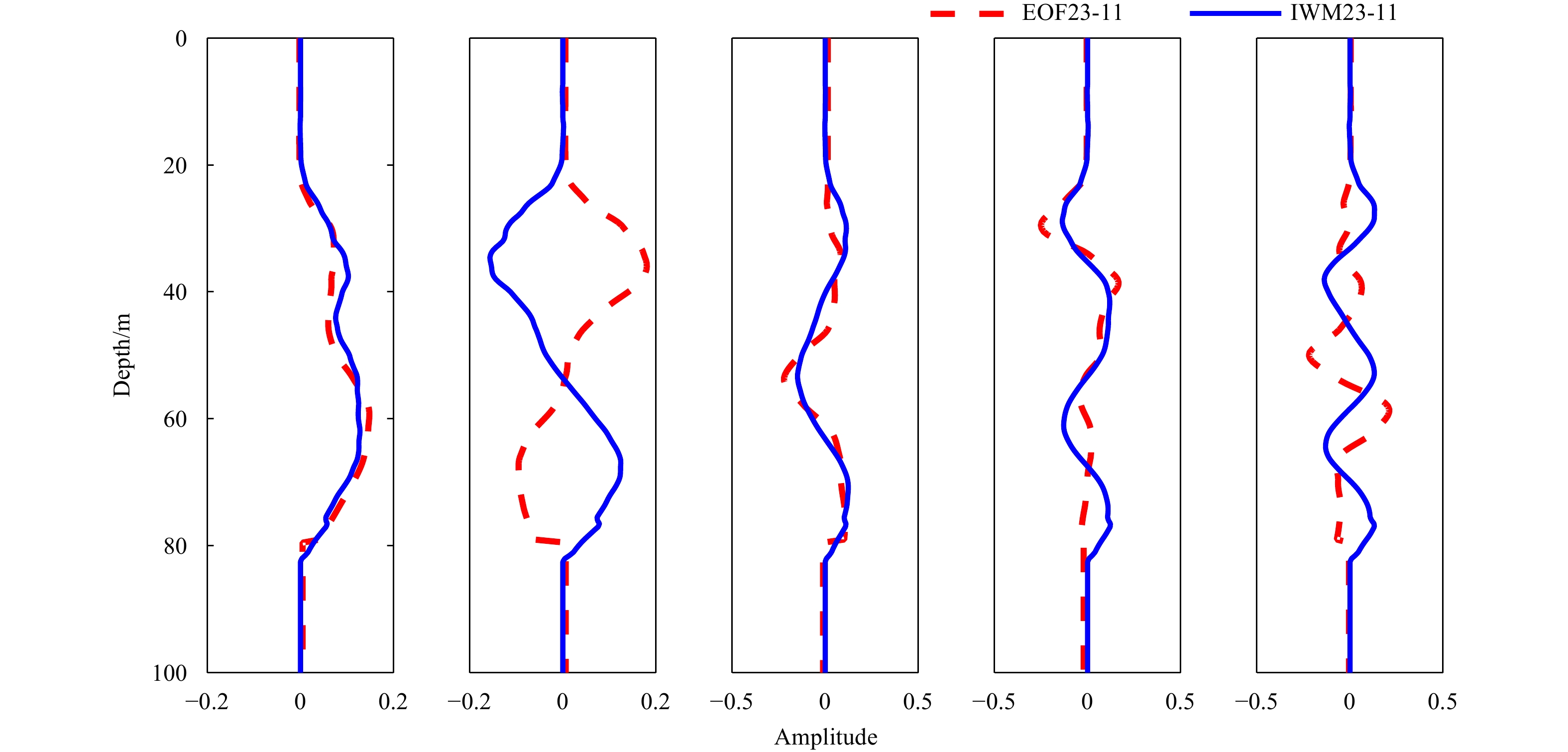
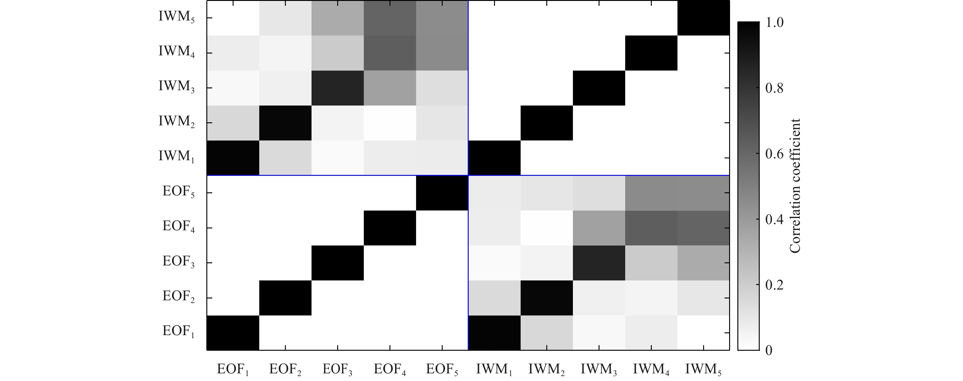
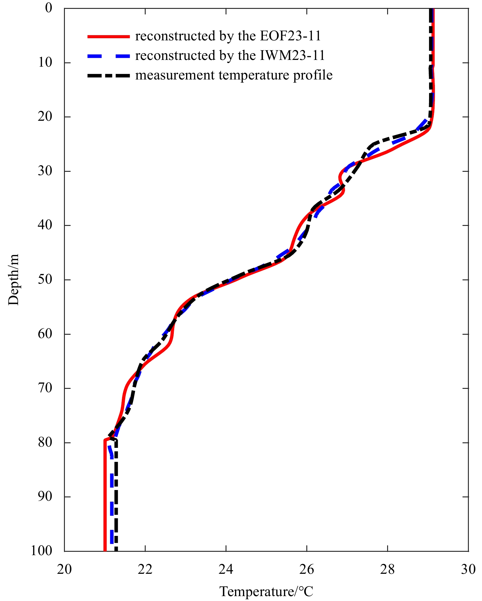
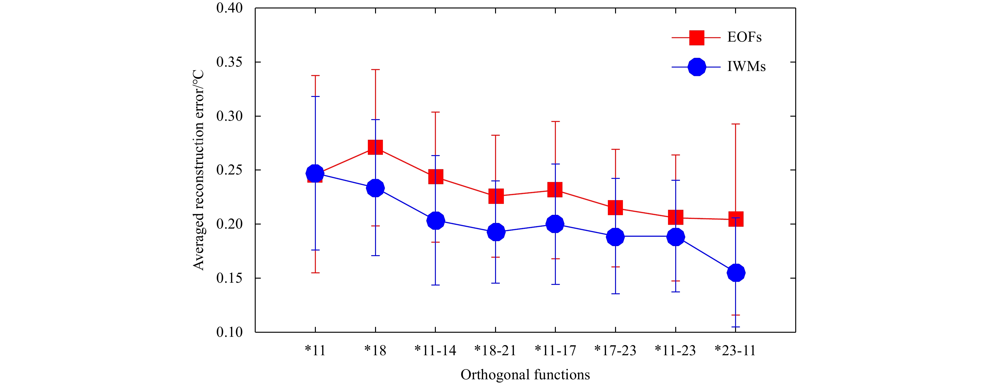
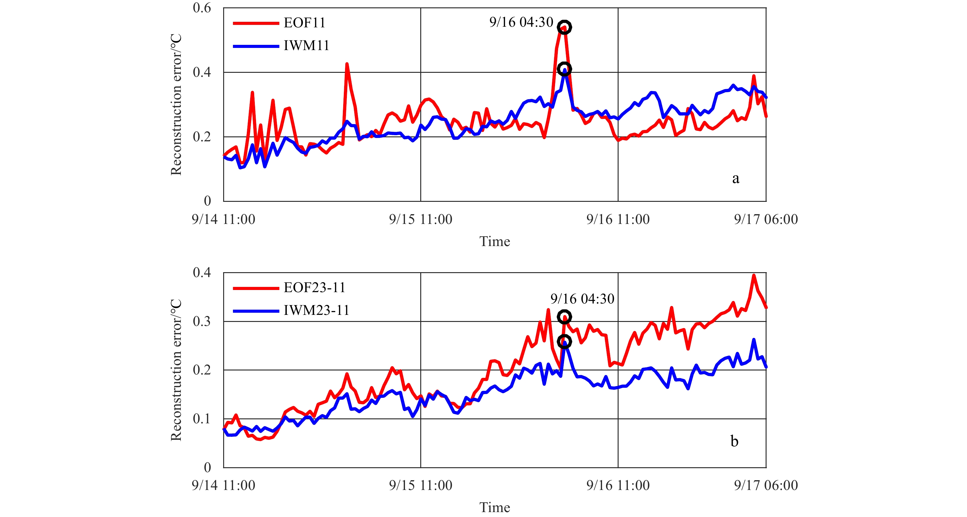
The shallow-water temperature profile is typically parameterized using a few empirical orthogonal function (EOF) coefficients. However, when the experimental area is poorly known or highly variable, the adaptability of the EOFs will be significantly ...
The shallow-water temperature profile is typically parameterized using a few empirical orthogonal function (EOF) coefficients. However, when the experimental area is poorly known or highly variable, the adaptability of the EOFs will be significantly ...


2023, 42(2): 65-73.
doi: 10.1007/s13131-022-2025-1
Abstract:
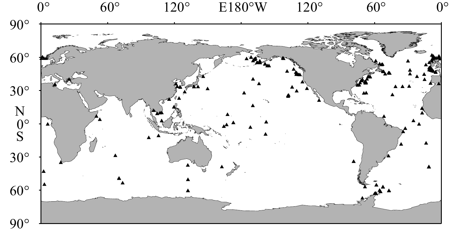
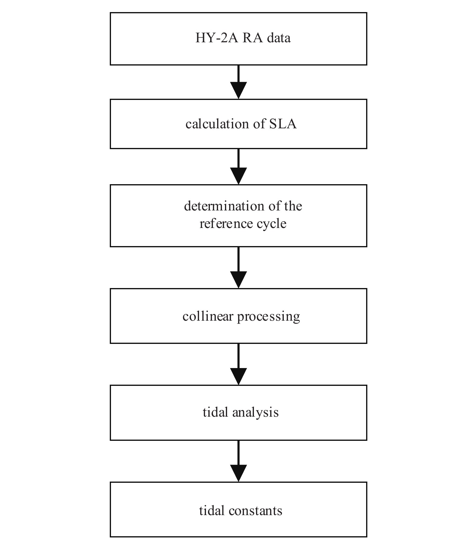
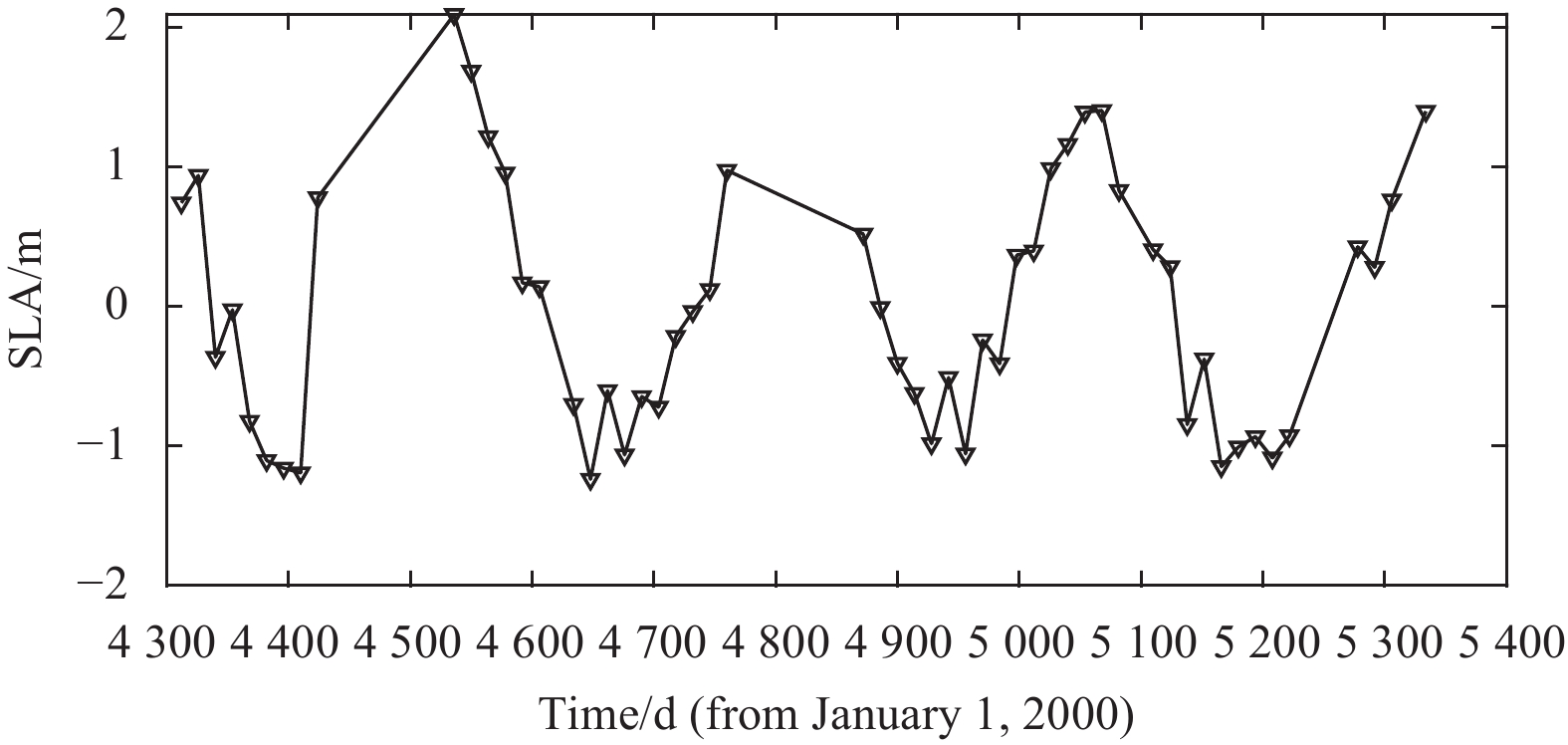
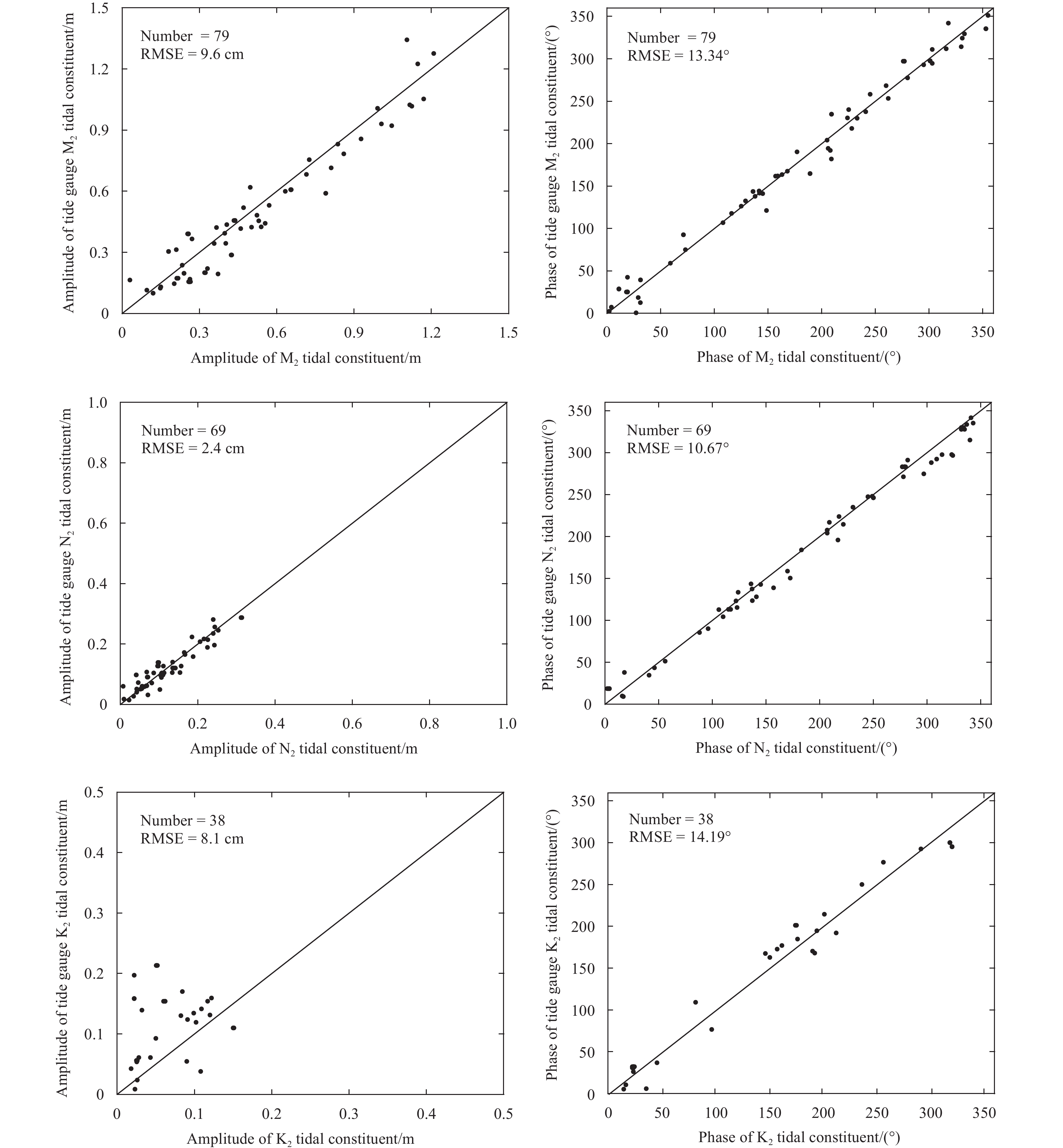
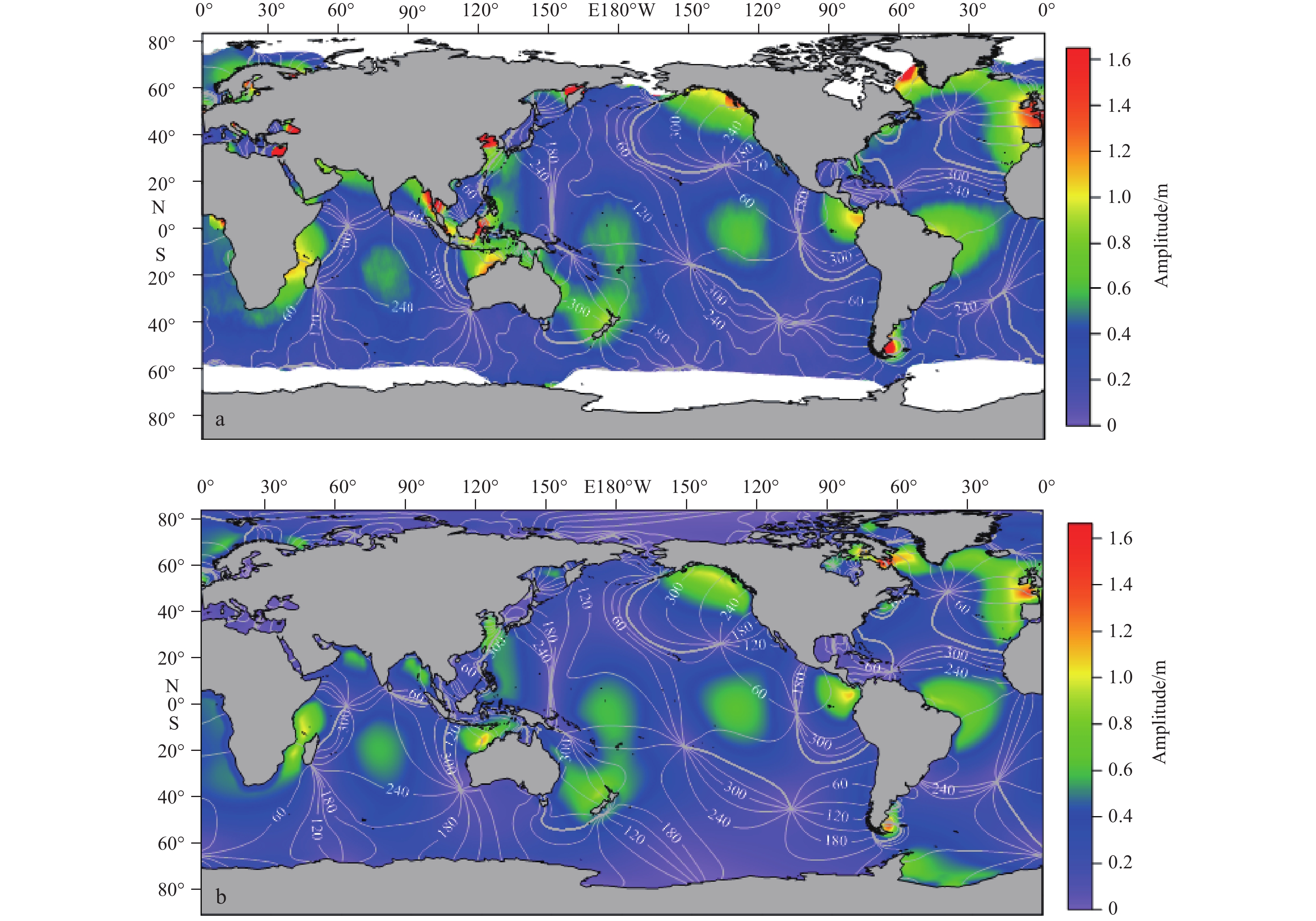
The HY-2A satellite, which is equipped with a radar altimeter and was launched on August 16, 2011, is the first Chinese marine dynamic environmental monitoring satellite. Extracting ocean tides is one of the important applications of the radar altime...
The HY-2A satellite, which is equipped with a radar altimeter and was launched on August 16, 2011, is the first Chinese marine dynamic environmental monitoring satellite. Extracting ocean tides is one of the important applications of the radar altime...

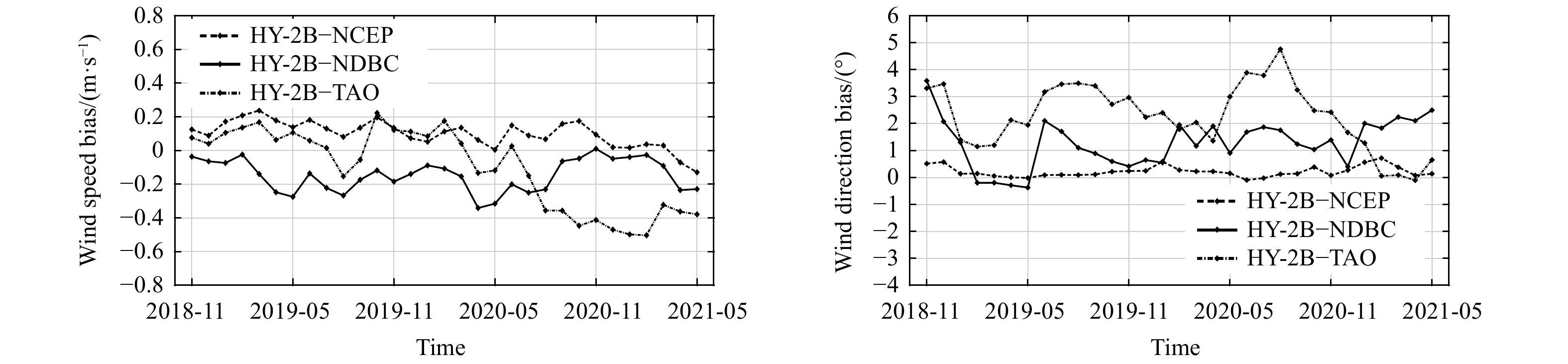
2023, 42(2): 74-82.
doi: 10.1007/s13131-022-2030-4
Abstract:
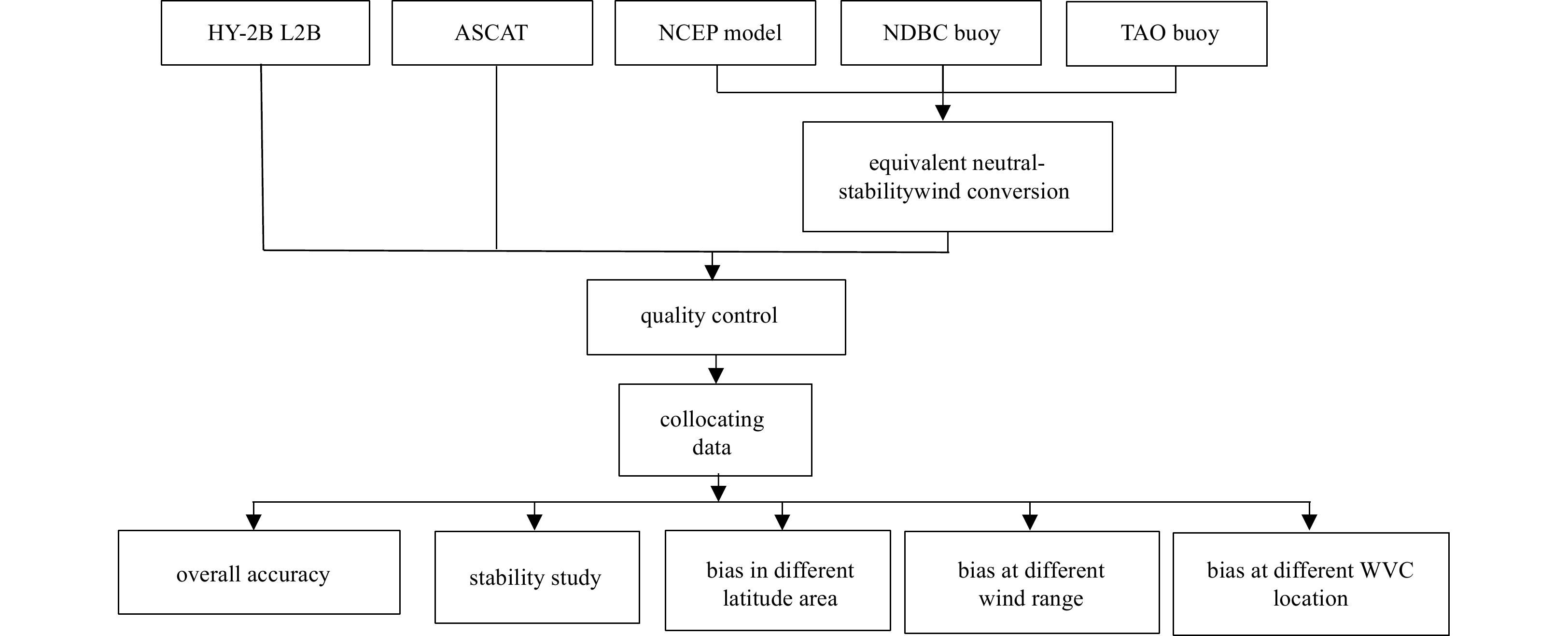
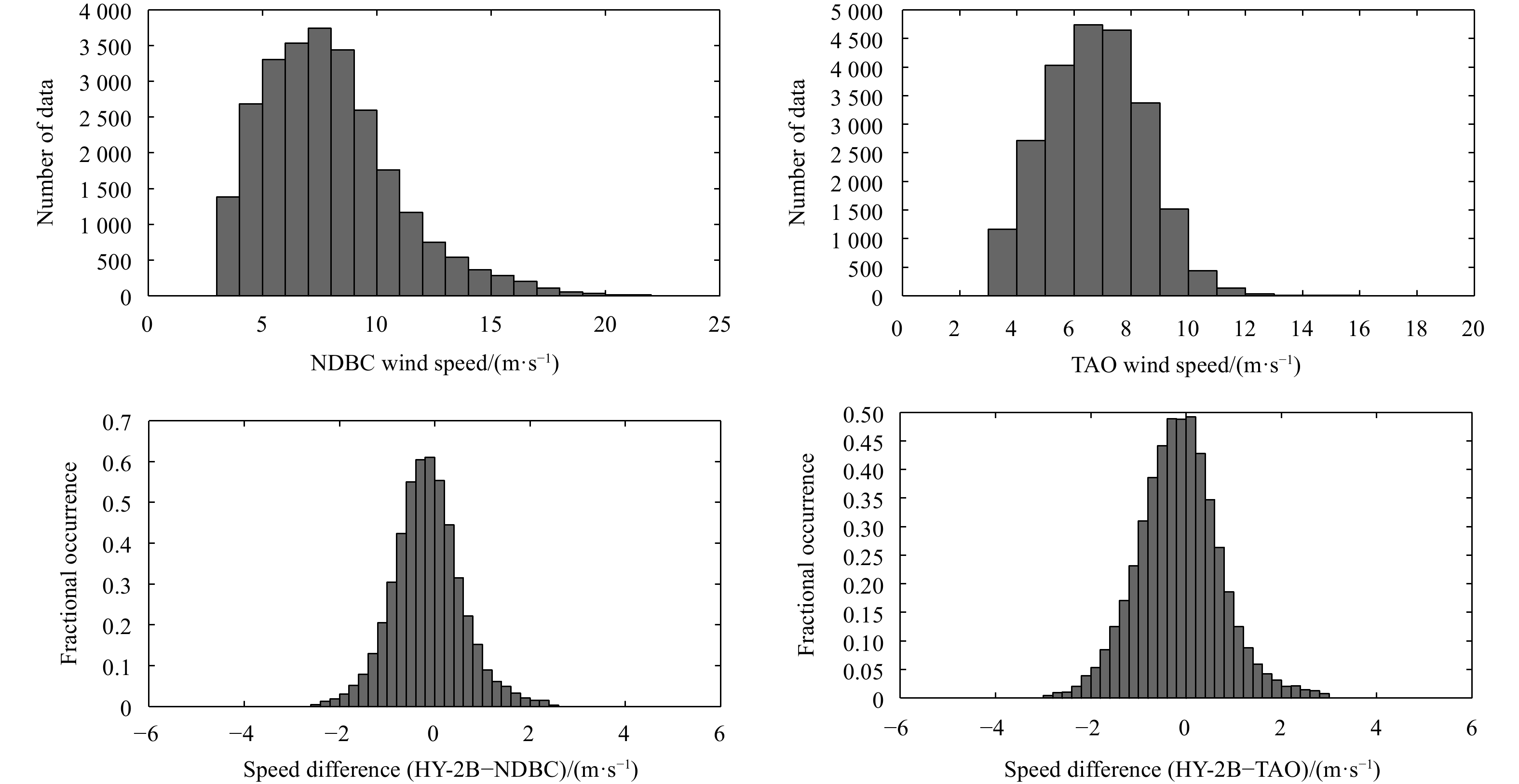
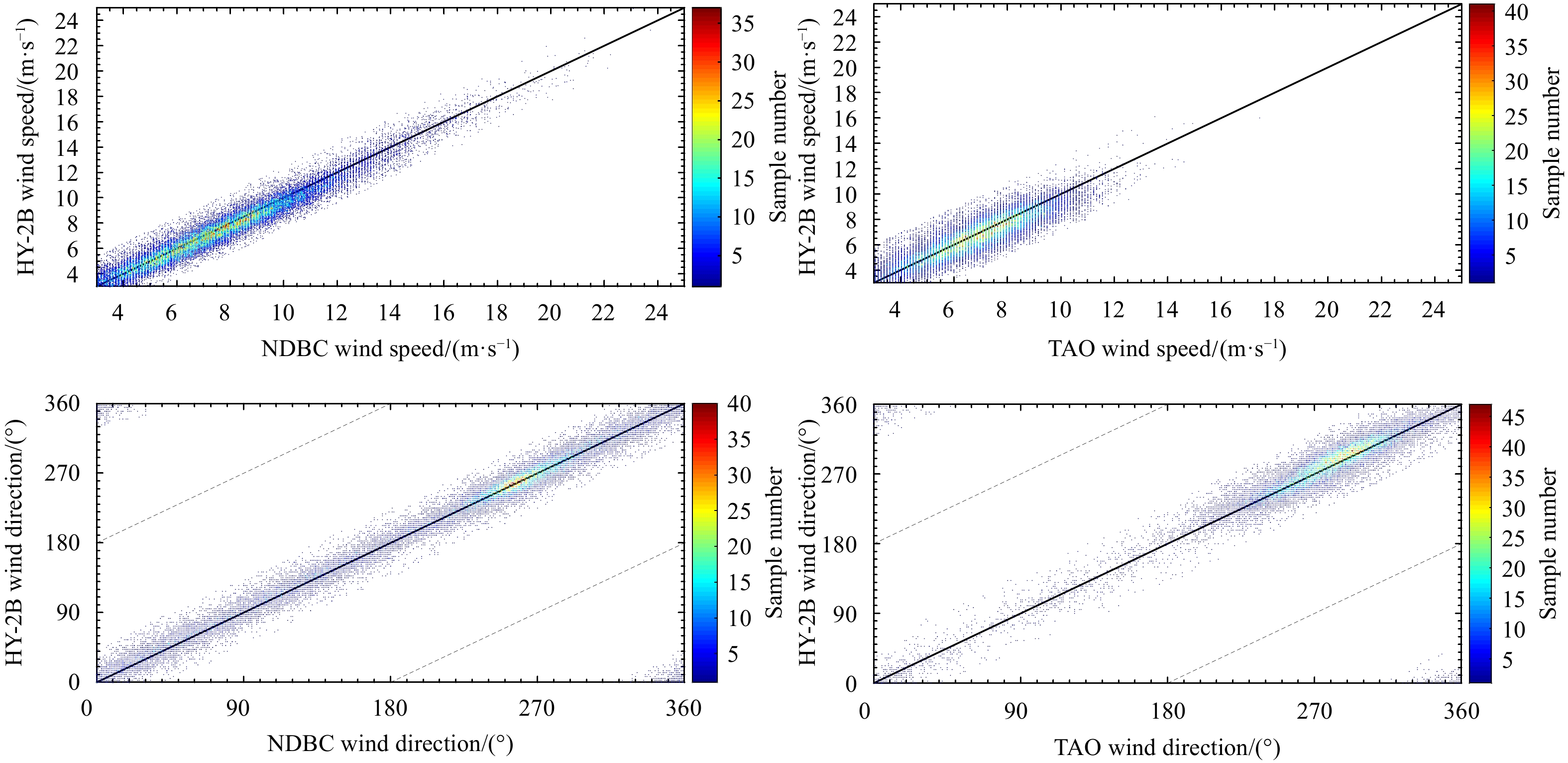
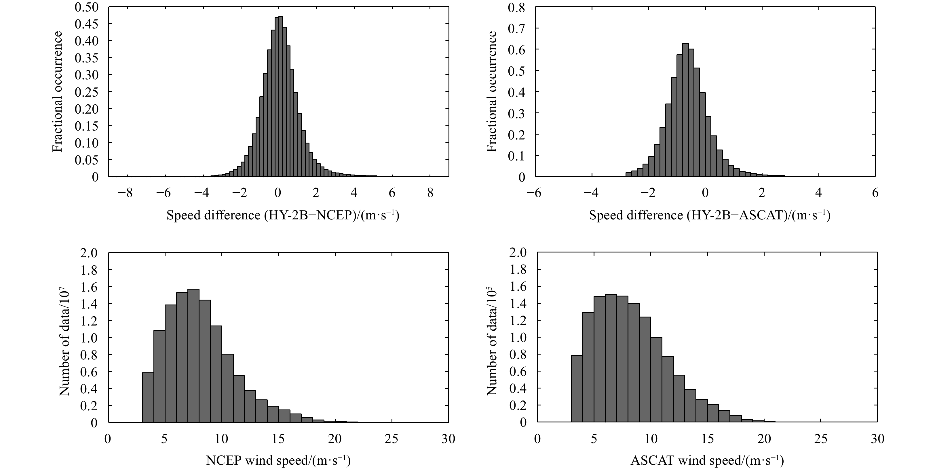
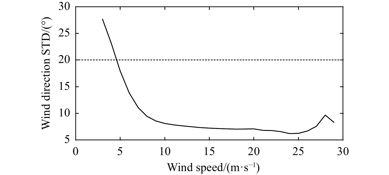
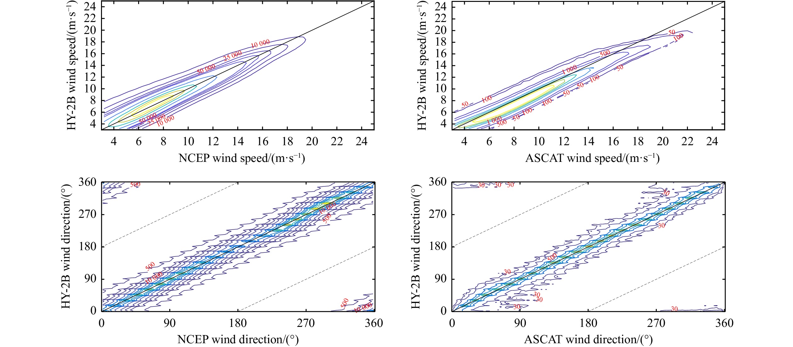
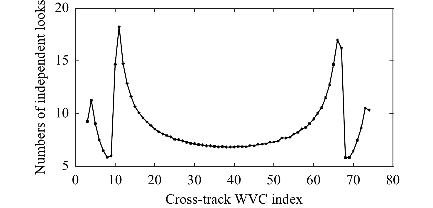
The Chinese marine dynamic environment satellite HY-2B was launched in October 2018 and carries a Ku-band scatterometer. This paper focuses on the accuracies of HY-2B scatterometer wind data during the period from November 2018 to May 2021. The HY-2B...
The Chinese marine dynamic environment satellite HY-2B was launched in October 2018 and carries a Ku-band scatterometer. This paper focuses on the accuracies of HY-2B scatterometer wind data during the period from November 2018 to May 2021. The HY-2B...


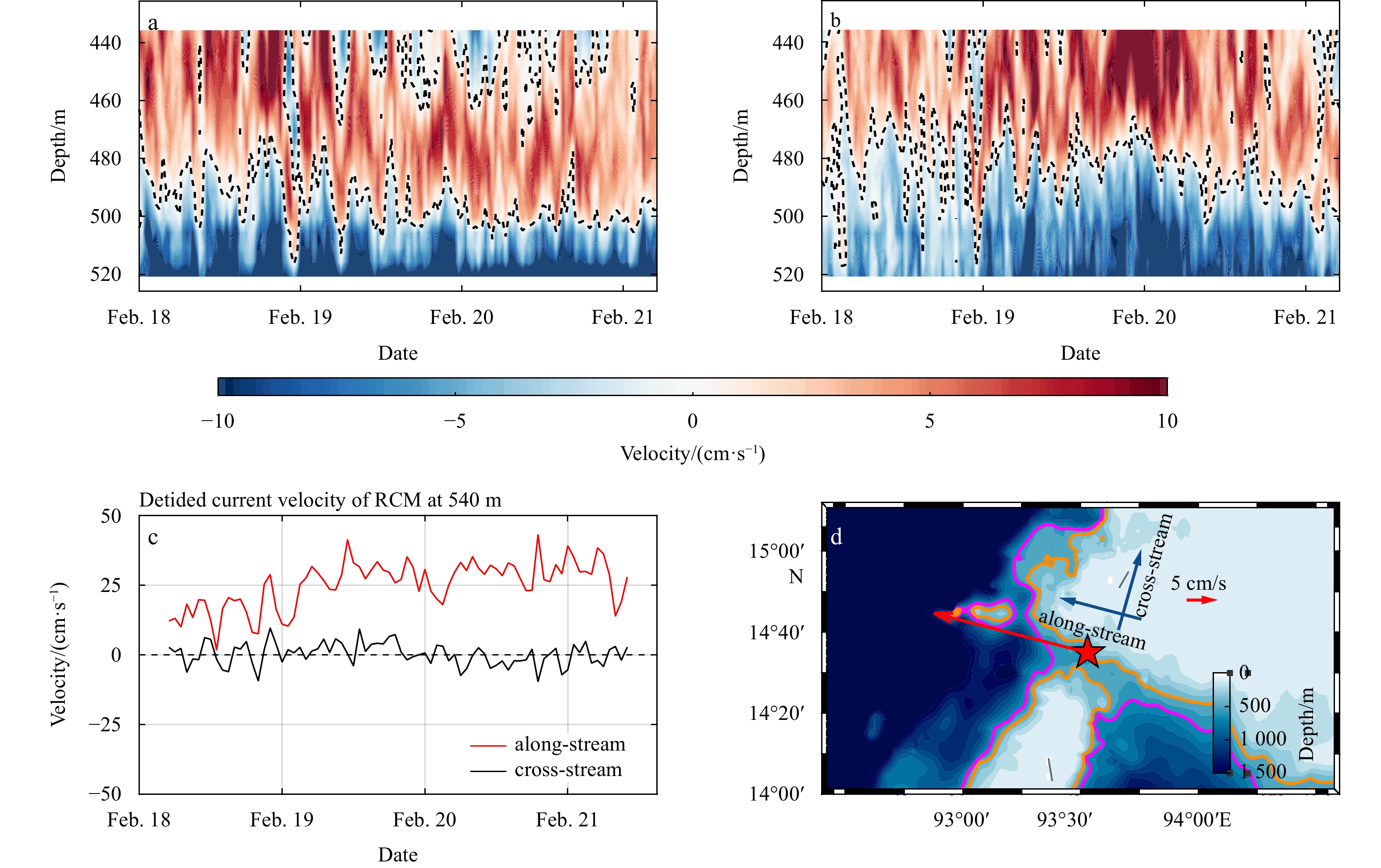
2023, 42(2): 83-93.
doi: 10.1007/s13131-022-2021-5
Abstract:
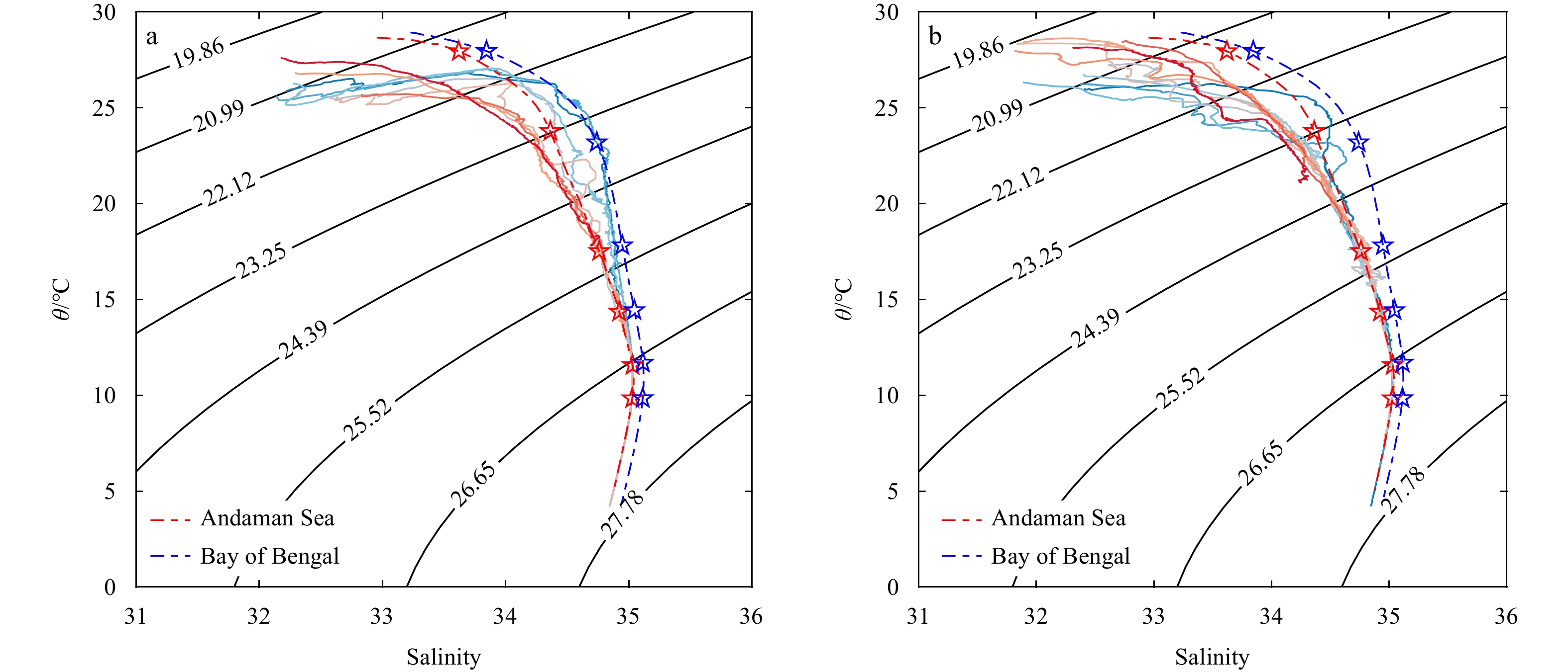
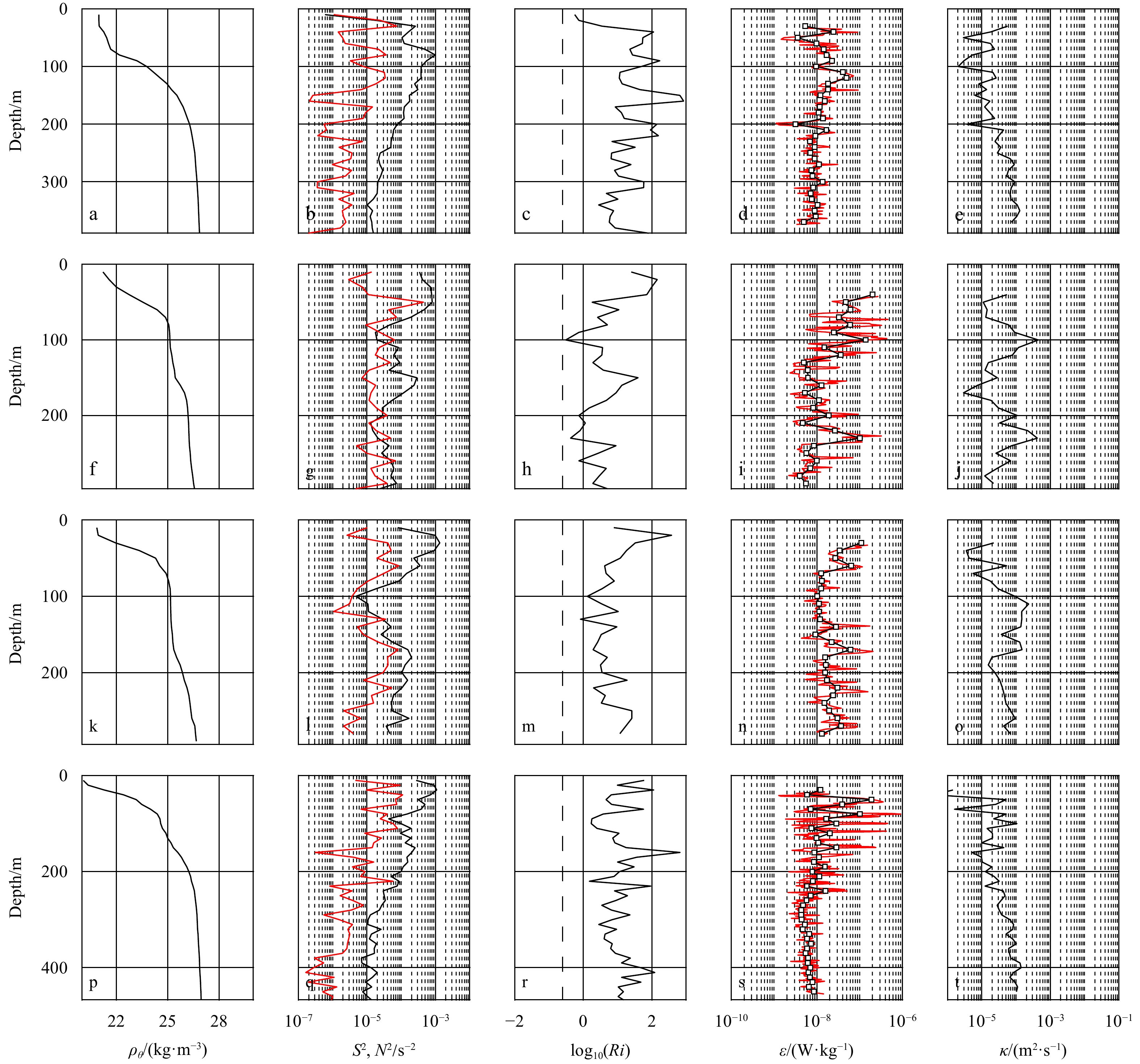
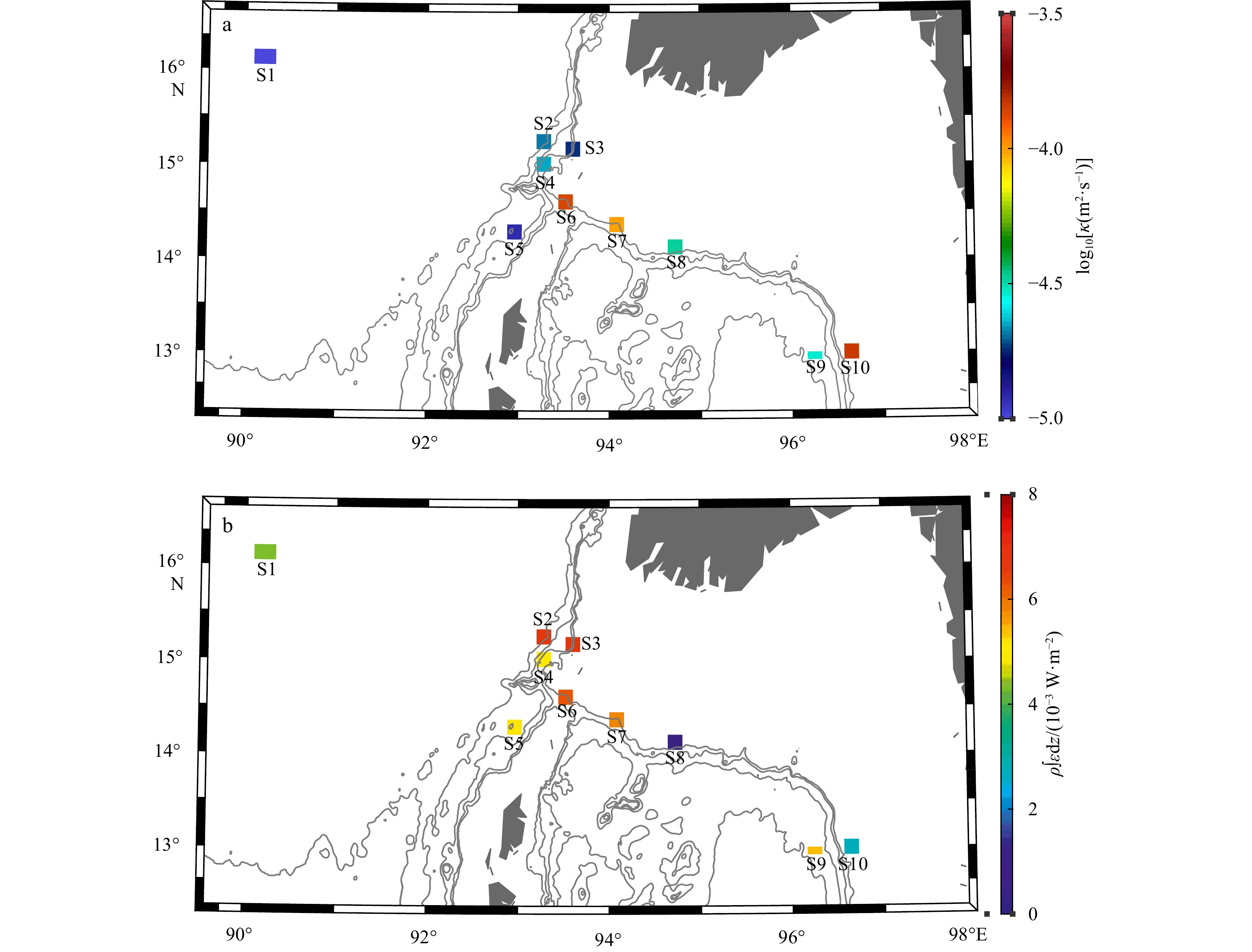
Preparis Channel is the very important exchange path of energy and materials between the northern Bay of Bengal and Andaman Sea (AS). A set of hydrographic measurements, a microstructure profiler, and a deep mooring were used to determine the charact...
Preparis Channel is the very important exchange path of energy and materials between the northern Bay of Bengal and Andaman Sea (AS). A set of hydrographic measurements, a microstructure profiler, and a deep mooring were used to determine the charact...


2023, 42(2): 94-103.
doi: 10.1007/s13131-022-2029-x
Abstract:
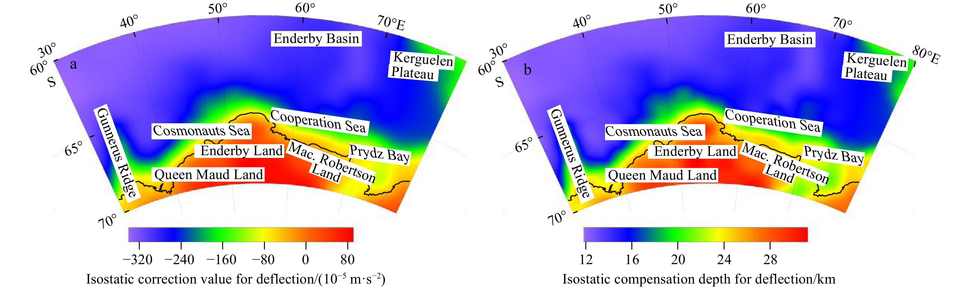
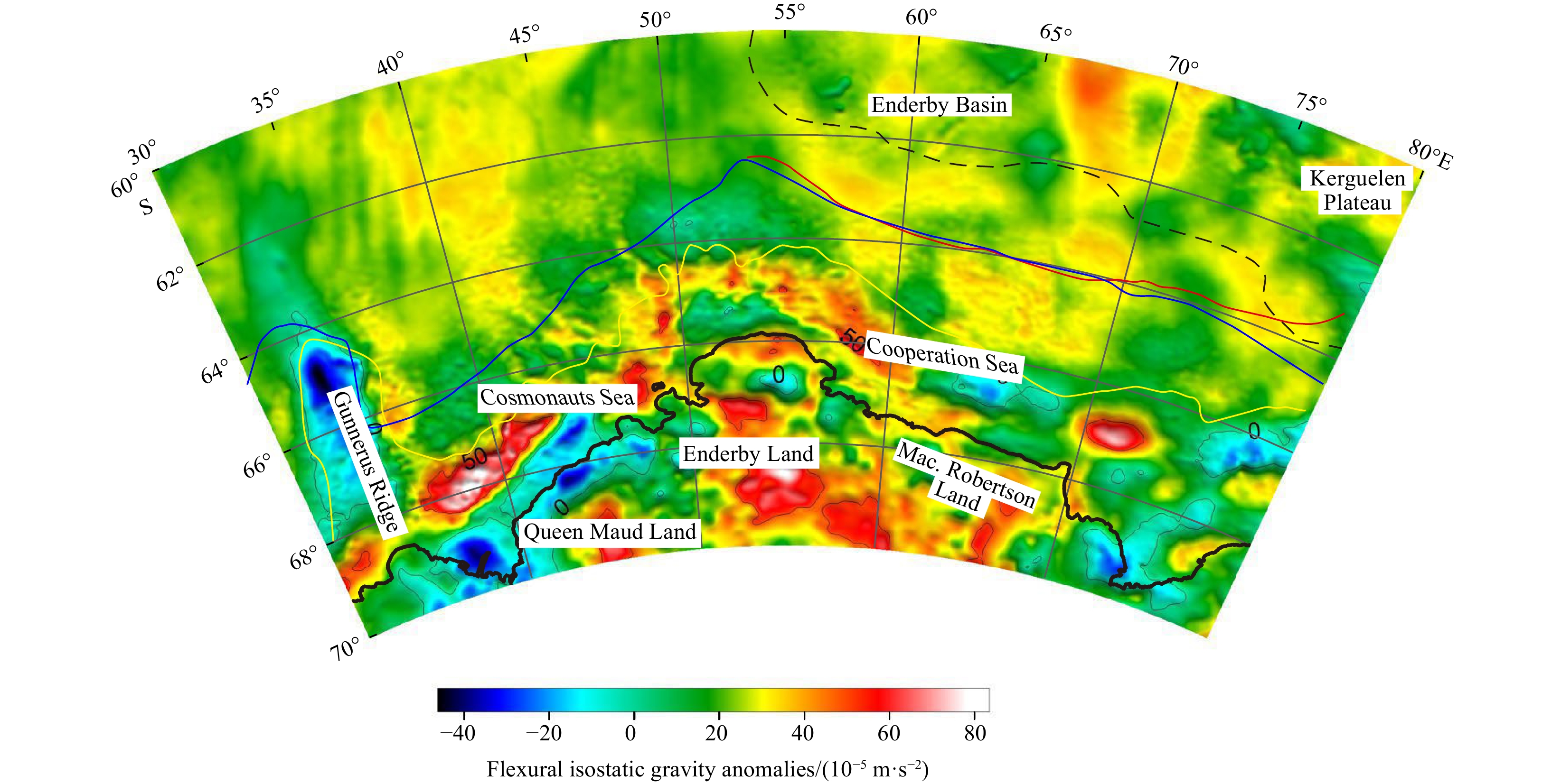
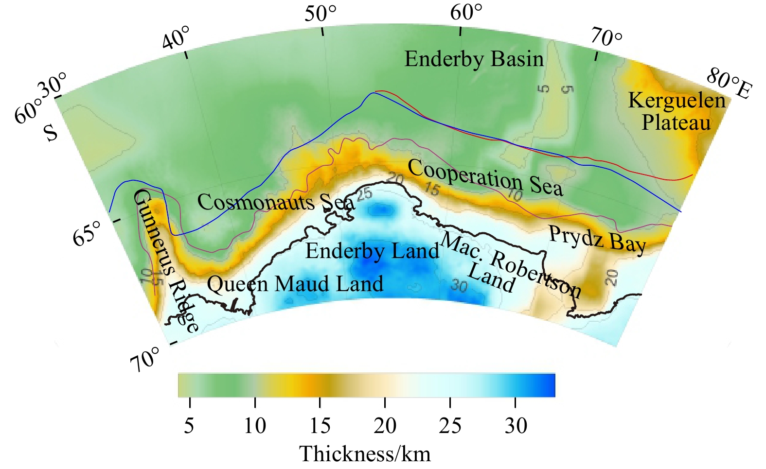
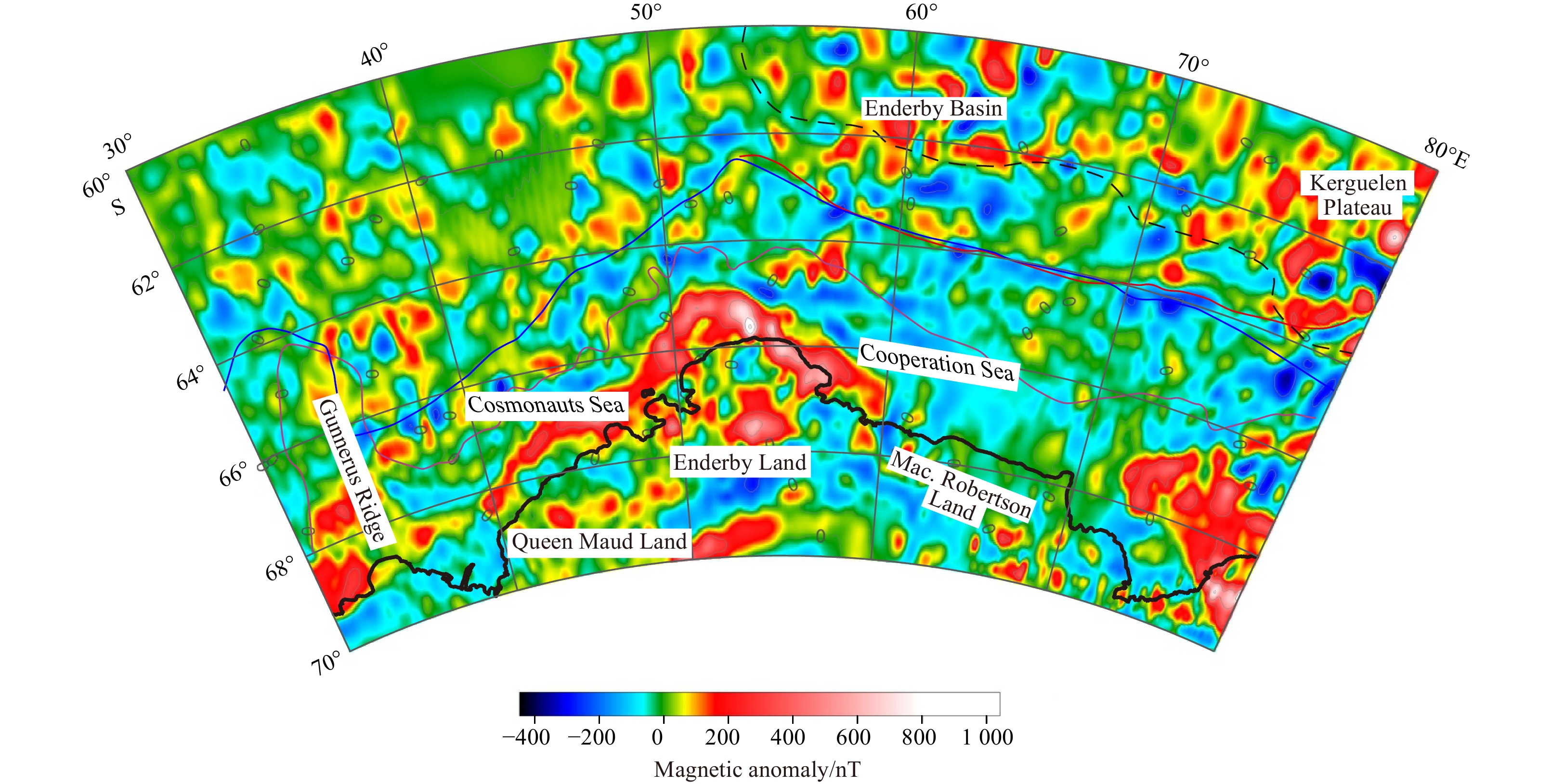
Enderby Land in East Antarctica and its adjacent areas, which are closely related to the Indian Plate in their geological evolution, have become one of the key zones for studies on how the Antarctic continent evolves. Based on the isostasy and flexur...
Enderby Land in East Antarctica and its adjacent areas, which are closely related to the Indian Plate in their geological evolution, have become one of the key zones for studies on how the Antarctic continent evolves. Based on the isostasy and flexur...


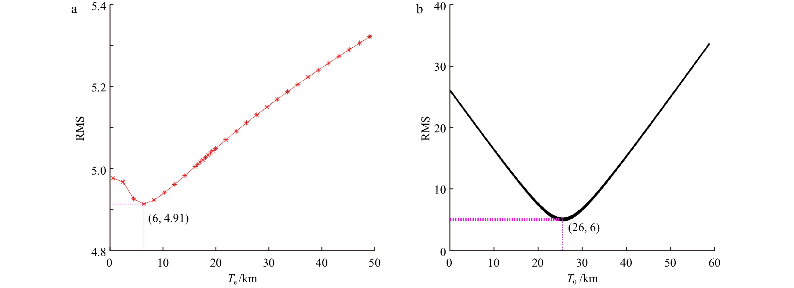

2023, 42(2): 104-119.
doi: 10.1007/s13131-022-2028-y
Abstract:
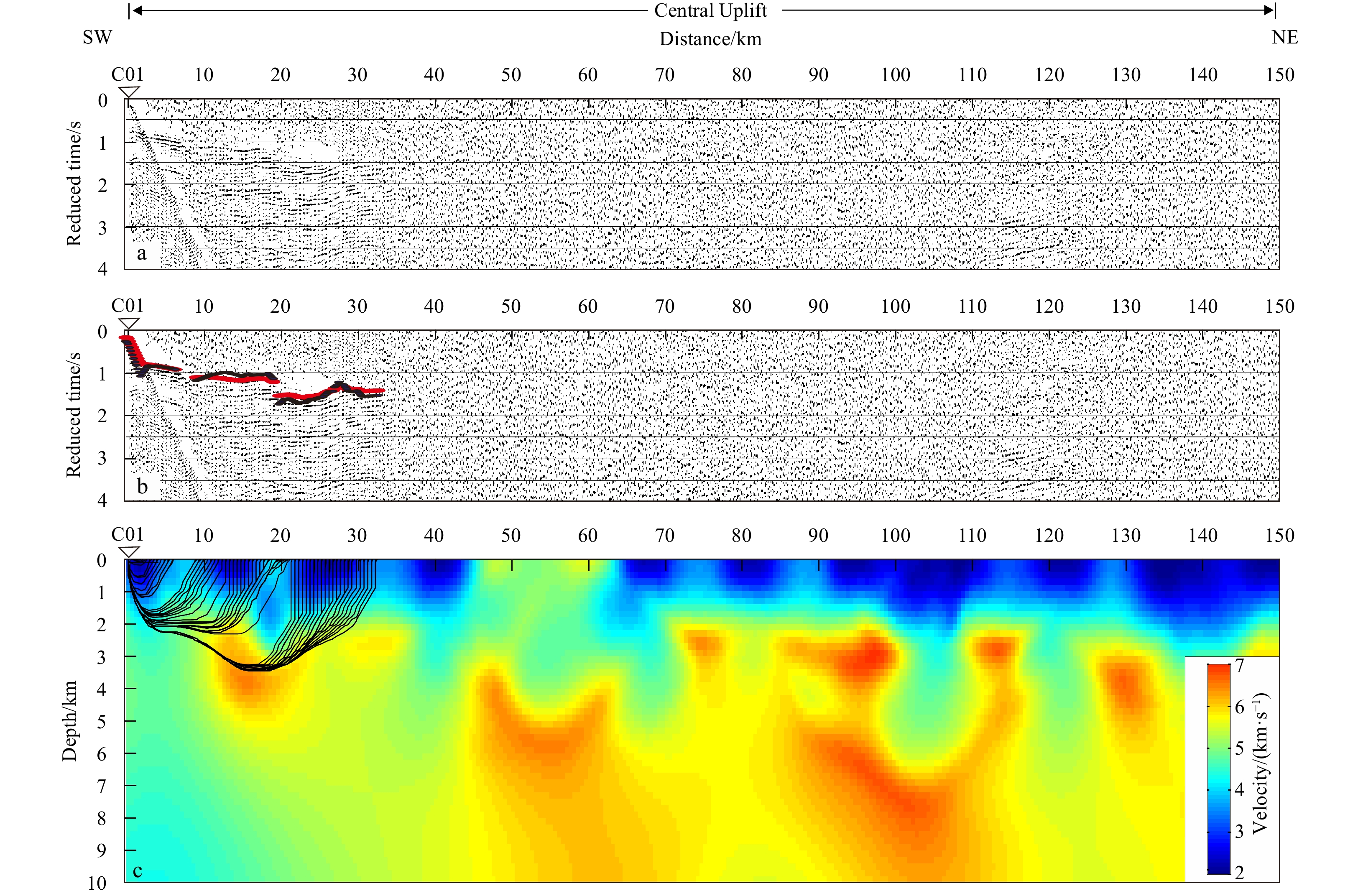
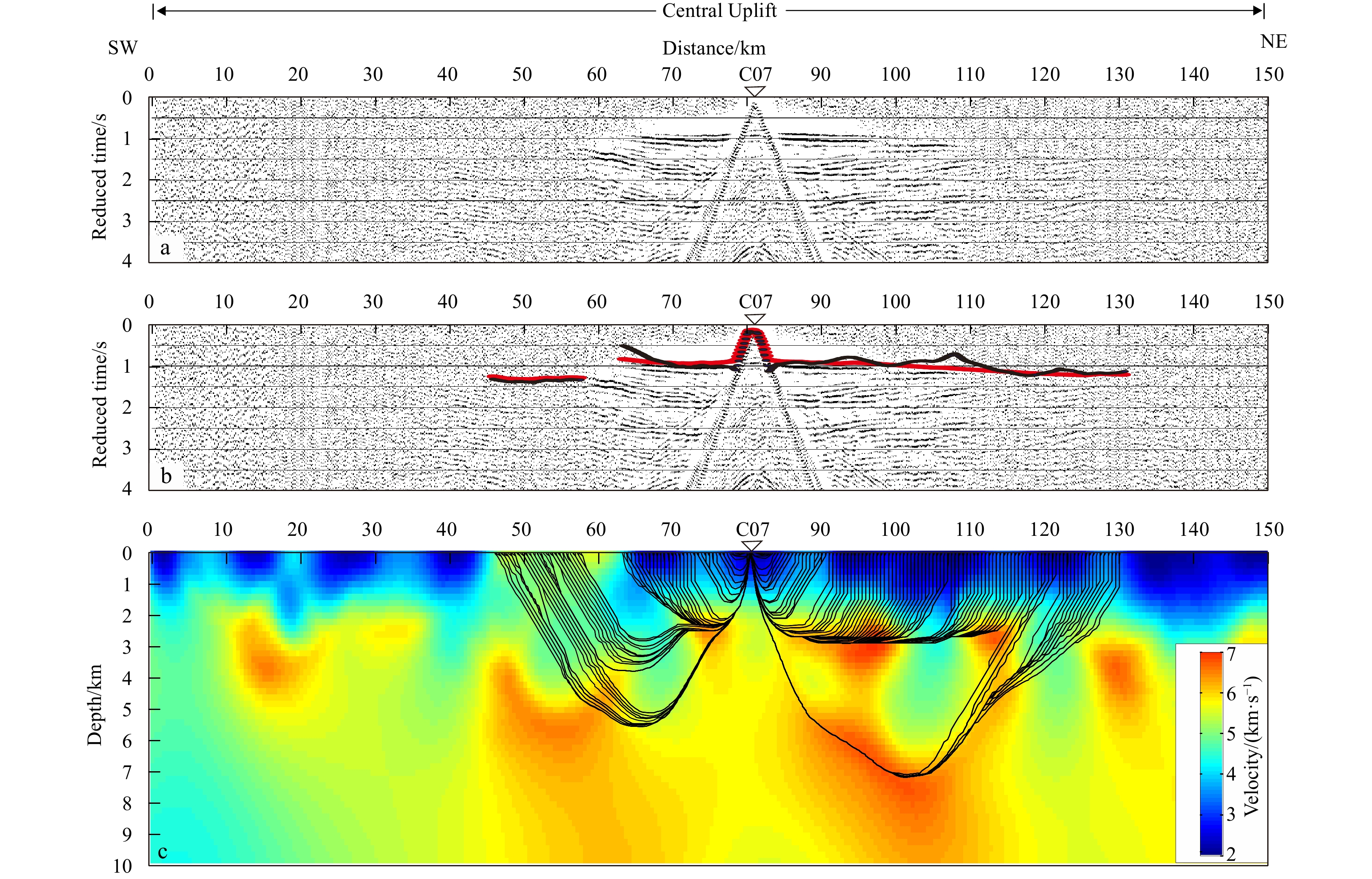
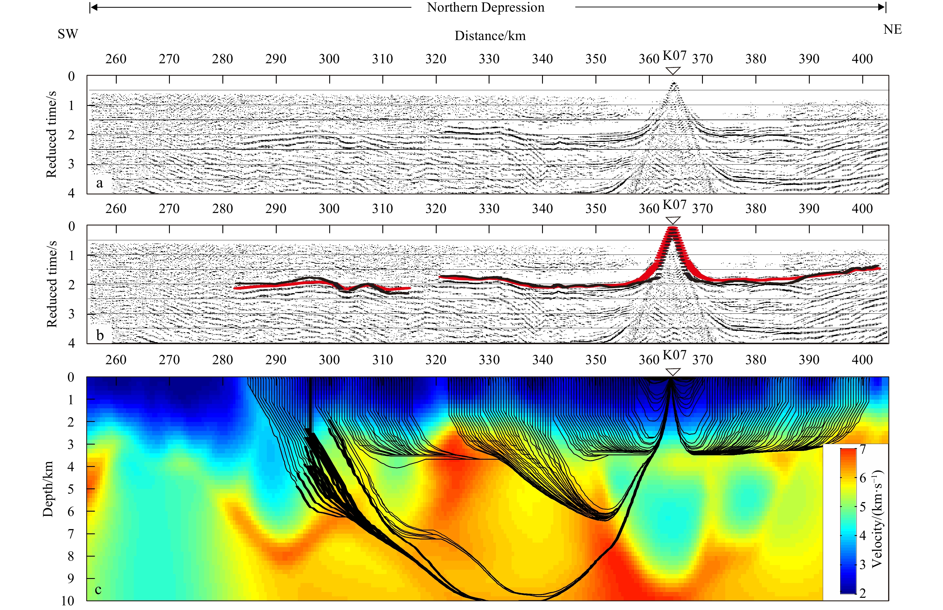
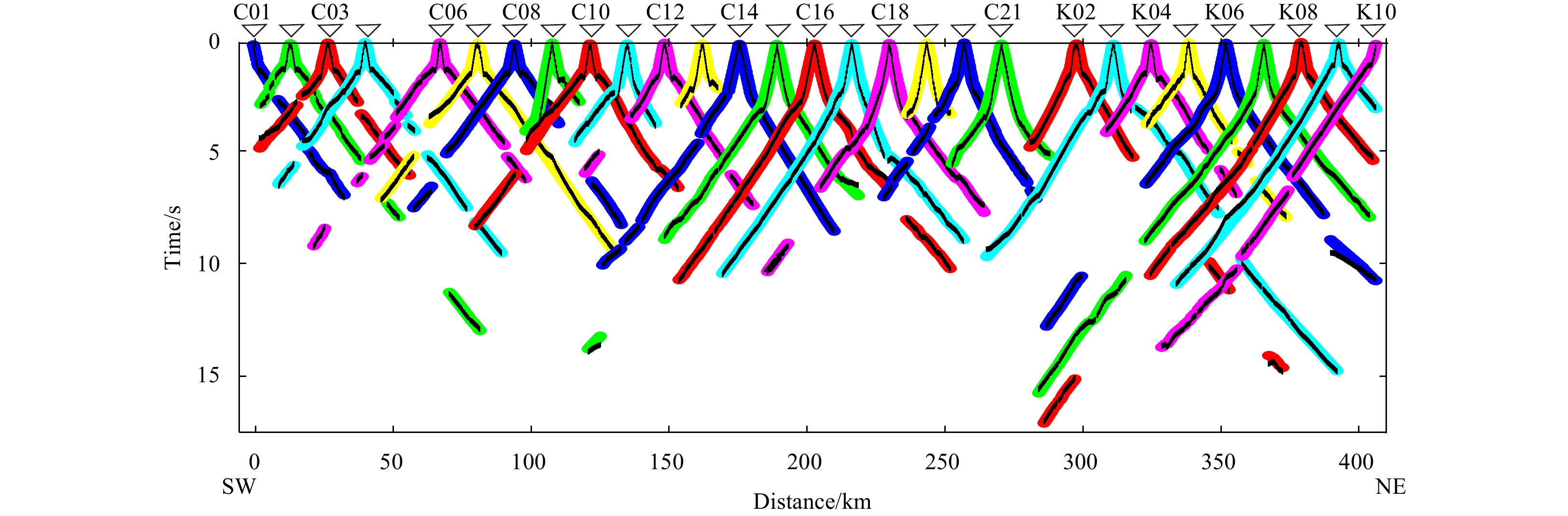
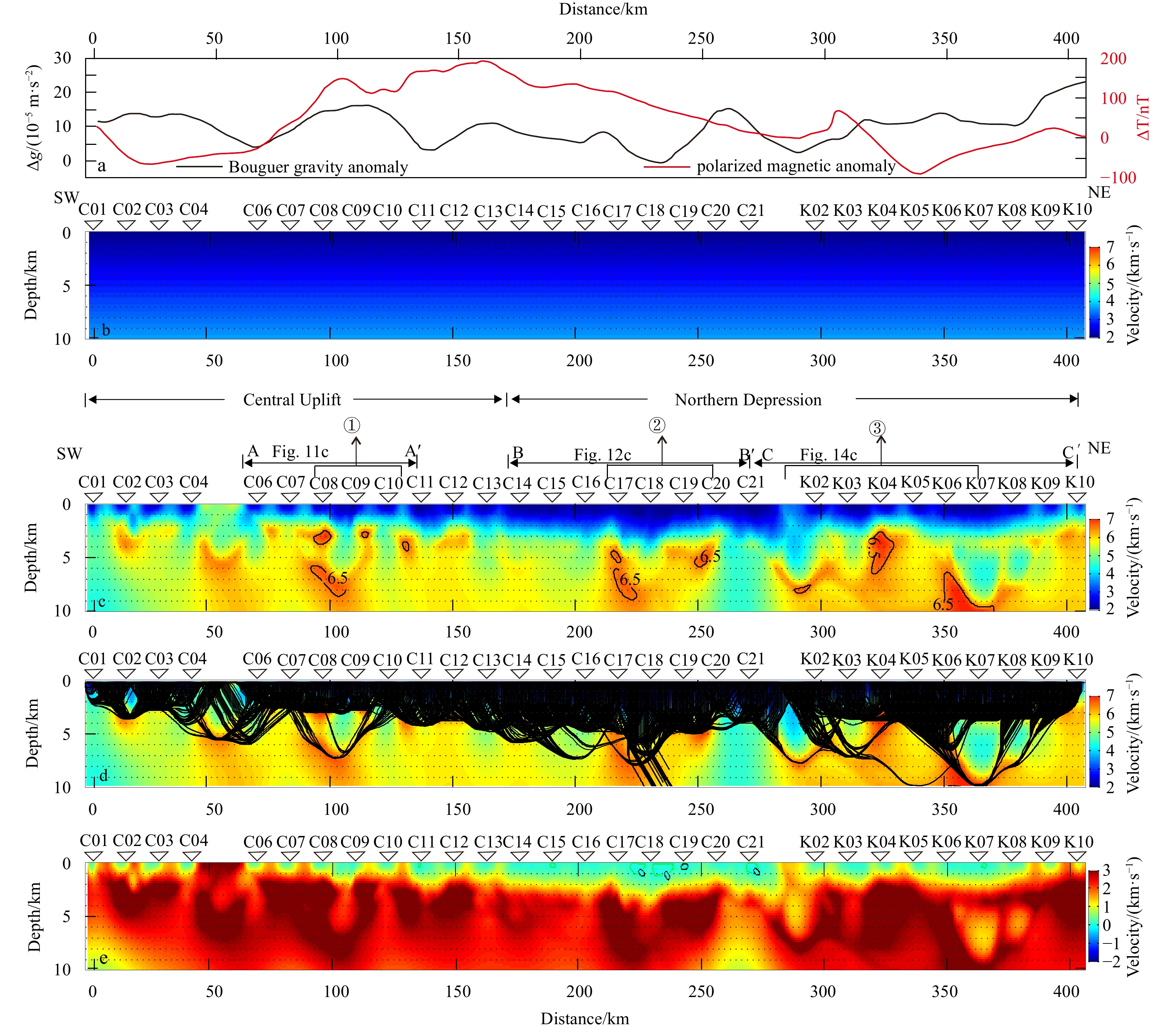
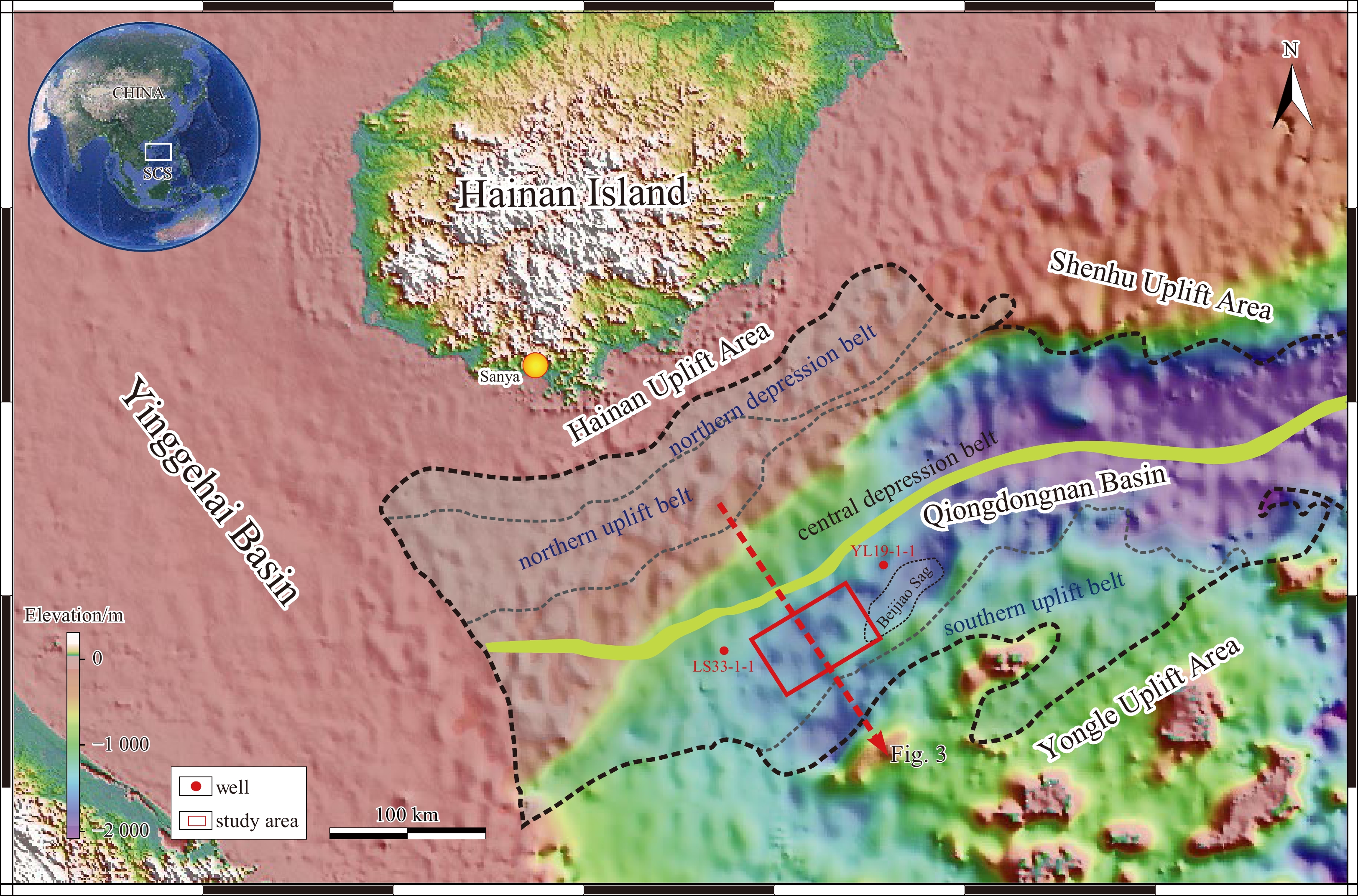
The South Yellow Sea basin is filled with Mesozoic–Cenozoic continental sediments overlying pre-Palaeozoic and Mesozoic–Palaeozoic marine sediments. Conventional multi-channel seismic data cannot describe the velocity structure of the marine residual...
The South Yellow Sea basin is filled with Mesozoic–Cenozoic continental sediments overlying pre-Palaeozoic and Mesozoic–Palaeozoic marine sediments. Conventional multi-channel seismic data cannot describe the velocity structure of the marine residual...


2023, 42(2): 120-133.
doi: 10.1007/s13131-022-2125-y
Abstract:
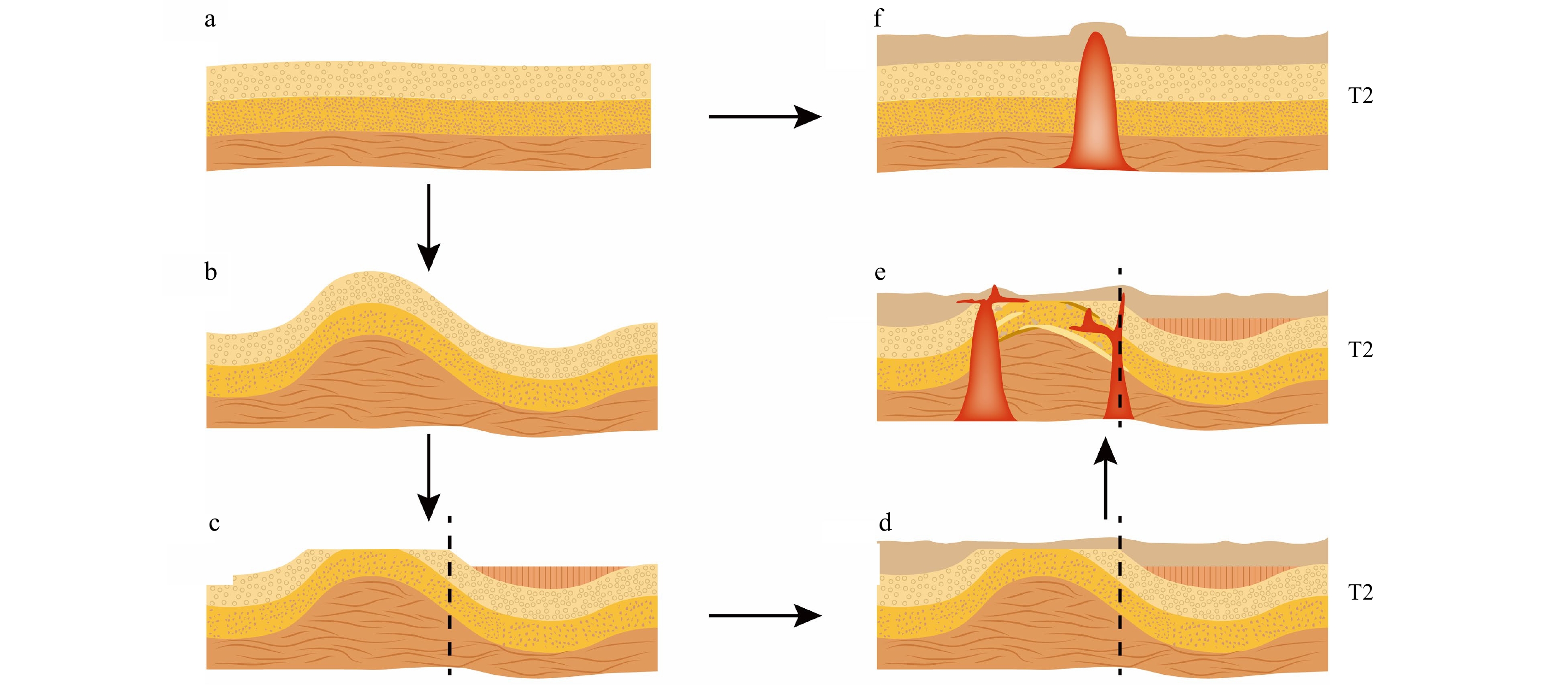
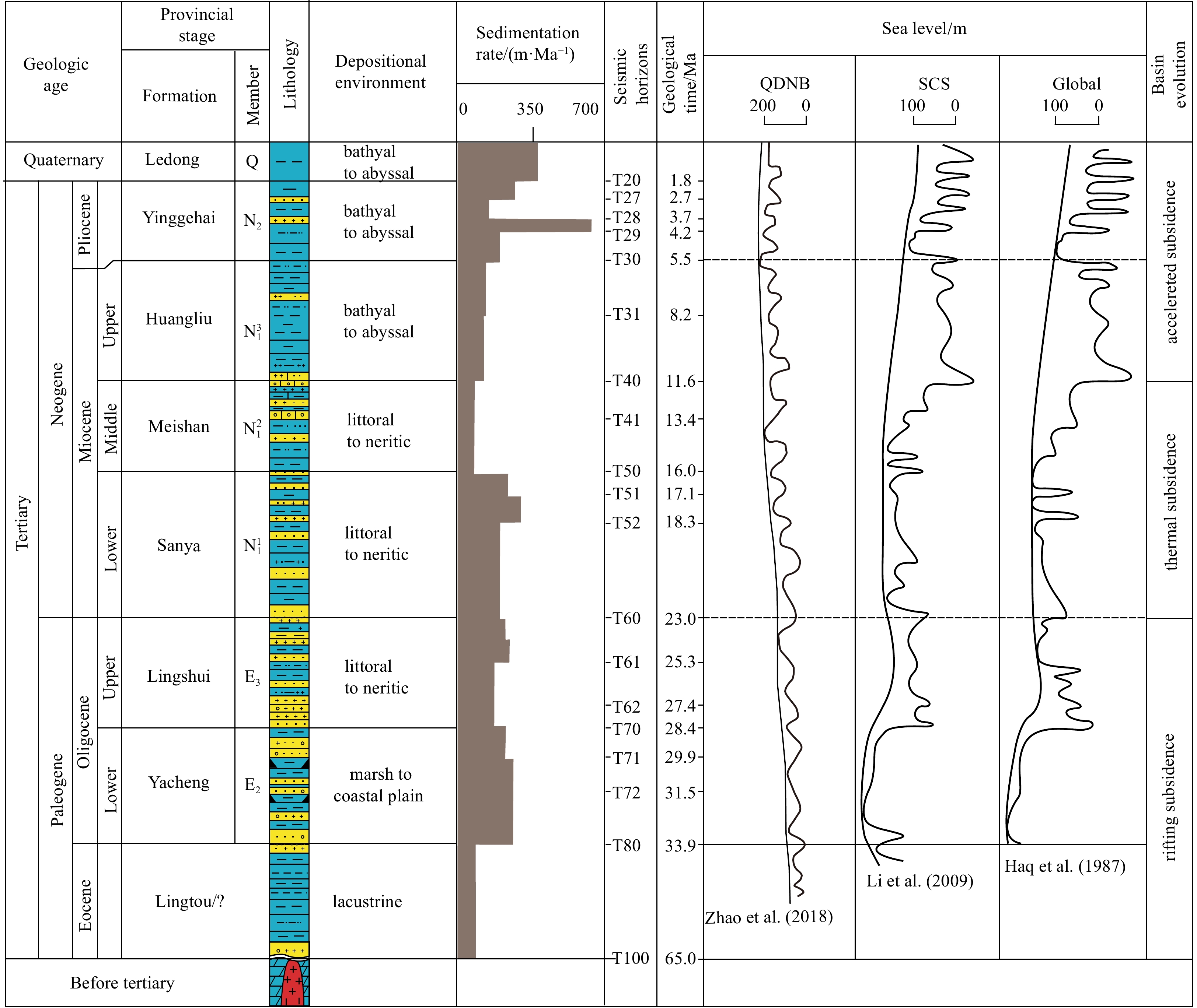
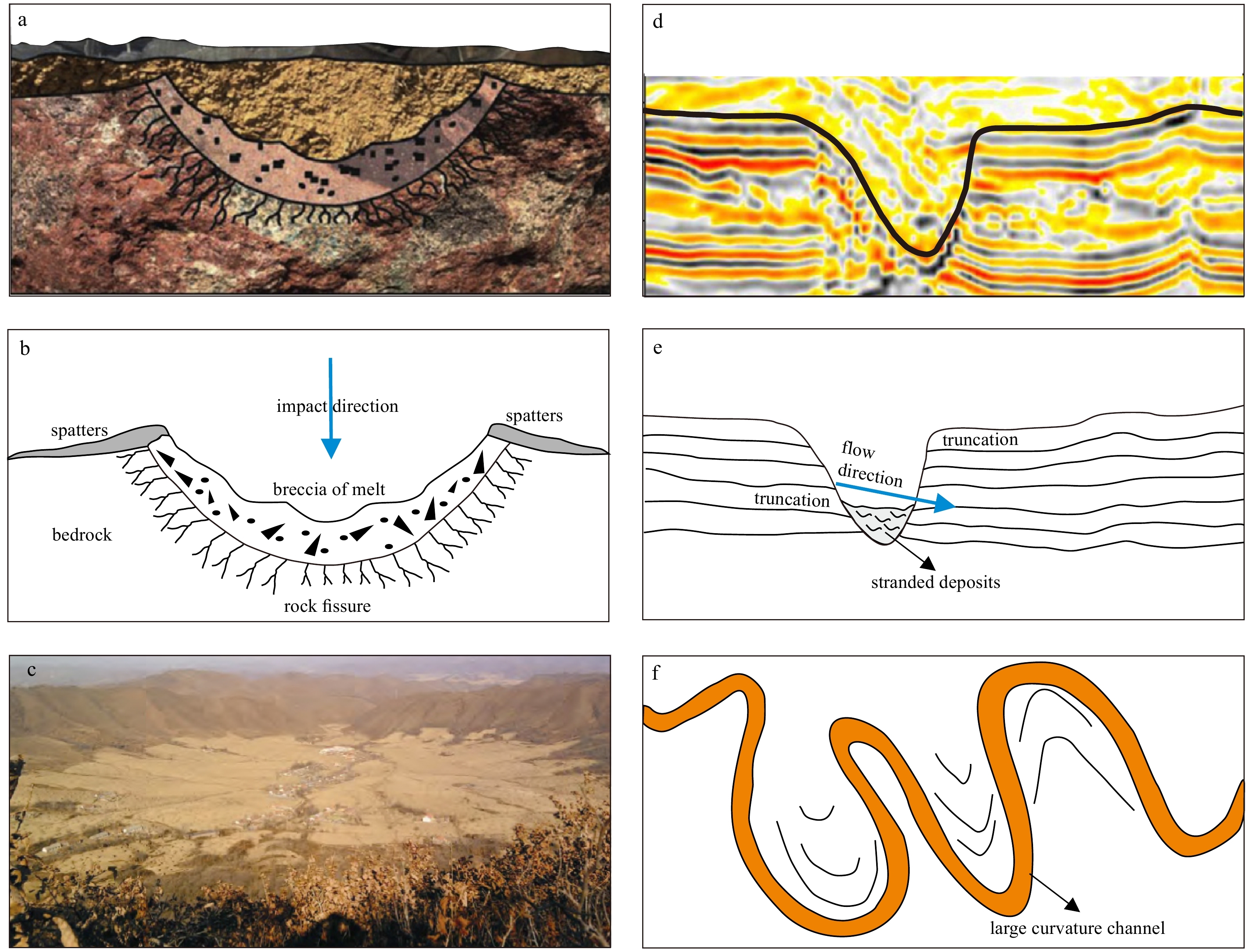
In the late Miocene, giant ancient pockmarks, which are fairly rare globally, developed in the Qiongdongnan Basin. In this paper, to determine the sedimentary characteristics and genetic mechanism of these giant ancient pockmarks in the Yinggehai For...
In the late Miocene, giant ancient pockmarks, which are fairly rare globally, developed in the Qiongdongnan Basin. In this paper, to determine the sedimentary characteristics and genetic mechanism of these giant ancient pockmarks in the Yinggehai For...


2023, 42(2): 134-141.
doi: 10.1007/s13131-022-2120-3
Abstract:
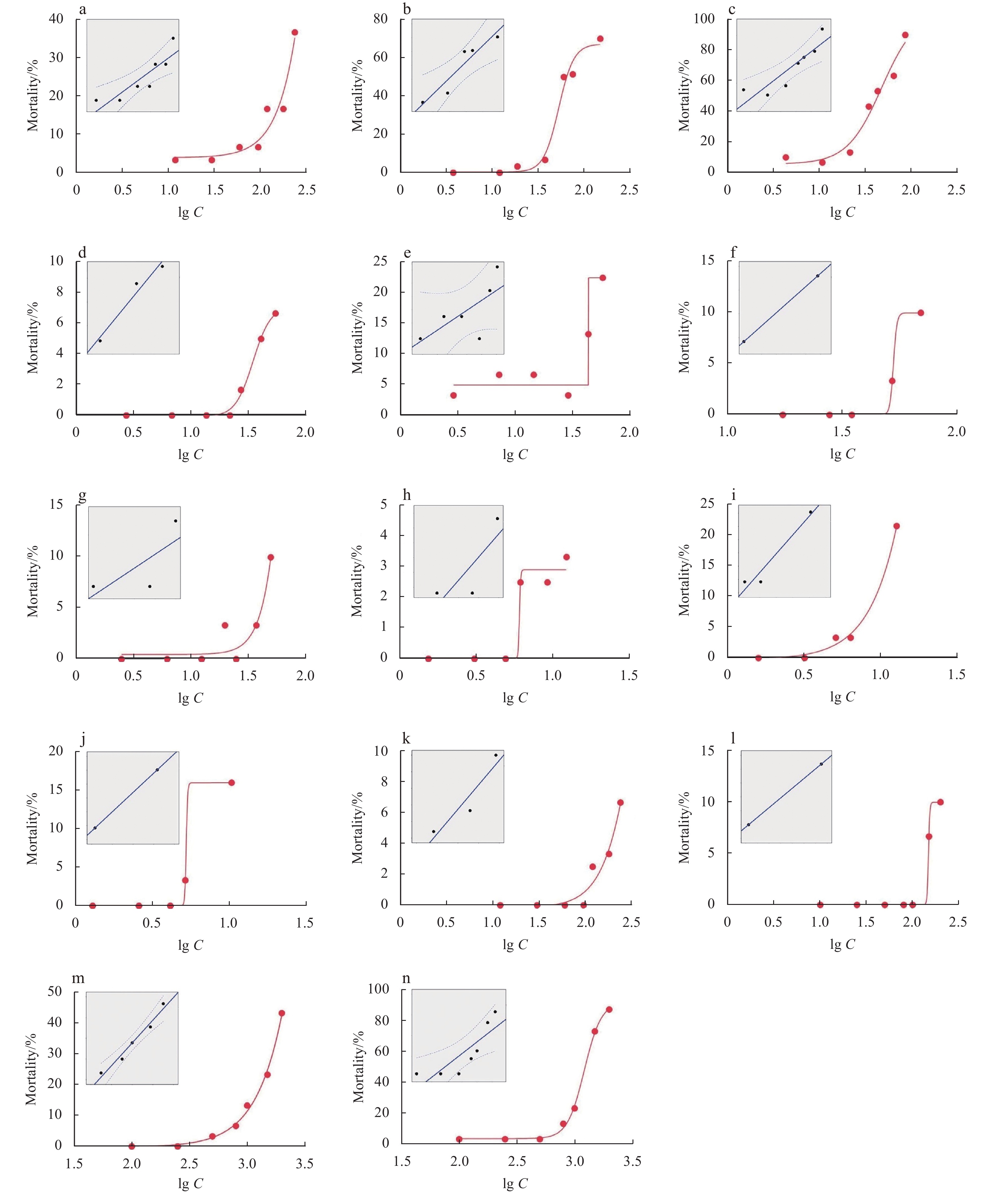
Toxic harmful algal blooms (HABs) can cause deleterious effects in marine organisms, threatening the stability of marine ecosystems. It is well known that different strains, natural populations and growth conditions of the same toxic algal species ma...
Toxic harmful algal blooms (HABs) can cause deleterious effects in marine organisms, threatening the stability of marine ecosystems. It is well known that different strains, natural populations and growth conditions of the same toxic algal species ma...

2023, 42(2): 142-149.
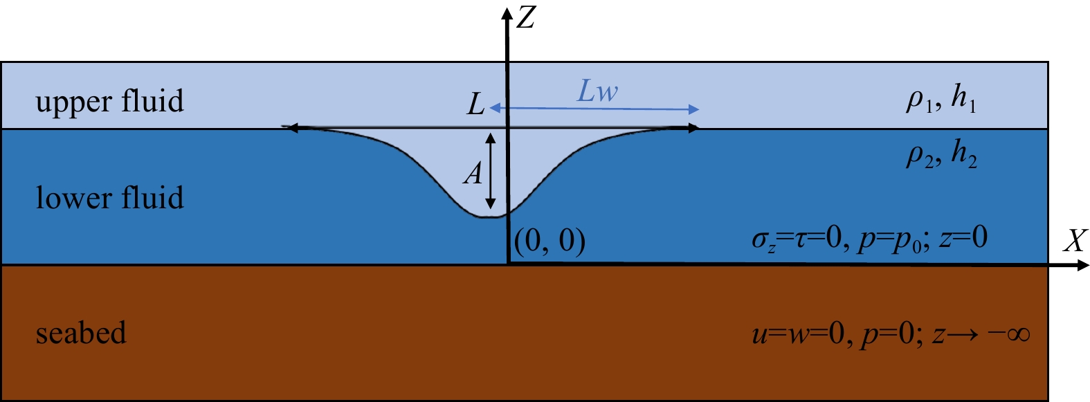
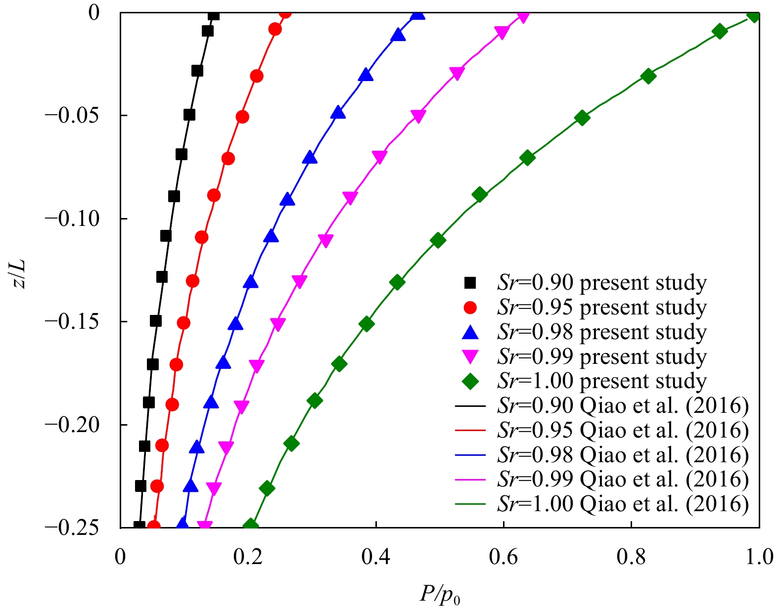
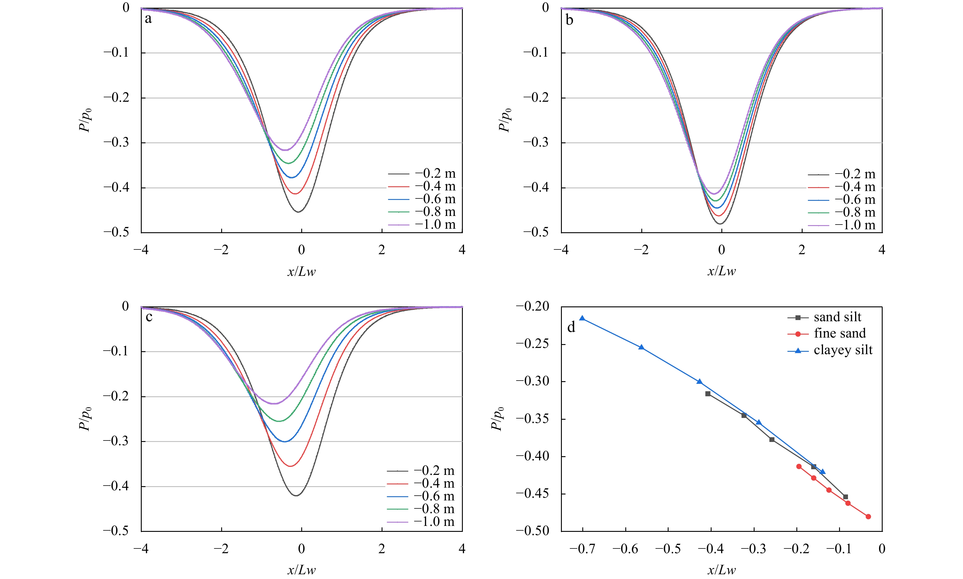
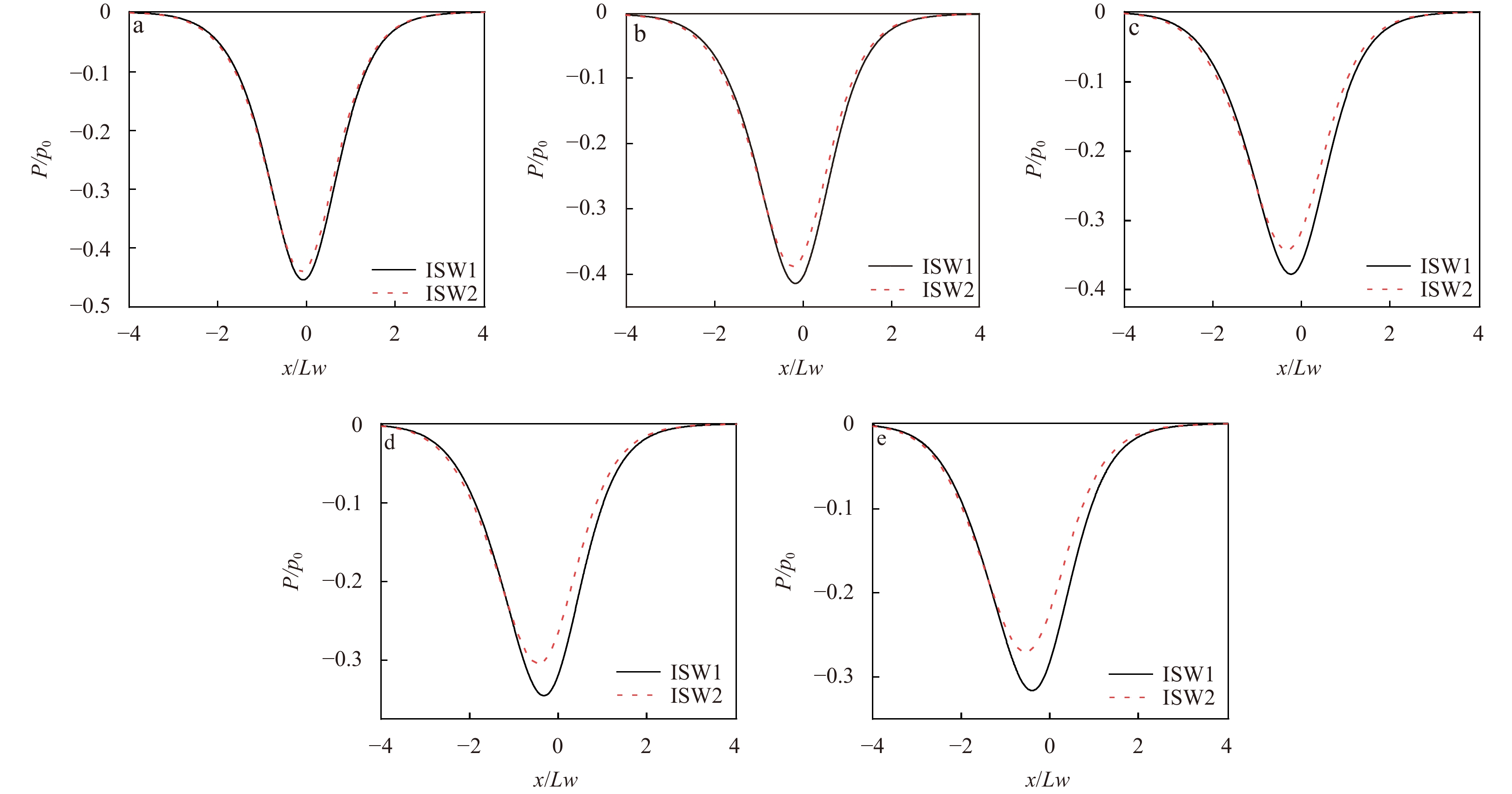
doi: 10.1007/s13131-022-2112-3
Abstract:
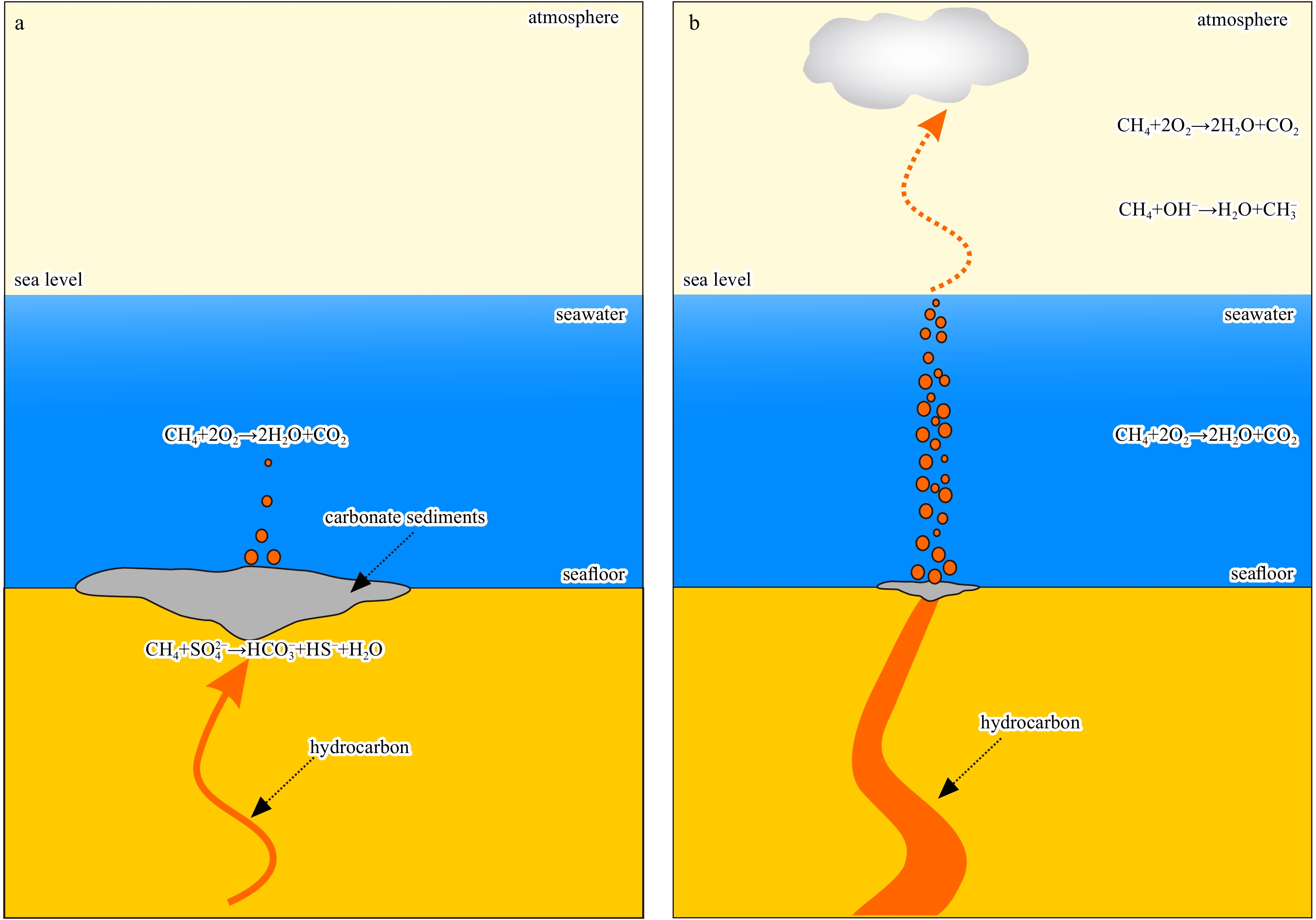
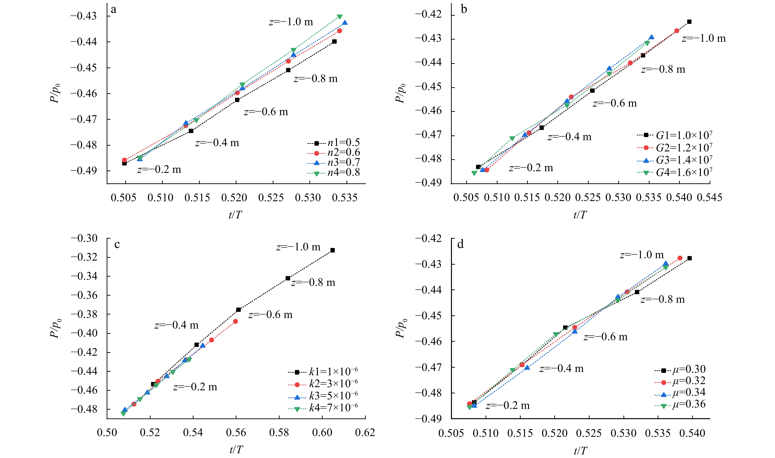
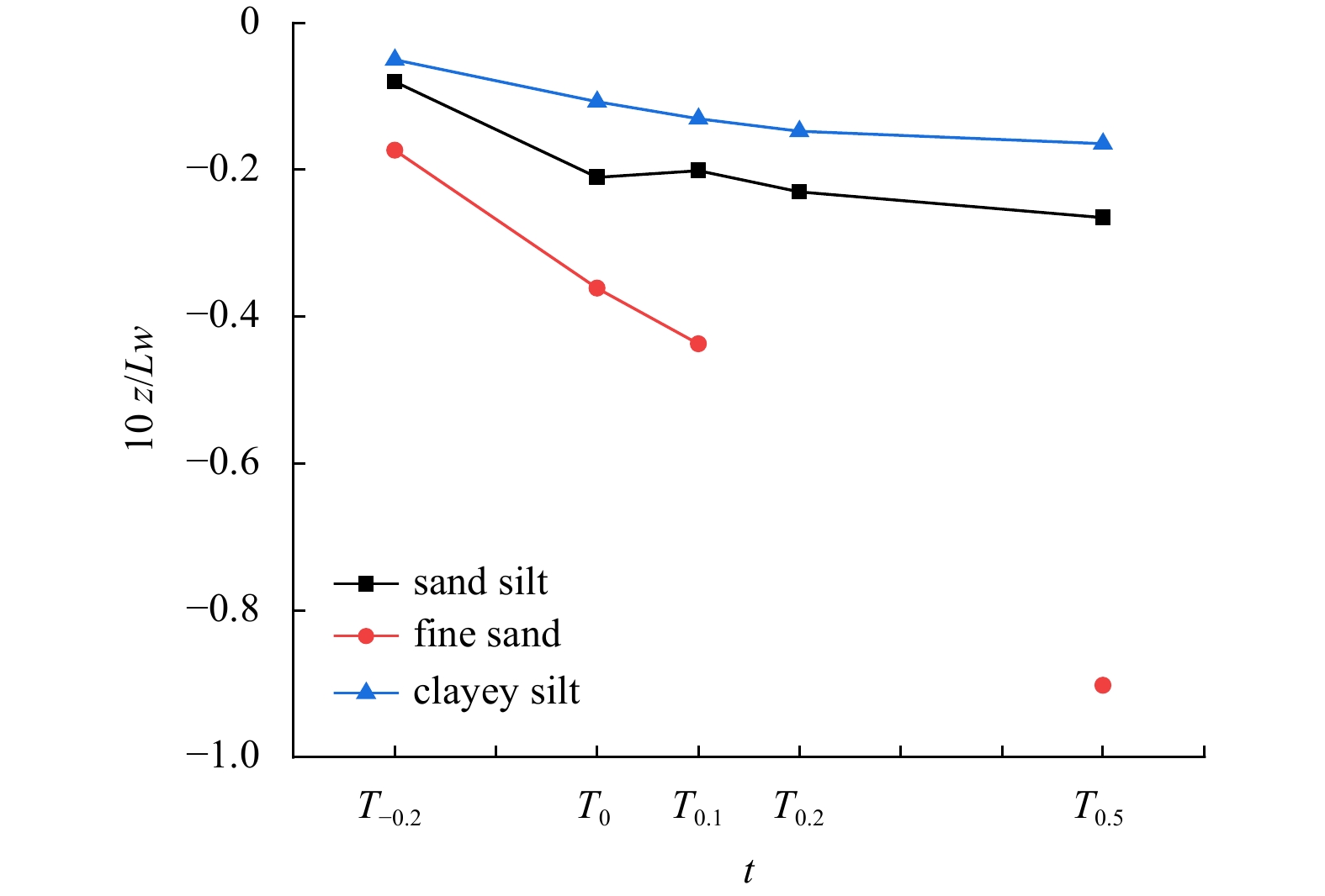
Internal solitary wave (ISW) is often accompanied by huge energy transport, which will change the pore water pressure in the seabed. Based on the two-dimensional Biot consolidation theory, the excess pore water pressure in seabed was simulated, and t...
Internal solitary wave (ISW) is often accompanied by huge energy transport, which will change the pore water pressure in the seabed. Based on the two-dimensional Biot consolidation theory, the excess pore water pressure in seabed was simulated, and t...


2023, 42(2): 150-162.
doi: 10.1007/s13131-022-2063-8
Abstract:
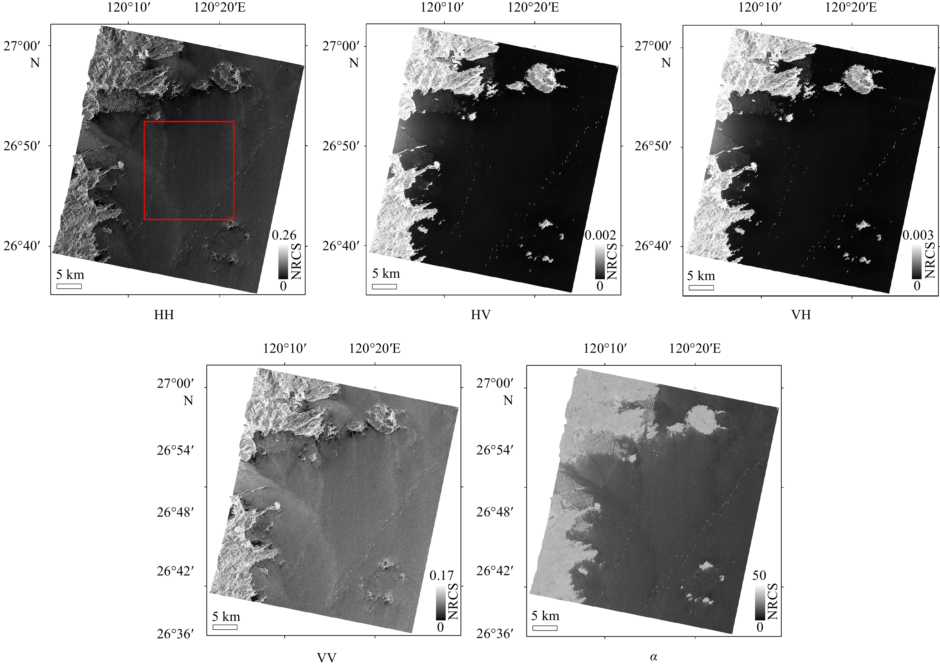
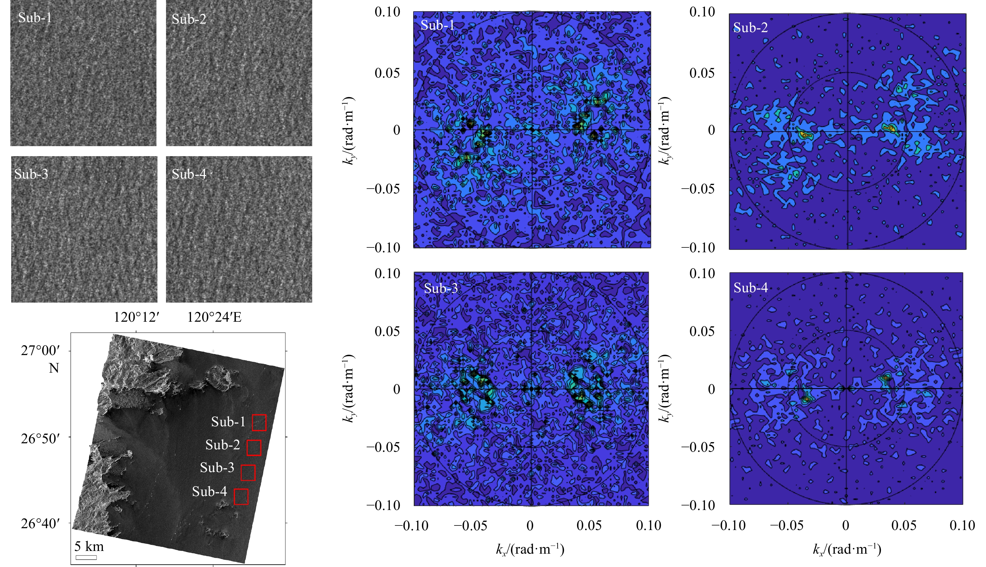
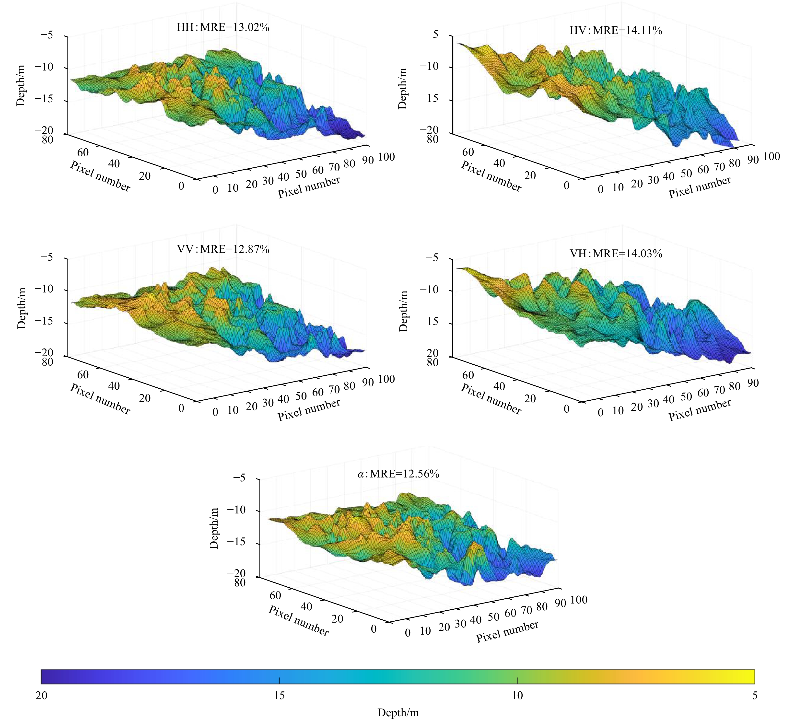
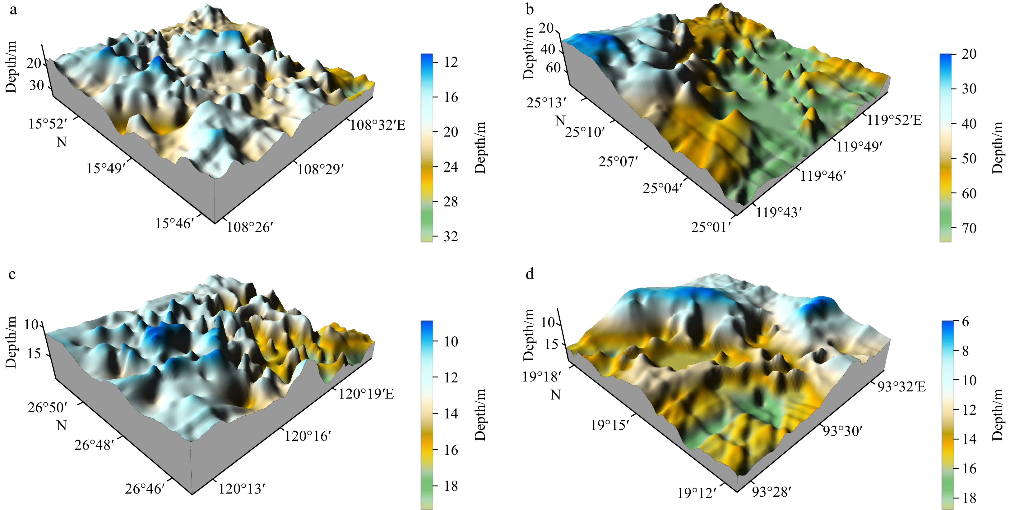
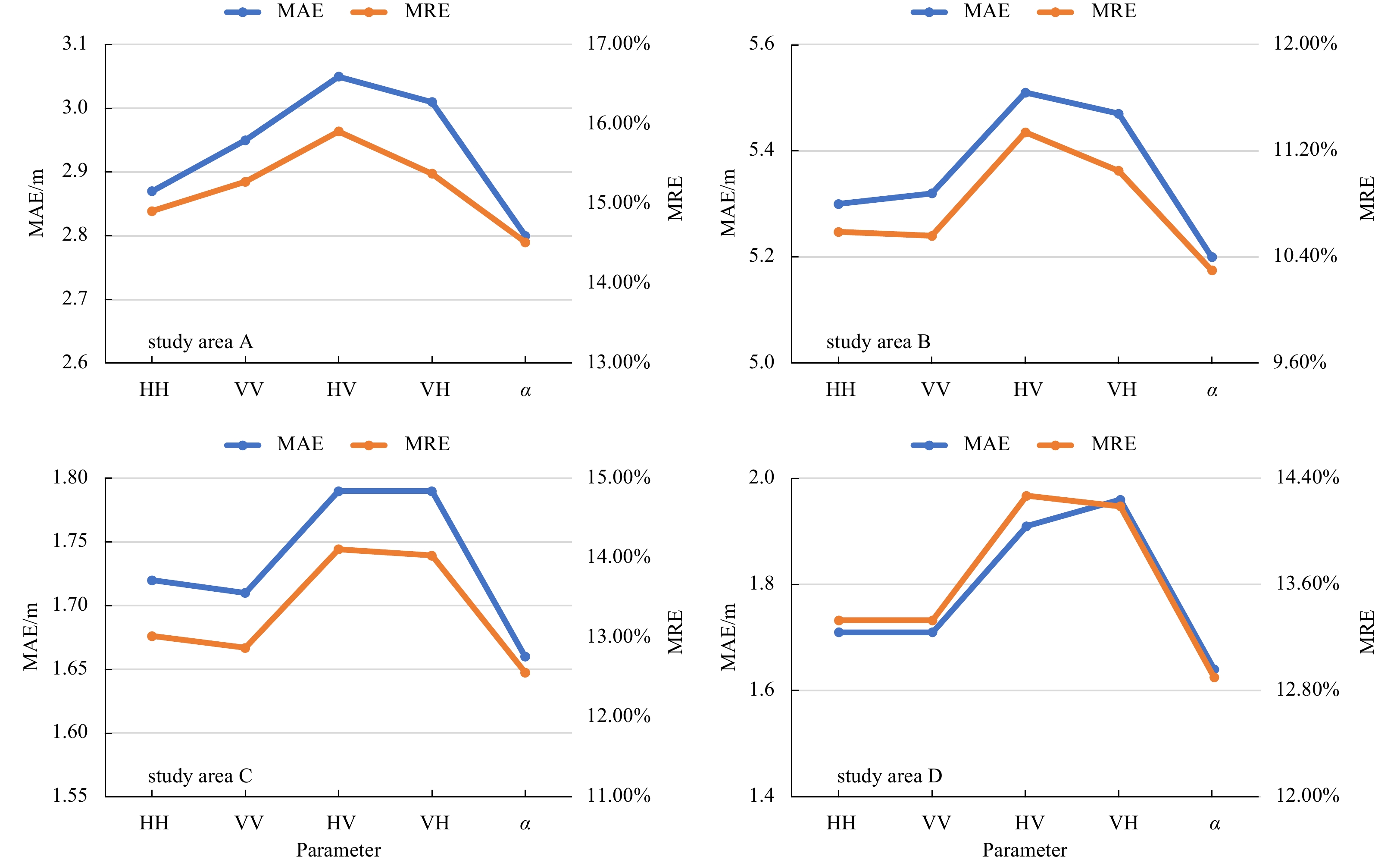
Compared to single-polarization synthetic aperture radar (SAR) data, fully polarimetric SAR data can provide more detailed information of the sea surface, which is important for applications such as shallow sea topography detection. The Gaofen-3 sate...
Compared to single-polarization synthetic aperture radar (SAR) data, fully polarimetric SAR data can provide more detailed information of the sea surface, which is important for applications such as shallow sea topography detection. The Gaofen-3 sate...


2023, 42(2): 163-174.
doi: 10.1007/s13131-022-2026-0
Abstract:
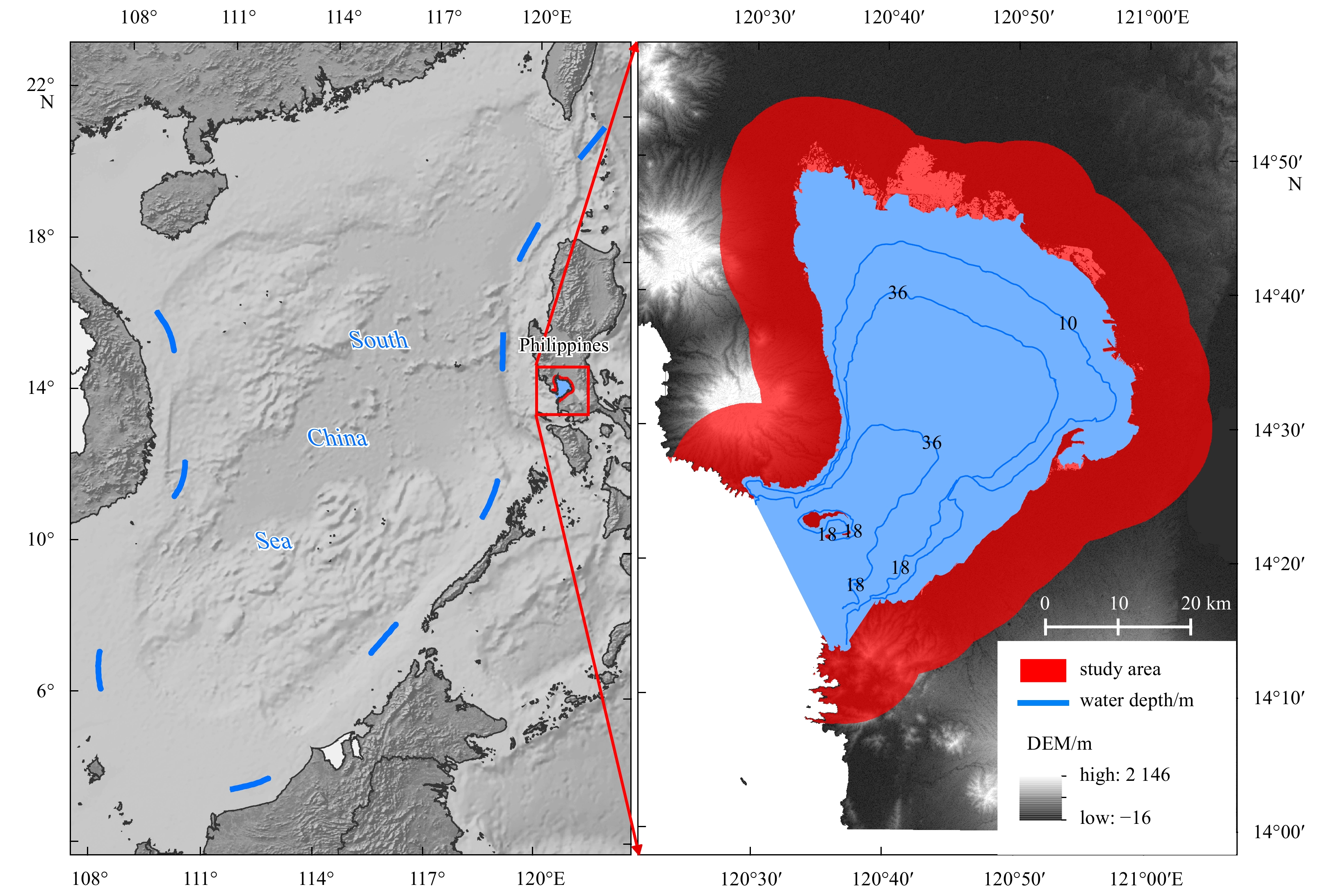
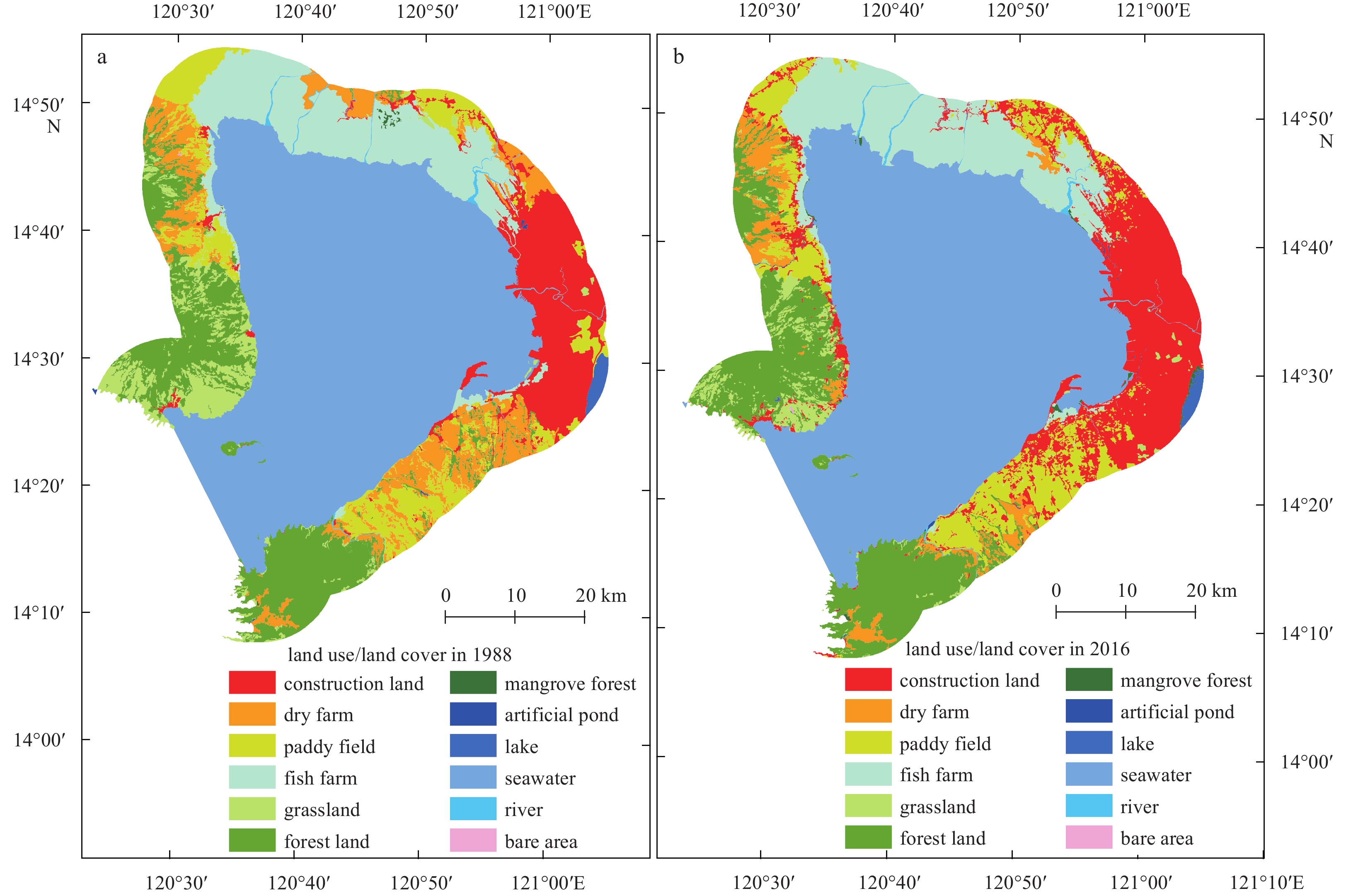
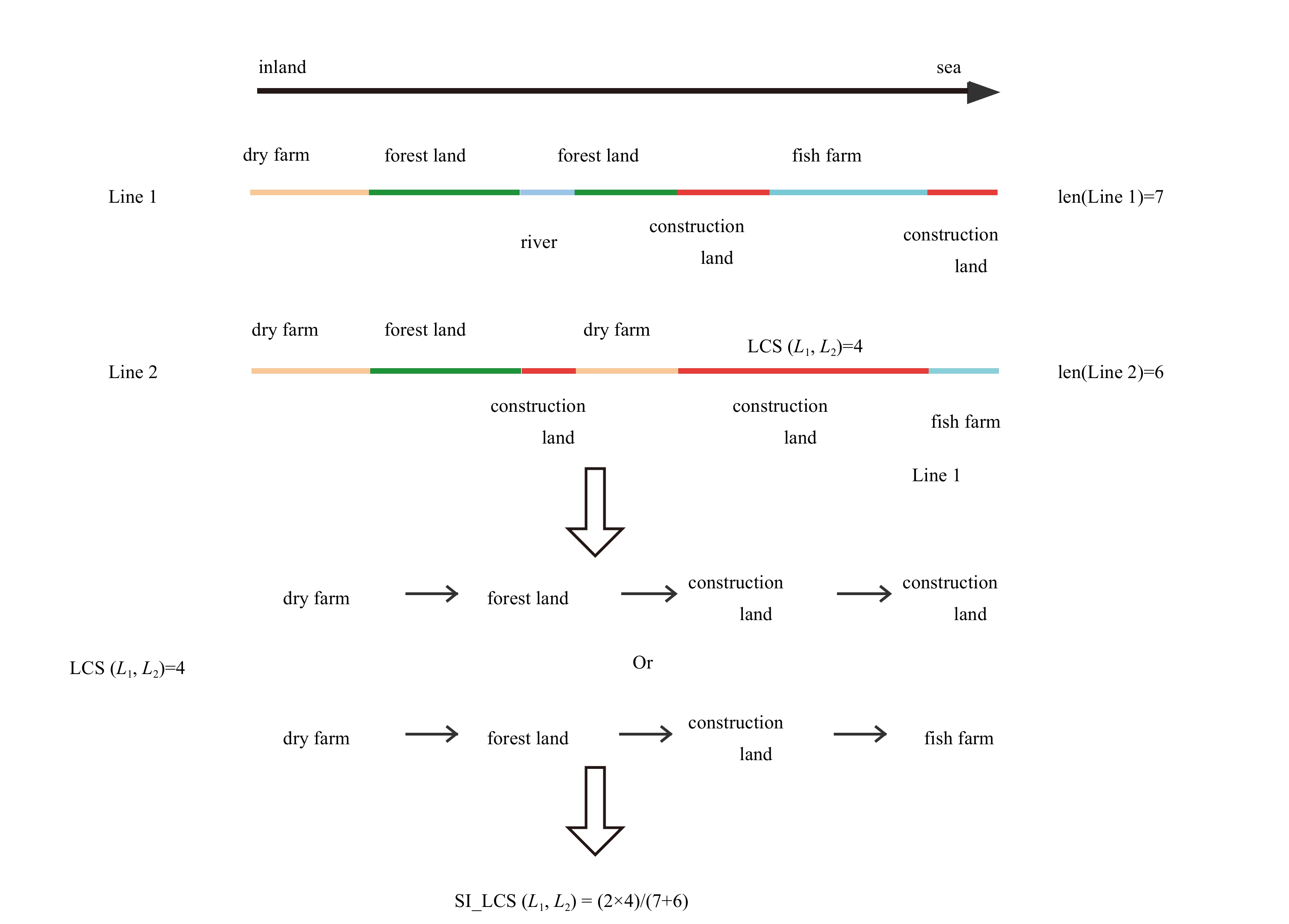
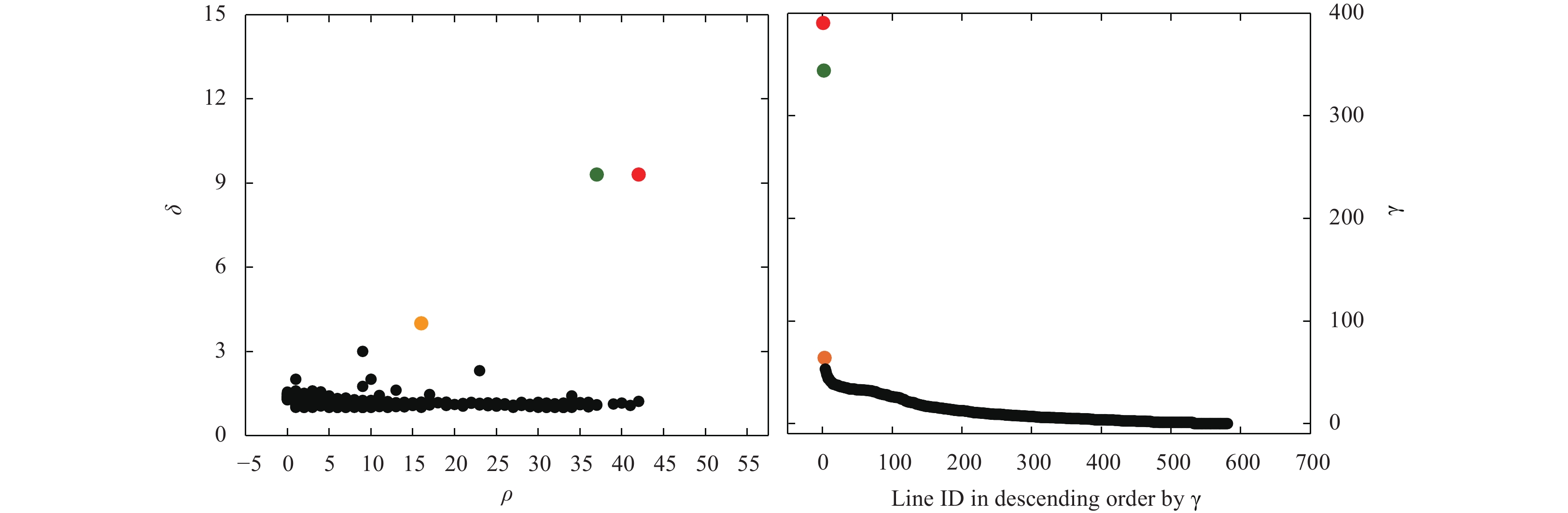
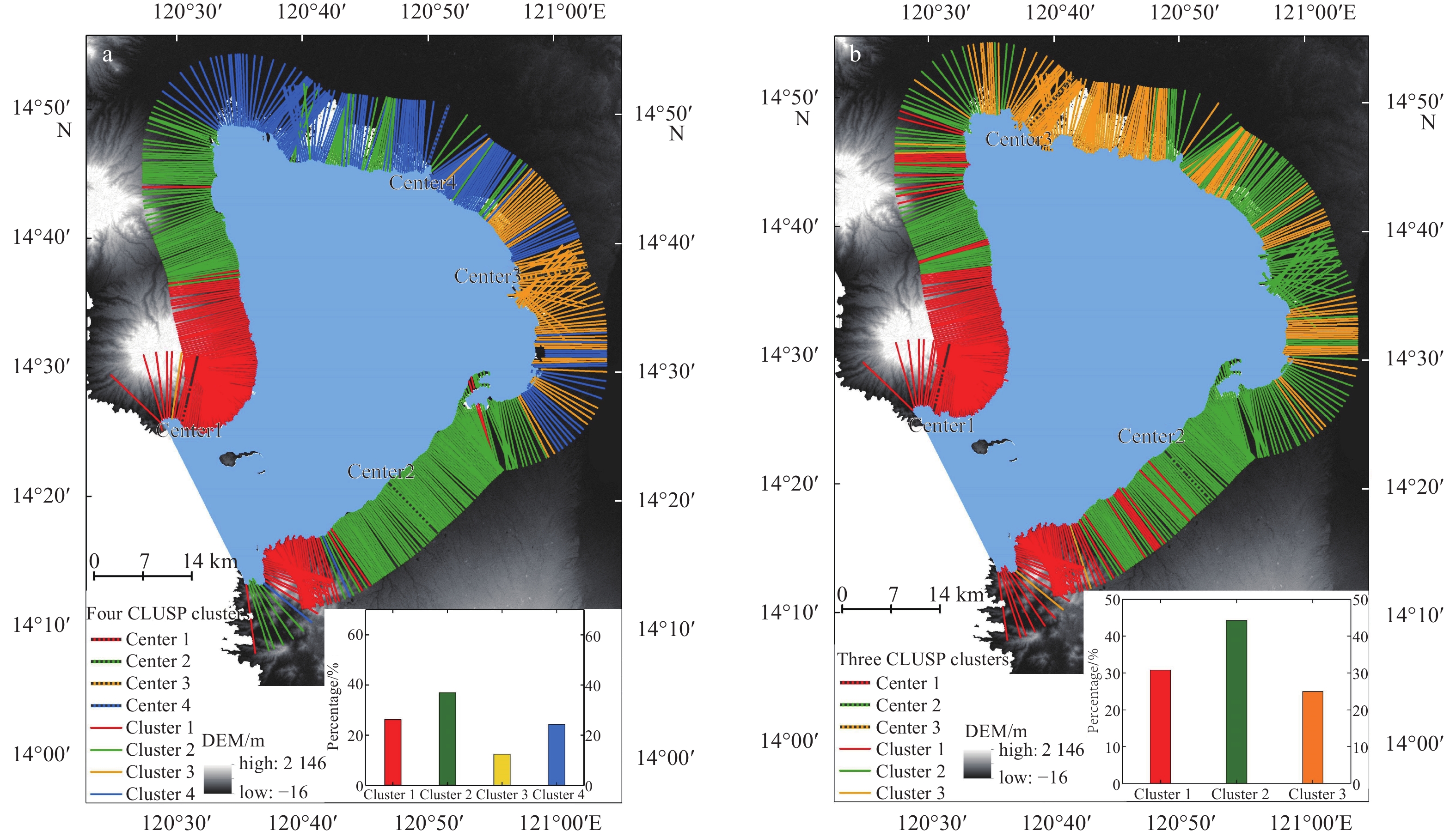
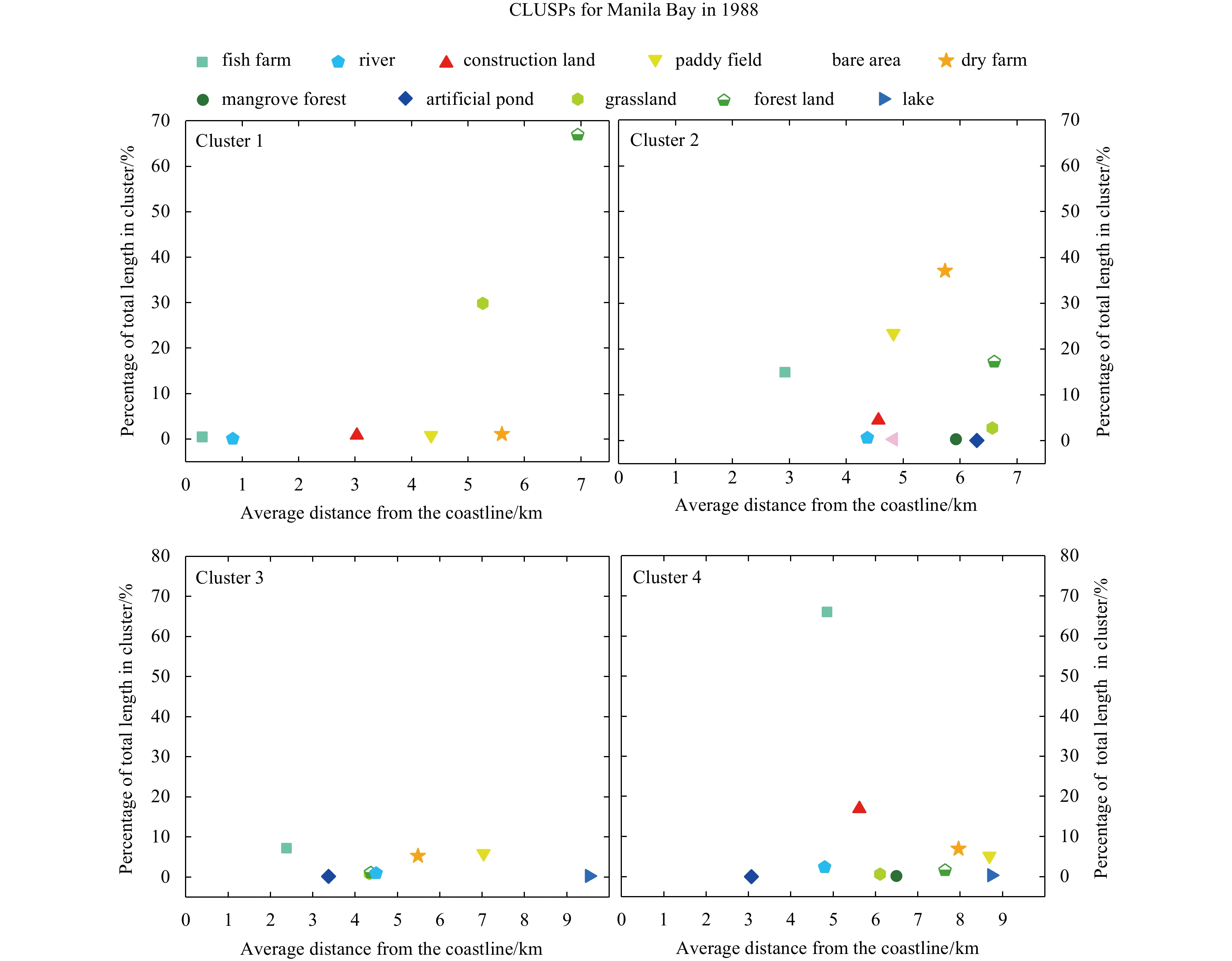
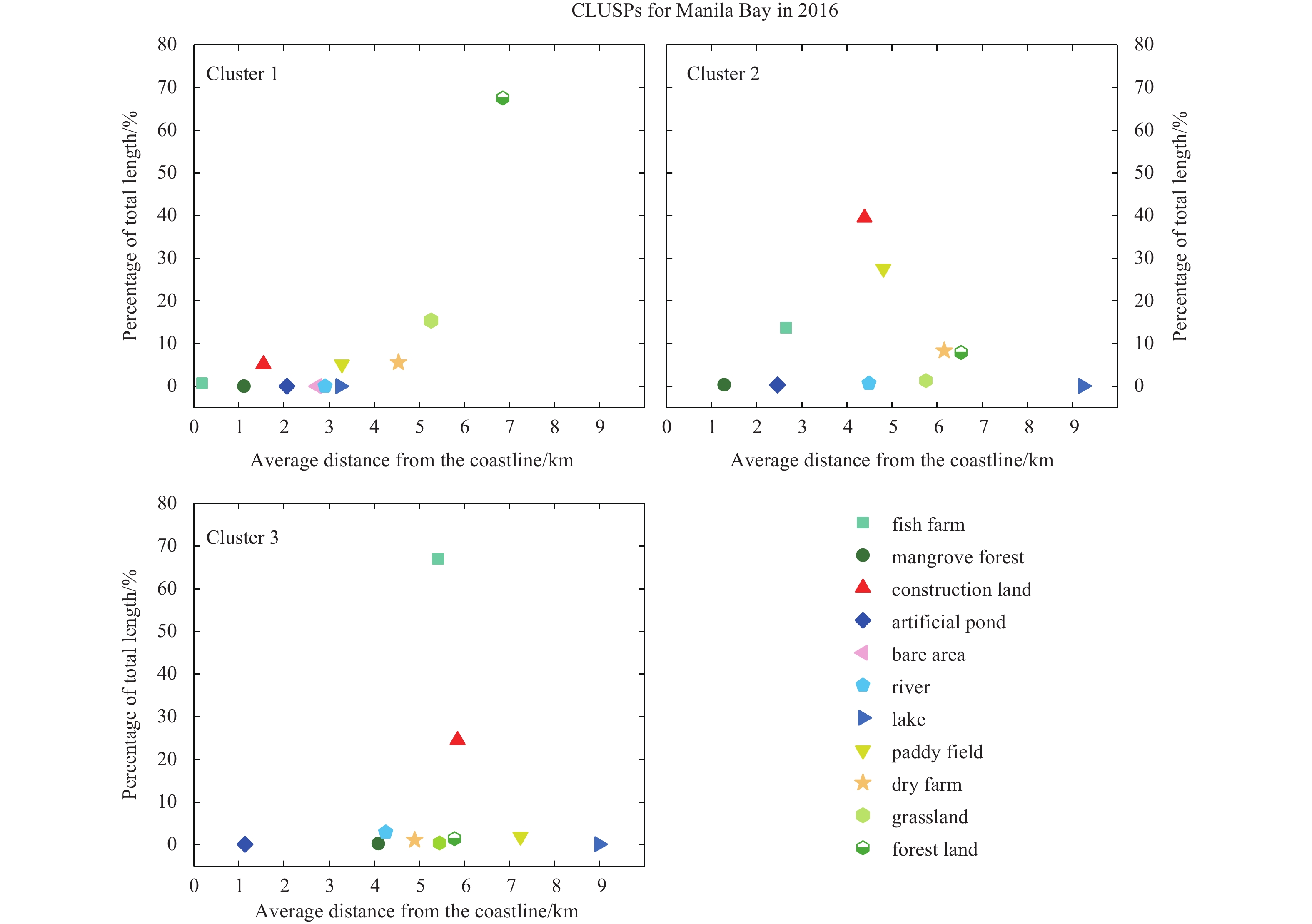
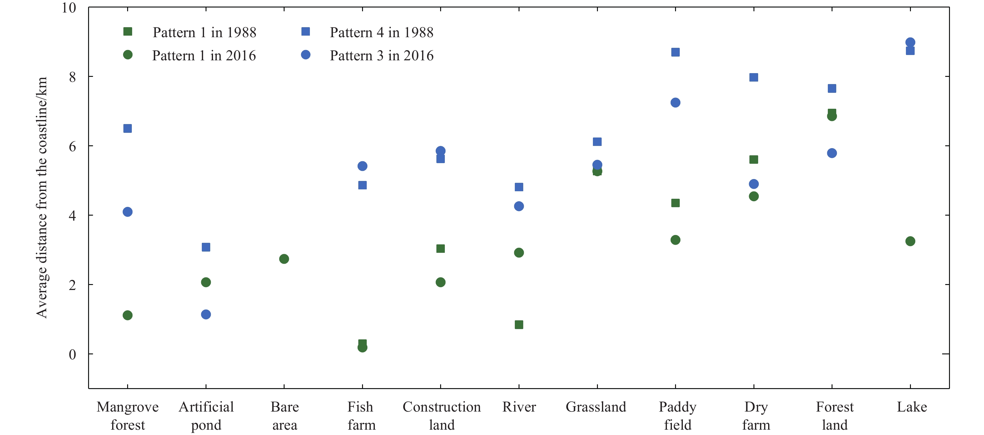
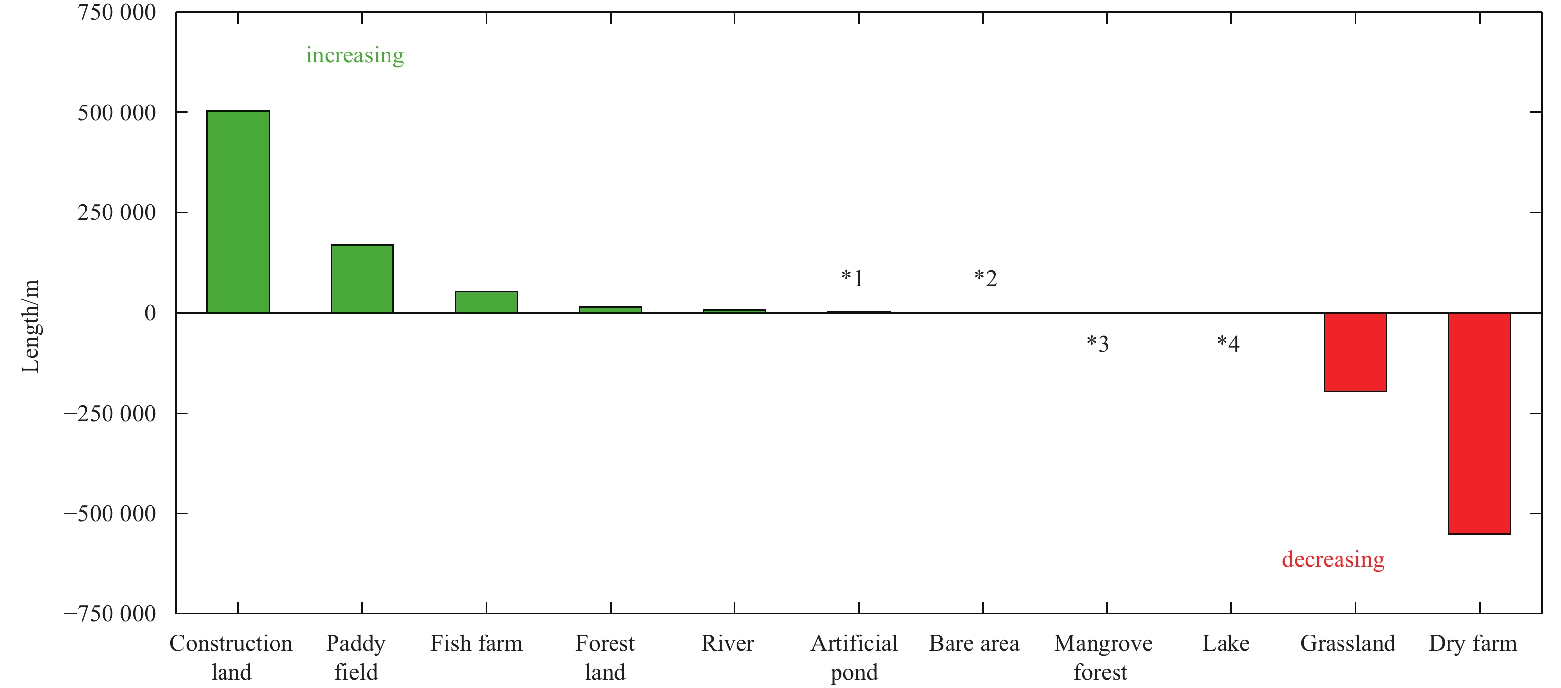
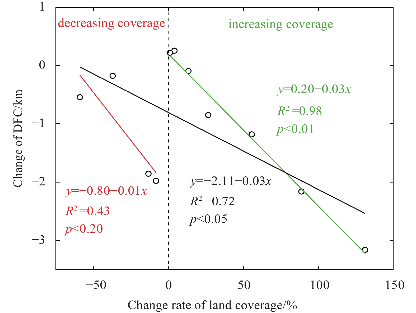
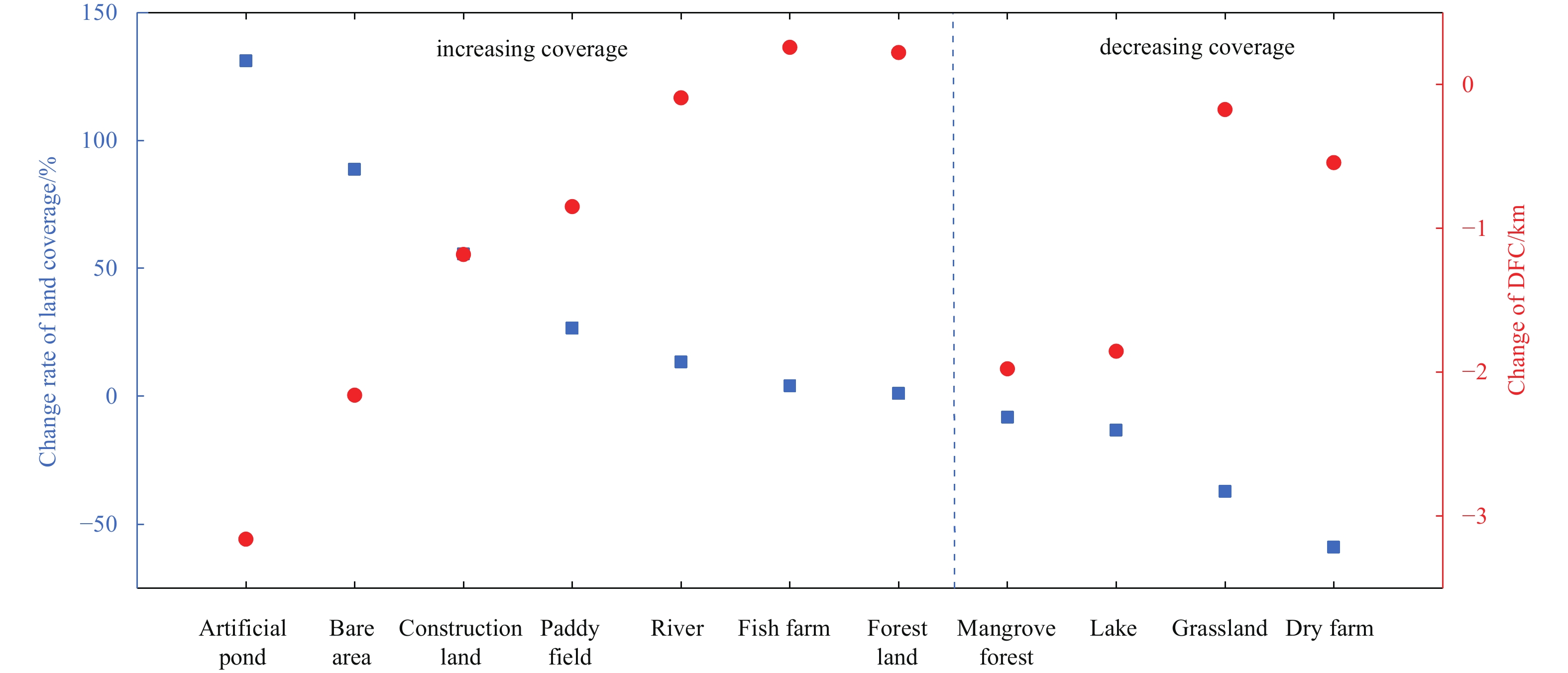
Increasing intense human activities have largely changed the coastal landscape and caused many environmental issues. However, whether human-induced activities could change the coastal land use gradient pattern, an important coastal zonal characterist...
Increasing intense human activities have largely changed the coastal landscape and caused many environmental issues. However, whether human-induced activities could change the coastal land use gradient pattern, an important coastal zonal characterist...