2021 Vol. 40, No. 1
Display Method:
2021, (1): 1-2.
Abstract:

2021, 40(1): 4-12.
doi: 10.1007/s13131-021-1719-0
Abstract:
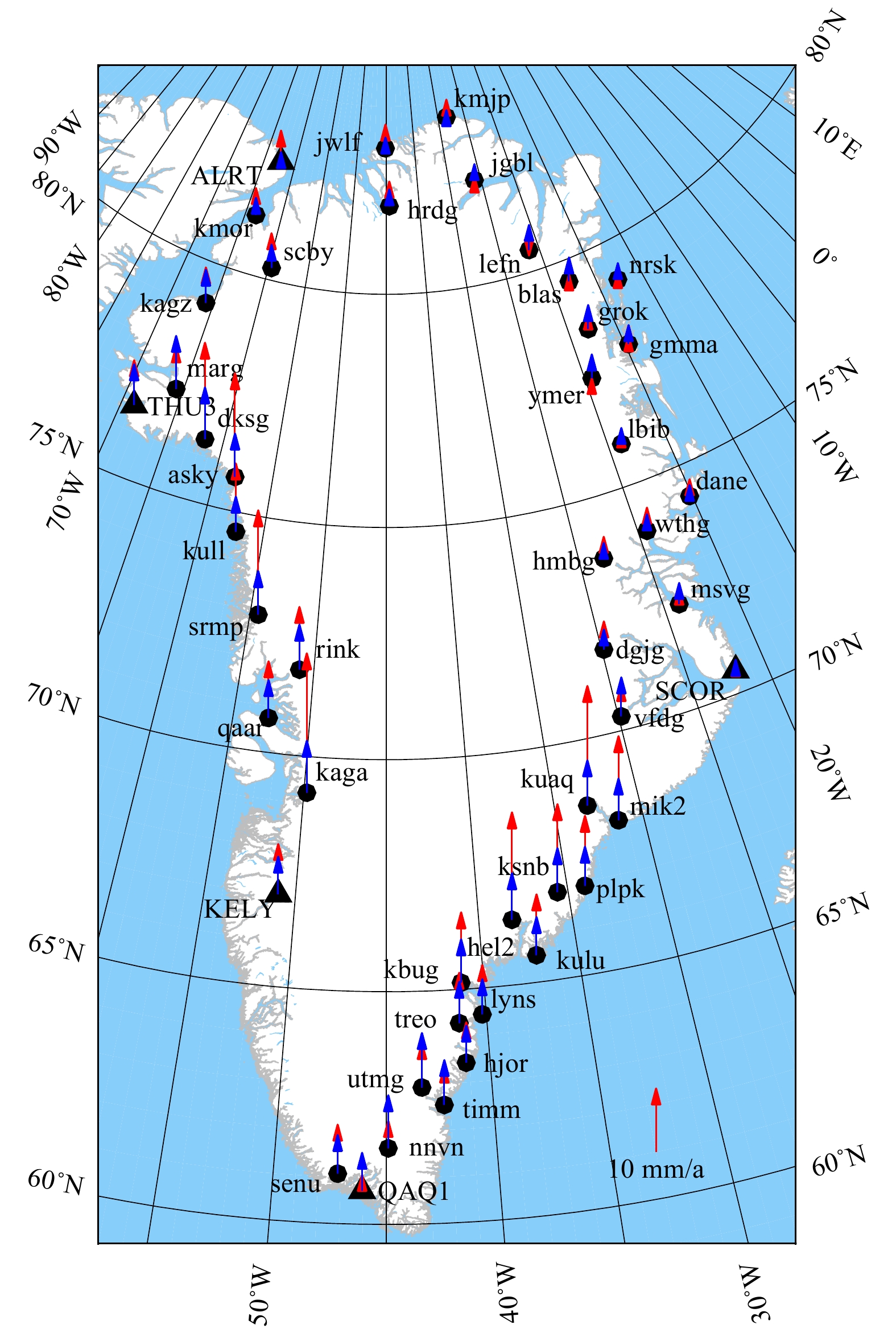
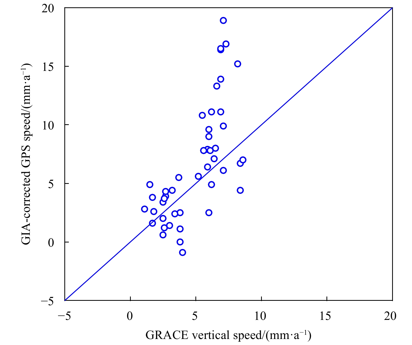
To better monitor the vertical crustal movements and sea level changes around Greenland, multiple data sources were used in this paper, including global positioning system (GPS), tide gauge, satellite gravimetry, satellite altimetry, glacial isostati...
To better monitor the vertical crustal movements and sea level changes around Greenland, multiple data sources were used in this paper, including global positioning system (GPS), tide gauge, satellite gravimetry, satellite altimetry, glacial isostati...


2021, 40(1): 13-21.
doi: 10.1007/s13131-020-1682-1
Abstract:
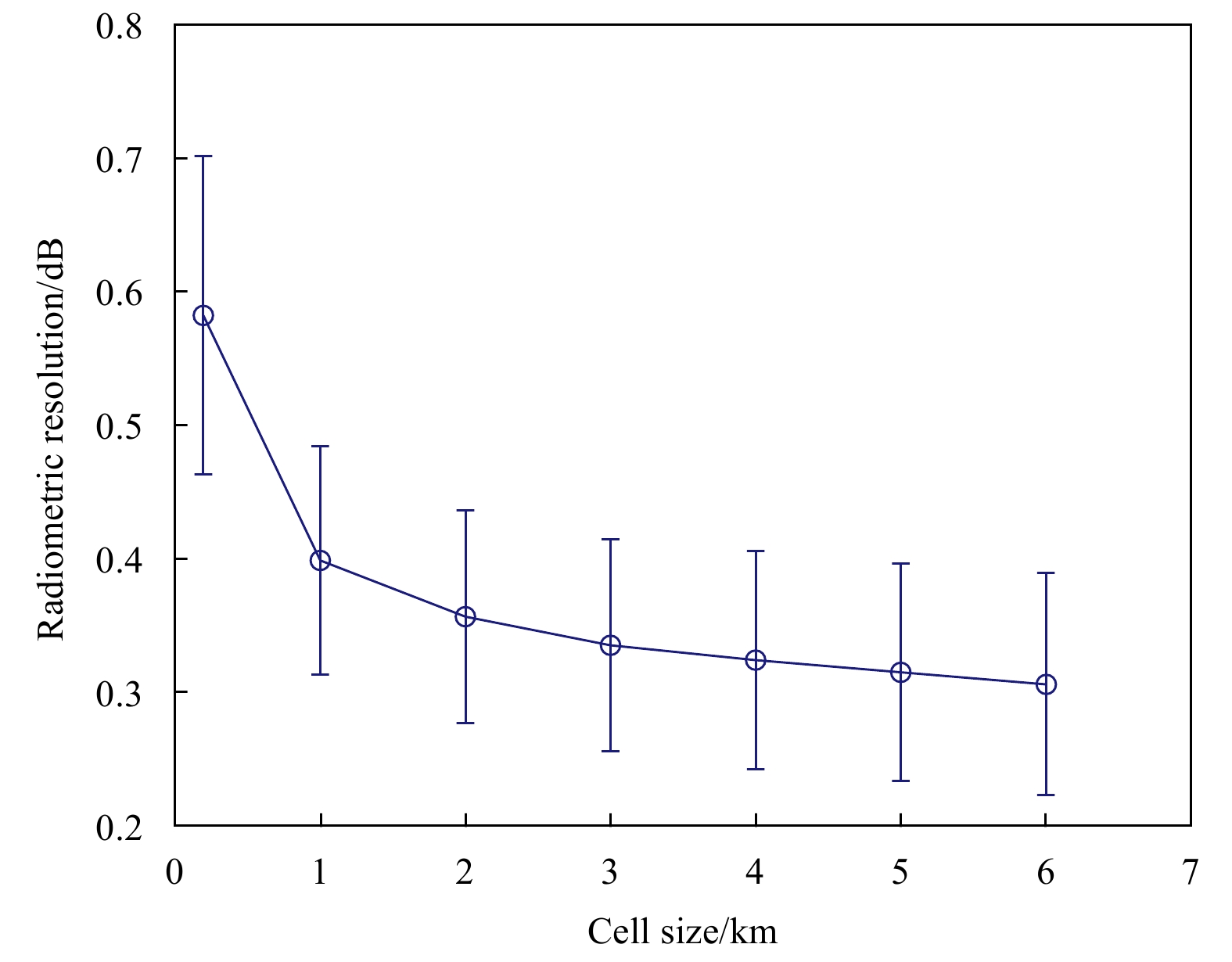
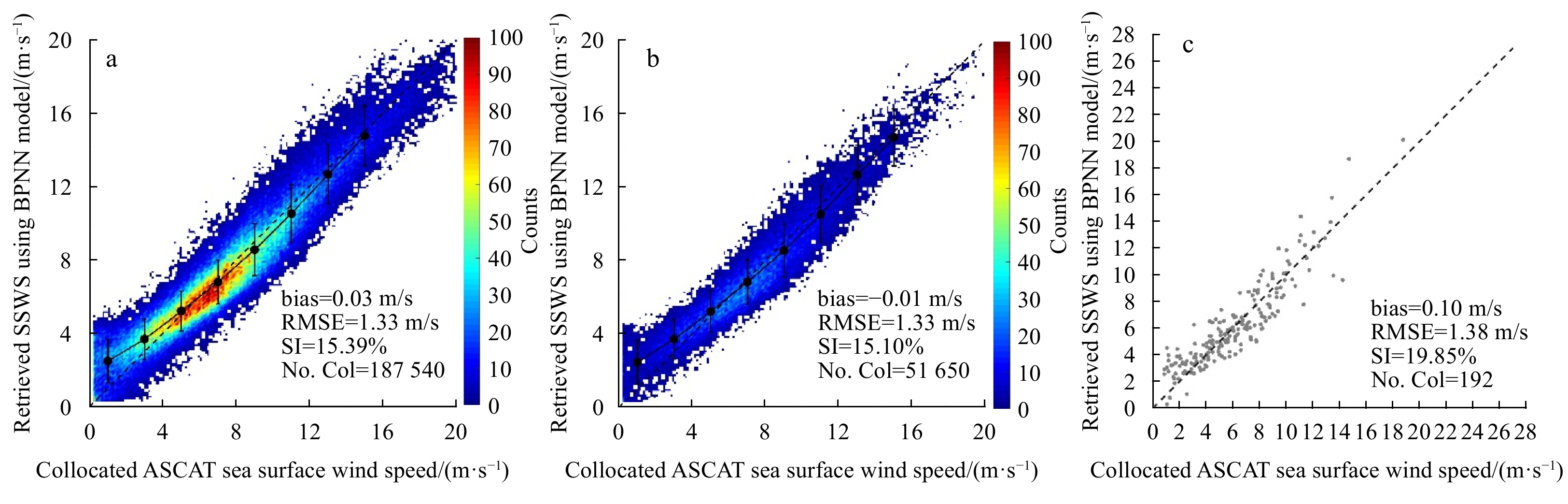
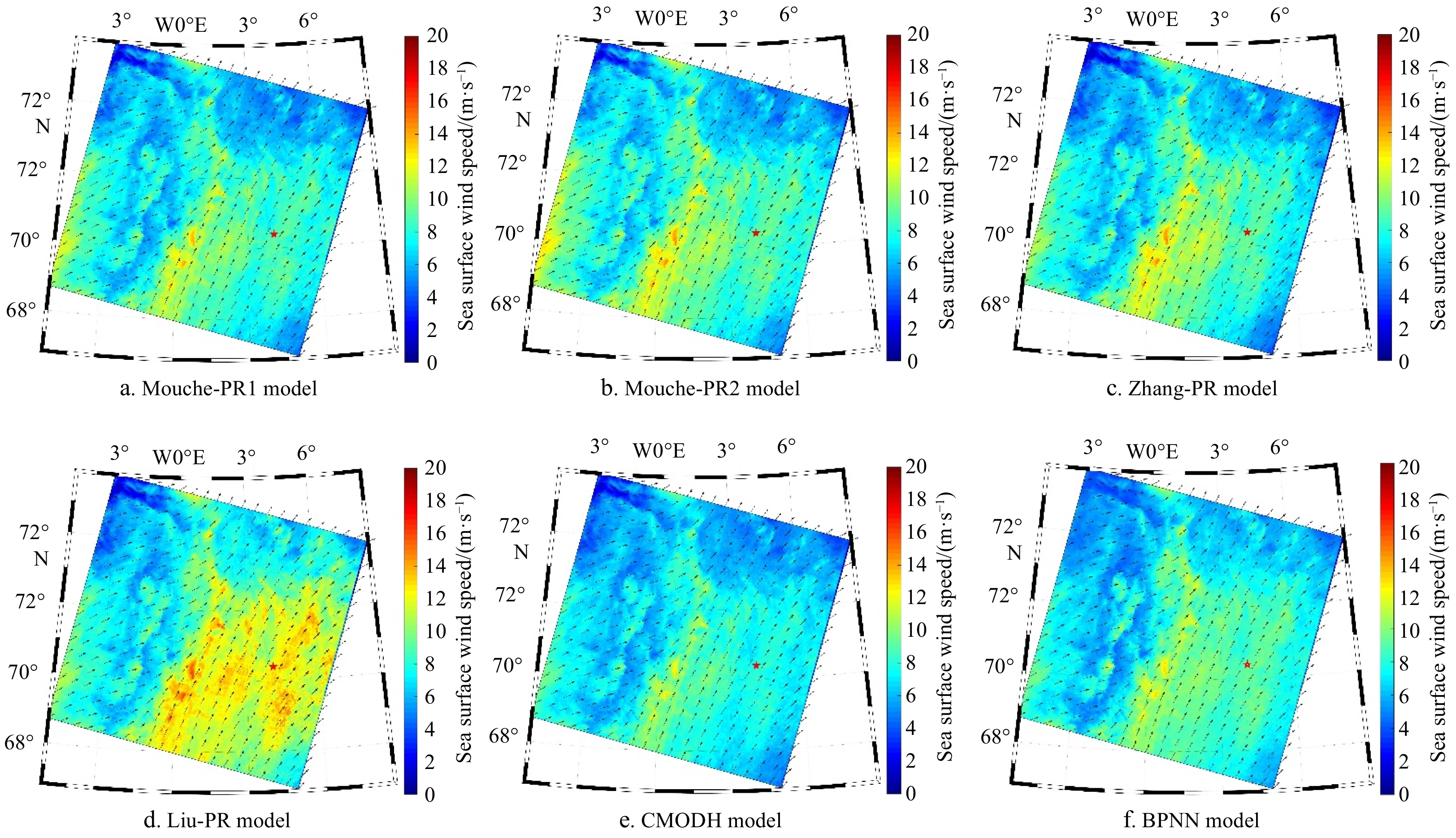
Conventional retrieval and neural network methods are used simultaneously to retrieve sea surface wind speed (SSWS) from HH-polarized Sentinel-1 (S1) SAR images. The Polarization Ratio (PR) models combined with the CMOD5.N Geophysical Model Function ...
Conventional retrieval and neural network methods are used simultaneously to retrieve sea surface wind speed (SSWS) from HH-polarized Sentinel-1 (S1) SAR images. The Polarization Ratio (PR) models combined with the CMOD5.N Geophysical Model Function ...


2021, 40(1): 22-32.
doi: 10.1007/s13131-021-1718-1
Abstract:
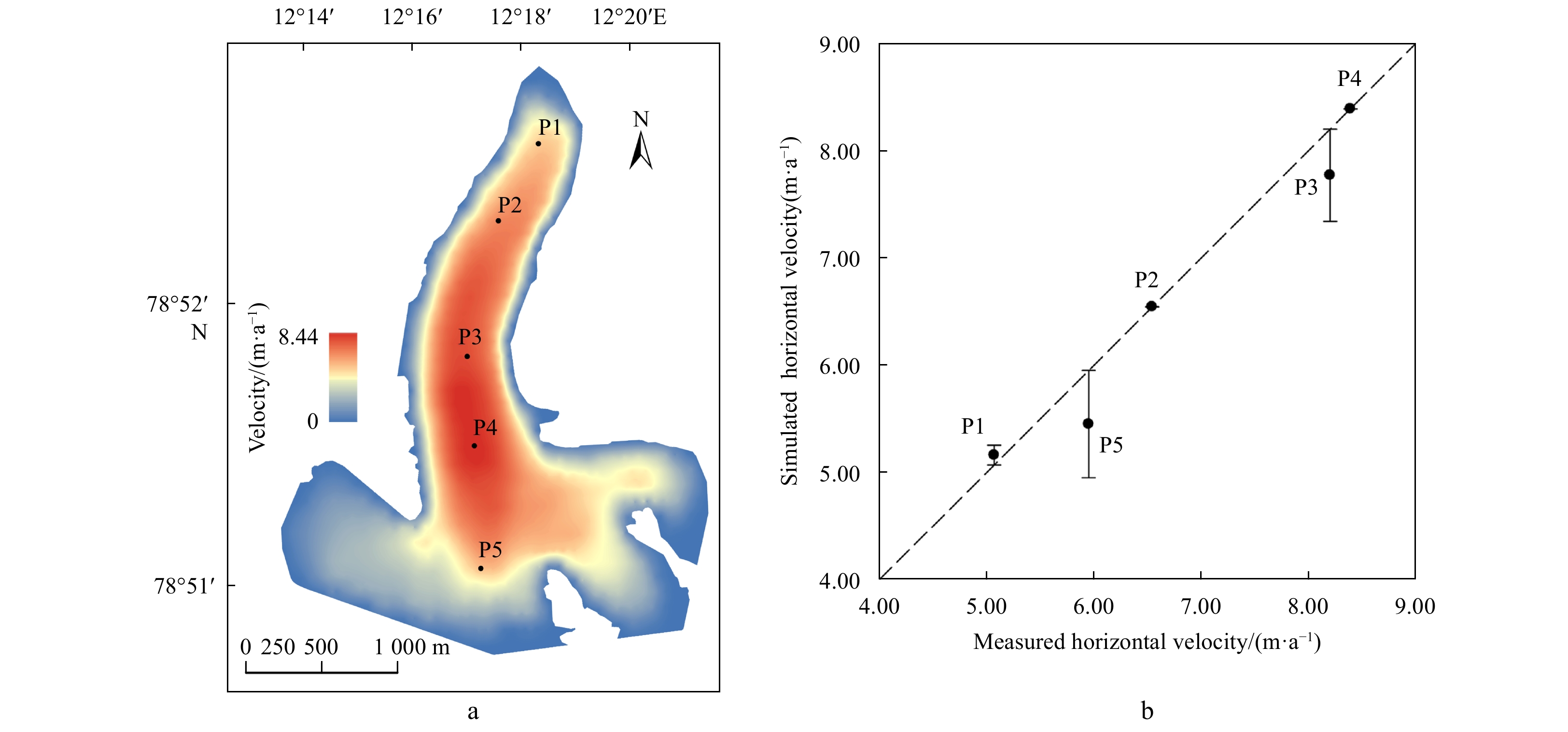
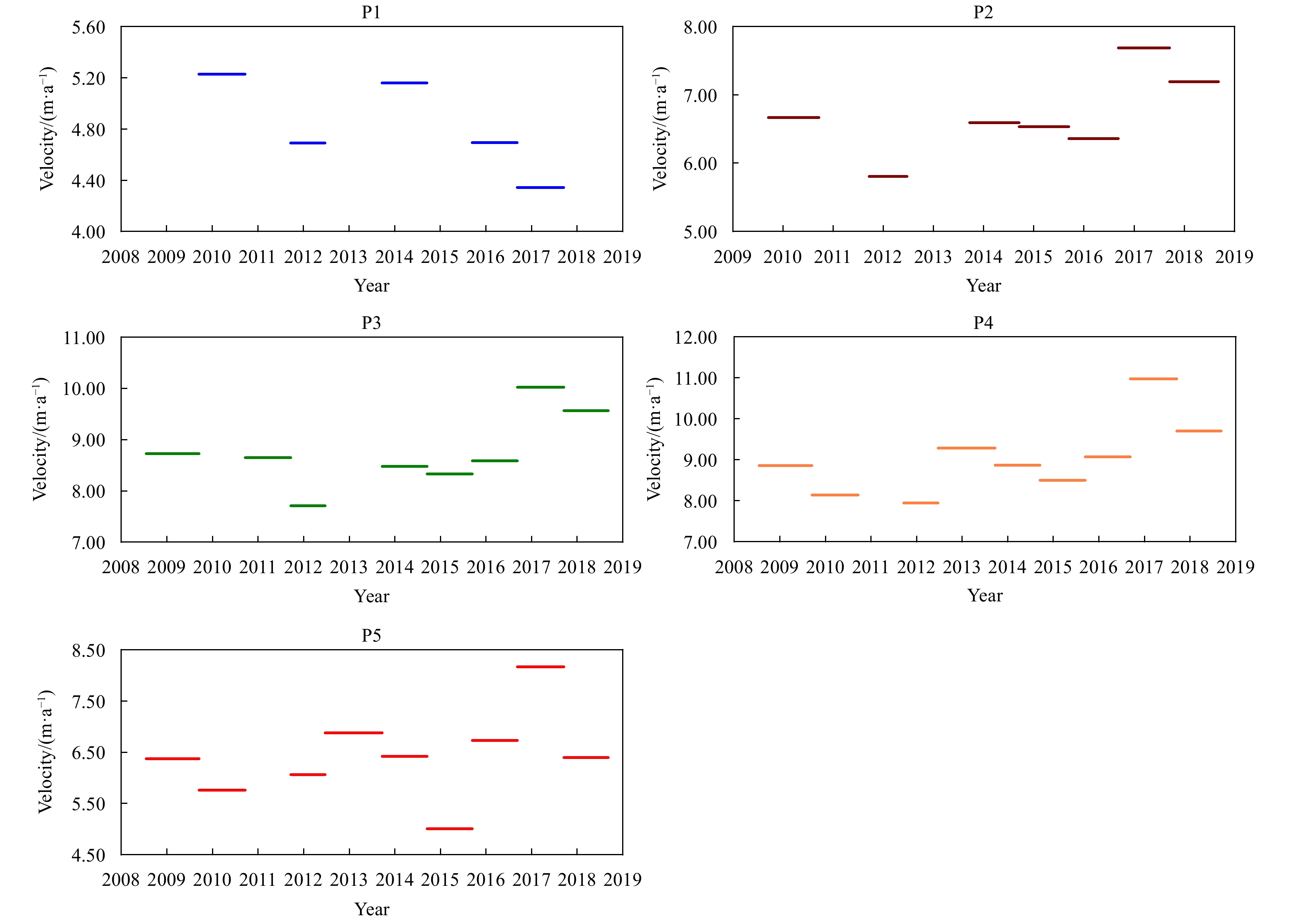
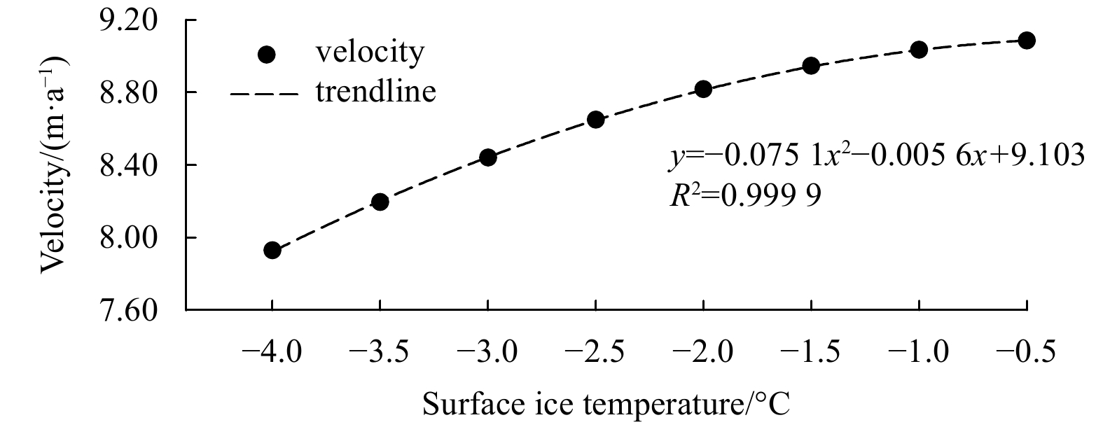
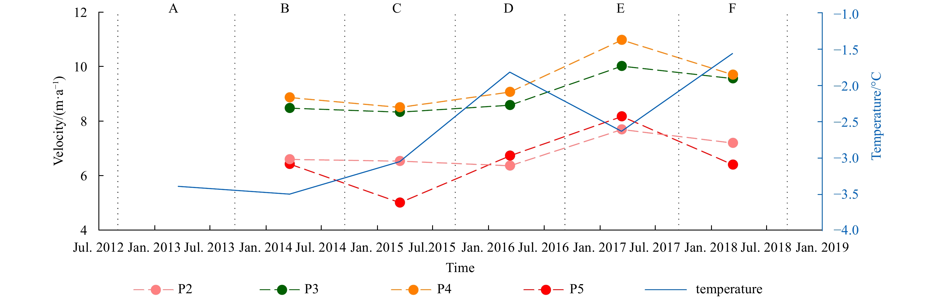
This study explores the ice flow acceleration (21.1%) of Pedersenbreen during 2016–2017 after the extremely warm winter throughout the whole Arctic in 2015/2016 using in situ data and quantitatively analyses the factors contributing to this accelerat...
This study explores the ice flow acceleration (21.1%) of Pedersenbreen during 2016–2017 after the extremely warm winter throughout the whole Arctic in 2015/2016 using in situ data and quantitatively analyses the factors contributing to this accelerat...


2021, 40(1): 33-42.
doi: 10.1007/s13131-021-1716-3
Abstract:
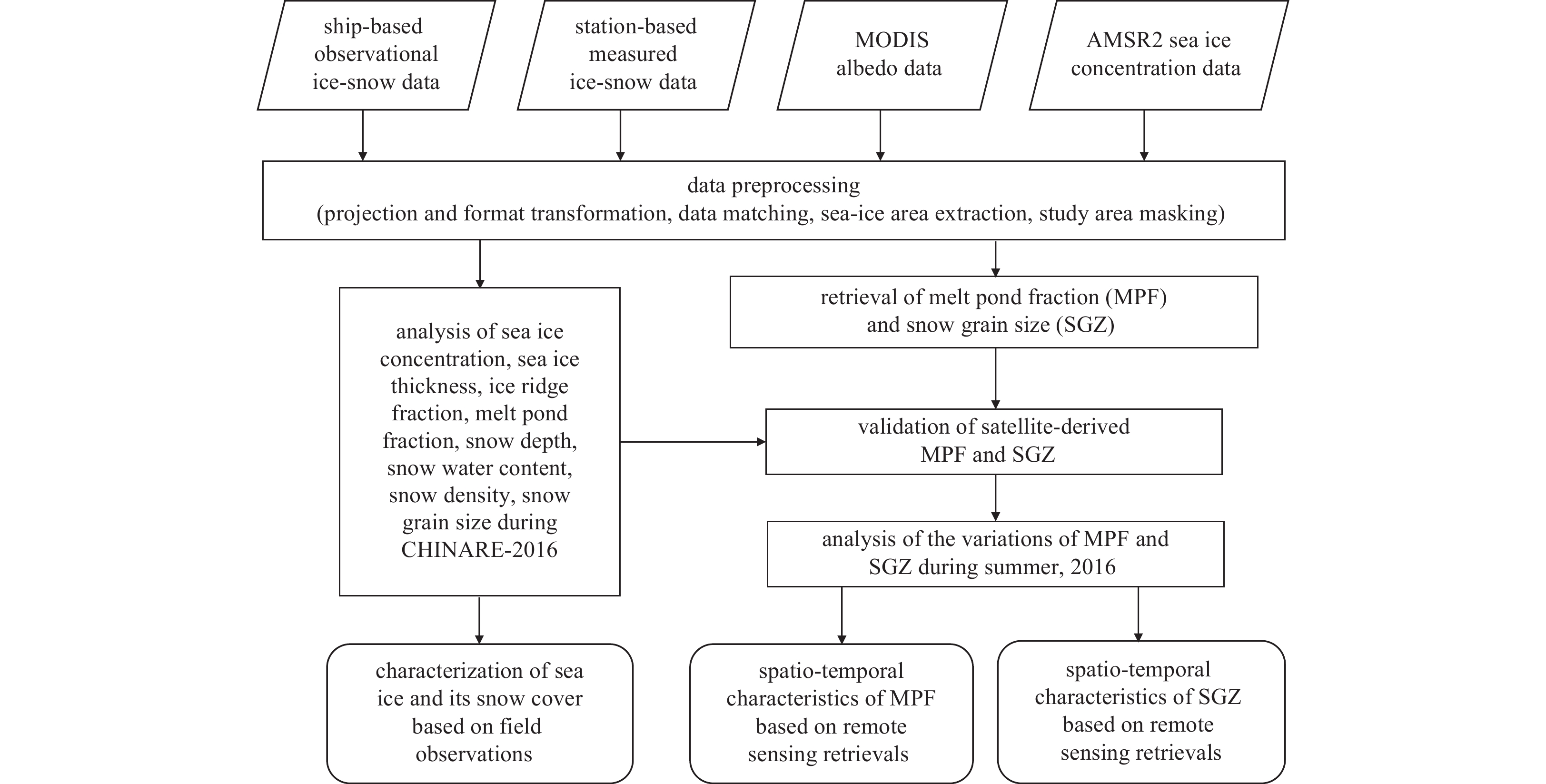
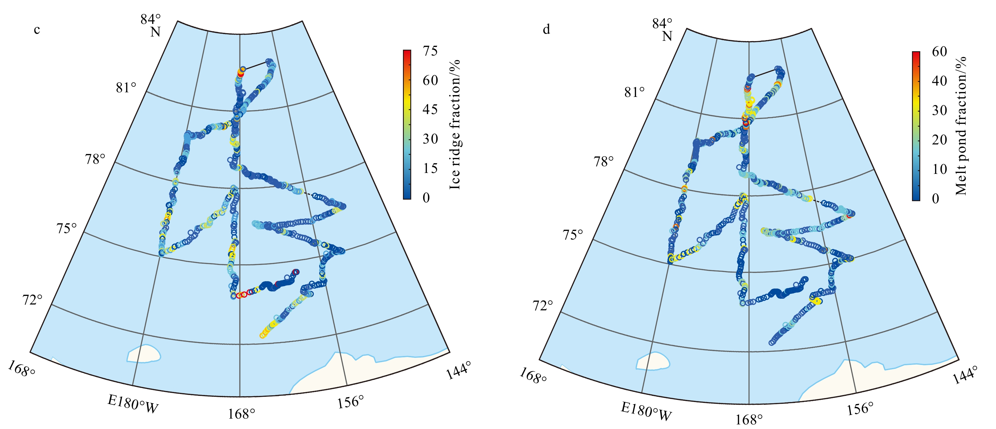
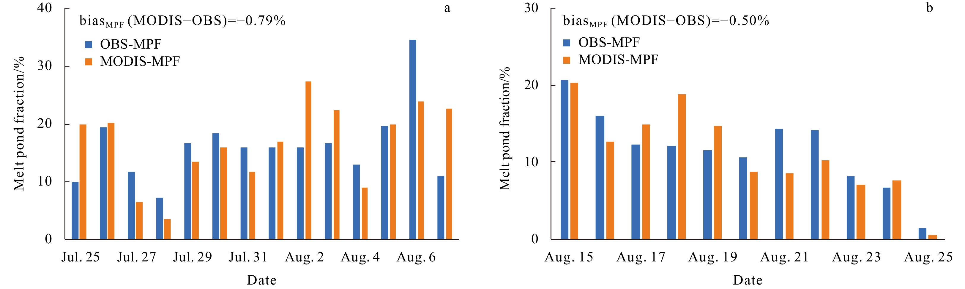
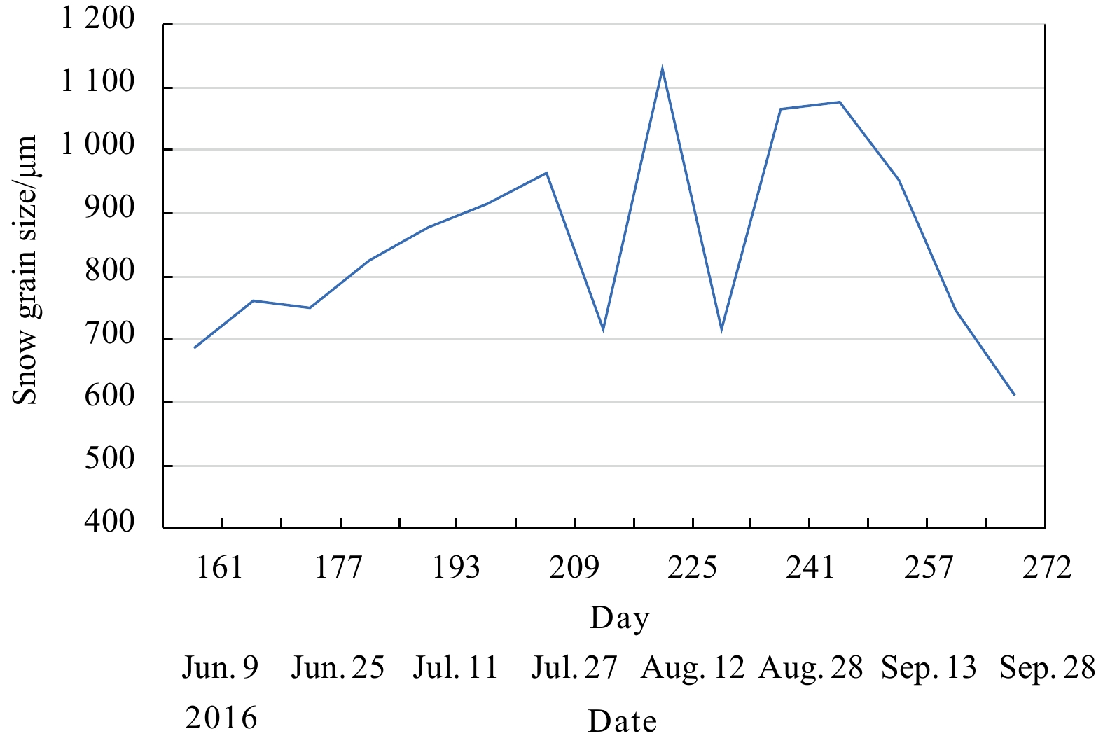
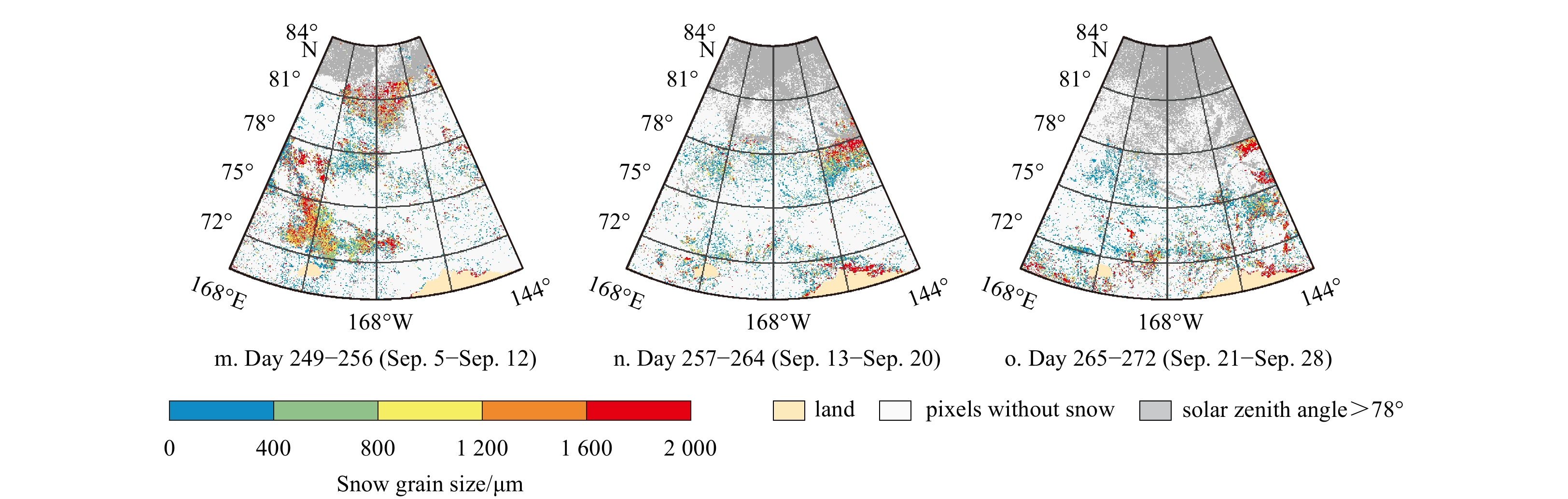
A comprehensive analysis of sea ice and its snow cover during the summer in the Arctic Pacific sector was conducted using the observations recorded during the 7th Chinese National Arctic Research Expedition (CHIANRE-2016) and the satellite-derived pa...
A comprehensive analysis of sea ice and its snow cover during the summer in the Arctic Pacific sector was conducted using the observations recorded during the 7th Chinese National Arctic Research Expedition (CHIANRE-2016) and the satellite-derived pa...


2021, 40(1): 43-53.
doi: 10.1007/s13131-021-1717-2
Abstract:
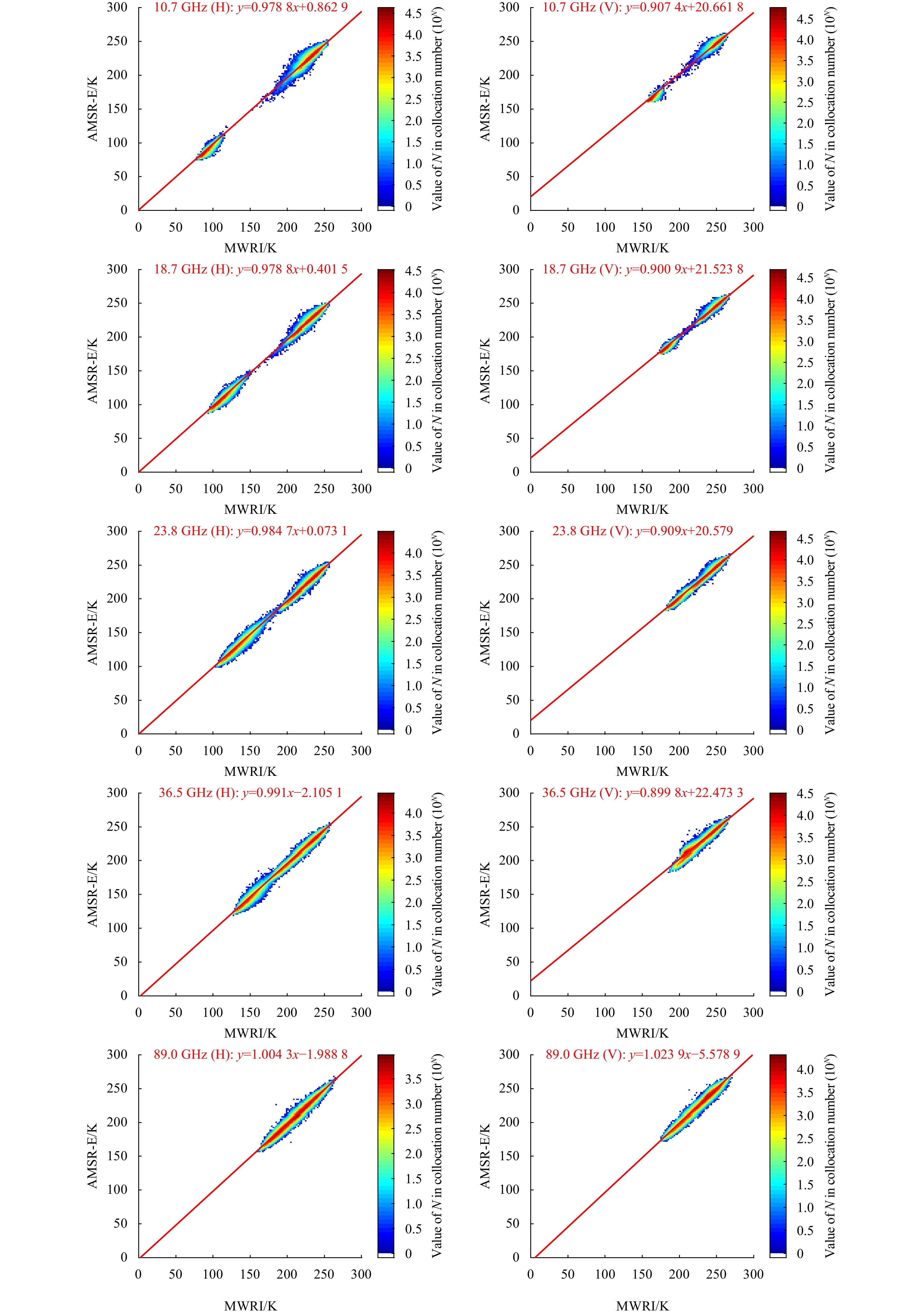
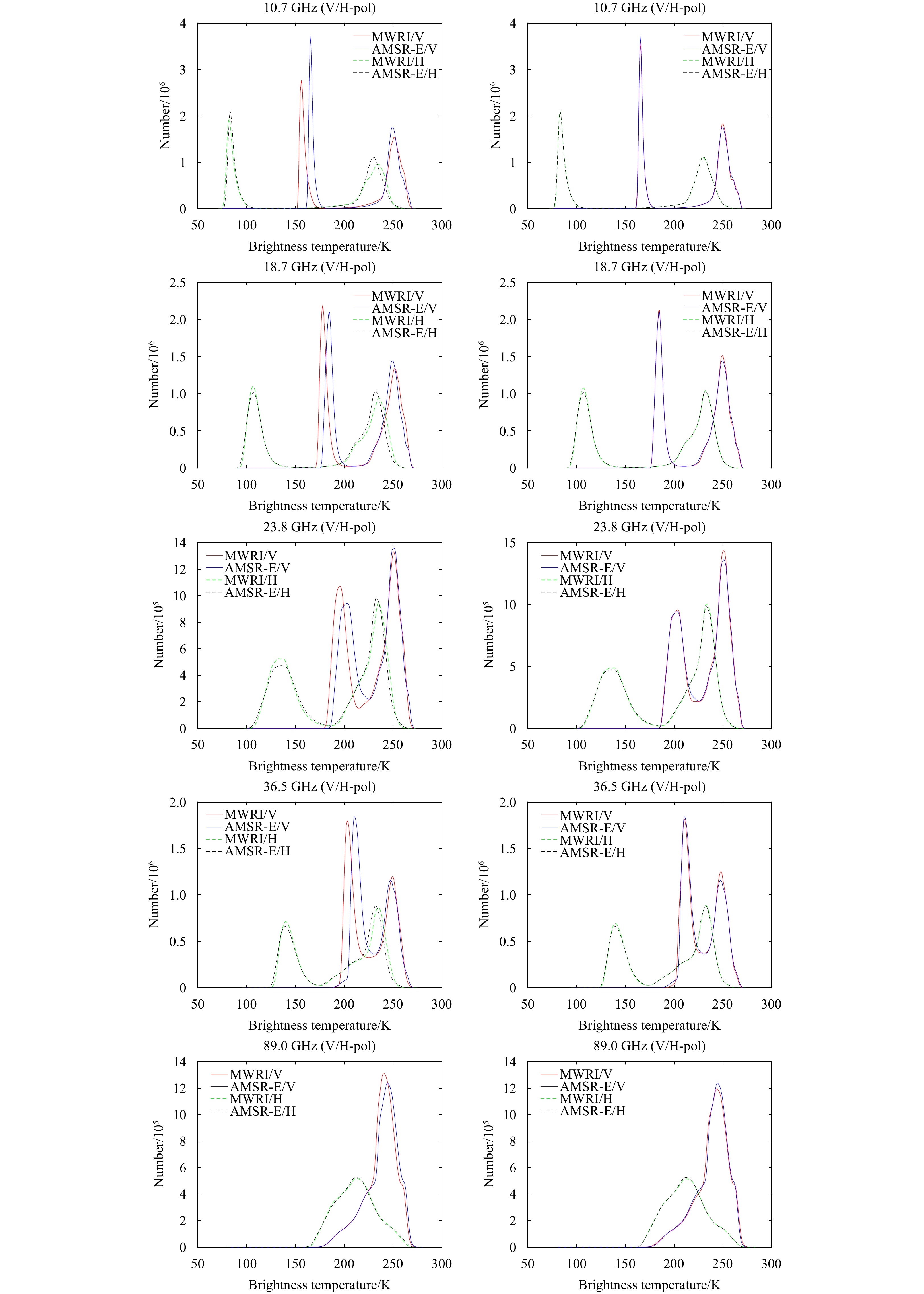
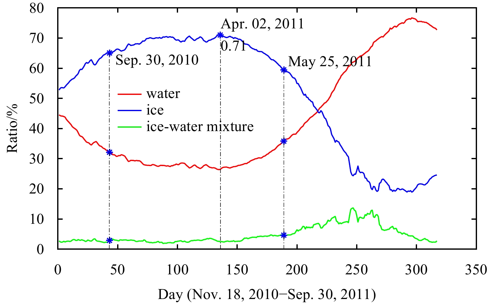
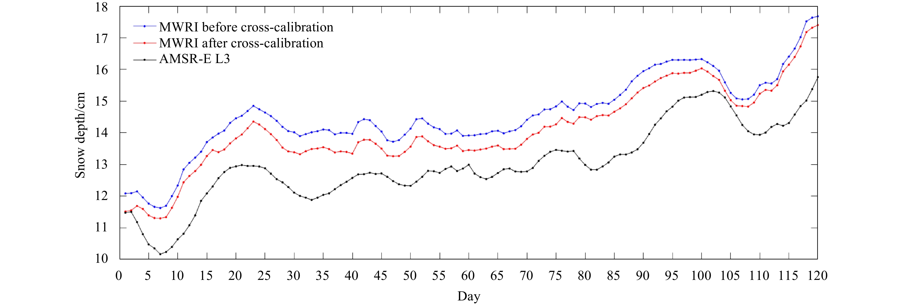
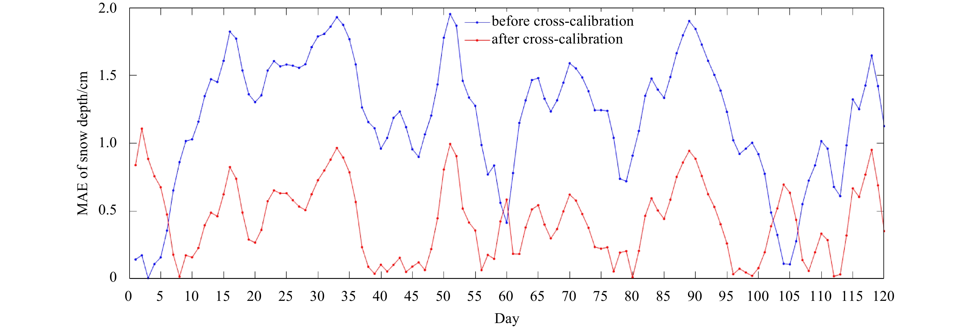
This study cross-calibrated the brightness temperatures observed in the Arctic by using the FY-3B/MWRI L1 and the Aqua/AMSR-E L2A. The monthly parameters of the cross-calibration were determined and evaluated using robust linear regression. The snow ...
This study cross-calibrated the brightness temperatures observed in the Arctic by using the FY-3B/MWRI L1 and the Aqua/AMSR-E L2A. The monthly parameters of the cross-calibration were determined and evaluated using robust linear regression. The snow ...


2021, 40(1): 54-61.
doi: 10.1007/s13131-020-1699-5
Abstract:
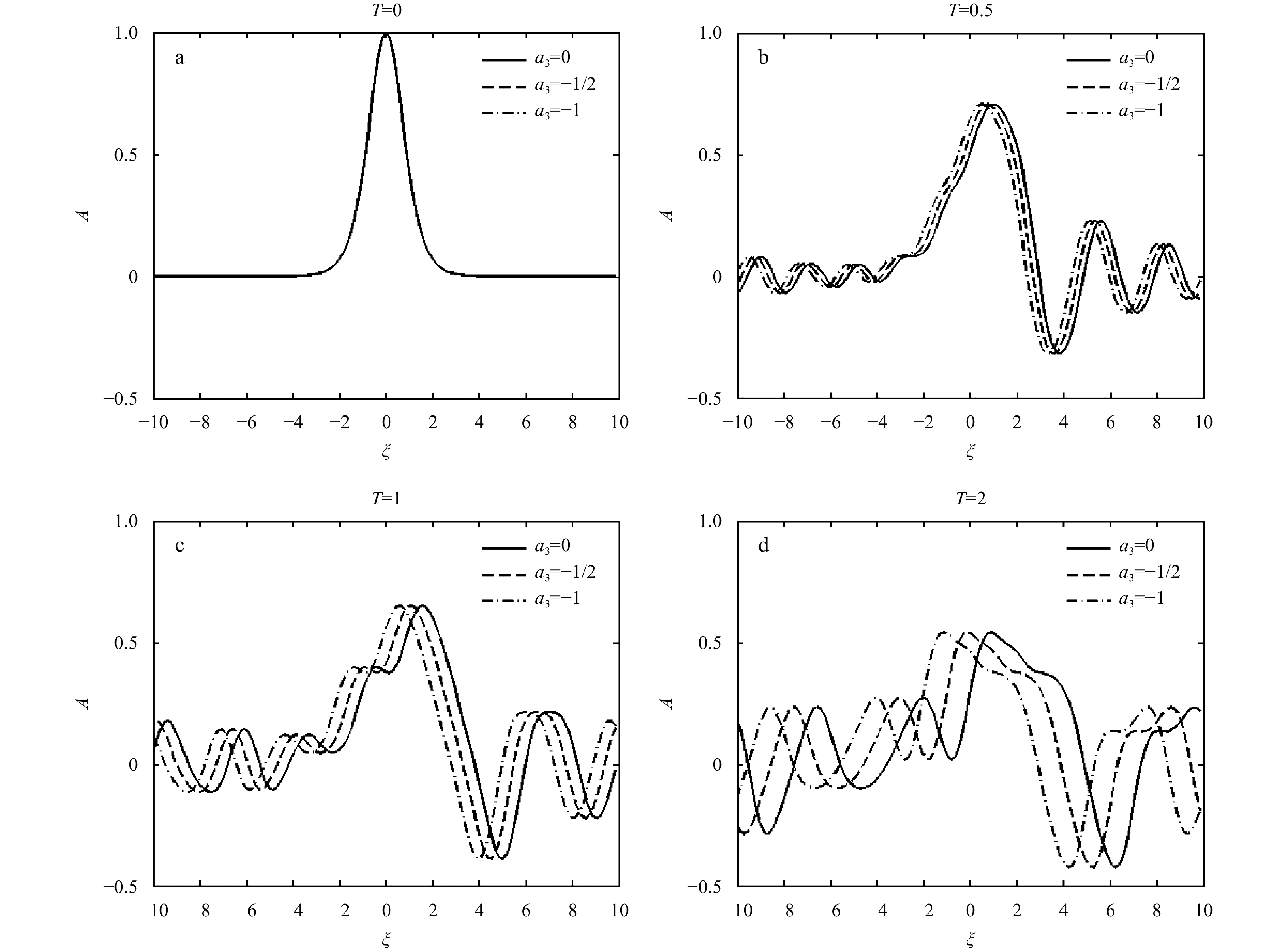
An investigation of equatorial near-inertial wave dynamics under complete Coriolis parameters is performed in this paper. Starting from the basic model equations of oceanic motions, a Korteweg de Vries equation is derived to simulate the evolution of...
An investigation of equatorial near-inertial wave dynamics under complete Coriolis parameters is performed in this paper. Starting from the basic model equations of oceanic motions, a Korteweg de Vries equation is derived to simulate the evolution of...

2021, 40(1): 62-69.
doi: 10.1007/s13131-020-1680-3
Abstract:
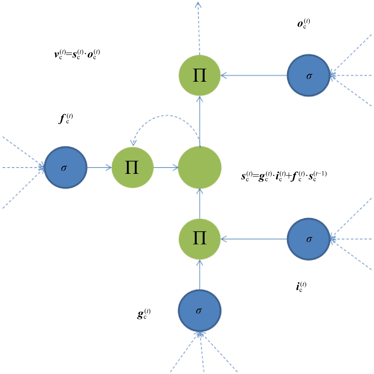
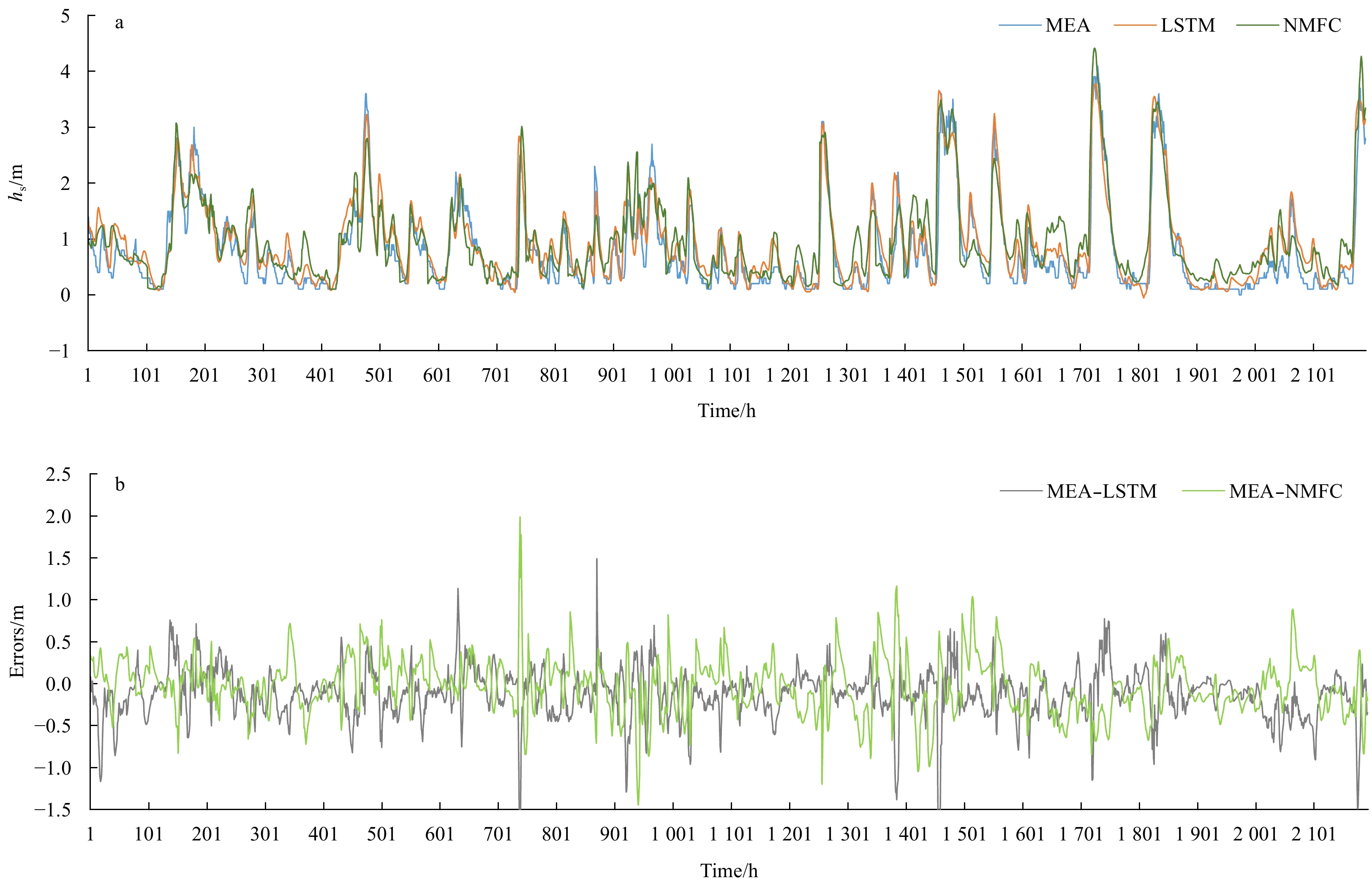
To explore new operational forecasting methods of waves, a forecasting model for wave heights at three stations in the Bohai Sea has been developed. This model is based on long short-term memory (LSTM) neural network with sea surface wind and wave he...
To explore new operational forecasting methods of waves, a forecasting model for wave heights at three stations in the Bohai Sea has been developed. This model is based on long short-term memory (LSTM) neural network with sea surface wind and wave he...


2021, 40(1): 70-84.
doi: 10.1007/s13131-021-1702-9
Abstract:
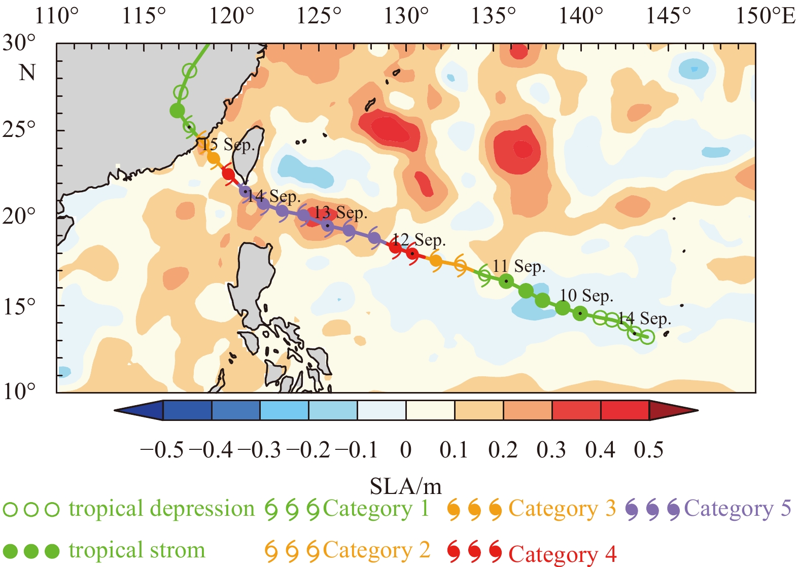
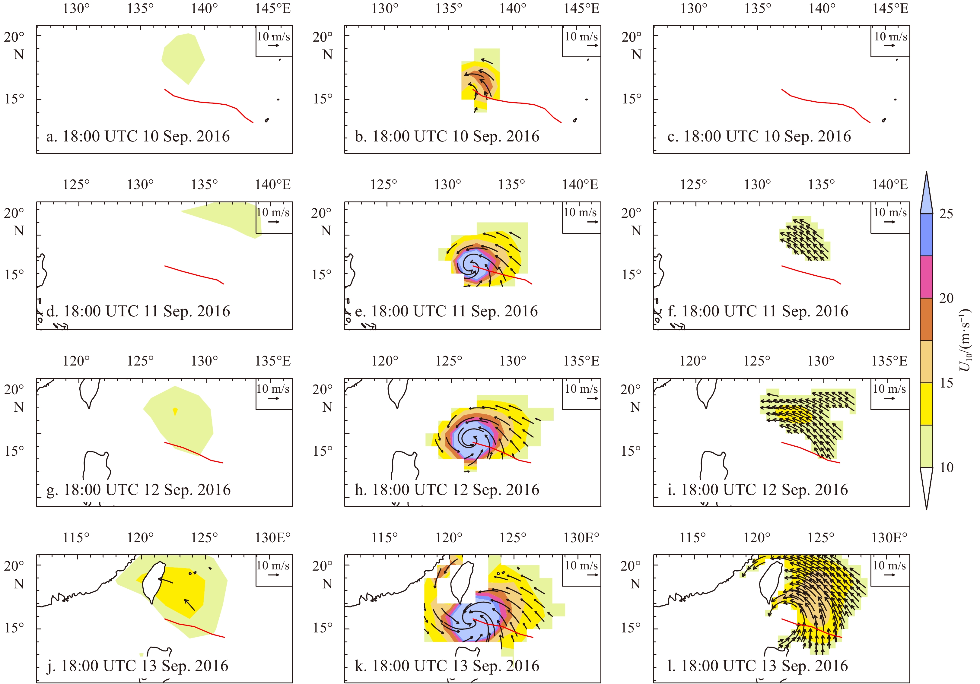
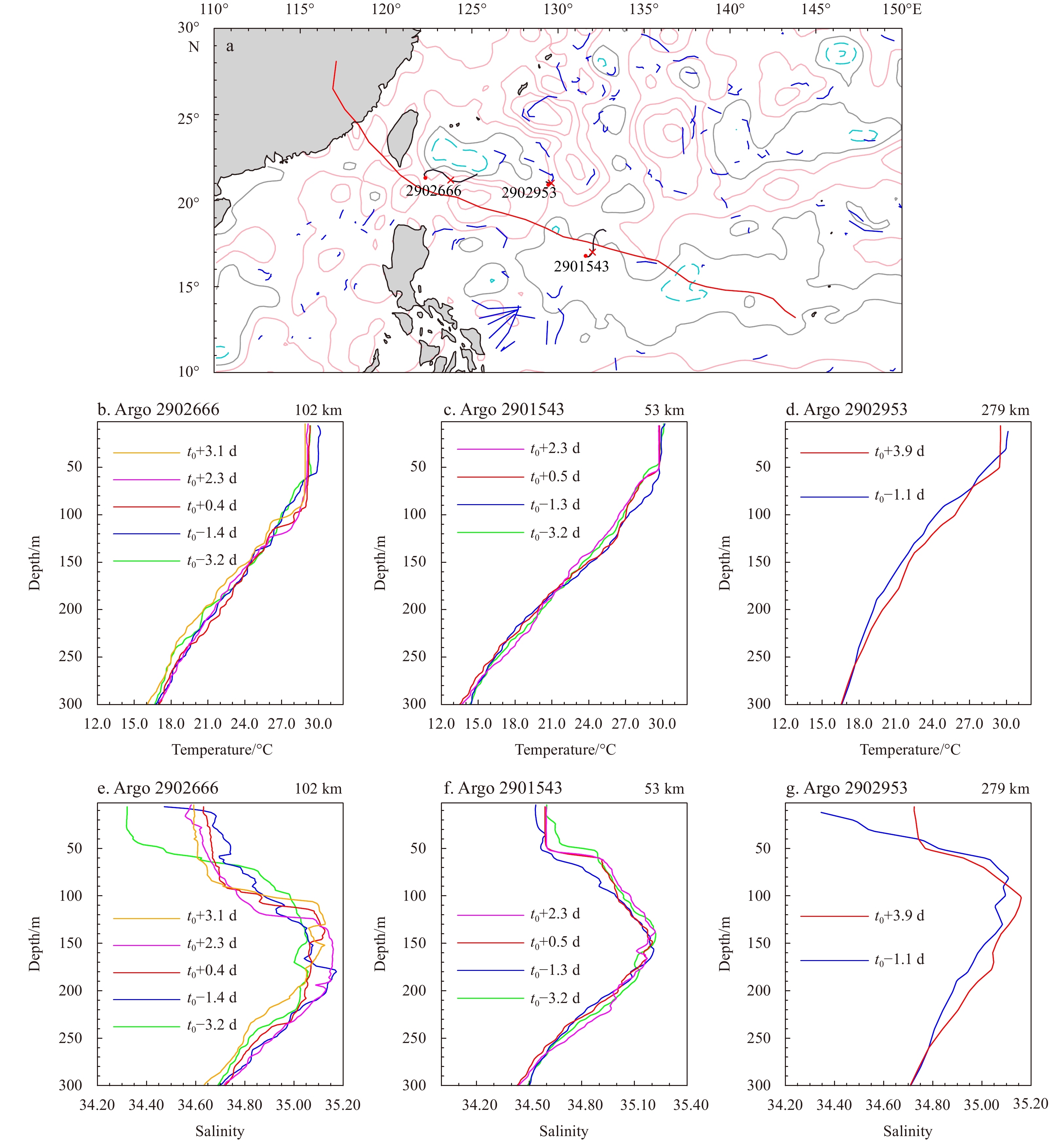
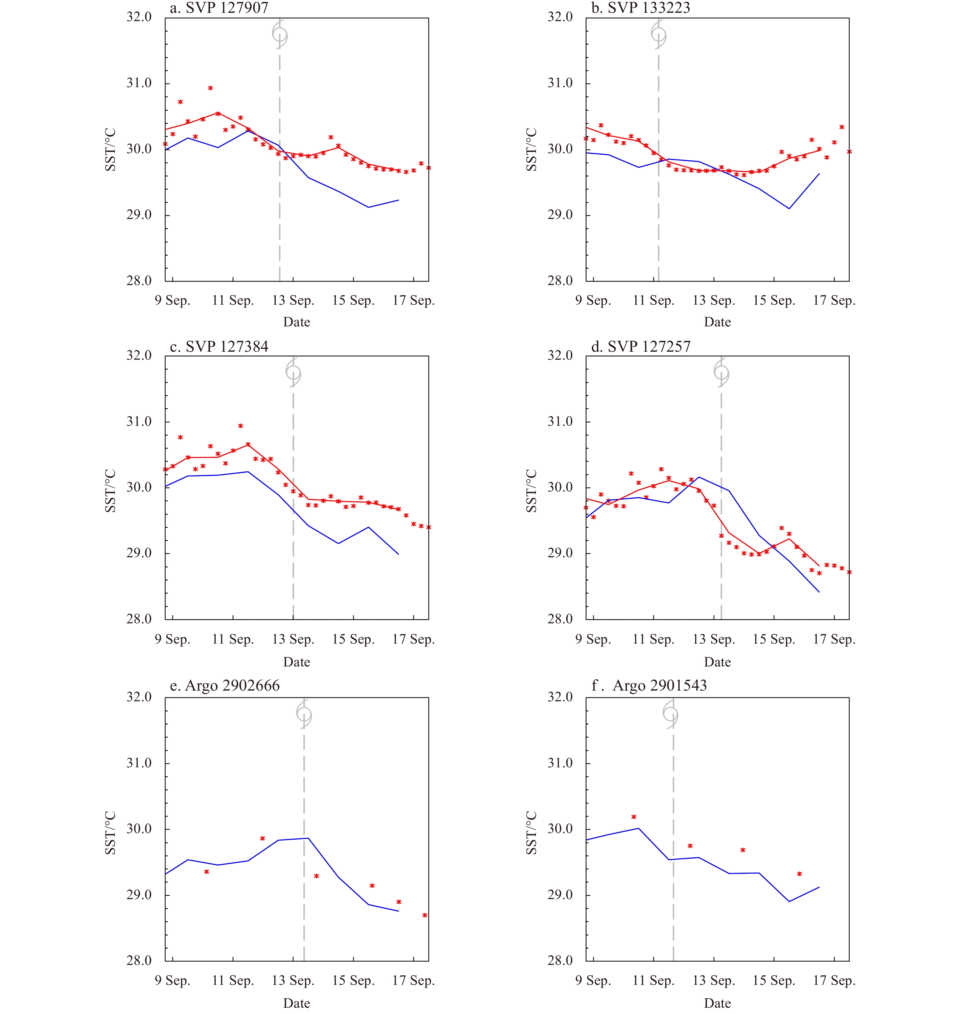
The present work describes the basic features of super typhoon Meranti (2016) by multiple data sources. We mainly focus on the upper ocean response to Meranti using multiplatform satellites, in situ surface drifter and Argo floats, and compare the re...
The present work describes the basic features of super typhoon Meranti (2016) by multiple data sources. We mainly focus on the upper ocean response to Meranti using multiplatform satellites, in situ surface drifter and Argo floats, and compare the re...


2021, 40(1): 85-102.
doi: 10.1007/s13131-021-1705-6
Abstract:
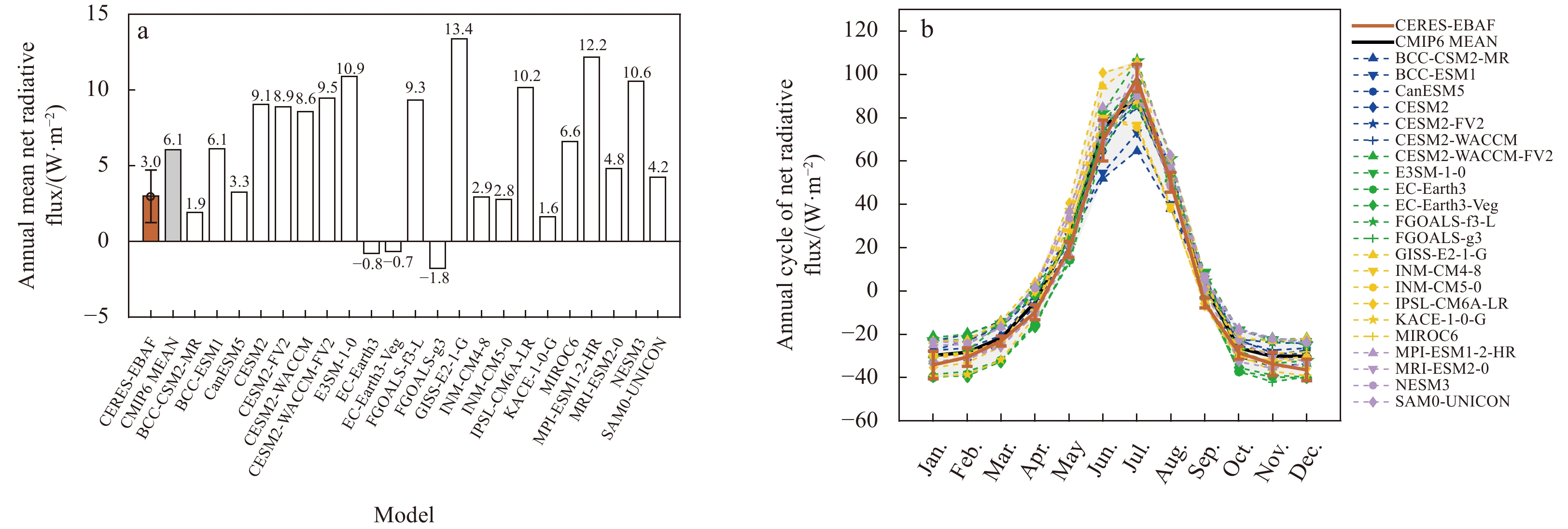
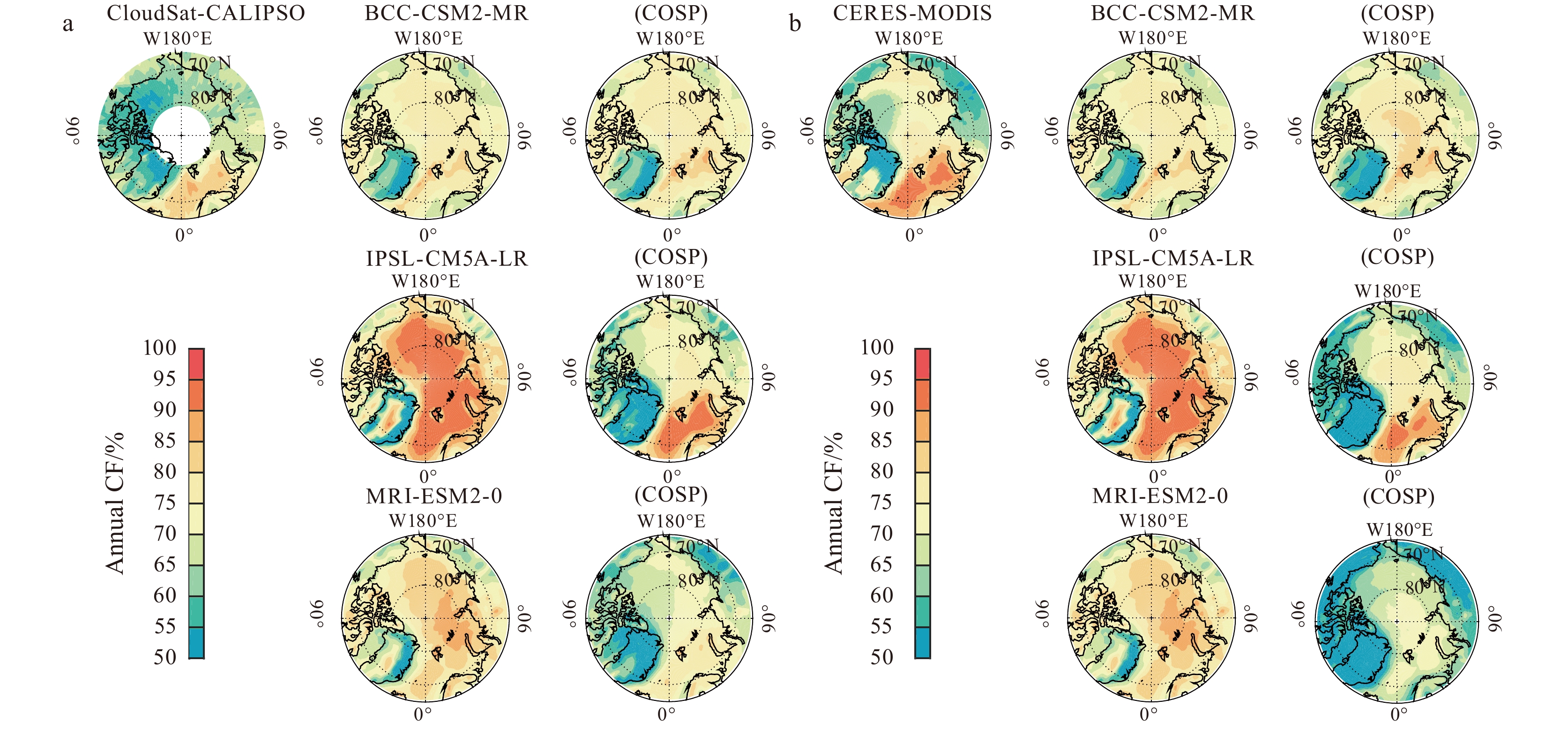
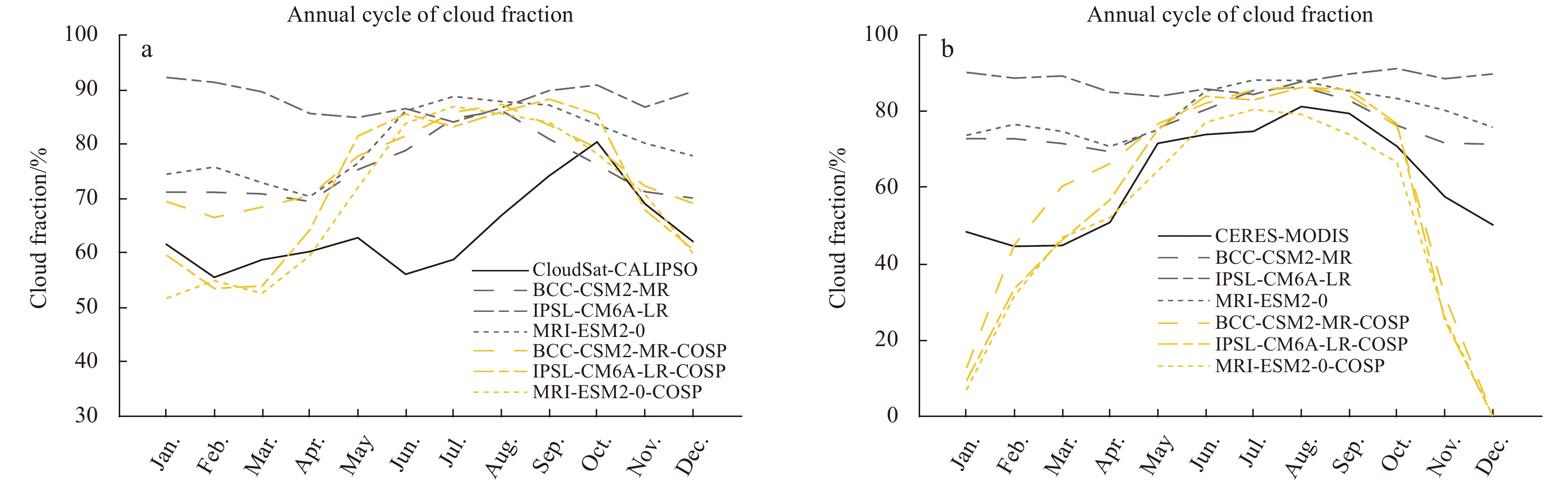
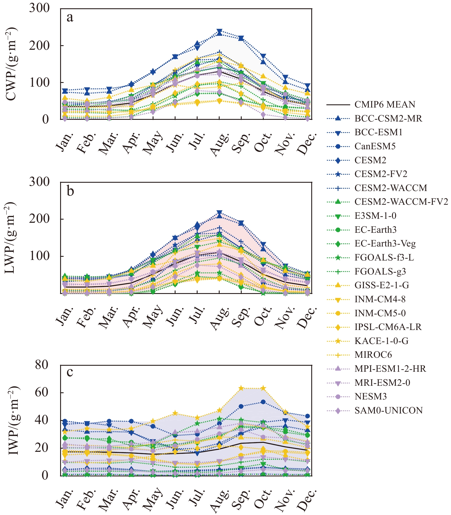
To assess the performances of state-of-the-art global climate models on simulating the Arctic clouds and surface radiation balance, the 2001–2014 Arctic Basin surface radiation budget, clouds, and the cloud radiative effects (CREs) in 22 coupled mode...
To assess the performances of state-of-the-art global climate models on simulating the Arctic clouds and surface radiation balance, the 2001–2014 Arctic Basin surface radiation budget, clouds, and the cloud radiative effects (CREs) in 22 coupled mode...


2021, 40(1): 103-112.
doi: 10.1007/s13131-020-1672-3
Abstract:
The evolution of thermohaline structure at the upper ocean during three tropical cyclones (TCs) in the Northwest Pacific was studied in this study based on successive observation by two new-style underwater gliders during fall 2018. These remote-cont...
The evolution of thermohaline structure at the upper ocean during three tropical cyclones (TCs) in the Northwest Pacific was studied in this study based on successive observation by two new-style underwater gliders during fall 2018. These remote-cont...


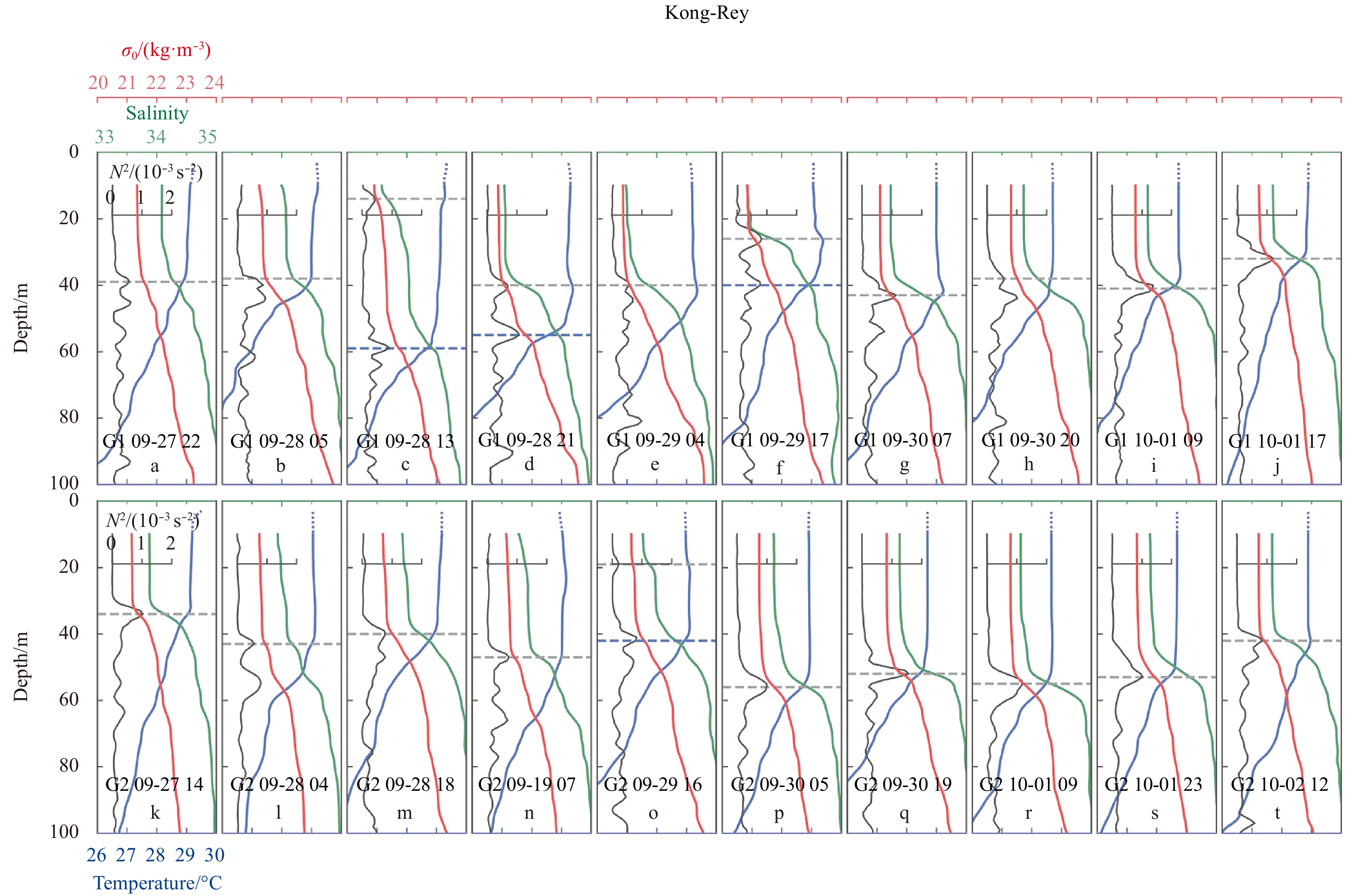
2021, 40(1): 113-125.
doi: 10.1007/s13131-020-1597-x
Abstract:
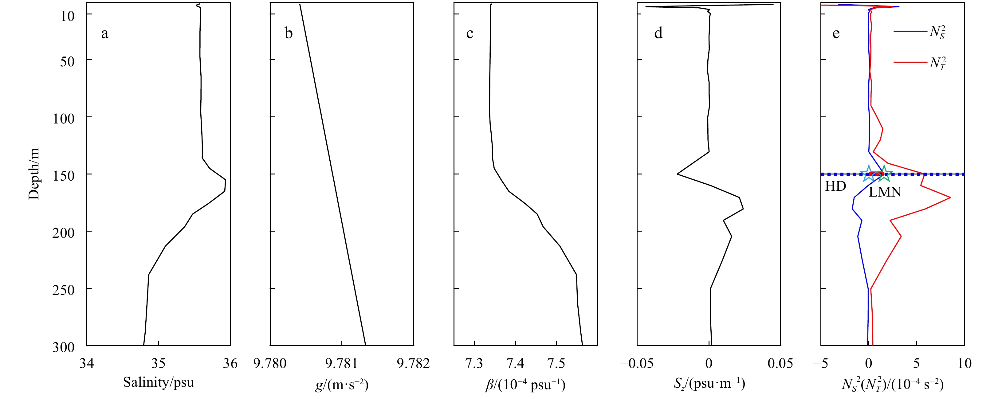
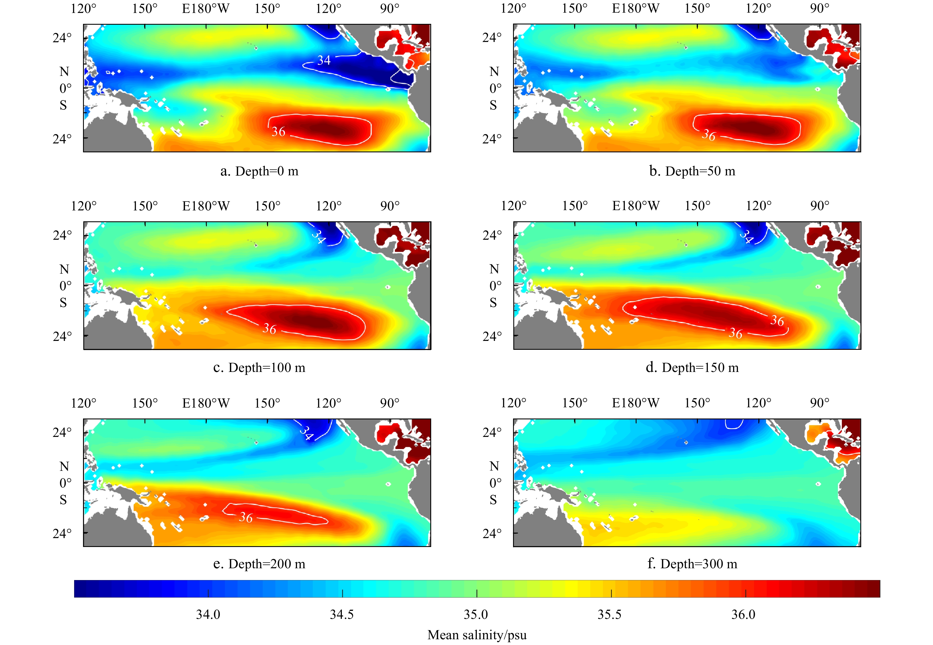
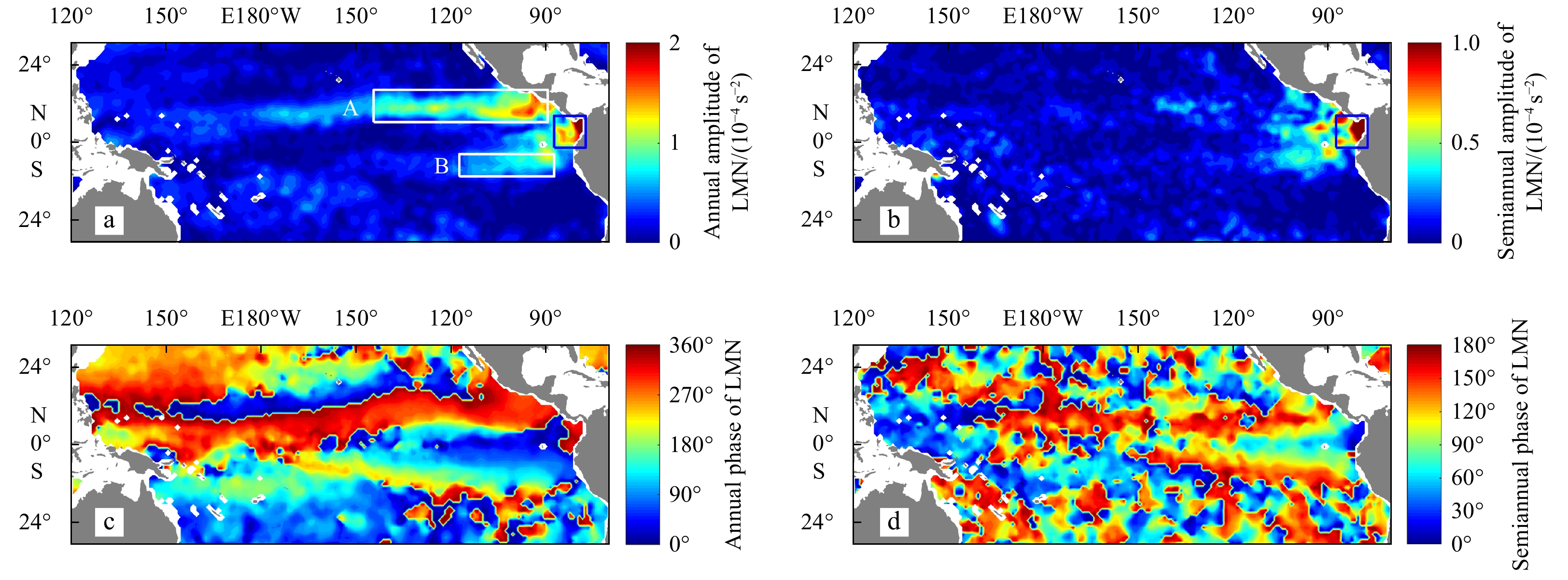
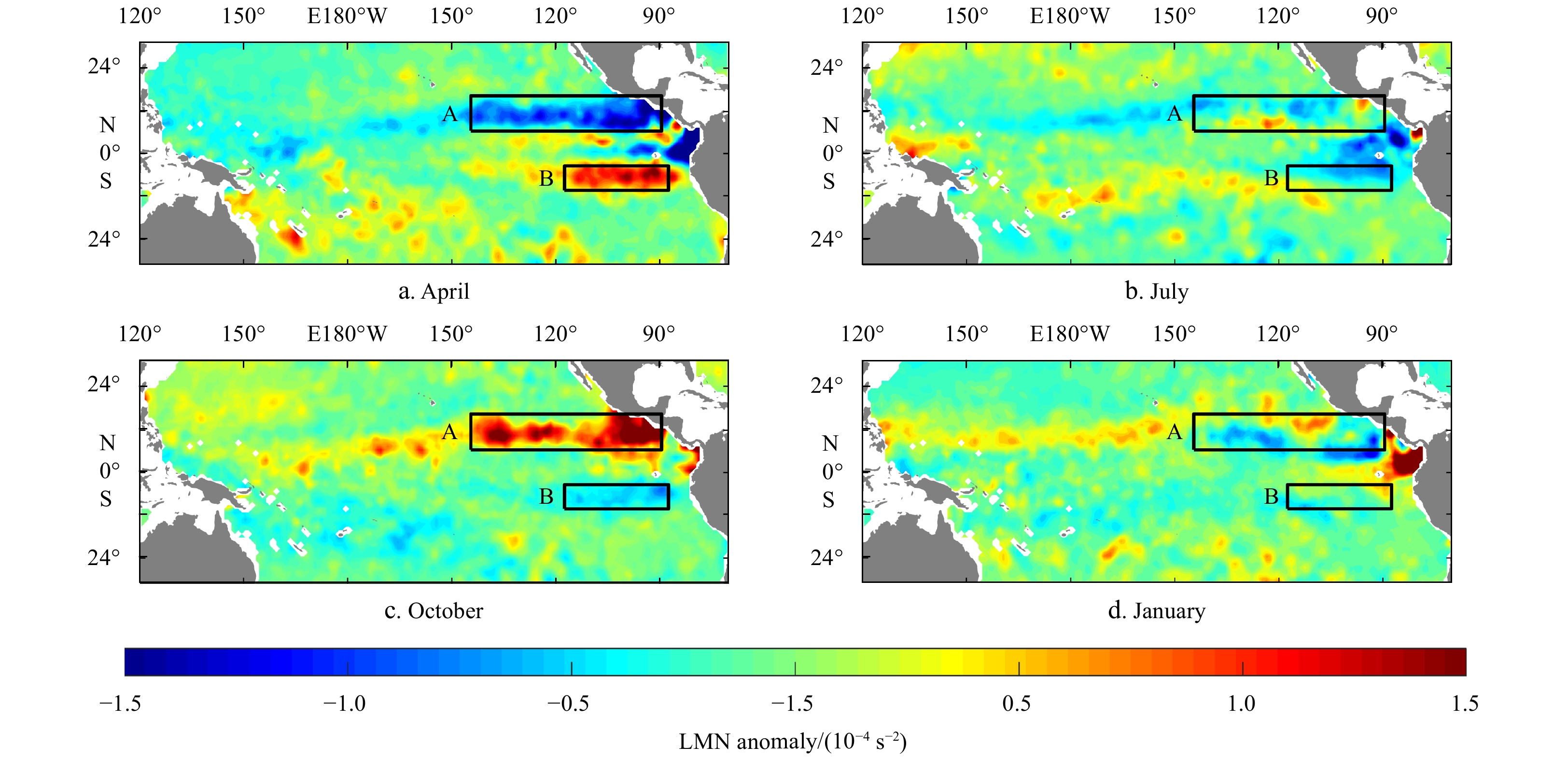
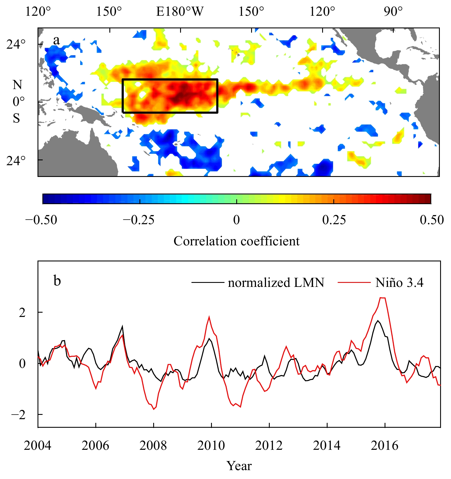
Using a gridded array for real-time geostrophic oceanography (Argo) program float dataset, the features of upper-ocean salinity stratification in the tropical Pacific Ocean are studied. The salinity component of the squared Brunt-Väisälä frequency\b...
Using a gridded array for real-time geostrophic oceanography (Argo) program float dataset, the features of upper-ocean salinity stratification in the tropical Pacific Ocean are studied. The salinity component of the squared Brunt-Väisälä frequency


2021, 40(1): 126-134.
doi: 10.1007/s13131-020-1675-0
Abstract:
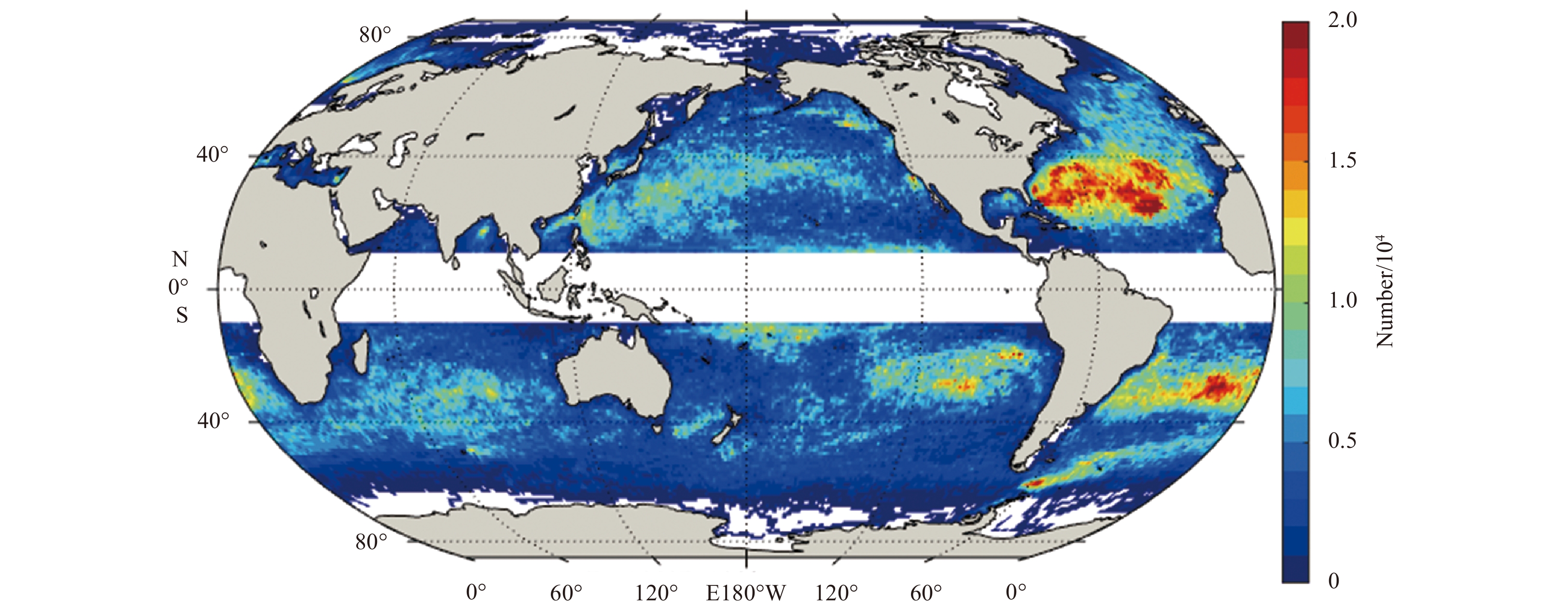
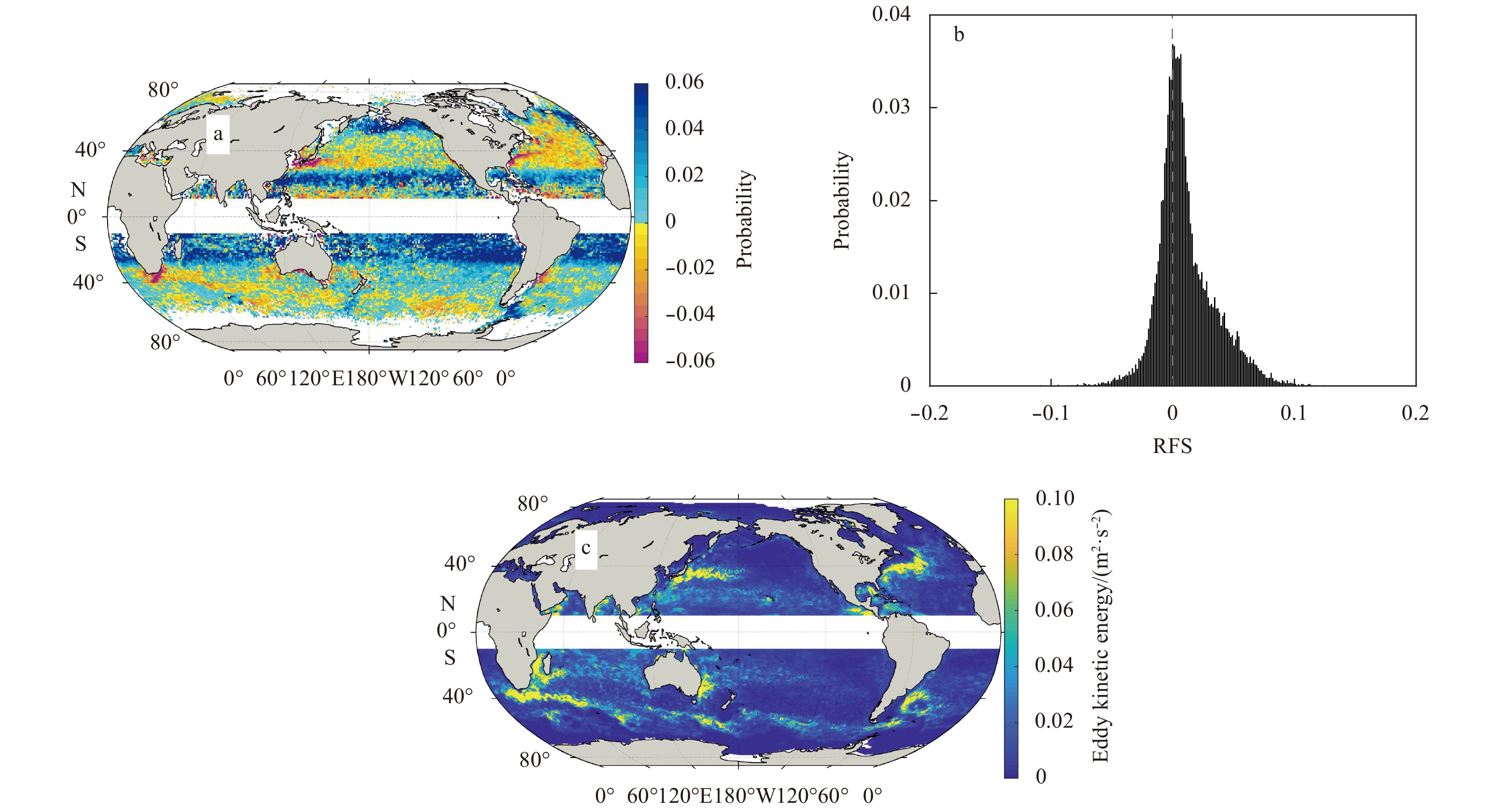
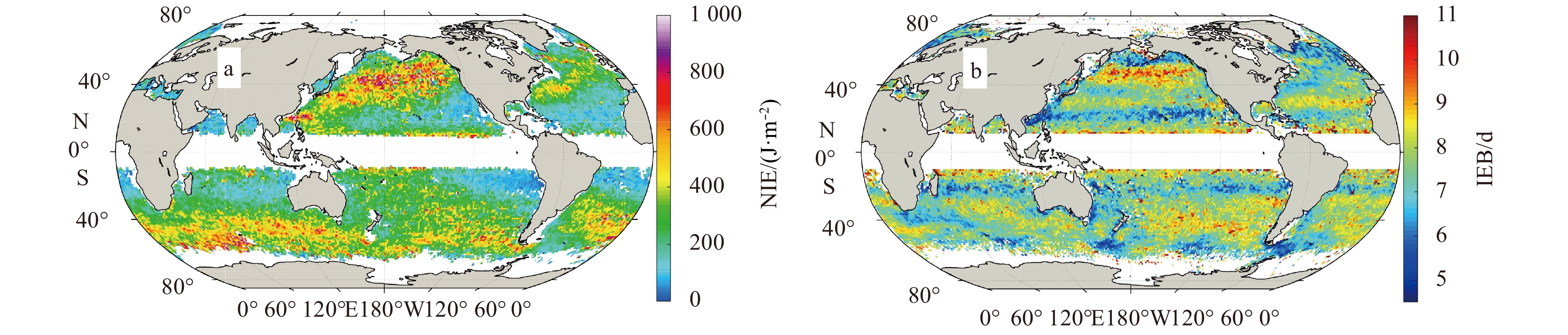
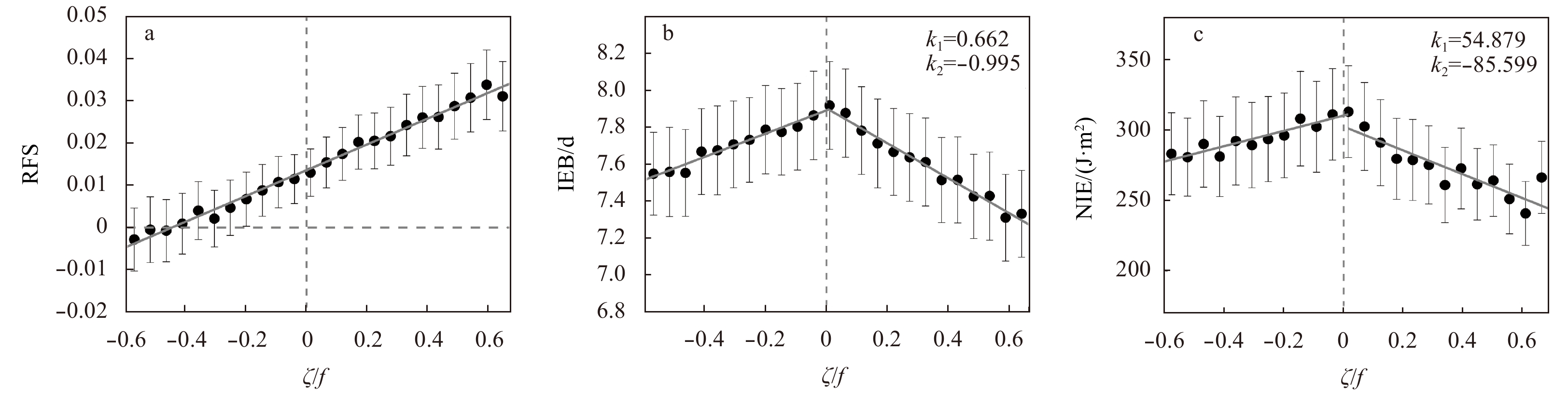
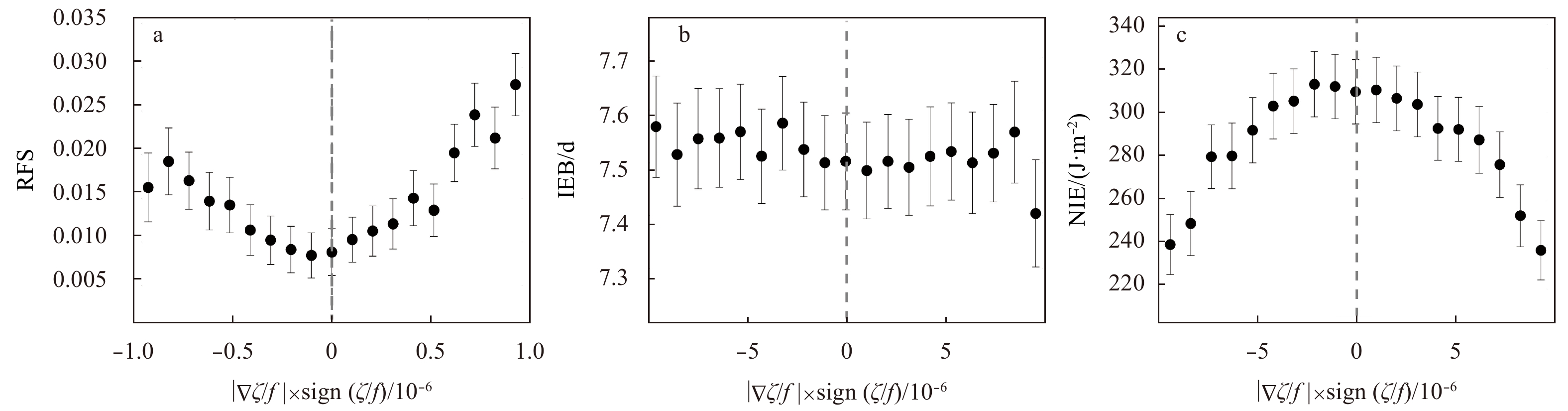
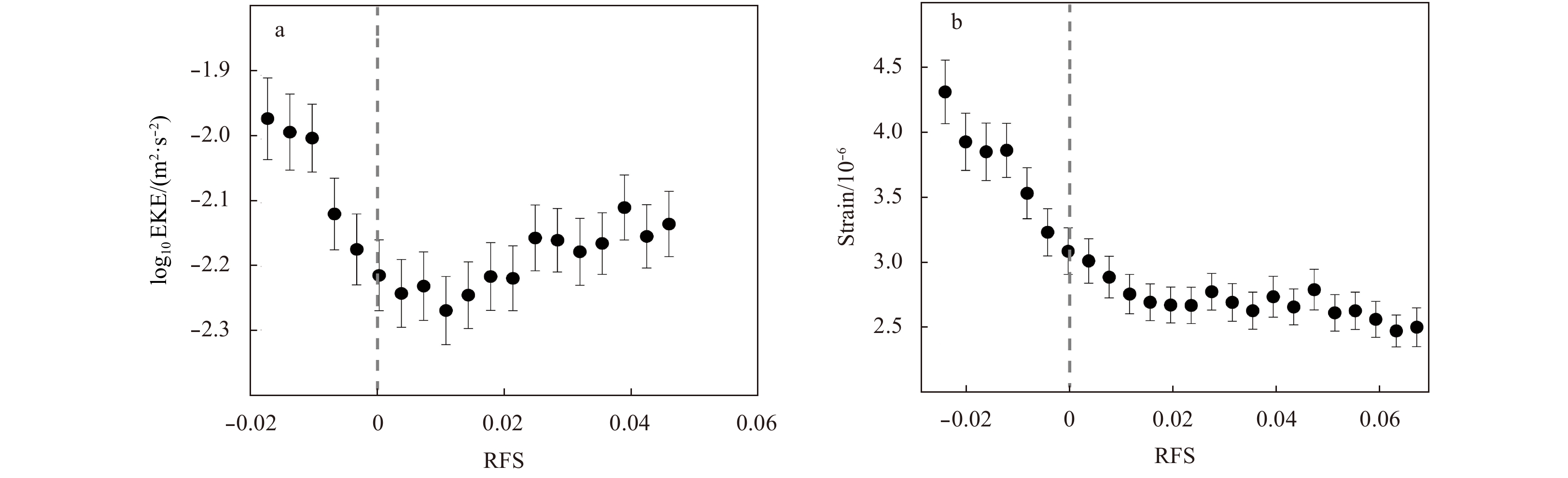
Based on the latest oceanic surface drifter dataset from the global drifter program during 2000–2019, this study investigated the global variation of relative frequency shift (RFS), near-inertial energy (NIE) and inverse excess bandwidth (IEB) of nea...
Based on the latest oceanic surface drifter dataset from the global drifter program during 2000–2019, this study investigated the global variation of relative frequency shift (RFS), near-inertial energy (NIE) and inverse excess bandwidth (IEB) of nea...


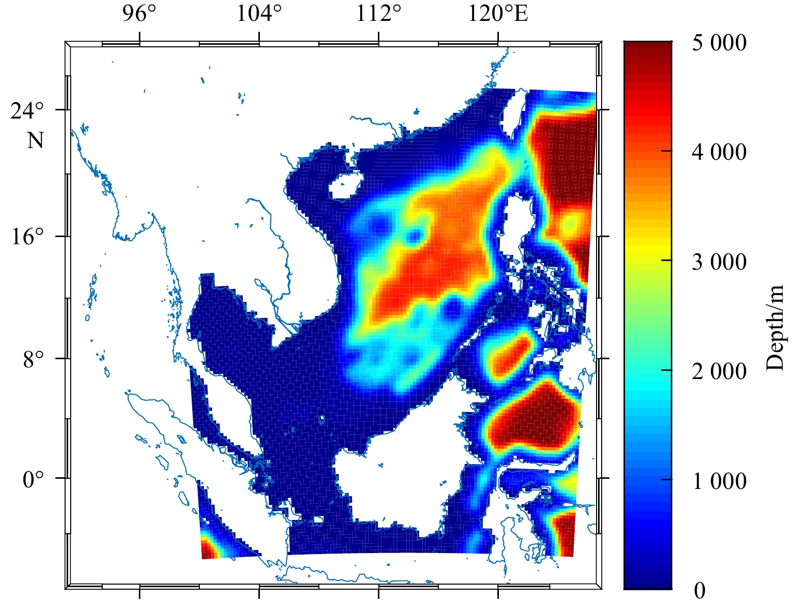
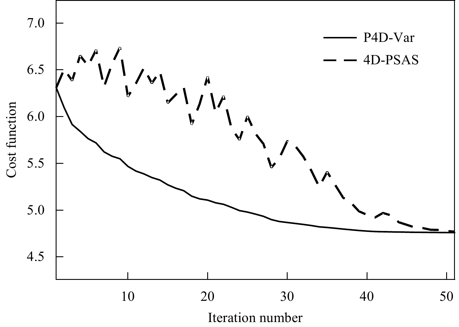
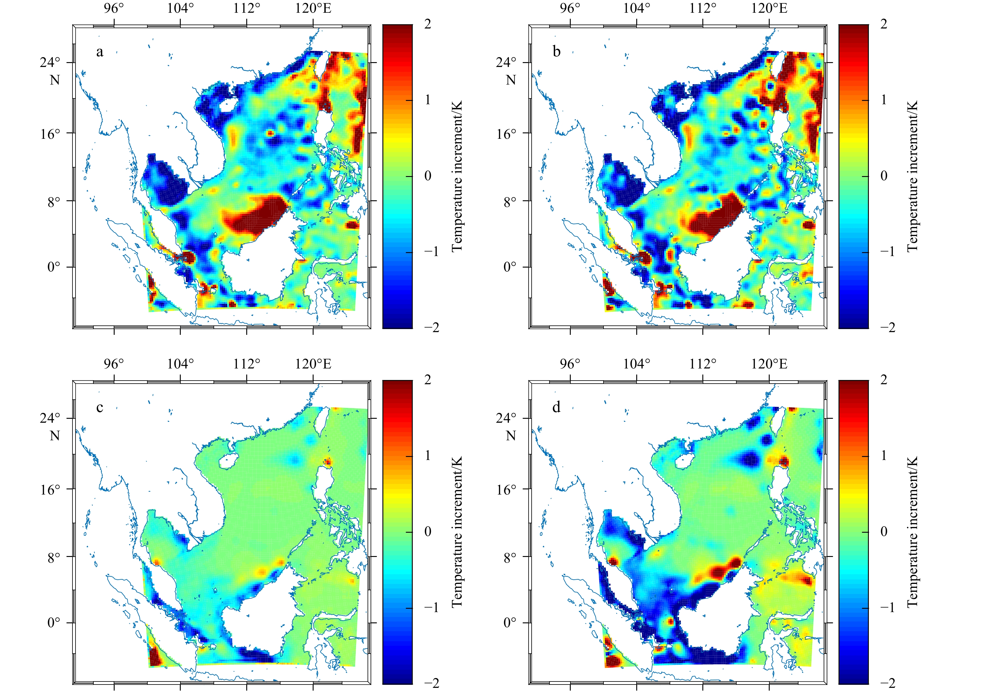
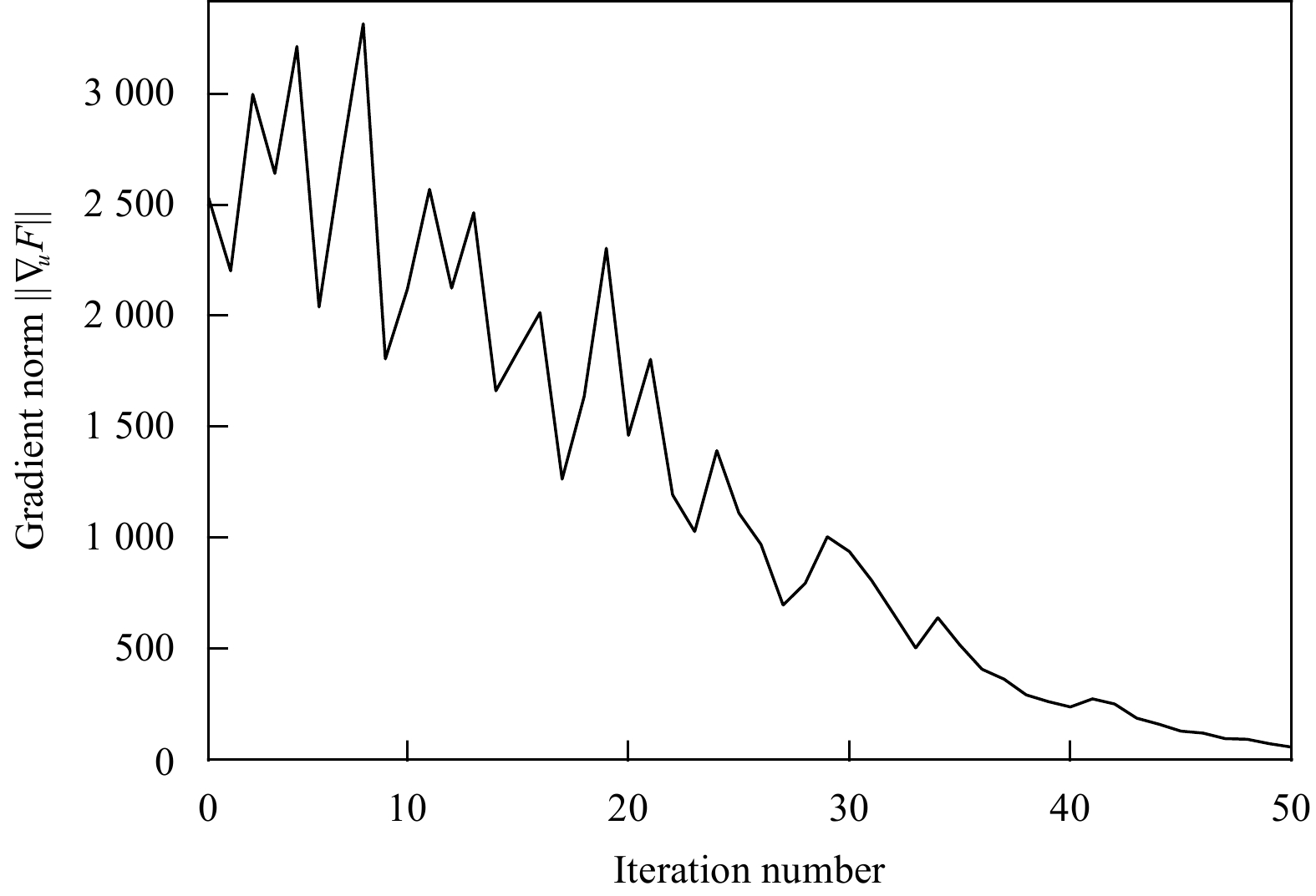
2021, 40(1): 135-146.
doi: 10.1007/s13131-021-1701-x
Abstract:
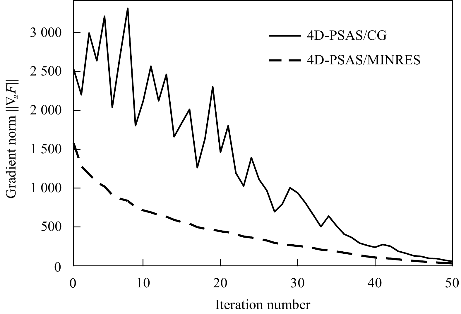
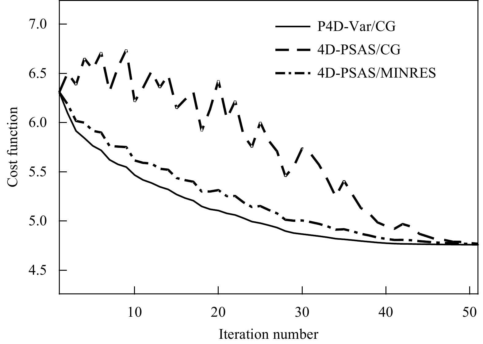
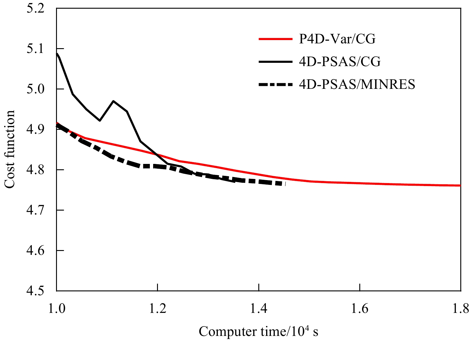
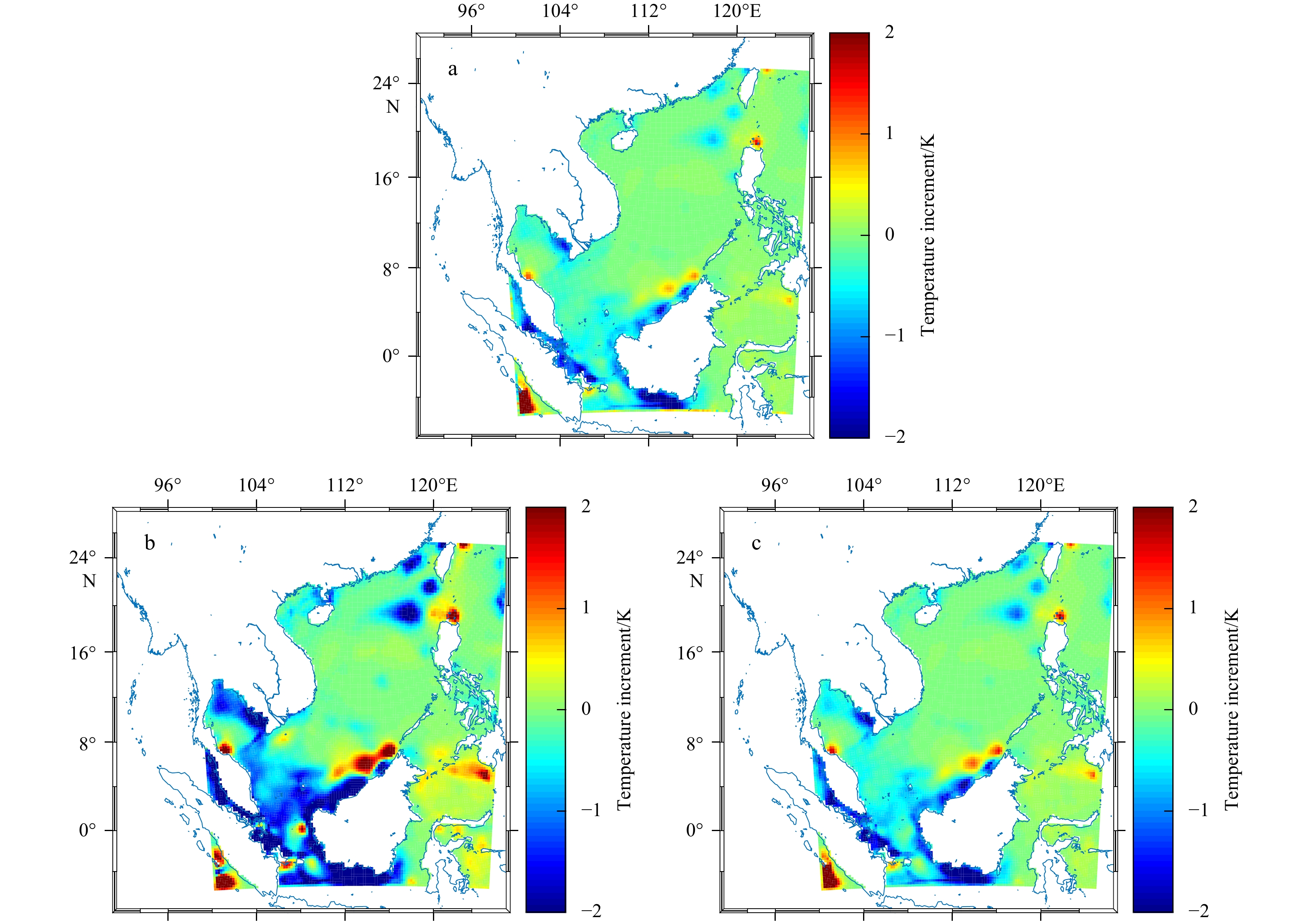
The four-dimensional variational assimilation (4D-Var) has been widely used in meteorological and oceanographic data assimilation. This method is usually implemented in the model space, known as primal approach (P4D-Var). Alternatively, physical spac...
The four-dimensional variational assimilation (4D-Var) has been widely used in meteorological and oceanographic data assimilation. This method is usually implemented in the model space, known as primal approach (P4D-Var). Alternatively, physical spac...
2021, 40(1): 147-154.
doi: 10.1007/s13131-020-1615-z
Abstract:
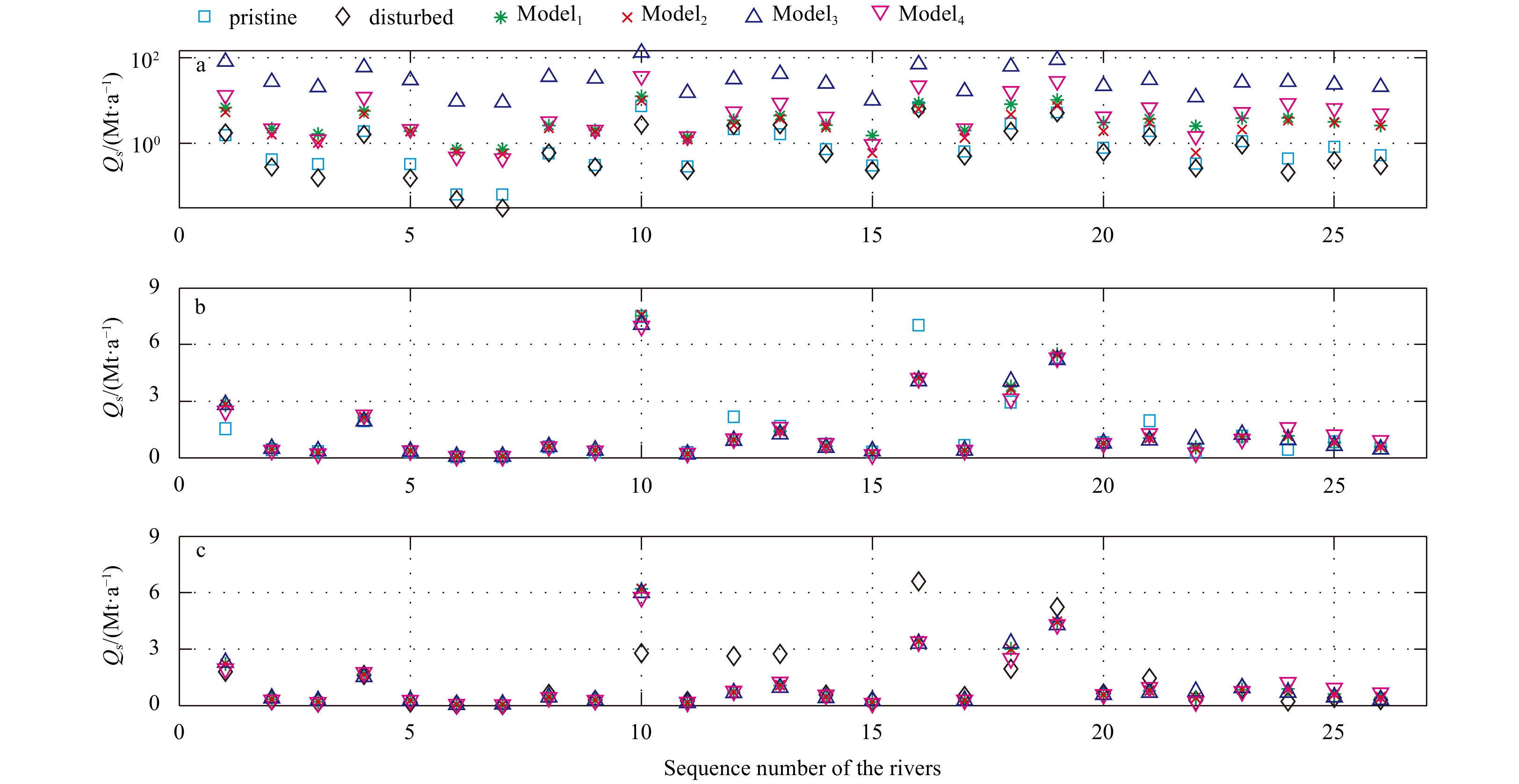
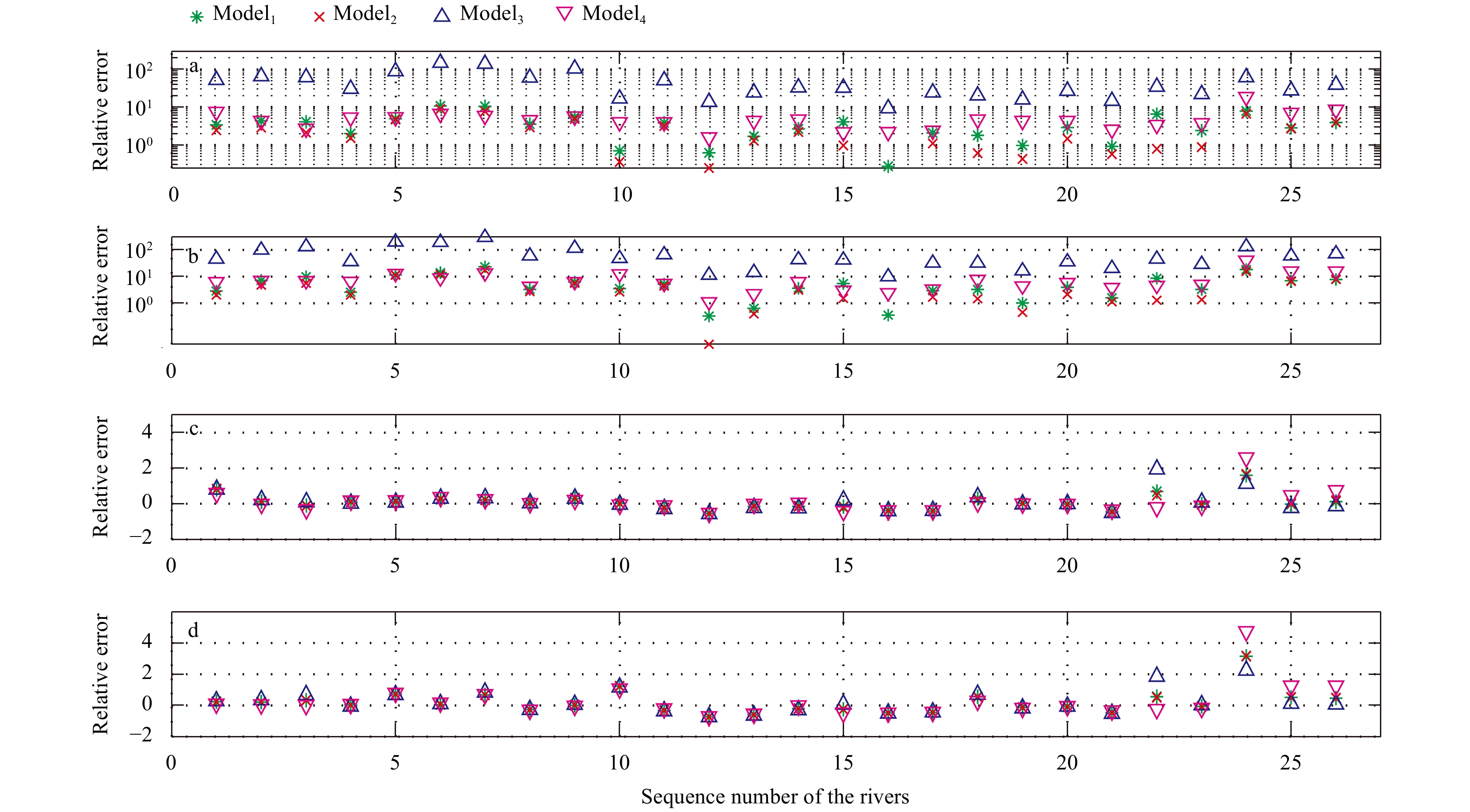
Two kinds of regression equations are used to reproduce the sediment flux of the 26 small coastal watersheds in southeastern China. The first kind is the global equations suggested byMilliman and Syvitski (1992) , Mulder and Syvitski (1996) , Syvitski...
Two kinds of regression equations are used to reproduce the sediment flux of the 26 small coastal watersheds in southeastern China. The first kind is the global equations suggested by


2021, 40(1): 155-161.
doi: 10.1007/s13131-021-1821-3
Abstract:
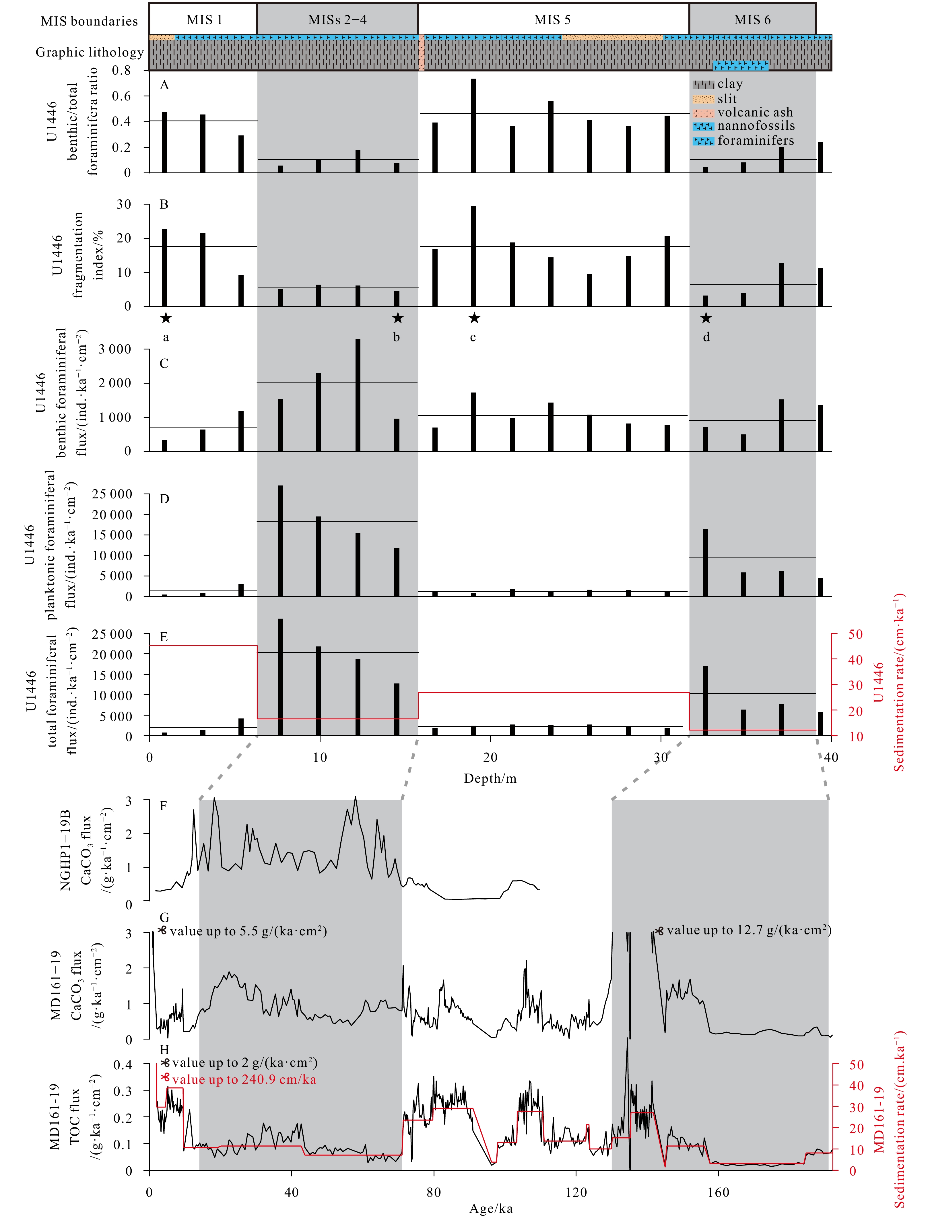
Site U1446 (19°50’N, 85°44’E, at water depth 1 430 m) was drilled during Expedition 353 (Indian monsoon rainfall) of the International Ocean Discovery Program (IODP). It is located in the Mahanadi offshore basin, on the northern Bay of Bengal. Sedime...
Site U1446 (19°50’N, 85°44’E, at water depth 1 430 m) was drilled during Expedition 353 (Indian monsoon rainfall) of the International Ocean Discovery Program (IODP). It is located in the Mahanadi offshore basin, on the northern Bay of Bengal. Sedime...


2021, 40(1): 162-172.
doi: 10.1007/s13131-020-1674-1
Abstract:
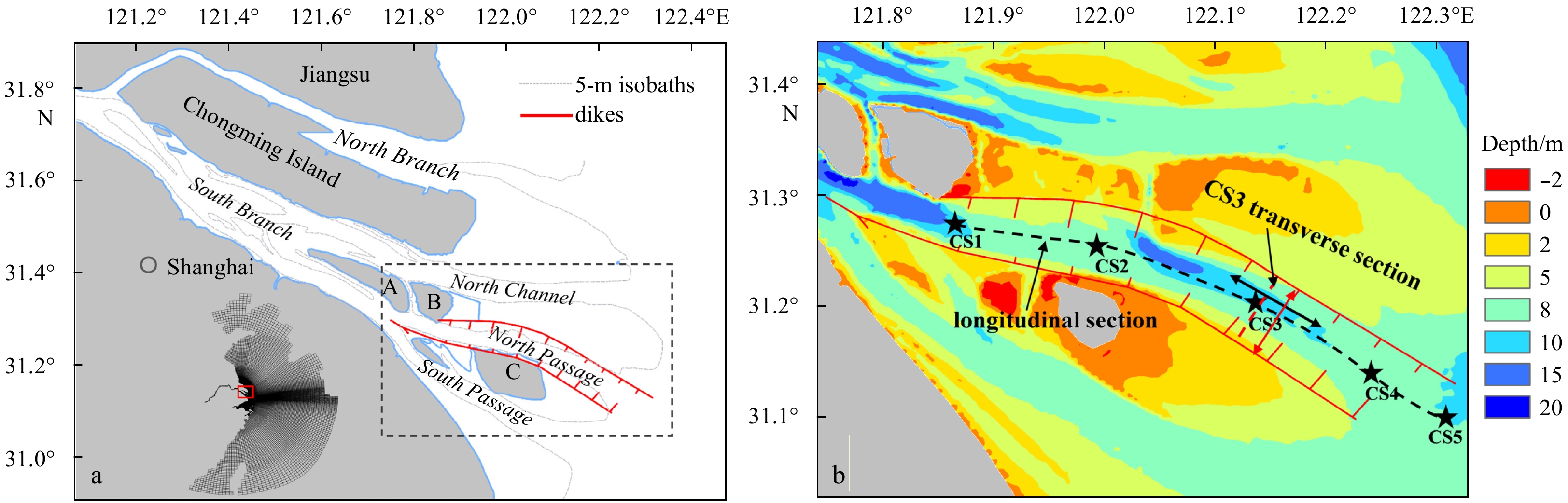
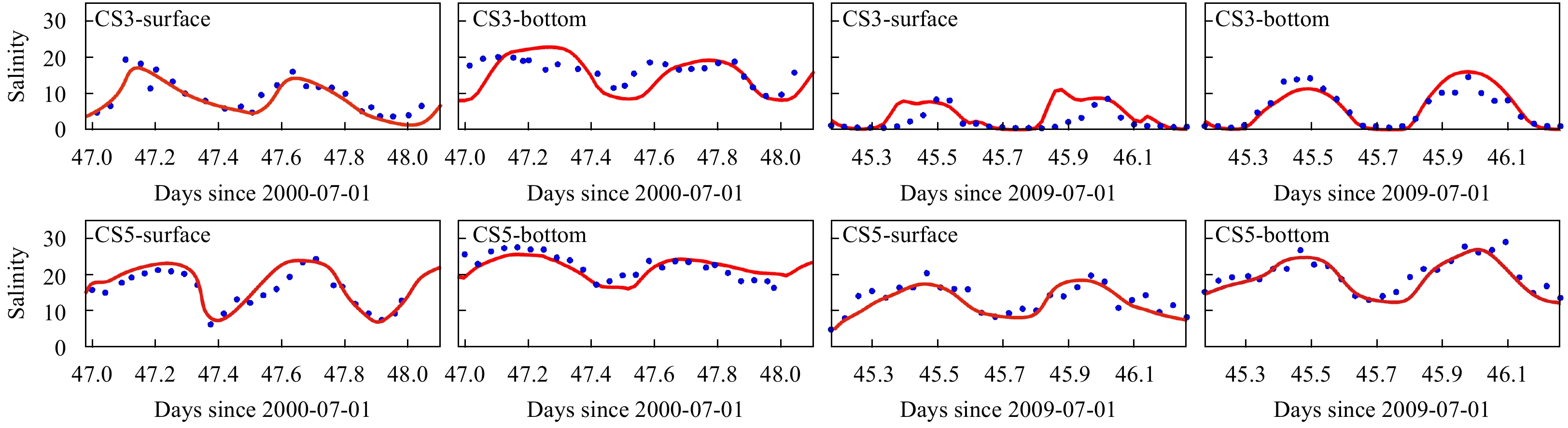
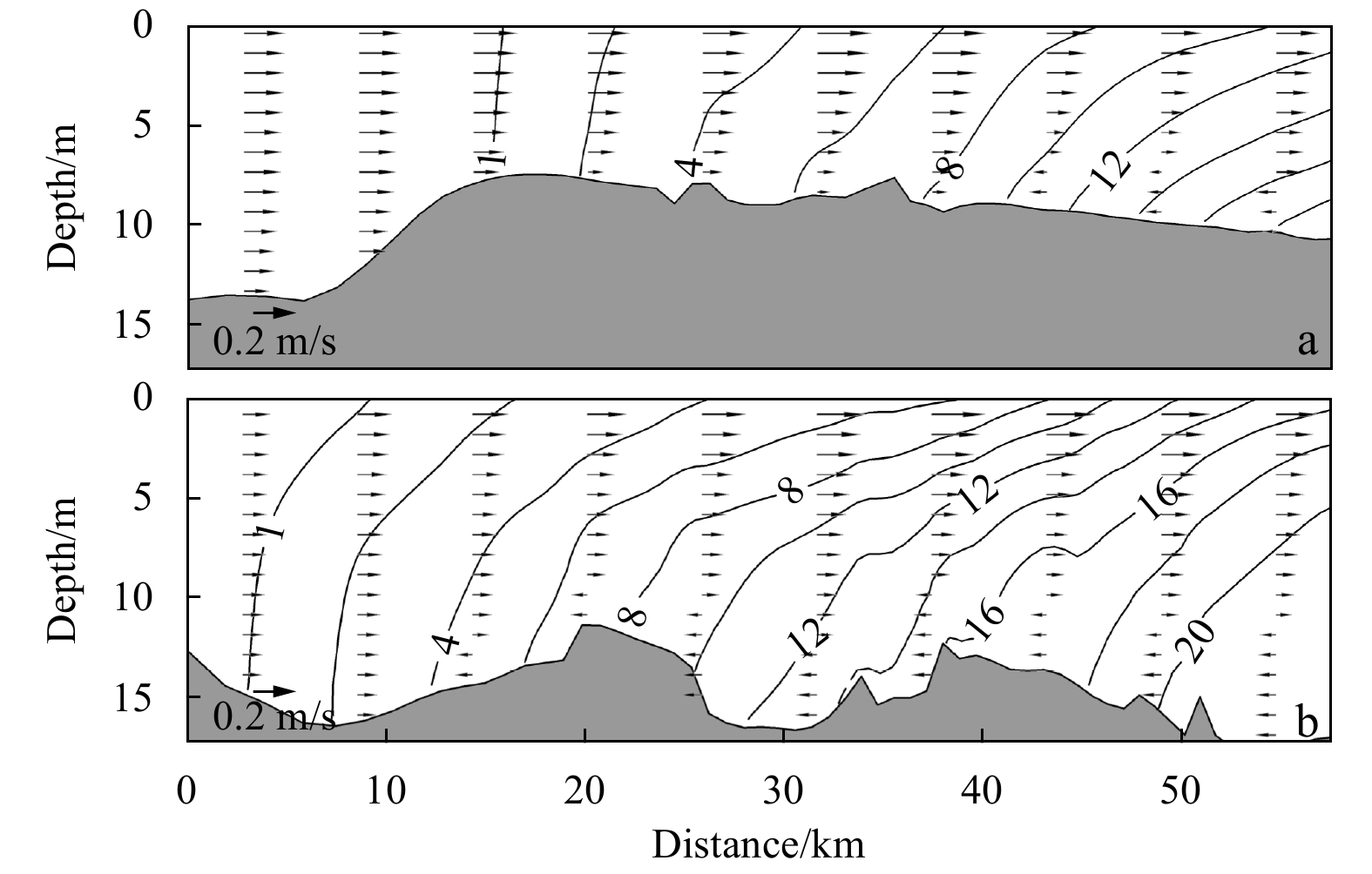
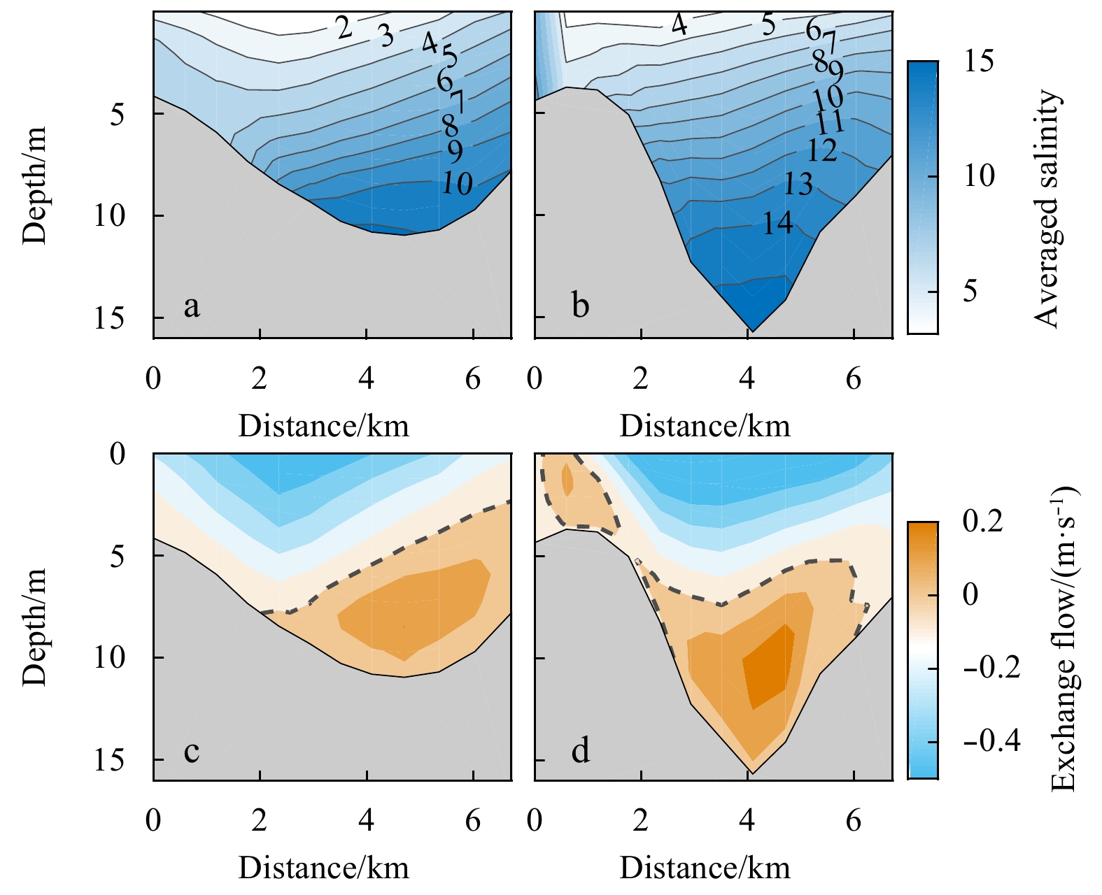
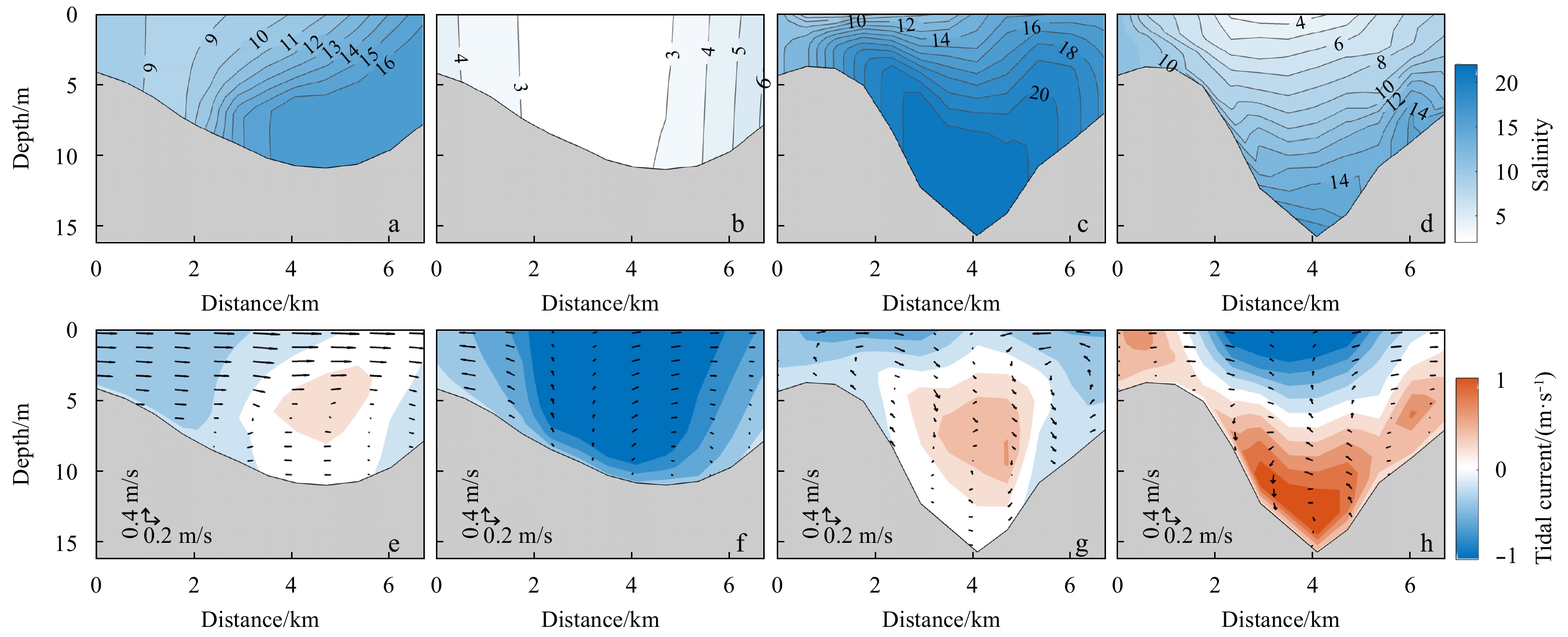
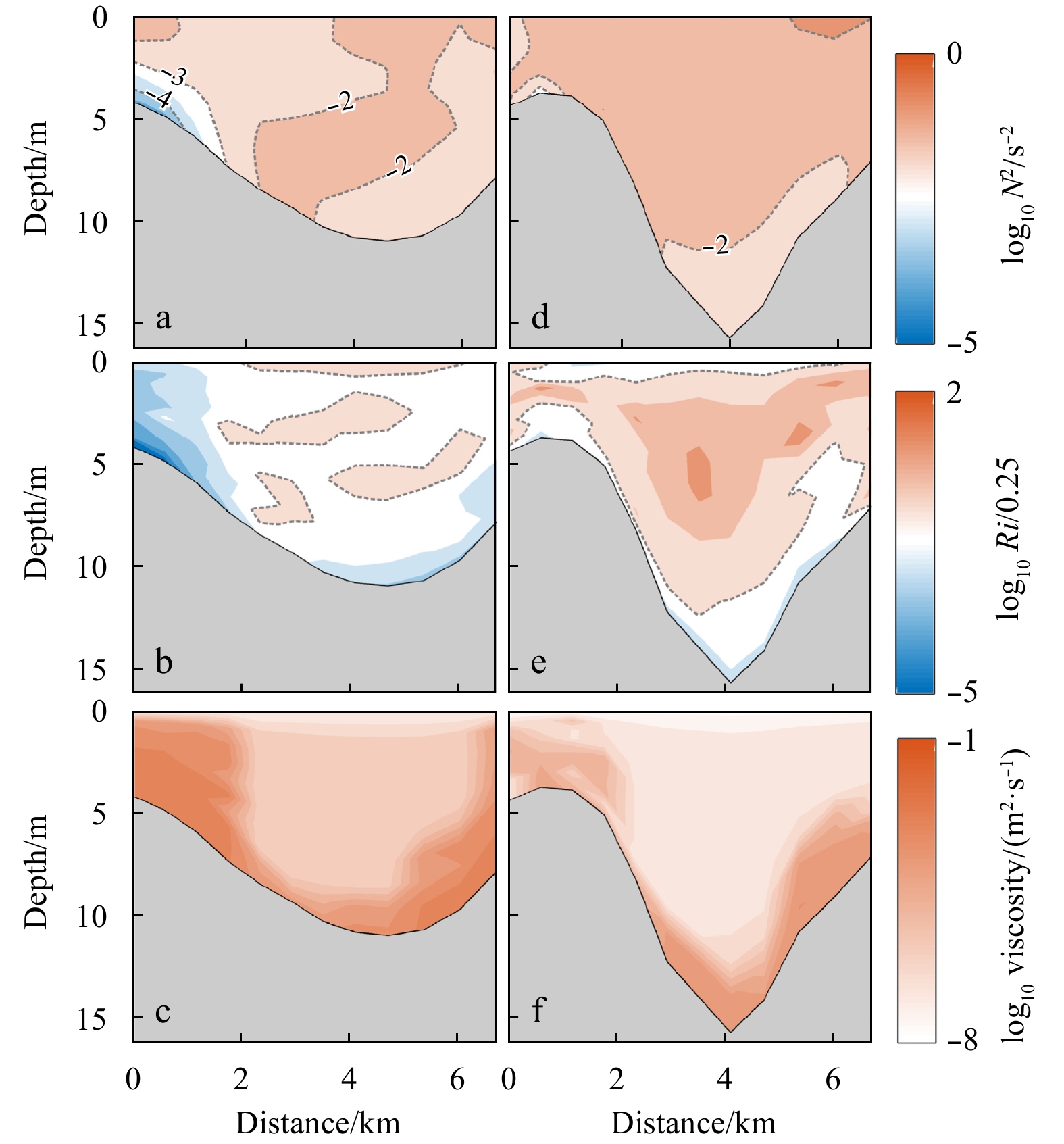
The exchange flow structure was examined in the North Passage of Changjiang River Estuary, where a deep waterway project (DWP) was carried out to improve the navigability. Before the construction of the DWP, the friction effect played a significant r...
The exchange flow structure was examined in the North Passage of Changjiang River Estuary, where a deep waterway project (DWP) was carried out to improve the navigability. Before the construction of the DWP, the friction effect played a significant r...