2021 Vol. 40, No. 3
Display Method:
2021, (3): 1-2.
Abstract:
2021, 40(3): 1-17.
doi: 10.1007/s13131-021-1720-7
Abstract:
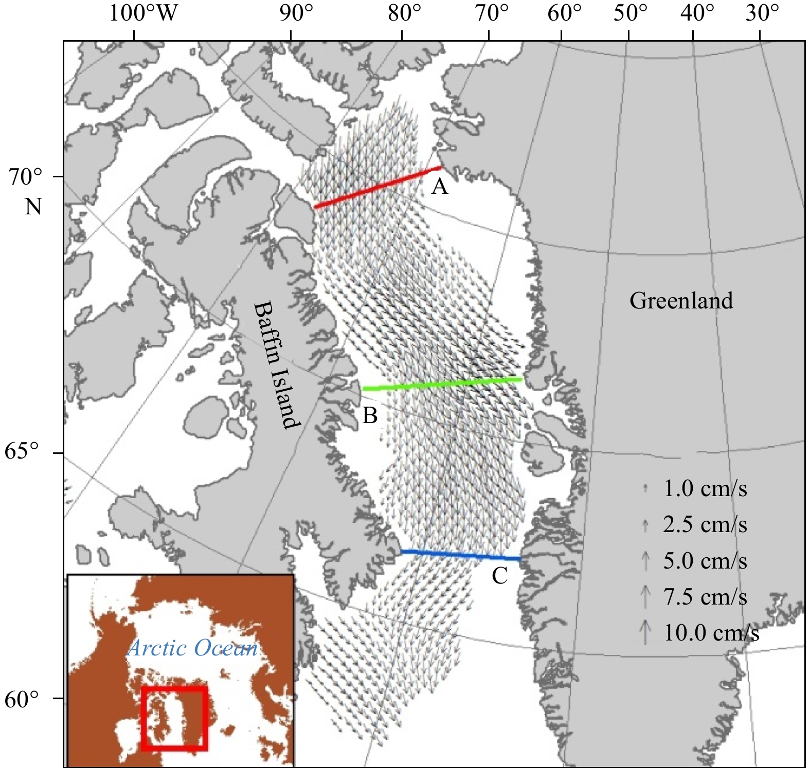
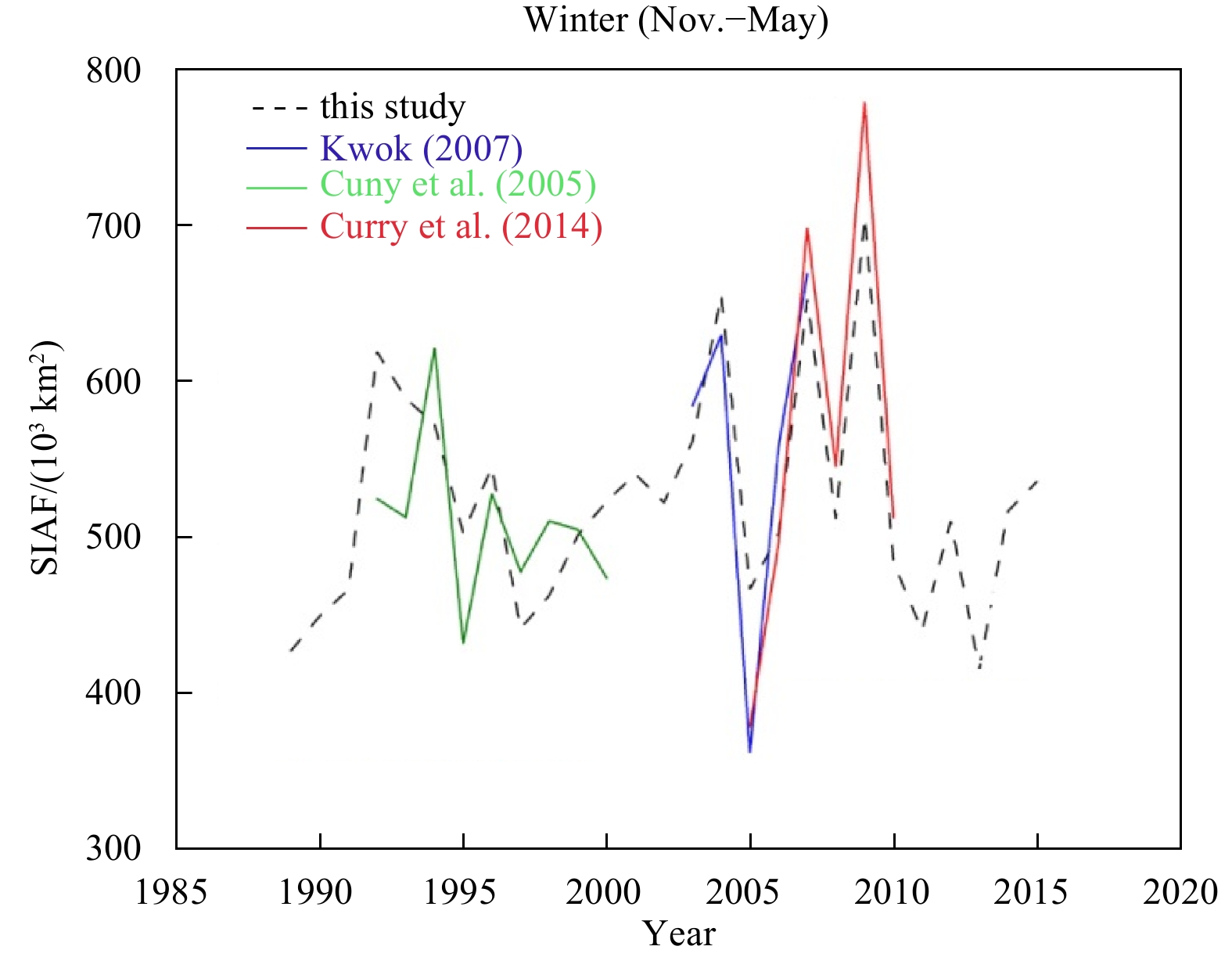
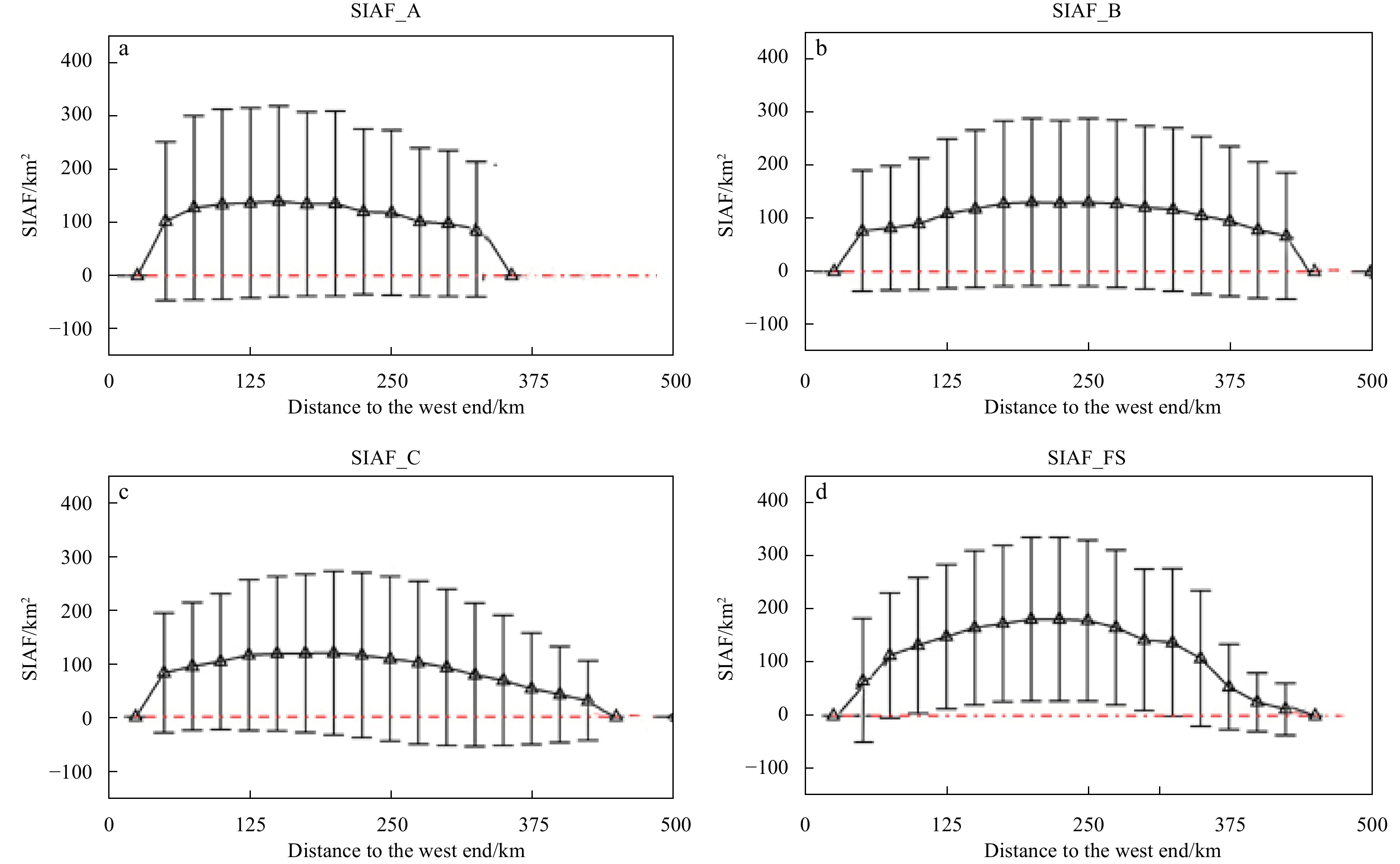
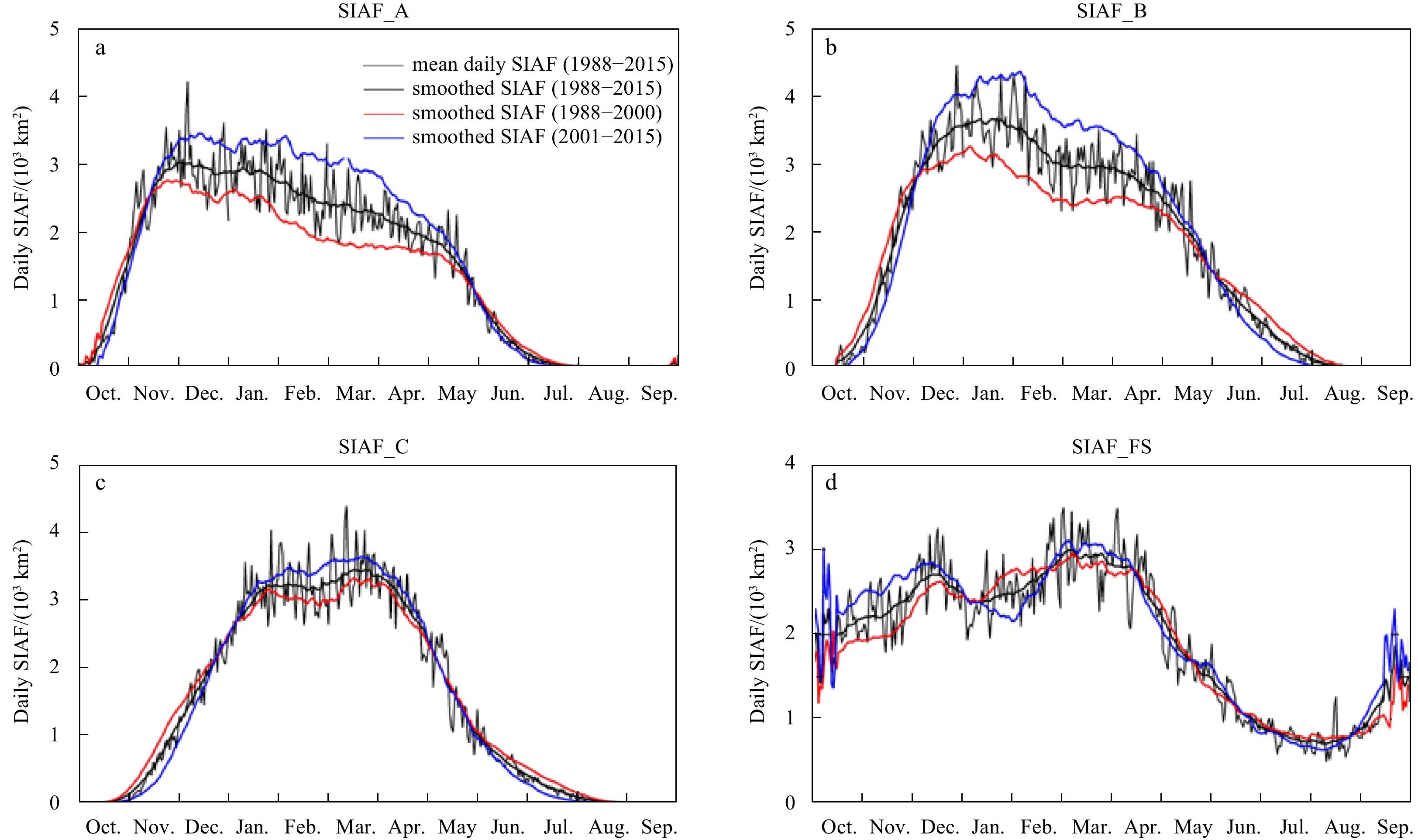
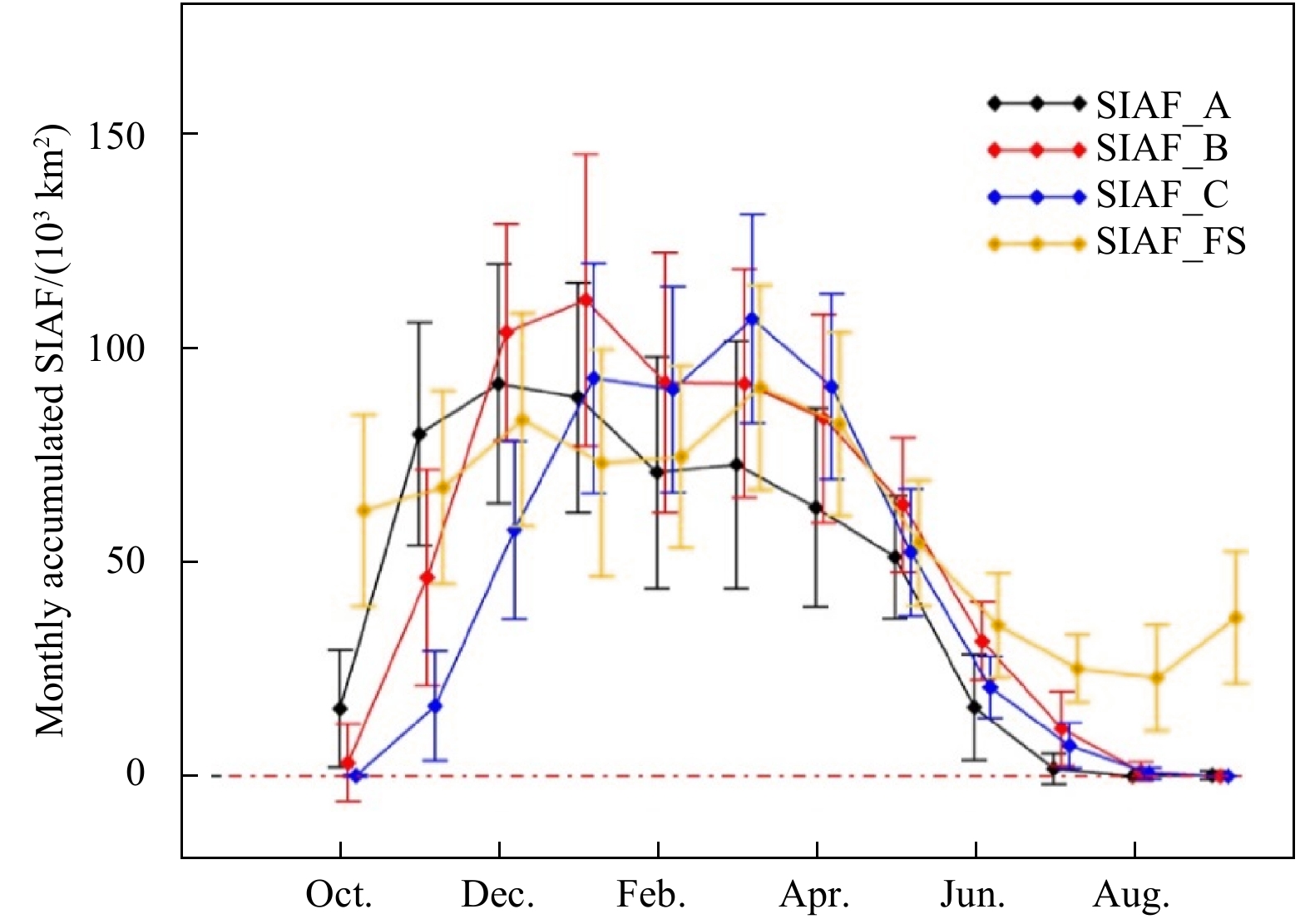
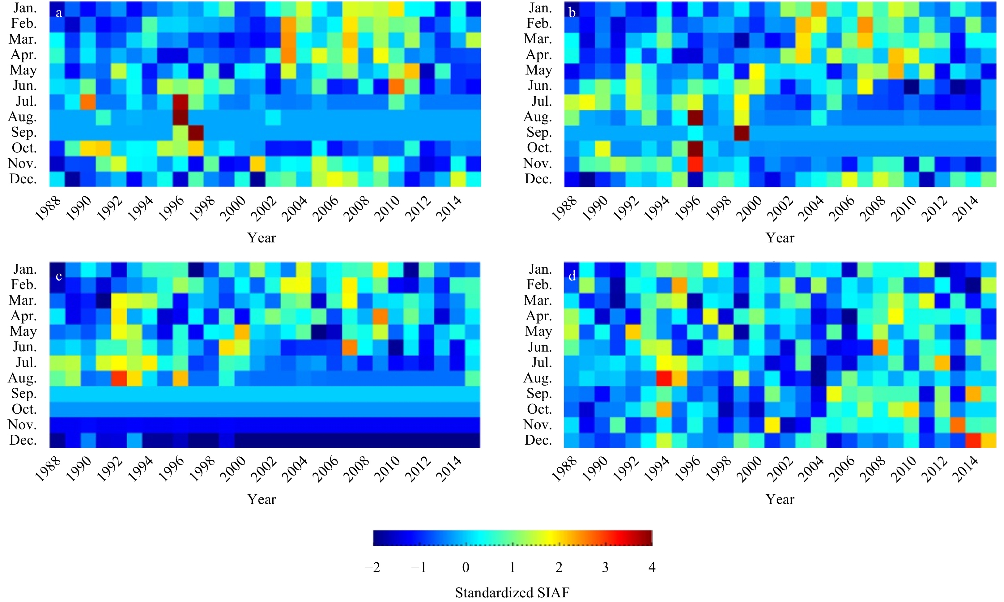
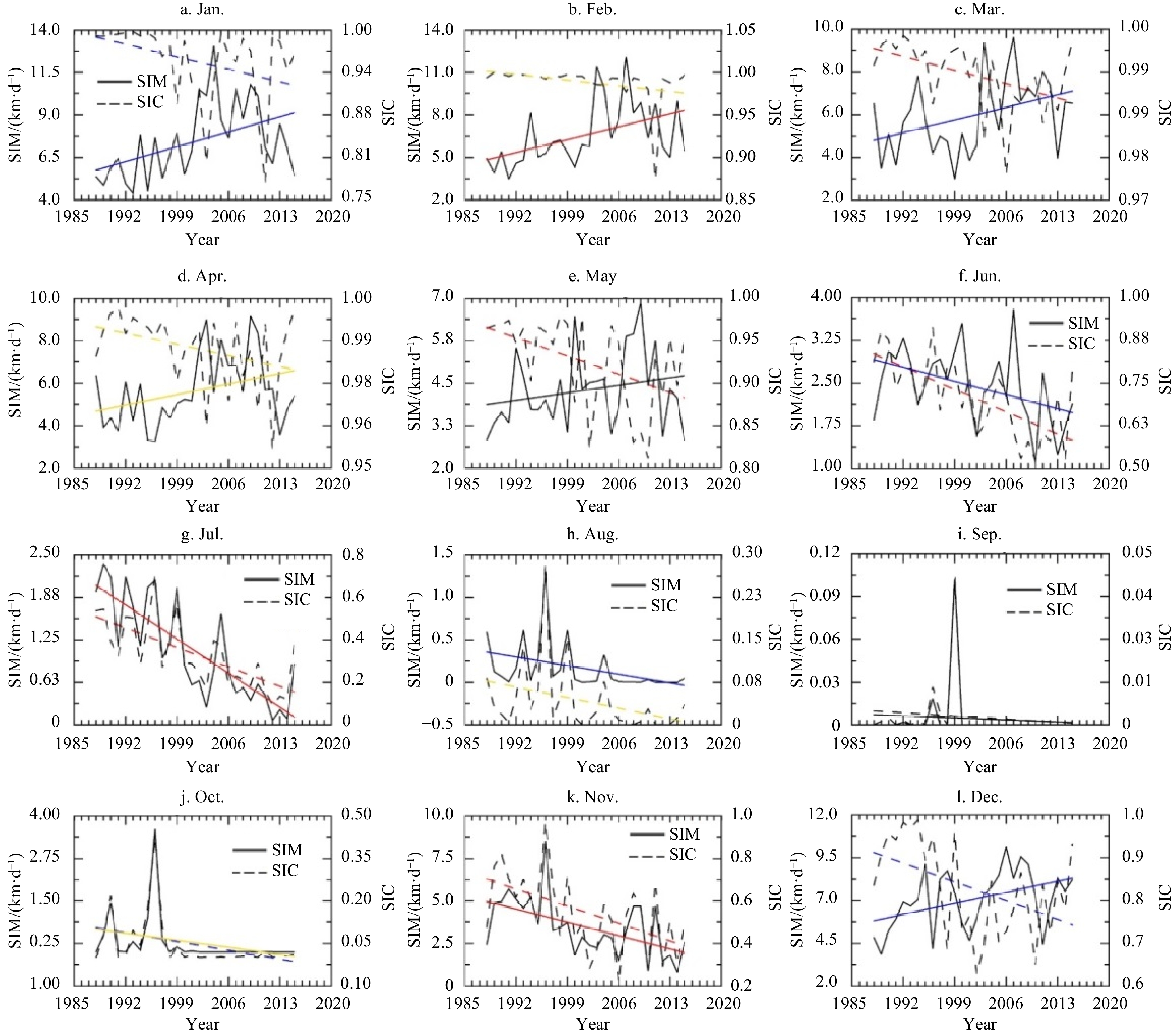
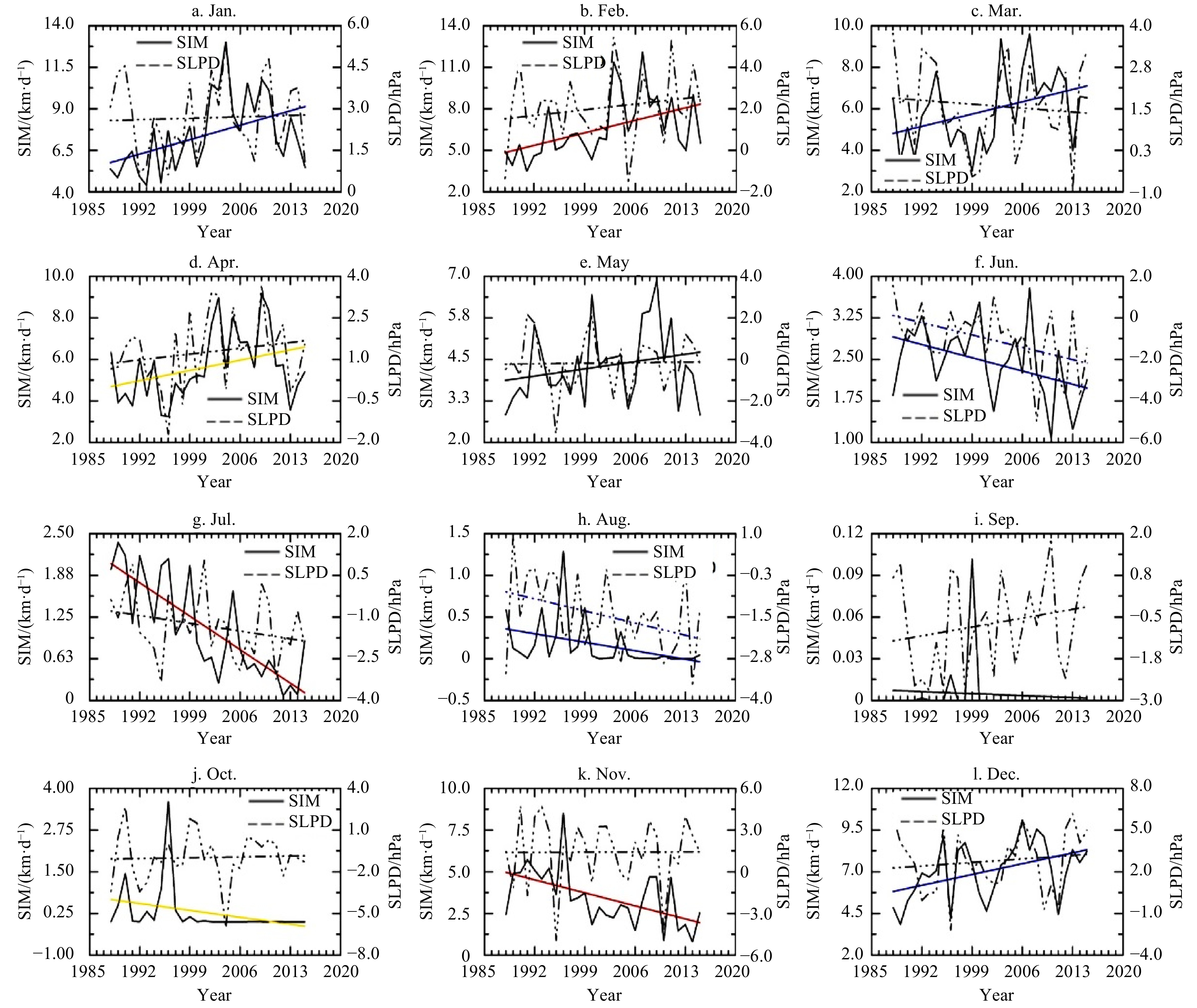
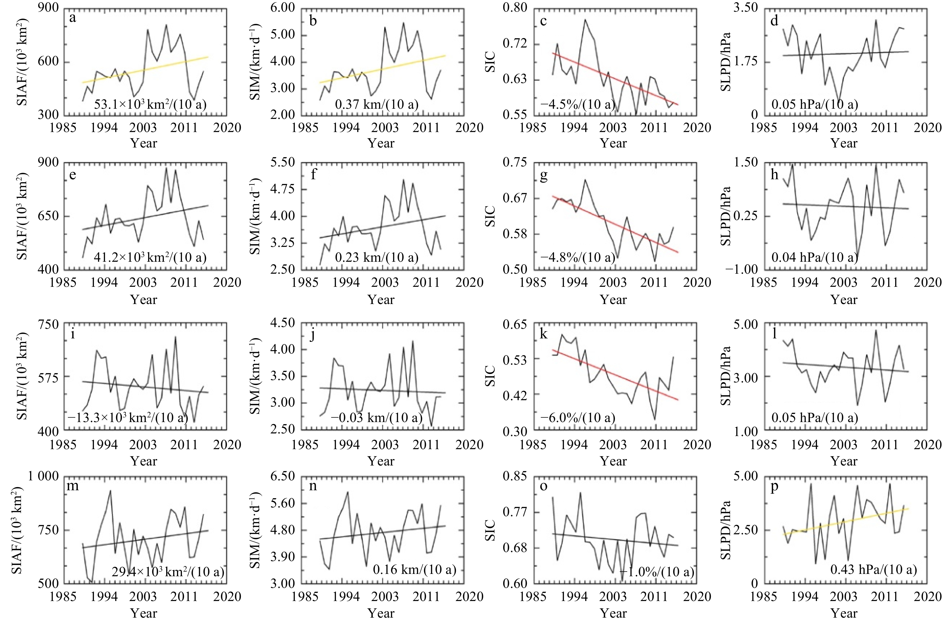
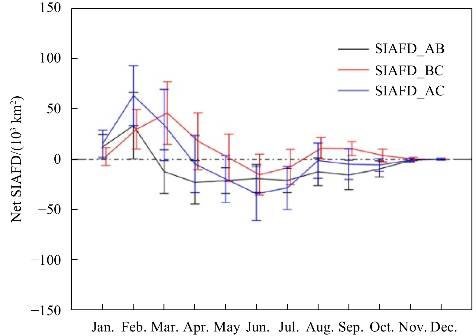
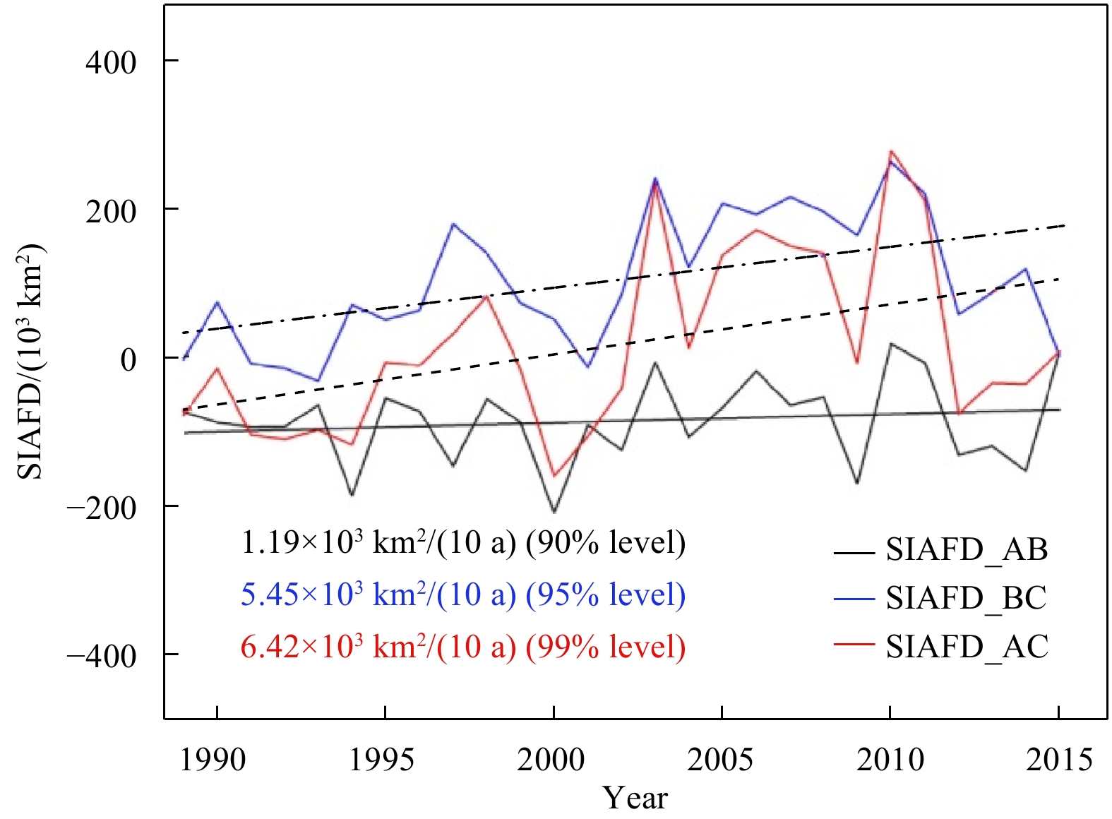
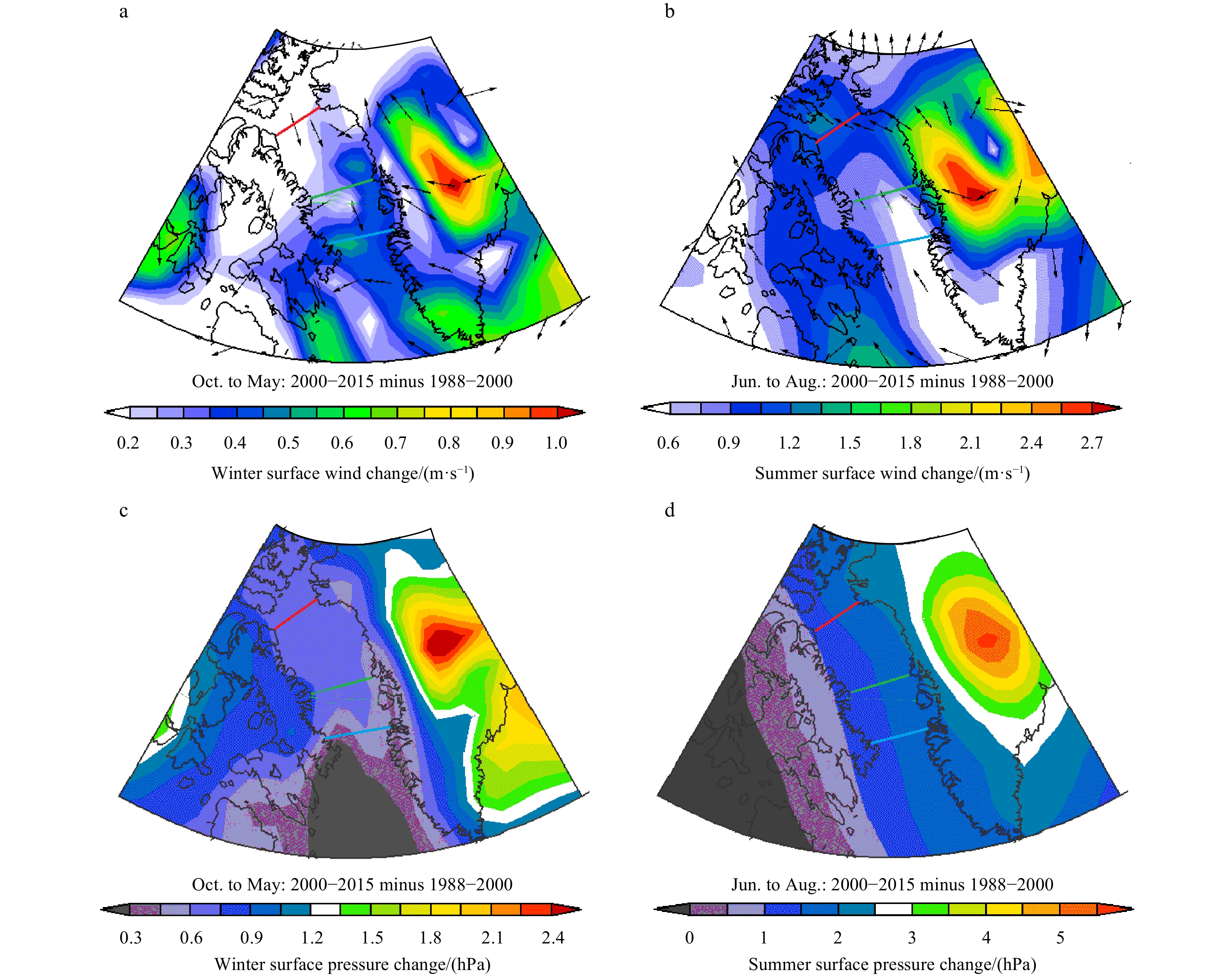
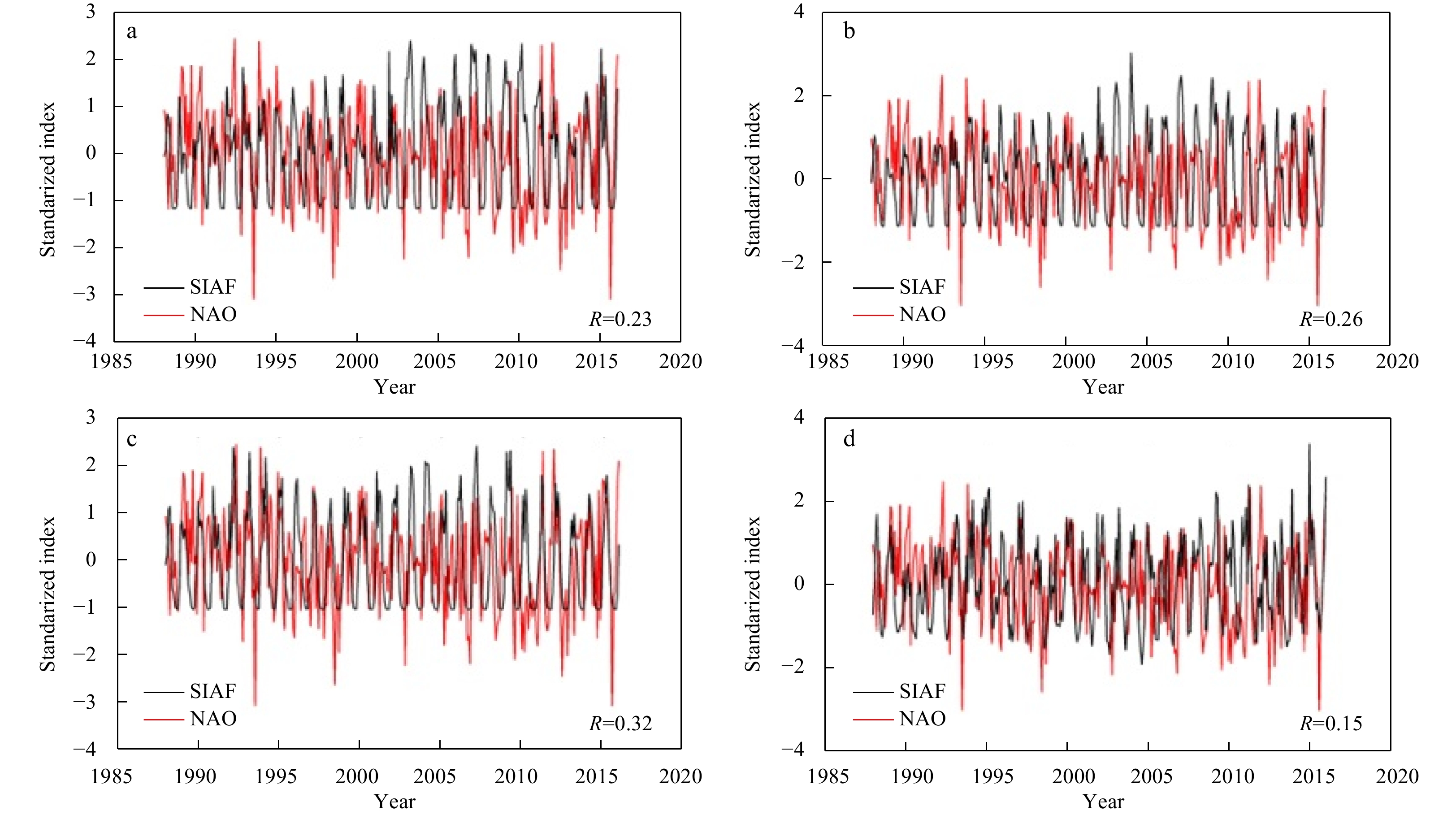
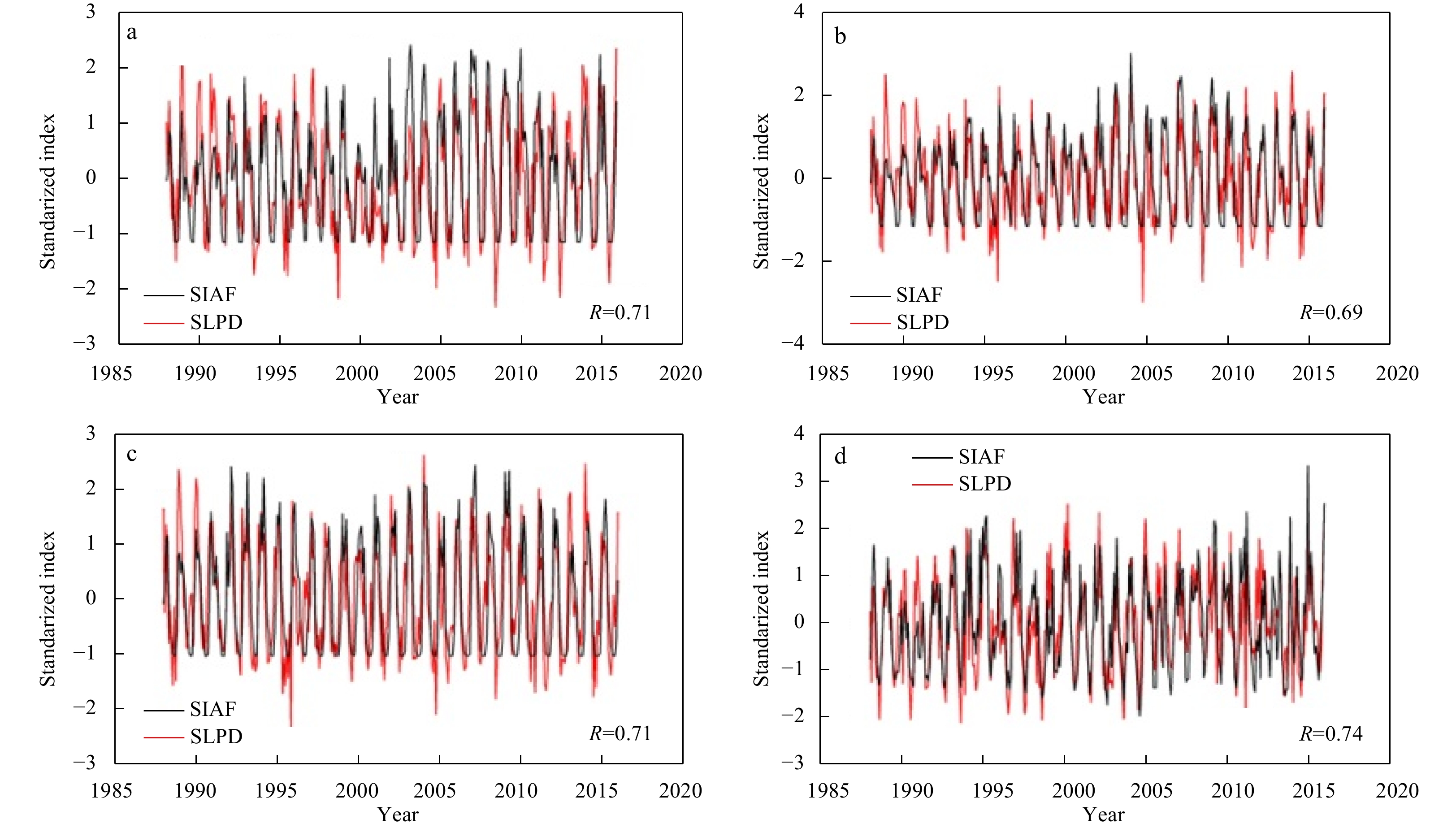
Sea ice export through the Baffin Bay plays a vital role in modulating the sea ice cover variability in the Labrador Sea. In this study, satellite-derived sea ice products are used to obtain the sea ice area flux (SIAF) through the three passages in ...
Sea ice export through the Baffin Bay plays a vital role in modulating the sea ice cover variability in the Labrador Sea. In this study, satellite-derived sea ice products are used to obtain the sea ice area flux (SIAF) through the three passages in ...


2021, 40(3): 18-26.
doi: 10.1007/s13131-021-1714-5
Abstract:
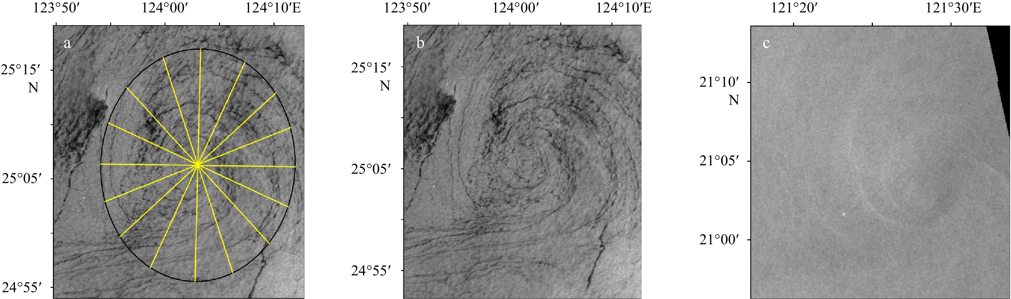
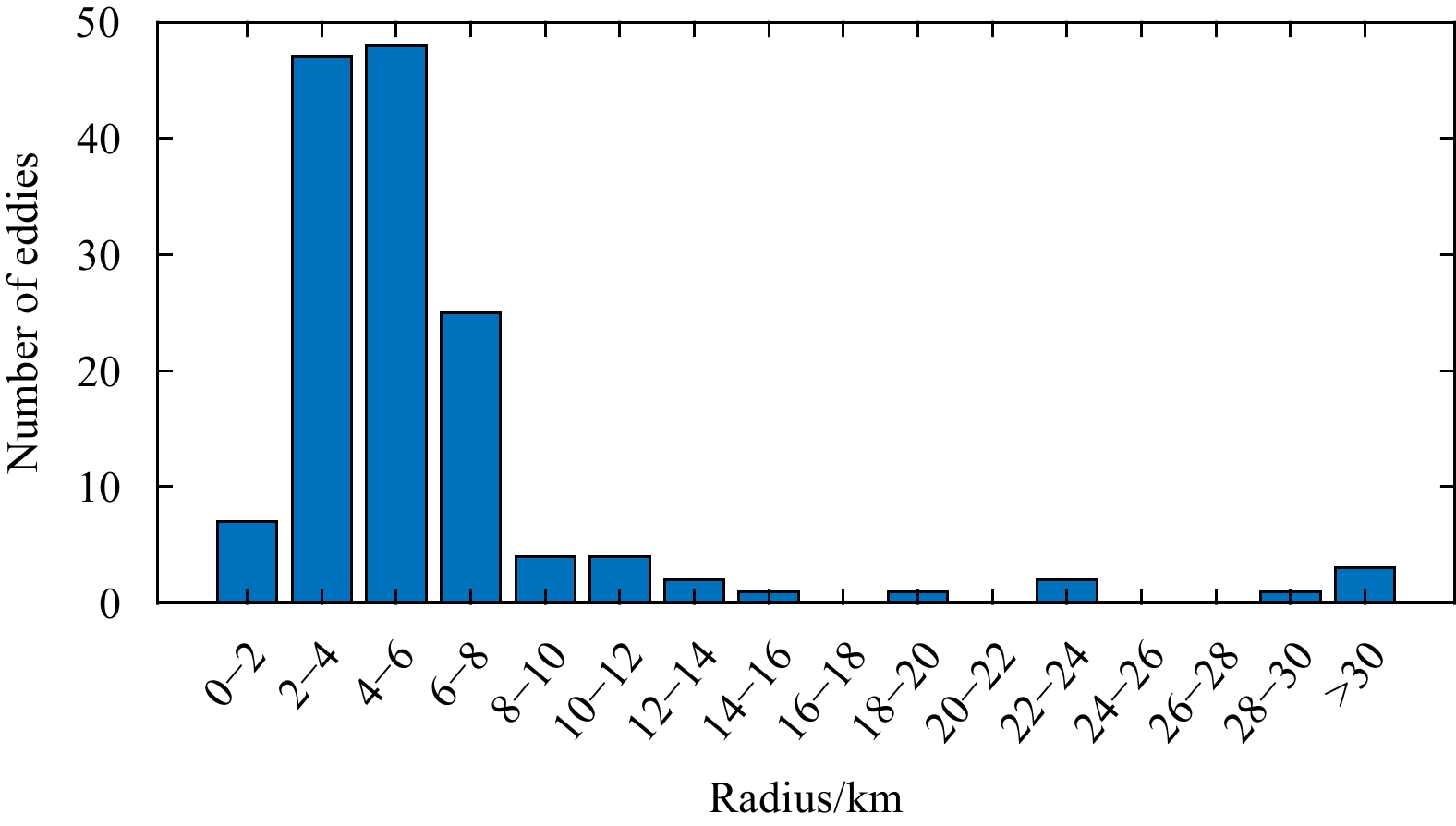
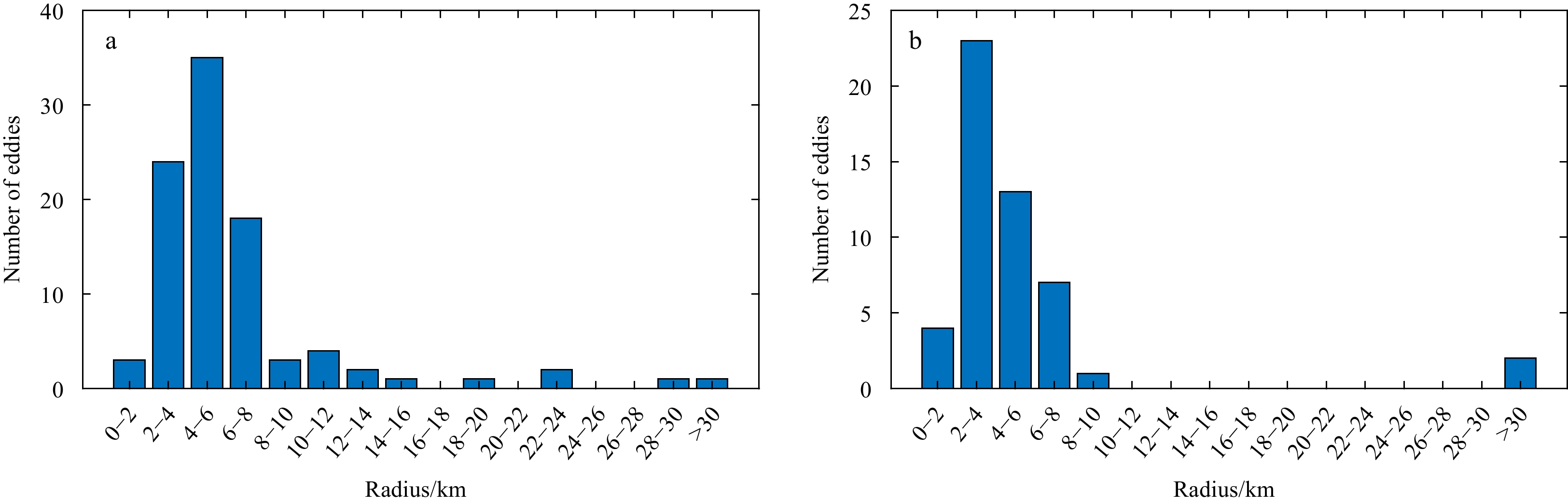
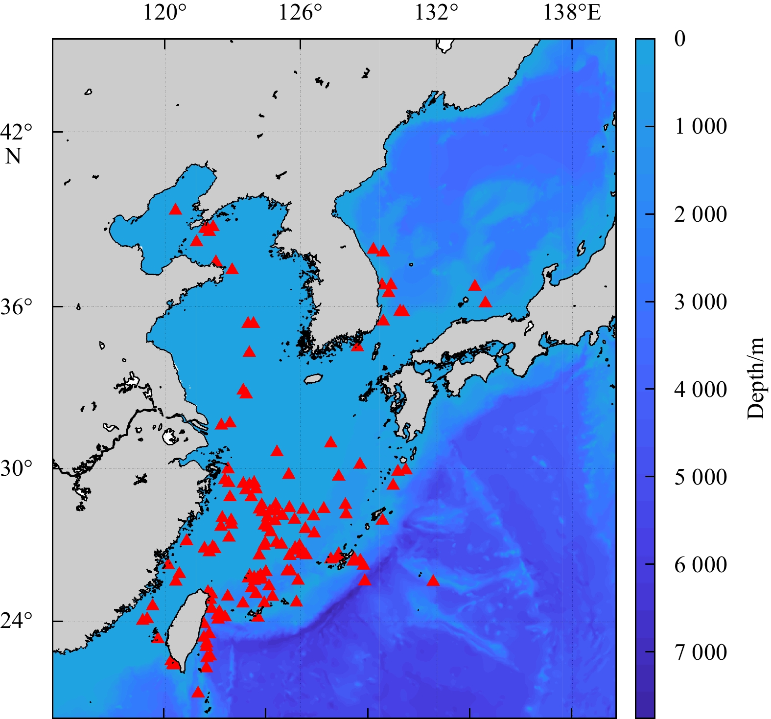
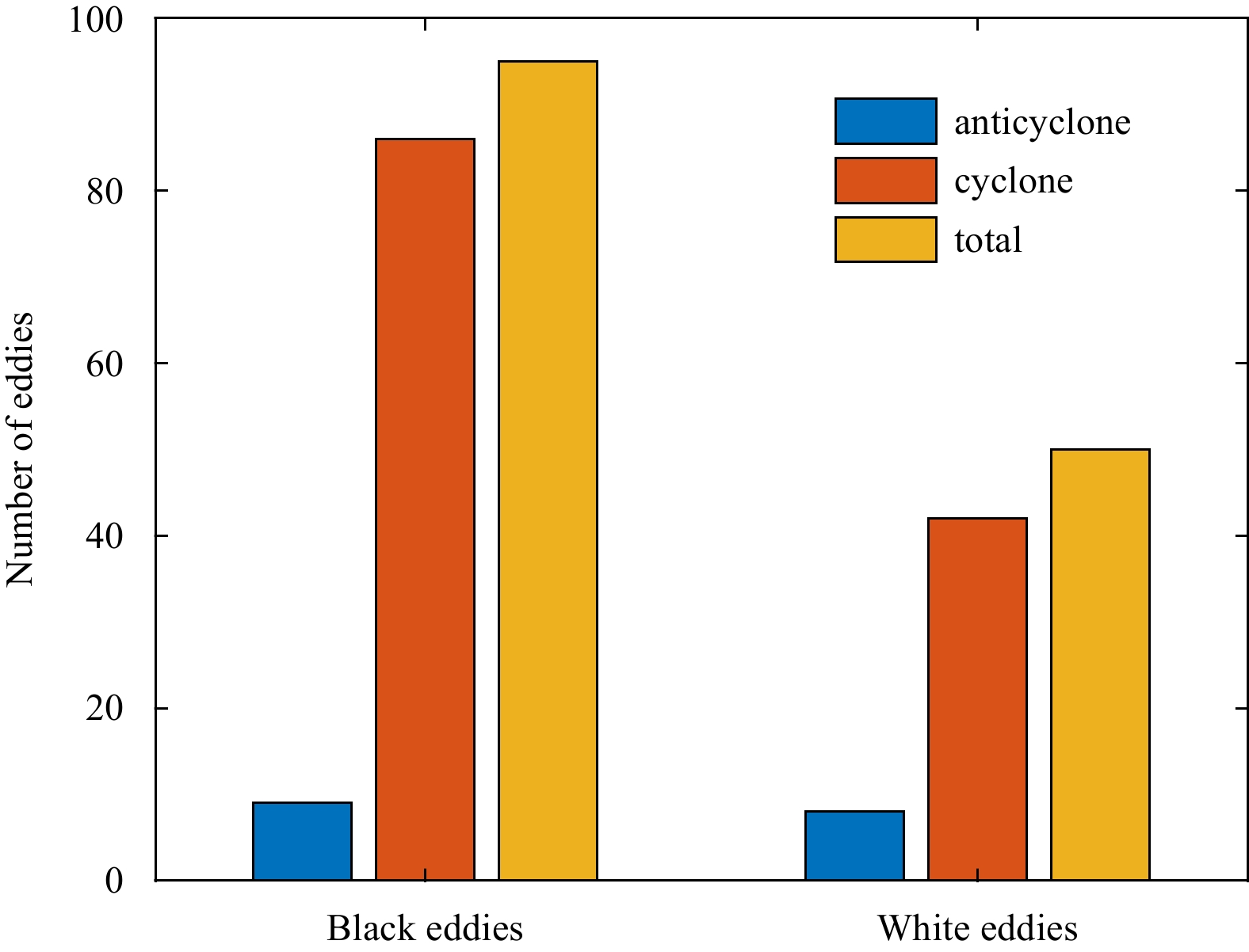
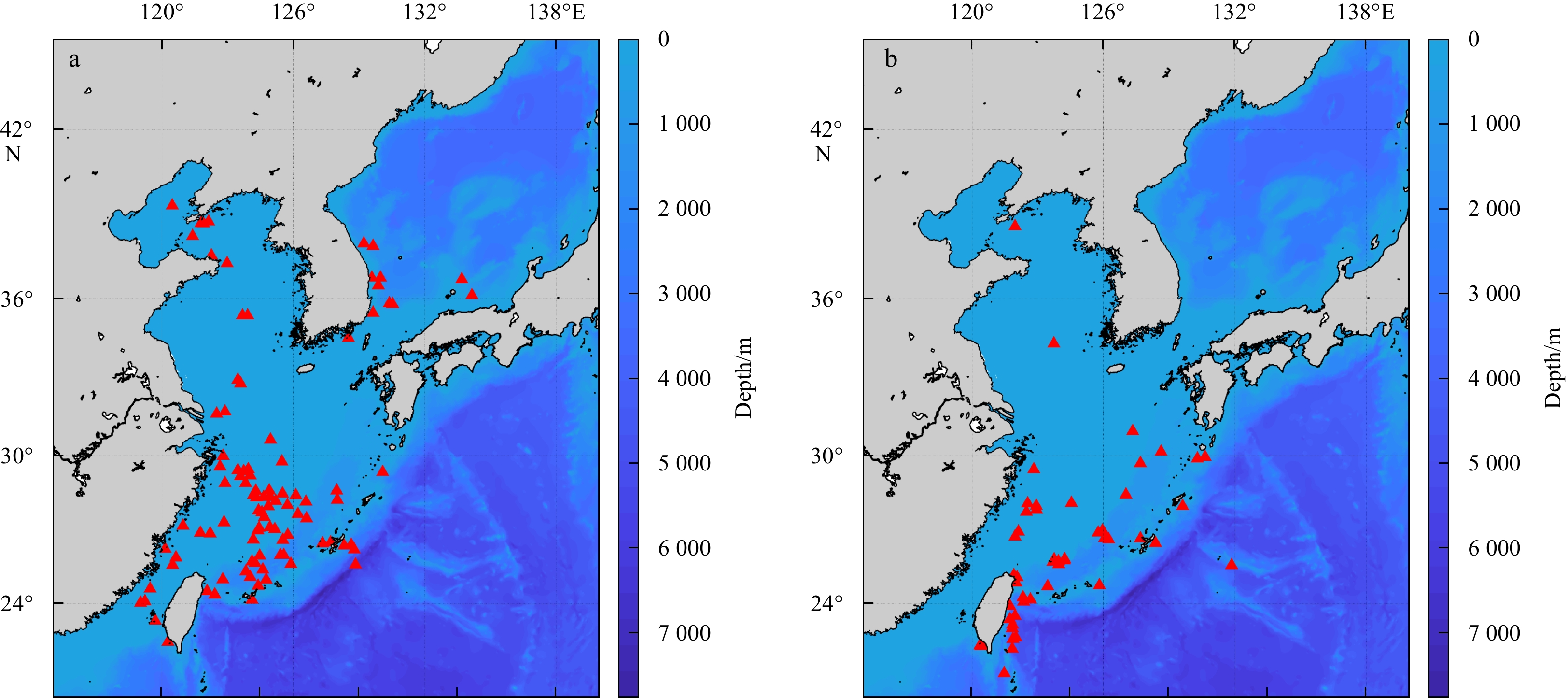
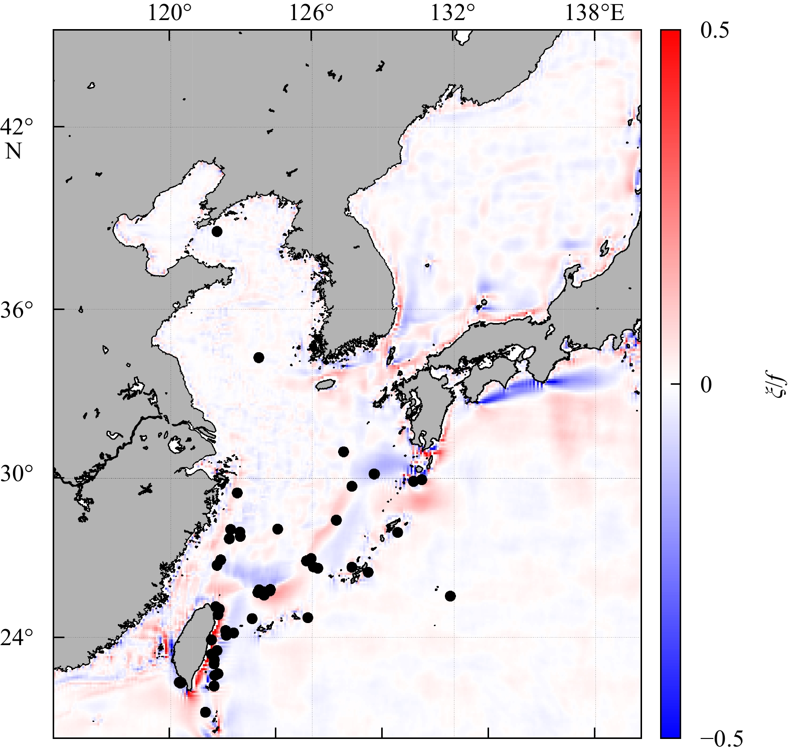
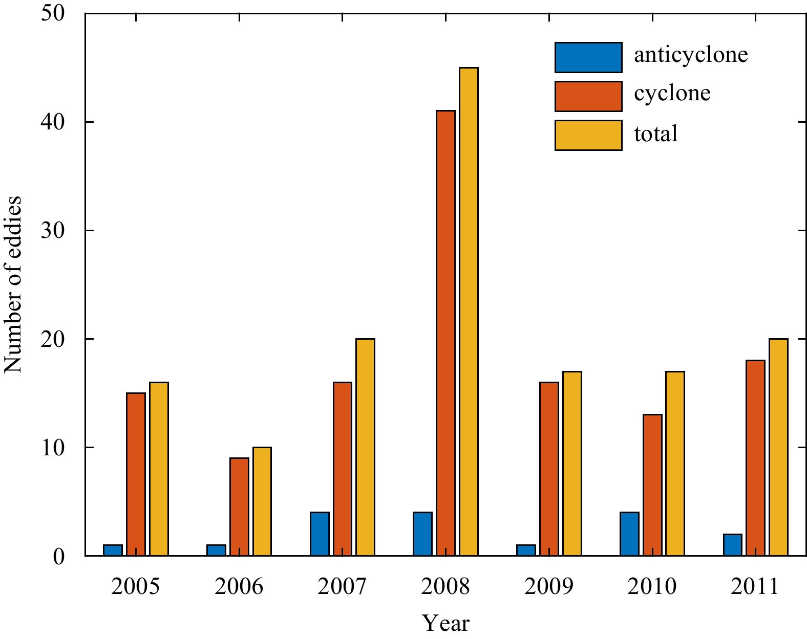
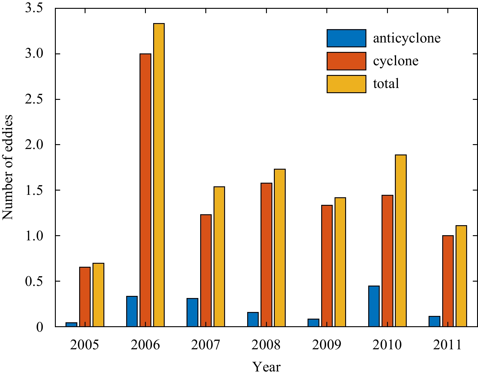
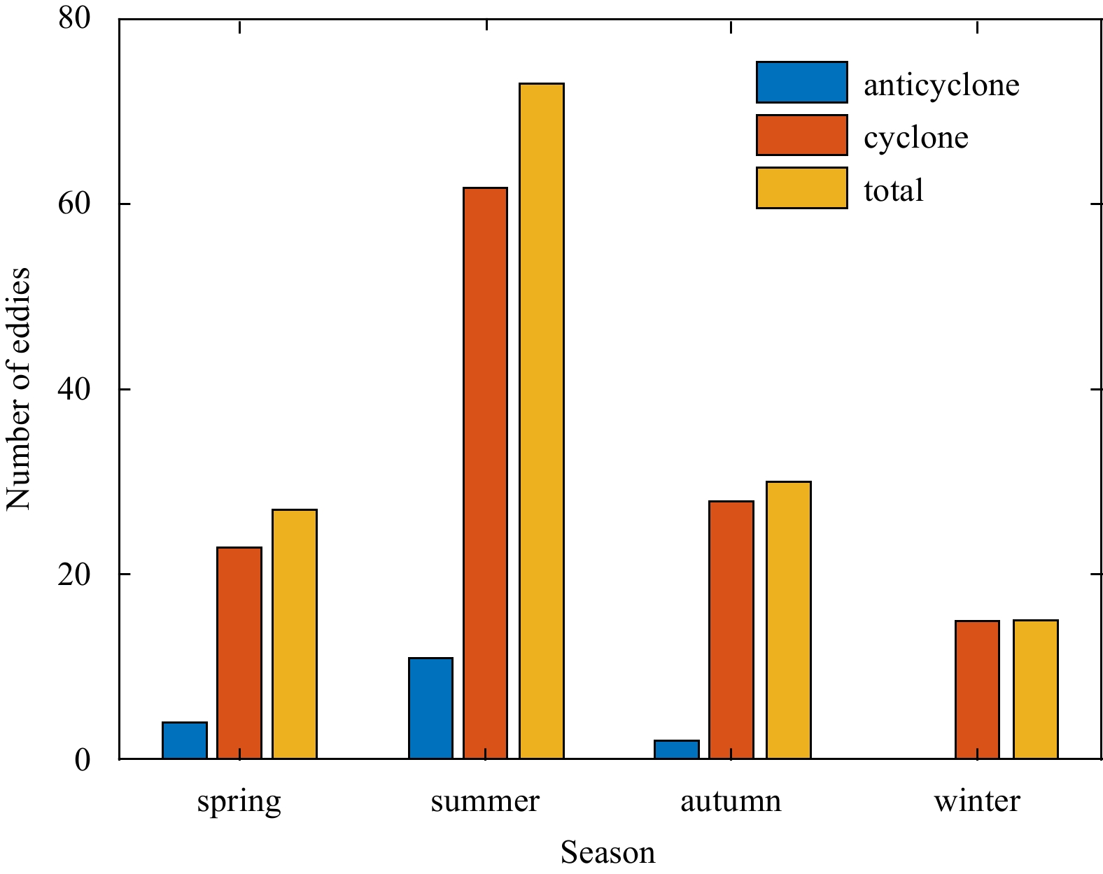
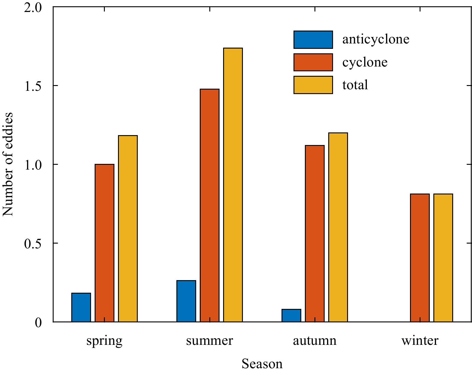
Seven-year (2005–2011) Synthetic Aperture Radar (SAR) images are applied to study oceanic eddies in the East China Sea. It is found that most of these eddies detected from the SAR images are less than 10 km, which are submesoscale eddies. Seasonal di...
Seven-year (2005–2011) Synthetic Aperture Radar (SAR) images are applied to study oceanic eddies in the East China Sea. It is found that most of these eddies detected from the SAR images are less than 10 km, which are submesoscale eddies. Seasonal di...

2021, 40(3): 27-33.
doi: 10.1007/s13131-021-1709-2
Abstract:
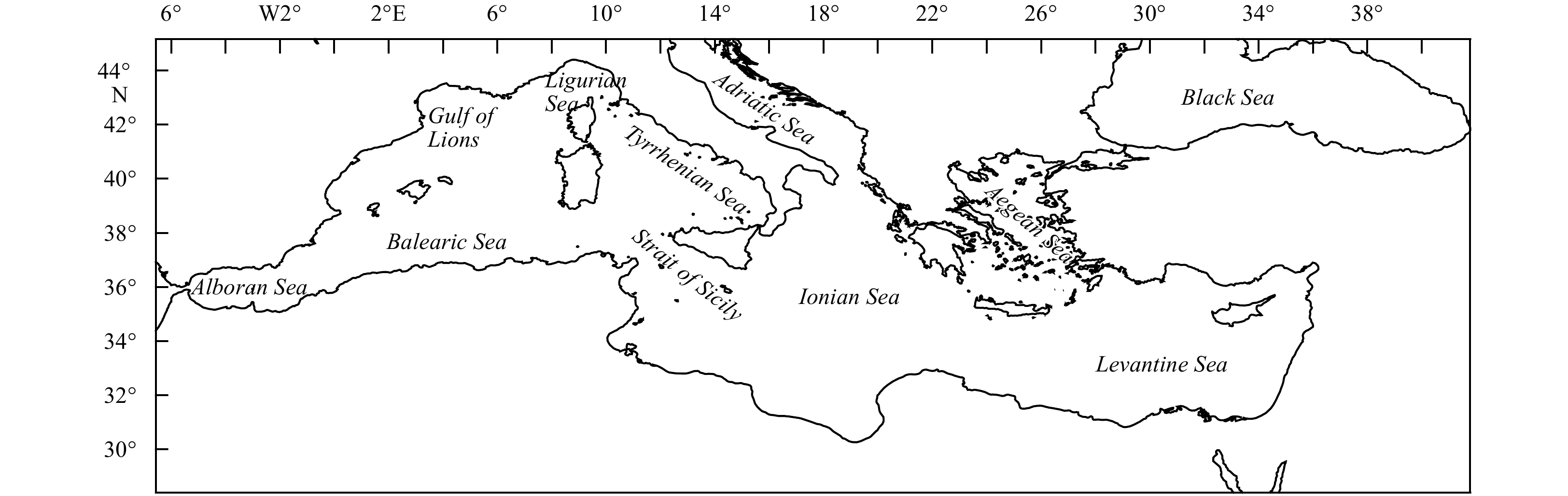
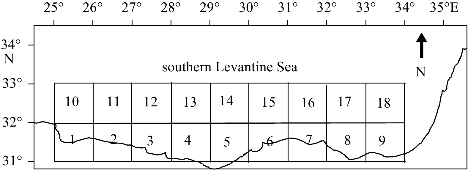
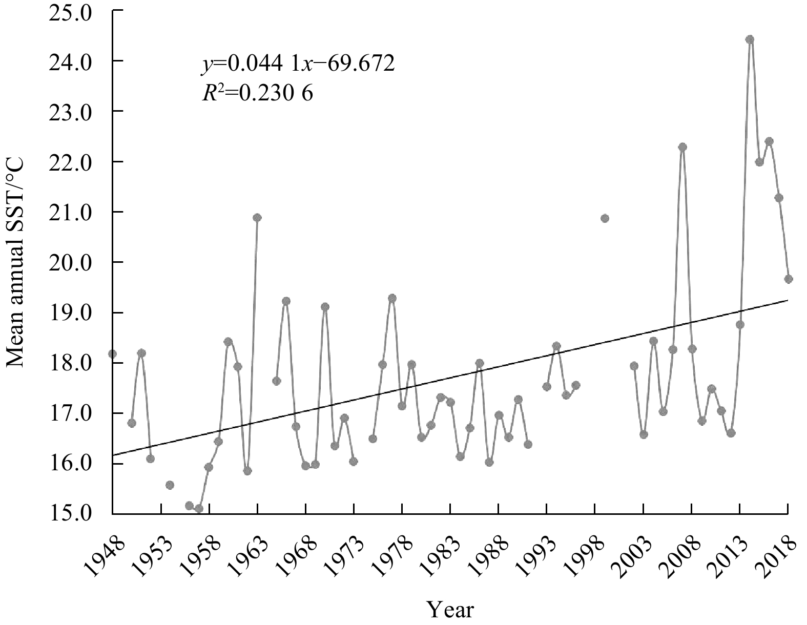
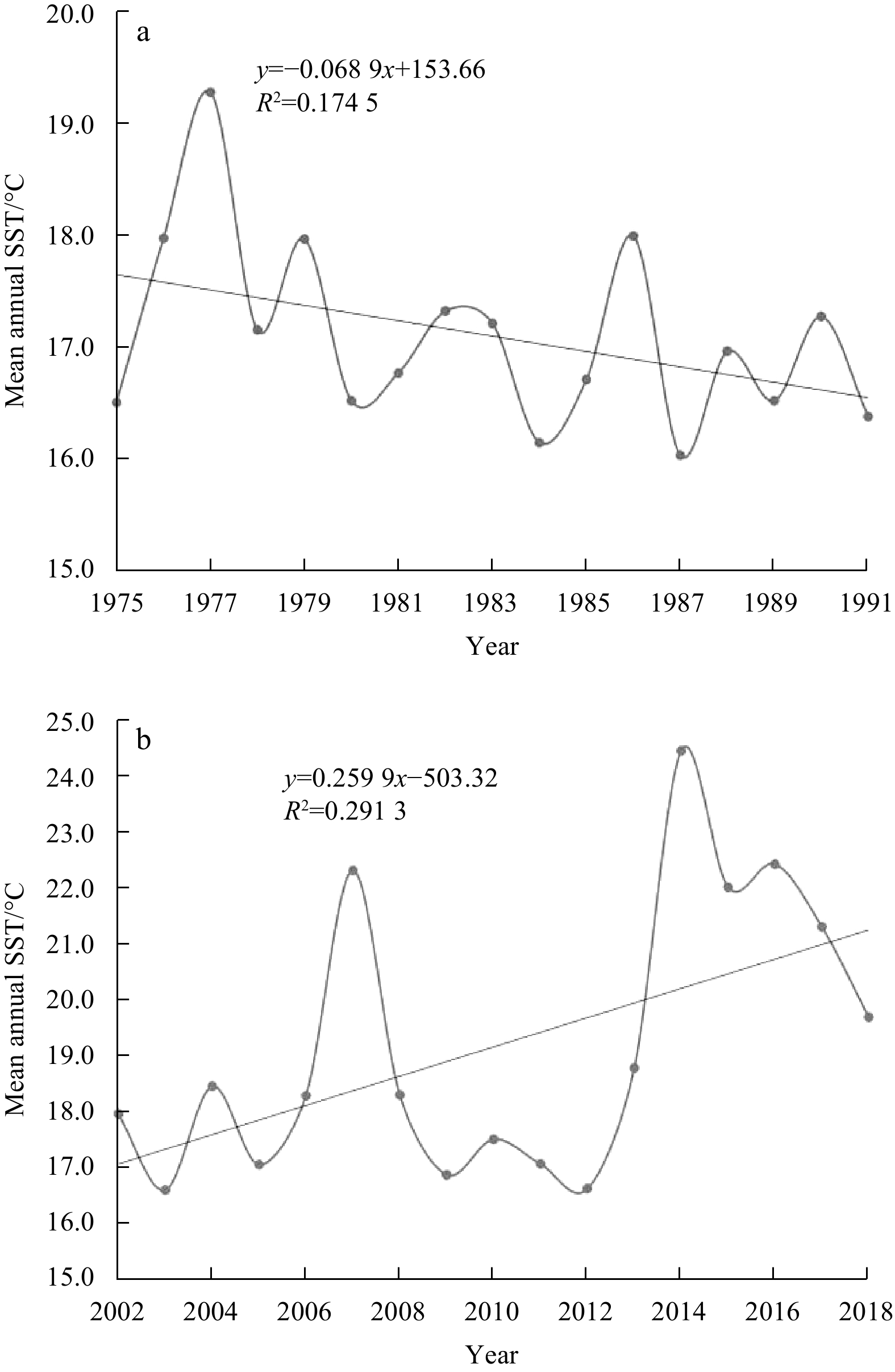
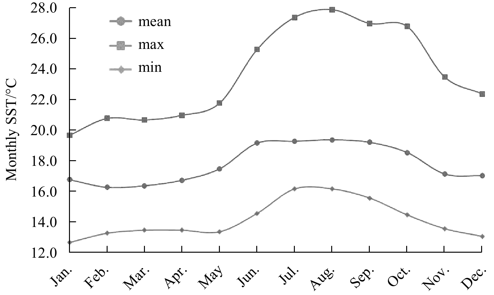
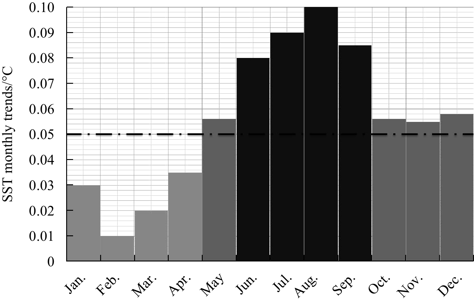
Knowledge of sea surface temperature (SST) behaviour is vital for long-term climate scenarios. This study highlights essential outcomes about the distinguishable and unsurprising warming of the SST along the southern border of the Levantine Basin. Th...
Knowledge of sea surface temperature (SST) behaviour is vital for long-term climate scenarios. This study highlights essential outcomes about the distinguishable and unsurprising warming of the SST along the southern border of the Levantine Basin. Th...

2021, 40(3): 34-45.
doi: 10.1007/s13131-021-1710-9
Abstract:
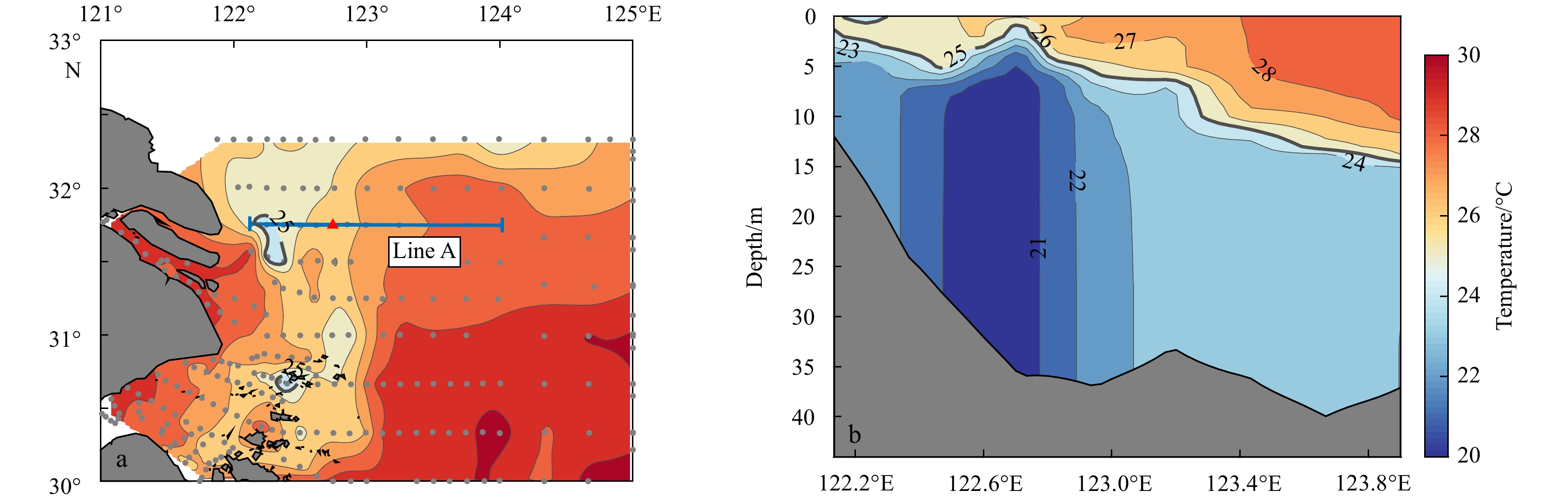
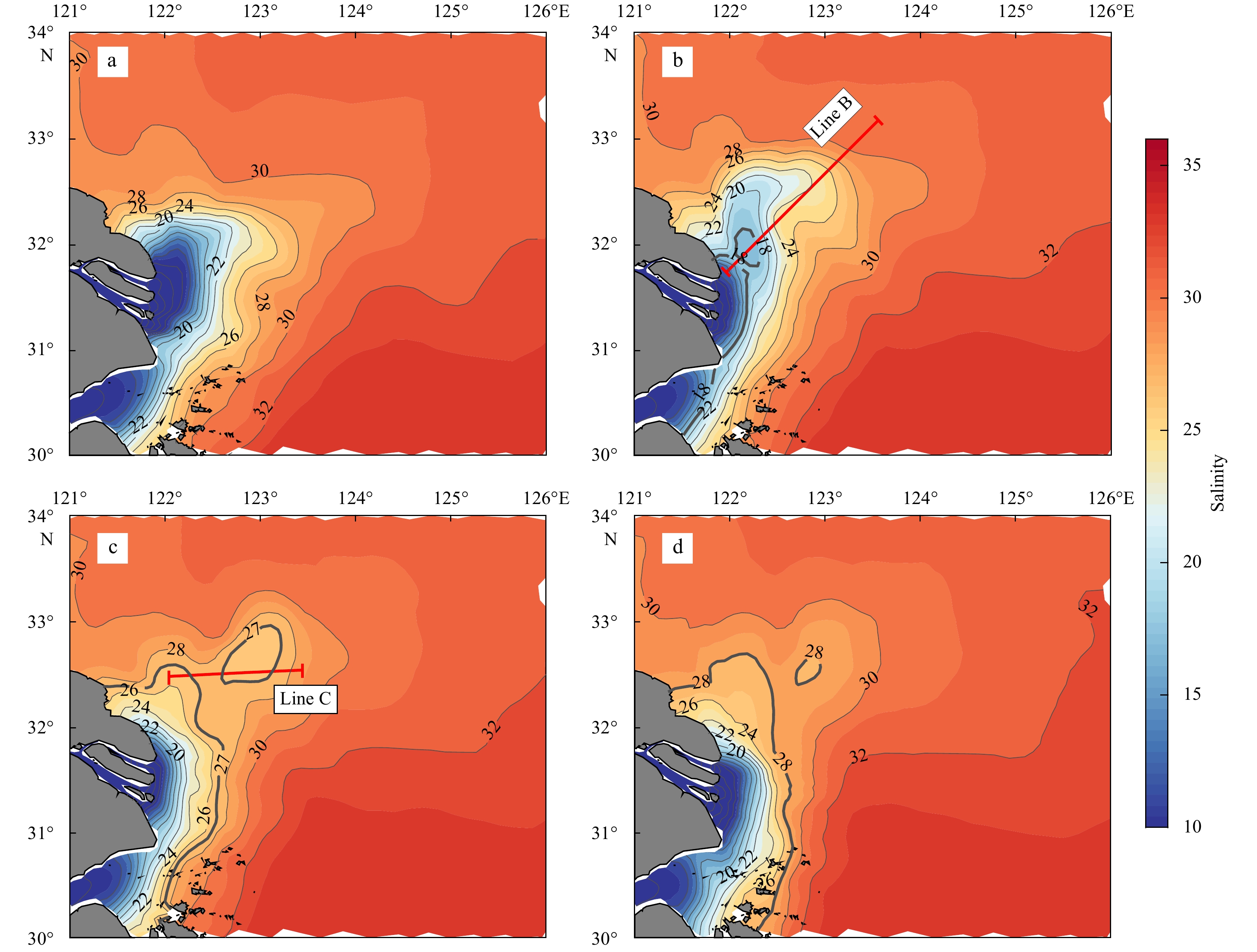
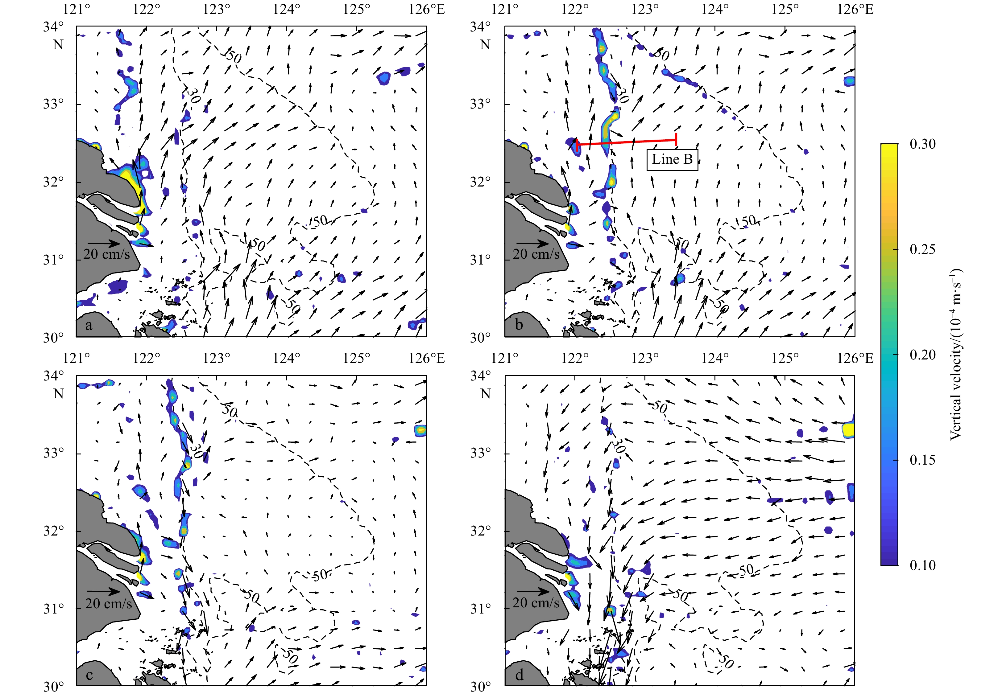
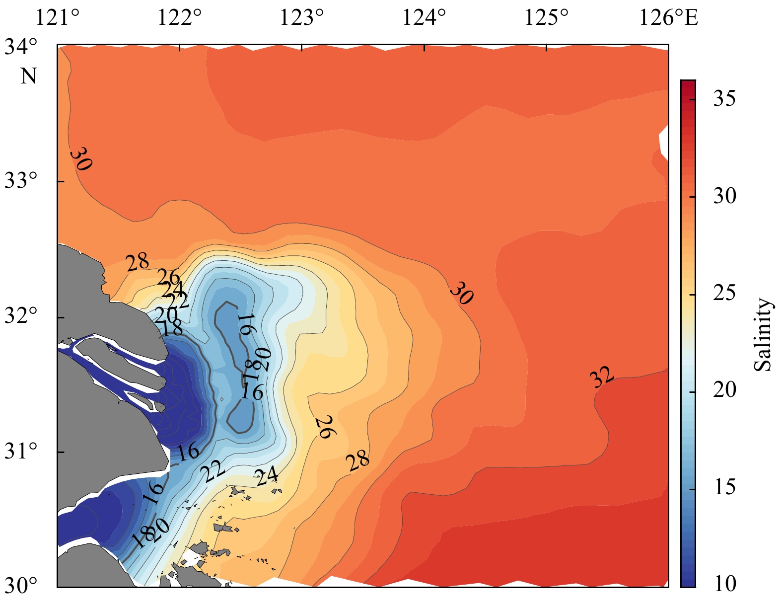
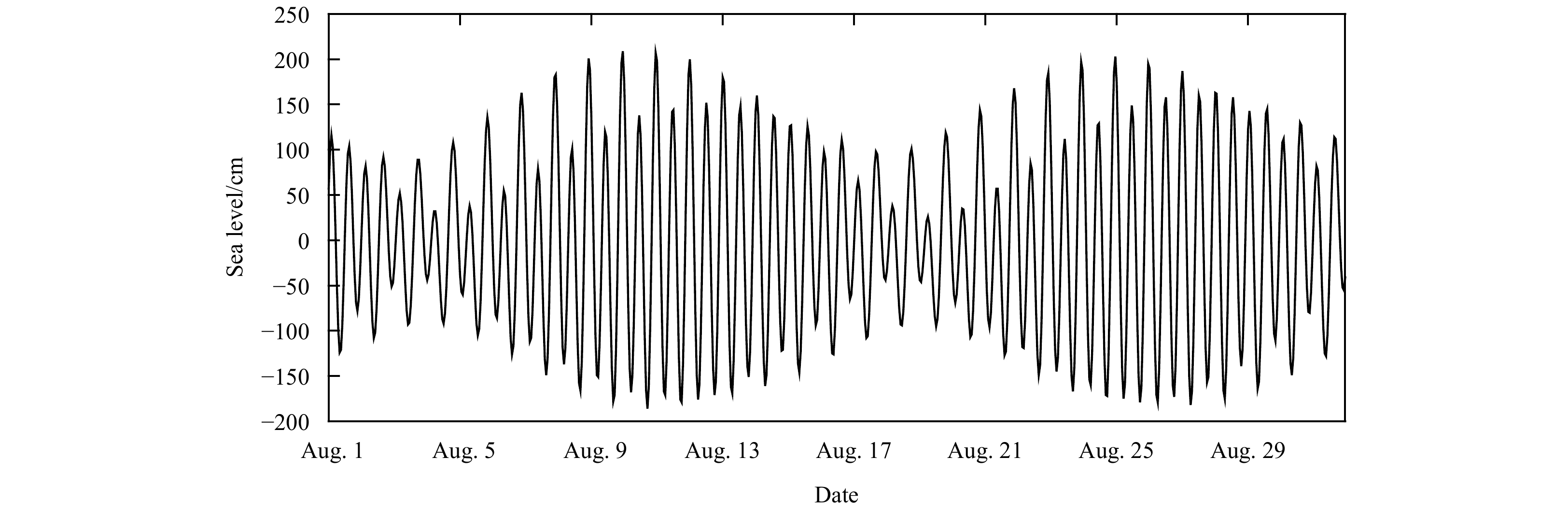
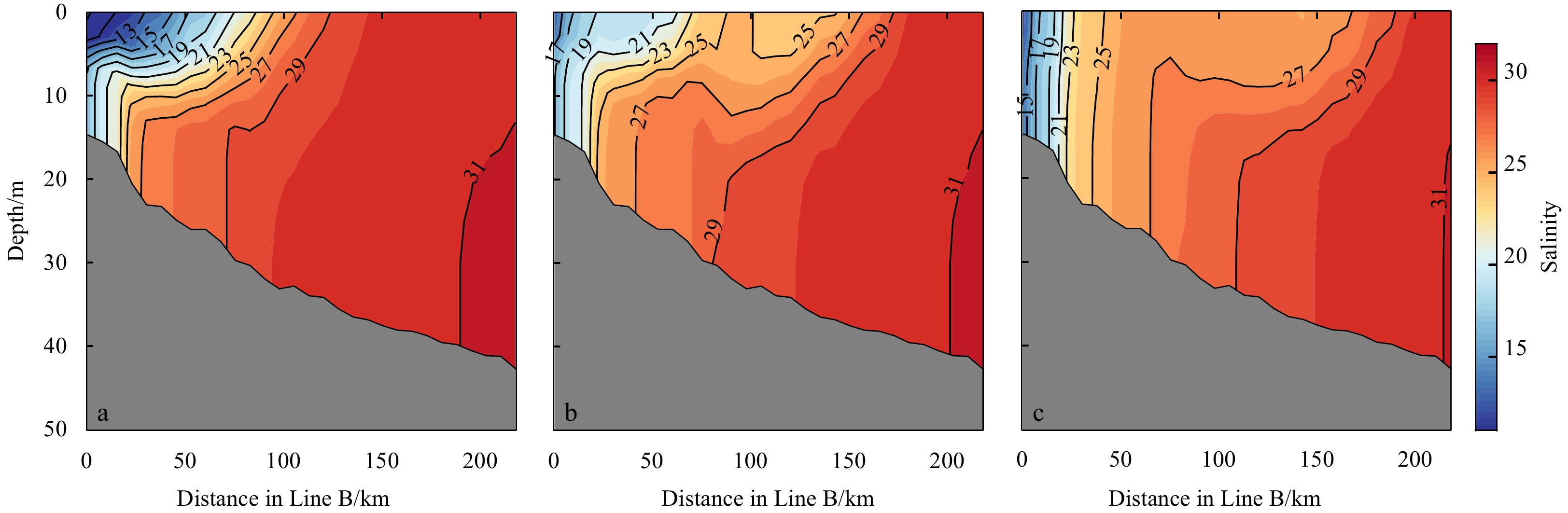
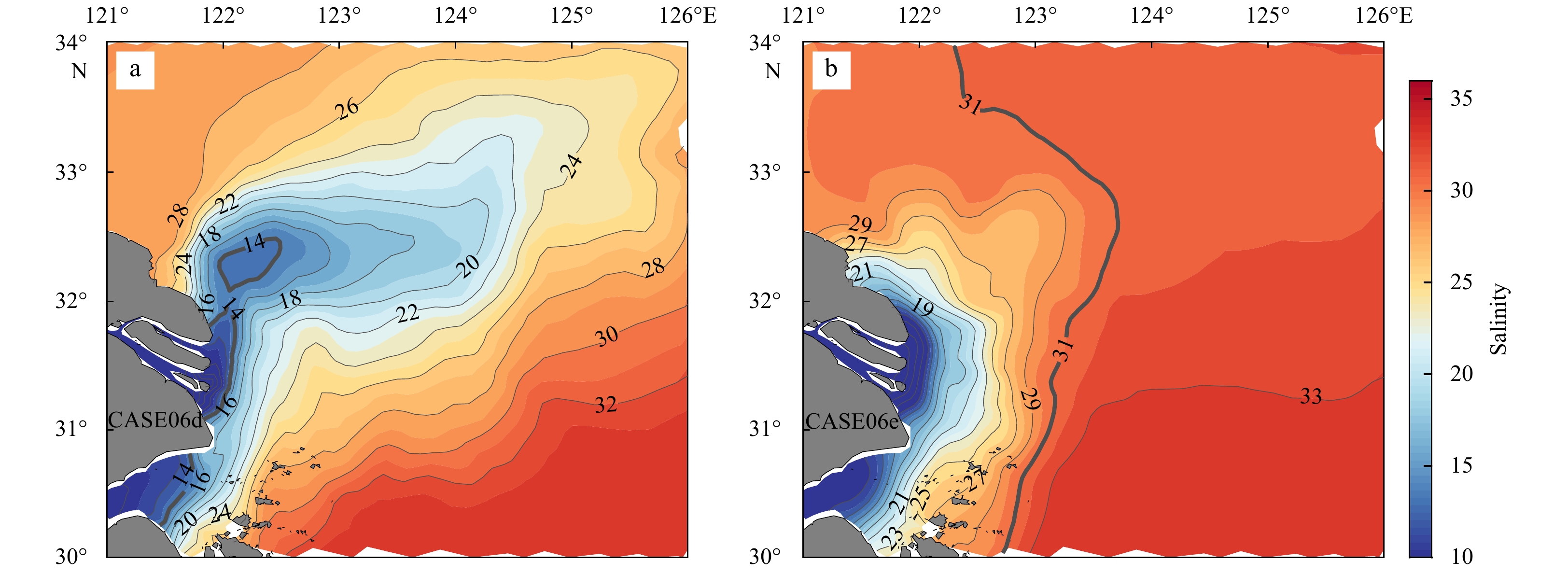
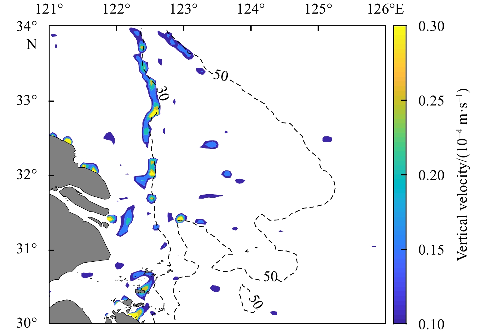
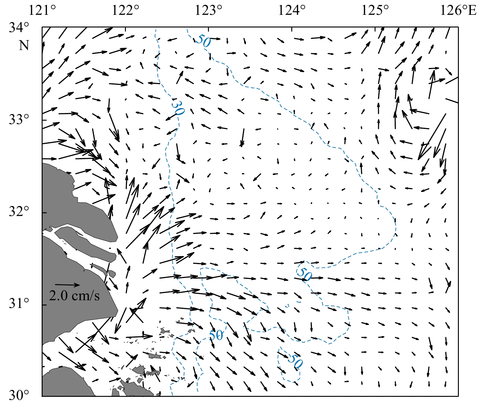
The Changjiang River diluted water (CDW) spreads into the East China Sea (ECS) primarily in a plume pattern, although in some years, low-salinity water lenses (LSWLs) detach from the main body of the CDW. In-situ observations indicate that in August ...
The Changjiang River diluted water (CDW) spreads into the East China Sea (ECS) primarily in a plume pattern, although in some years, low-salinity water lenses (LSWLs) detach from the main body of the CDW. In-situ observations indicate that in August ...


2021, 40(3): 46-57.
doi: 10.1007/s13131-021-1706-5
Abstract:
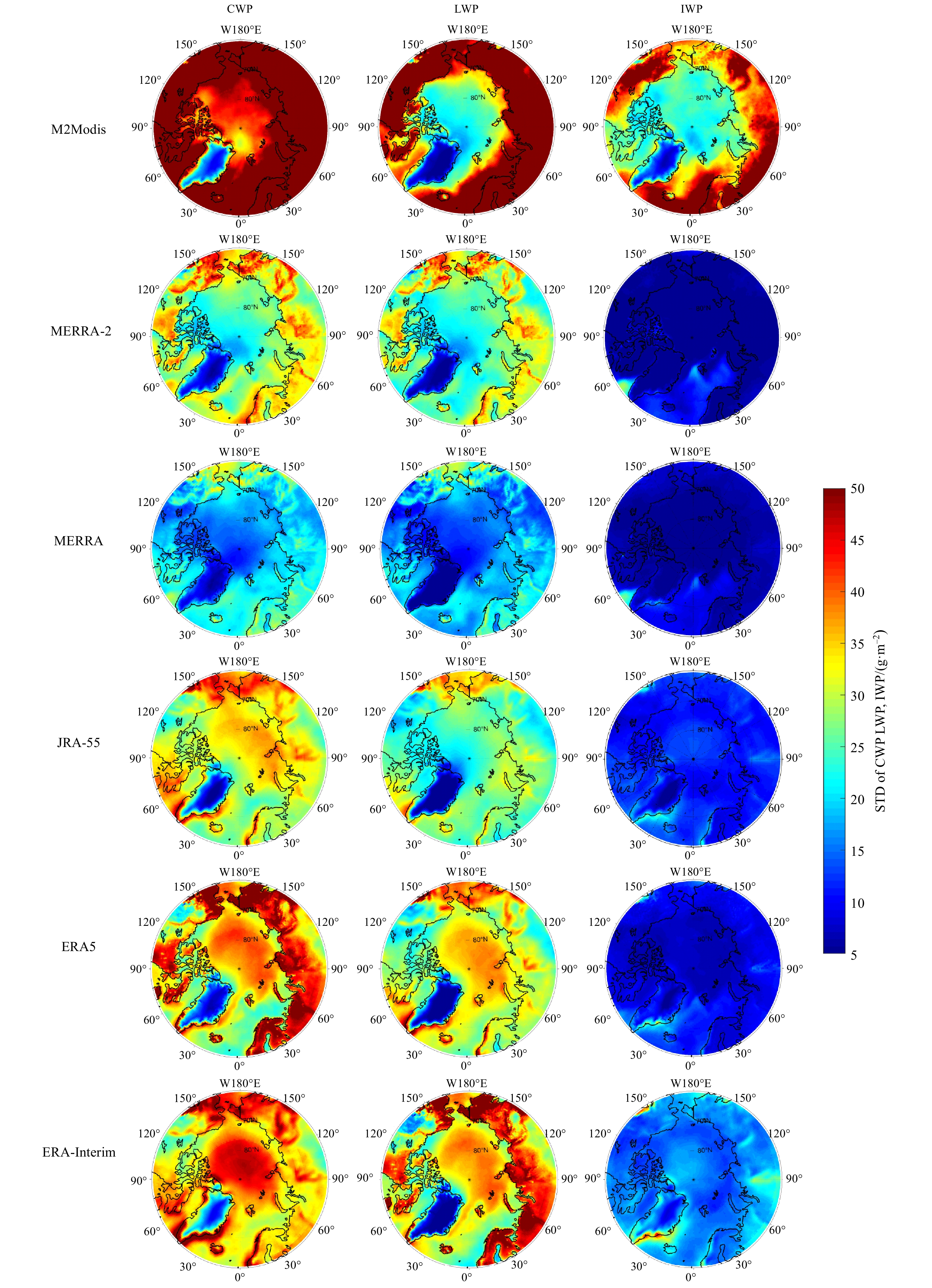
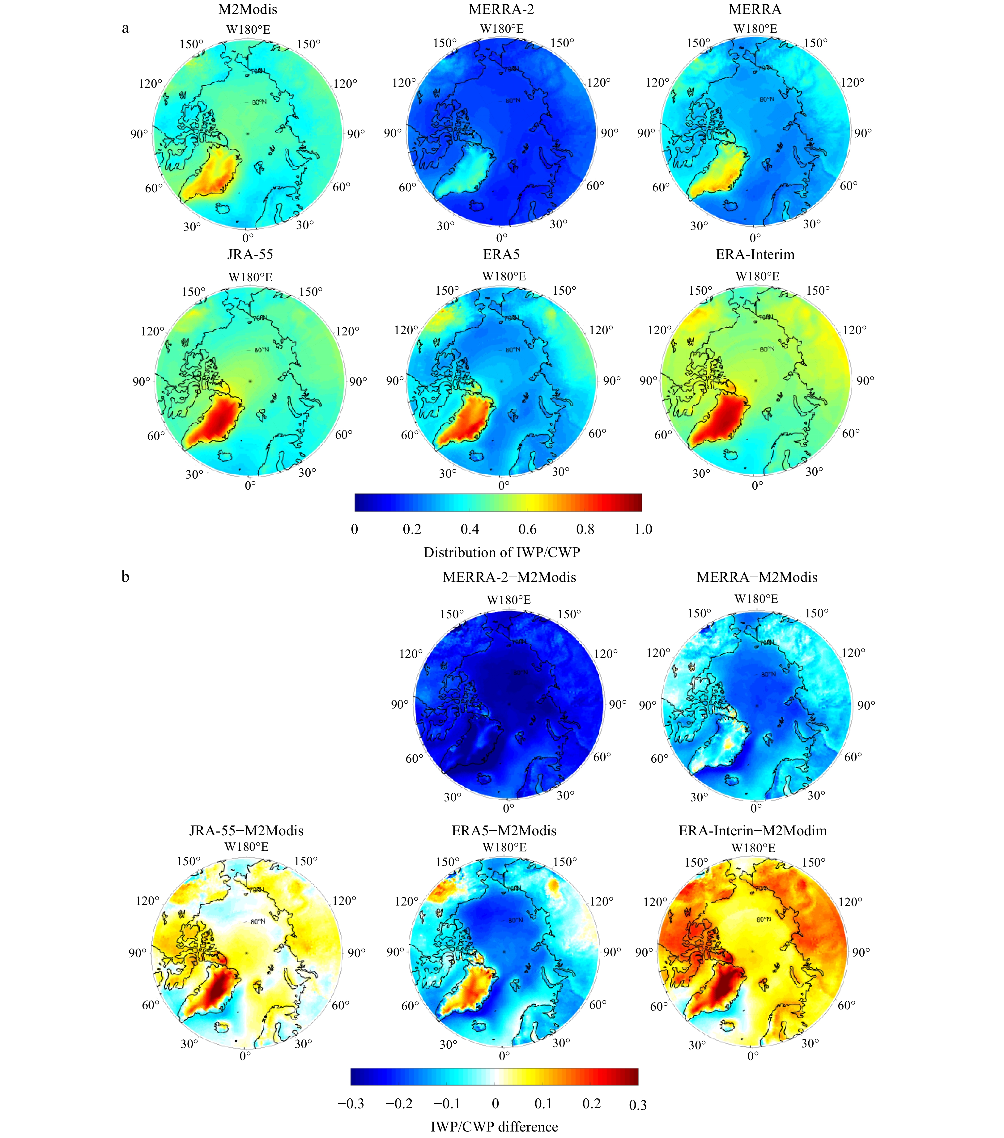
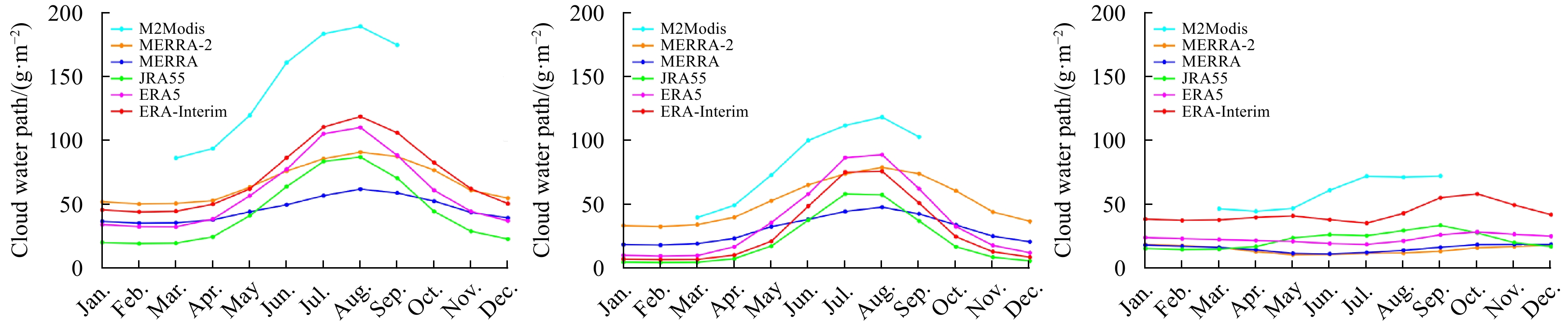
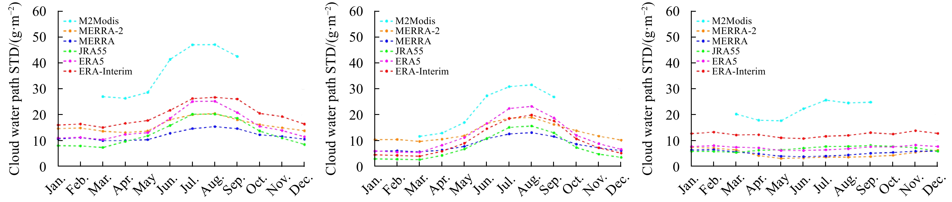
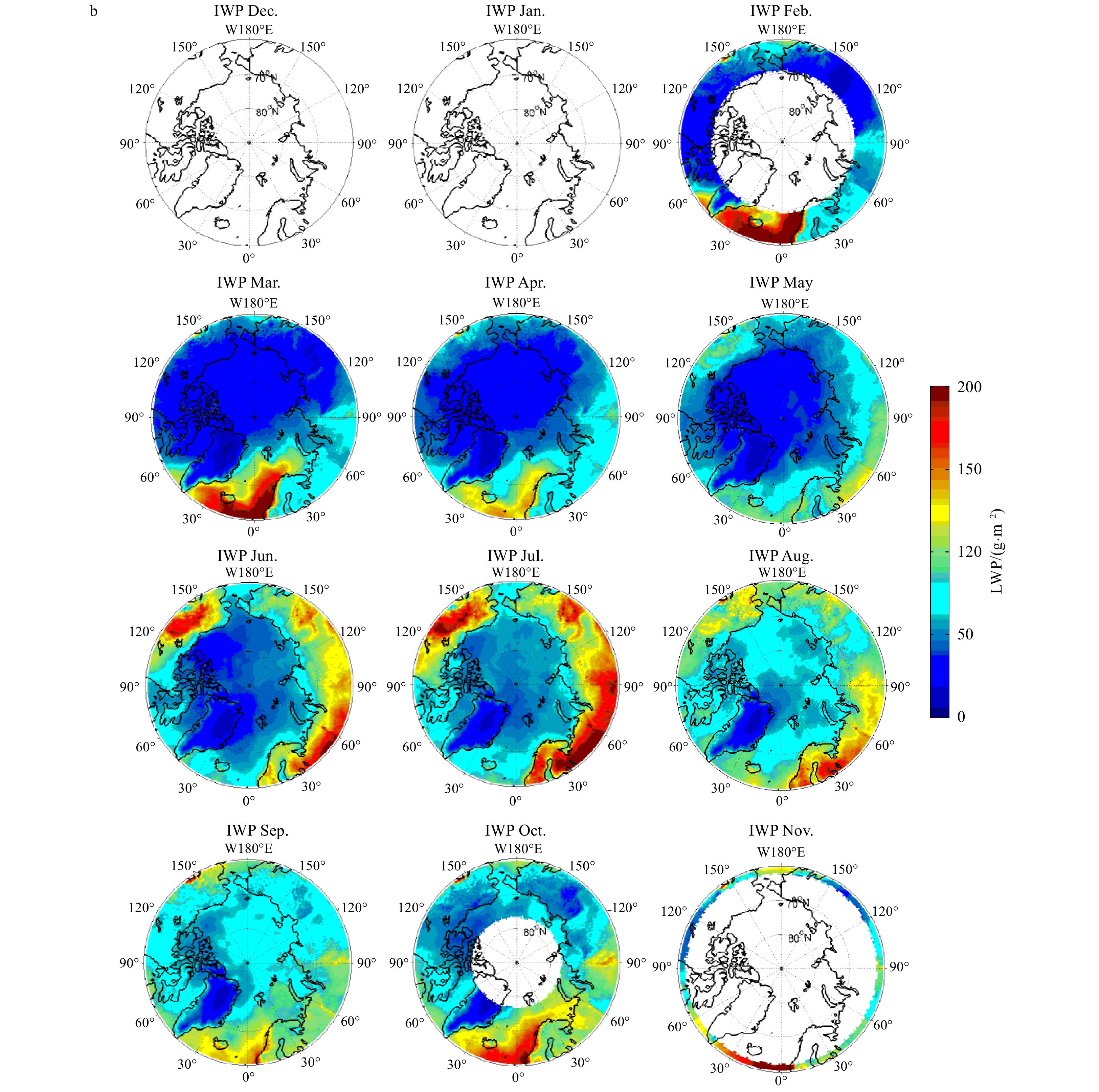
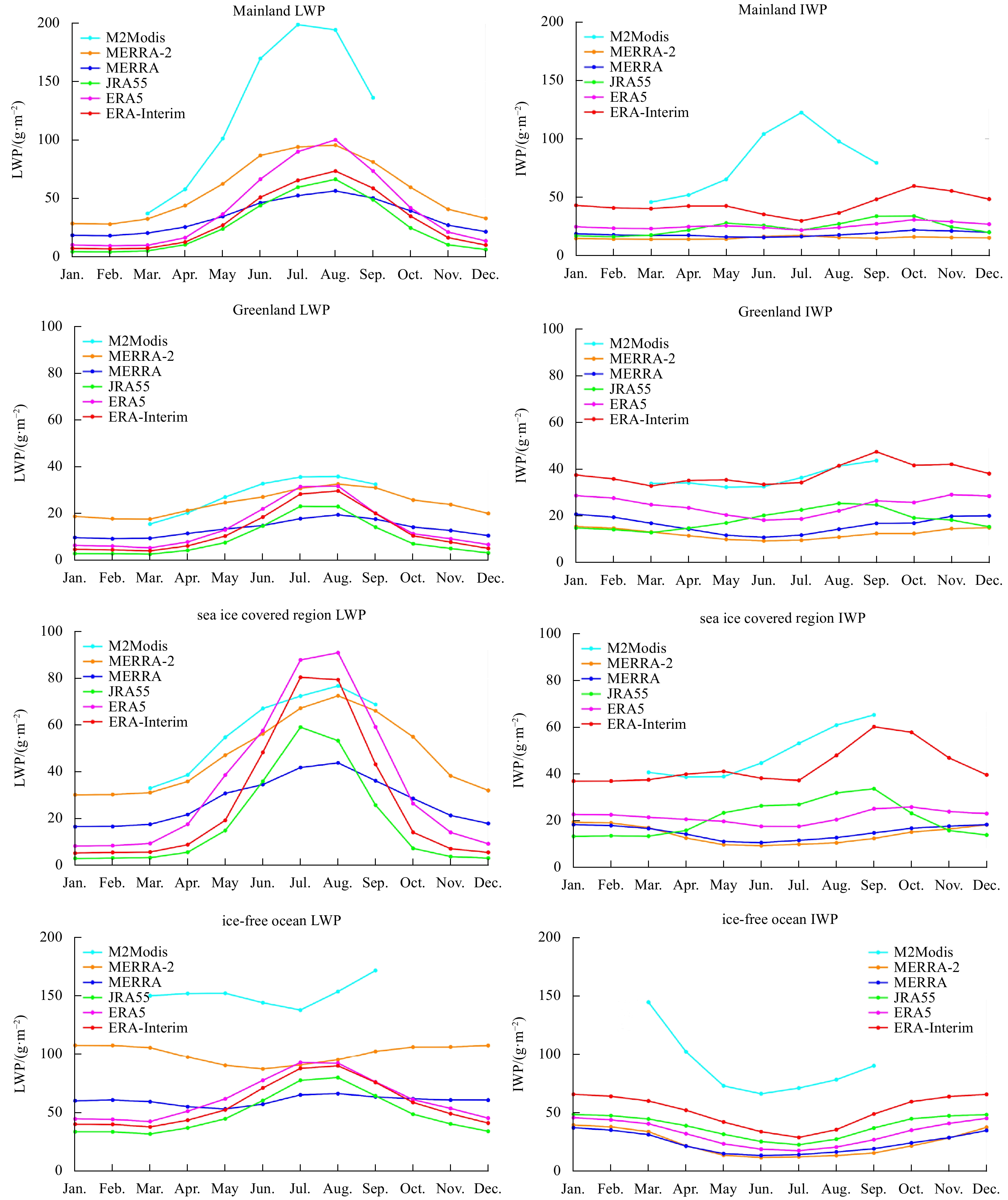
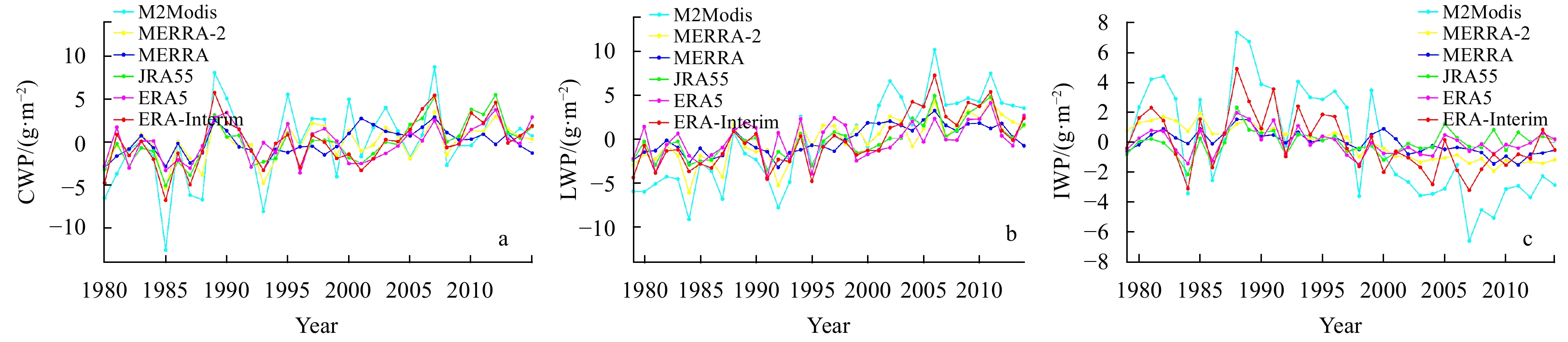
The role of Arctic clouds in the recent rapid Arctic warming has attracted much attention. However, Arctic cloud water paths (CWPs) from reanalysis datasets have not been well evaluated. This study evaluated the CWPs as well as LWPs (cloud liquid wat...
The role of Arctic clouds in the recent rapid Arctic warming has attracted much attention. However, Arctic cloud water paths (CWPs) from reanalysis datasets have not been well evaluated. This study evaluated the CWPs as well as LWPs (cloud liquid wat...


2021, 40(3): 58-69.
doi: 10.1007/s13131-021-1746-x
Abstract:
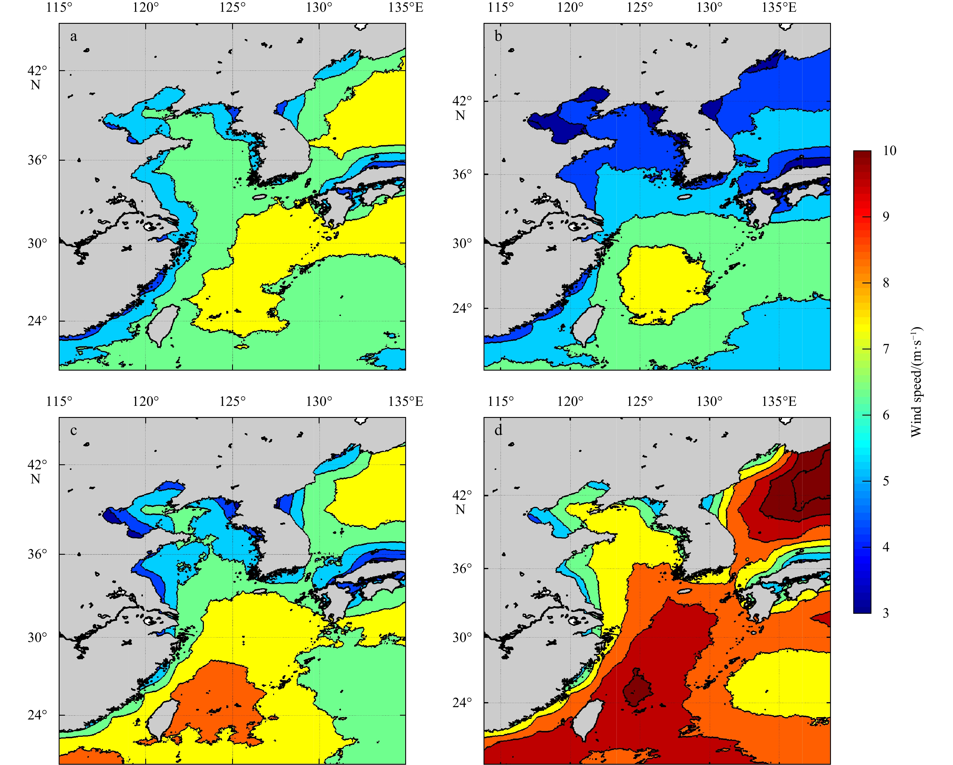
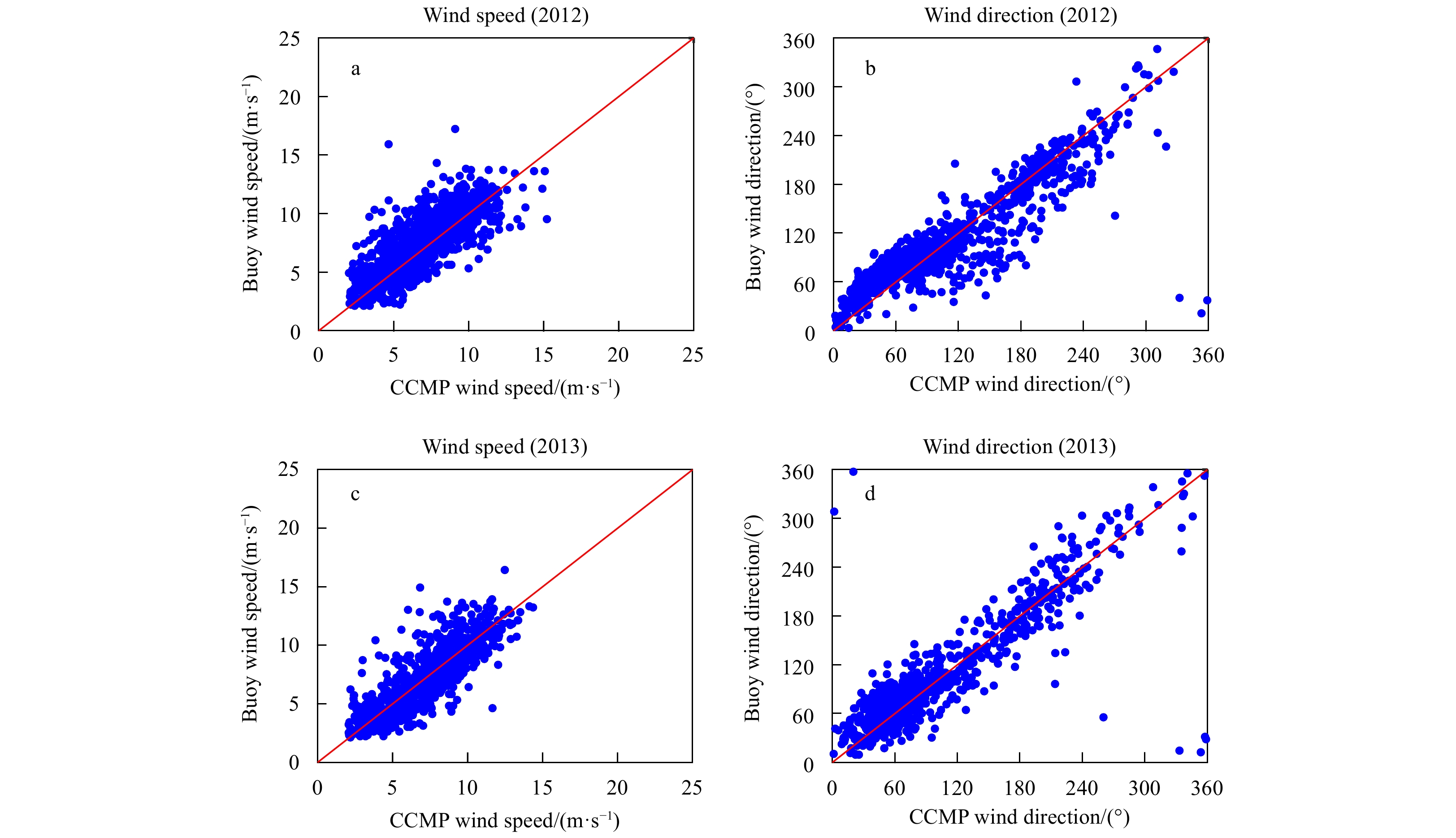
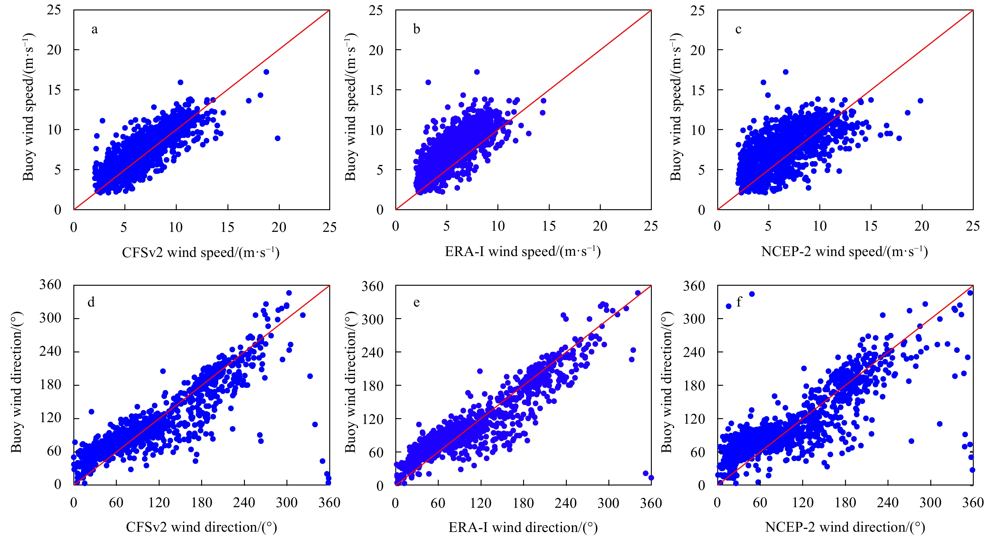
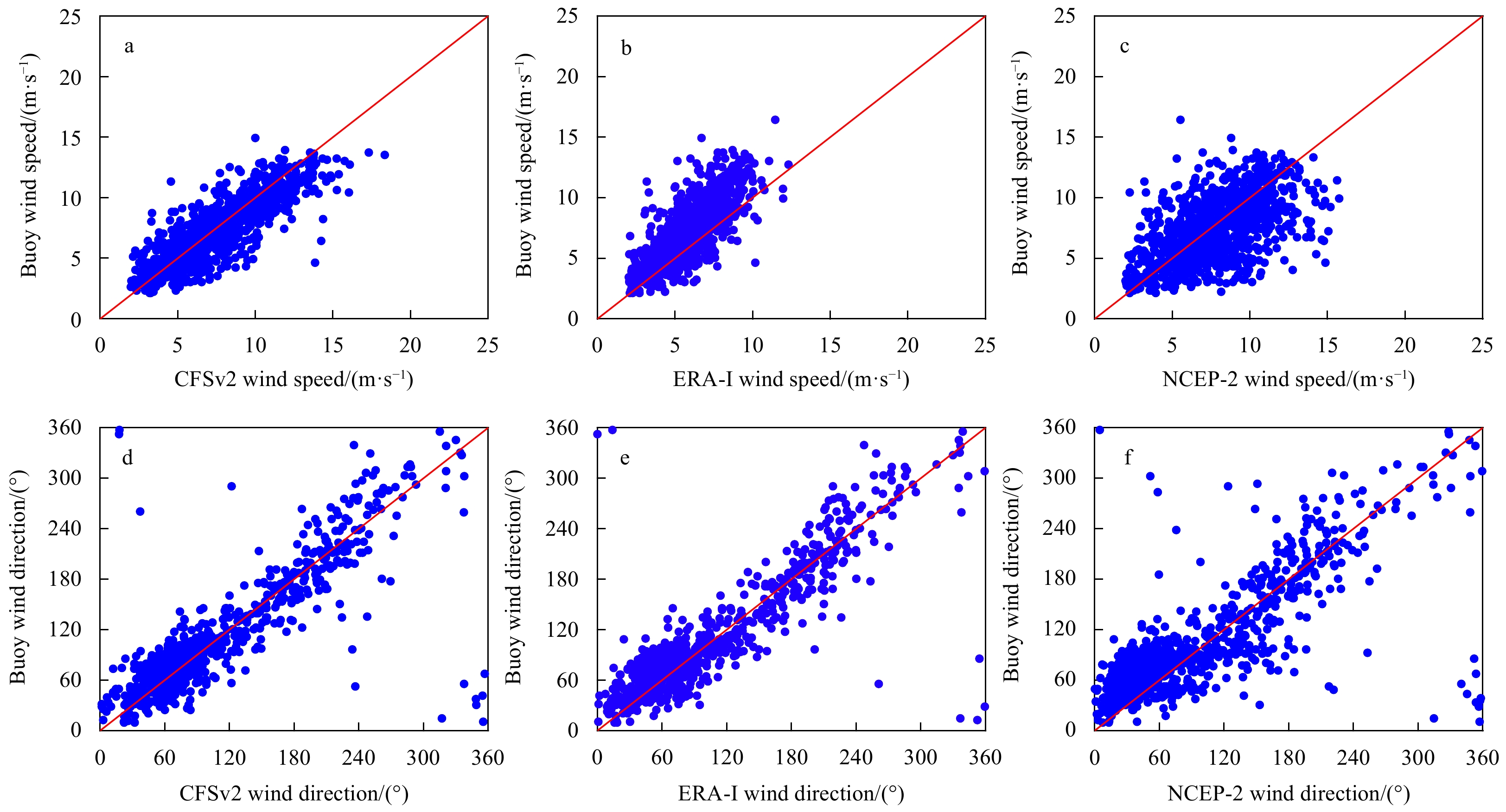
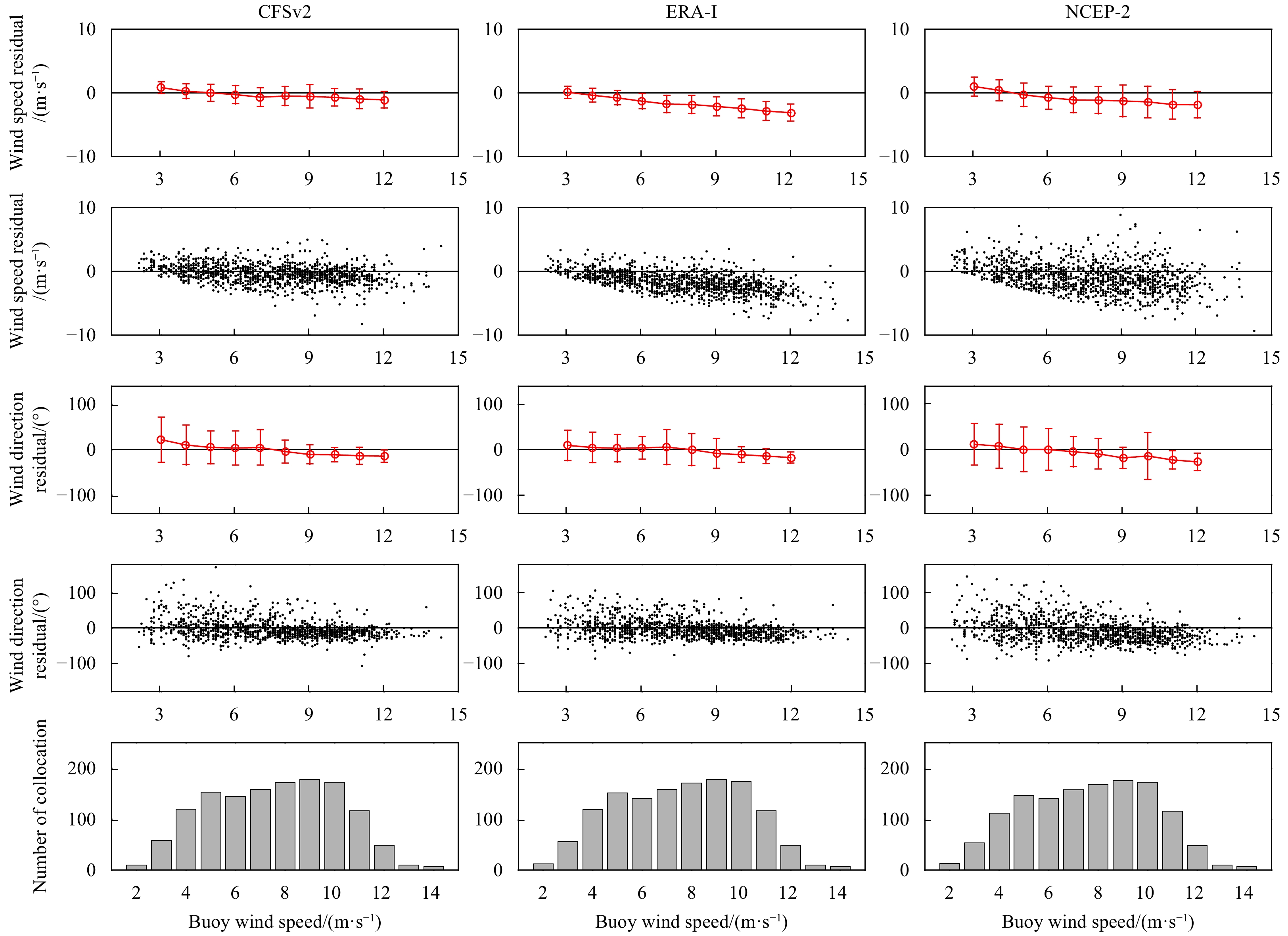
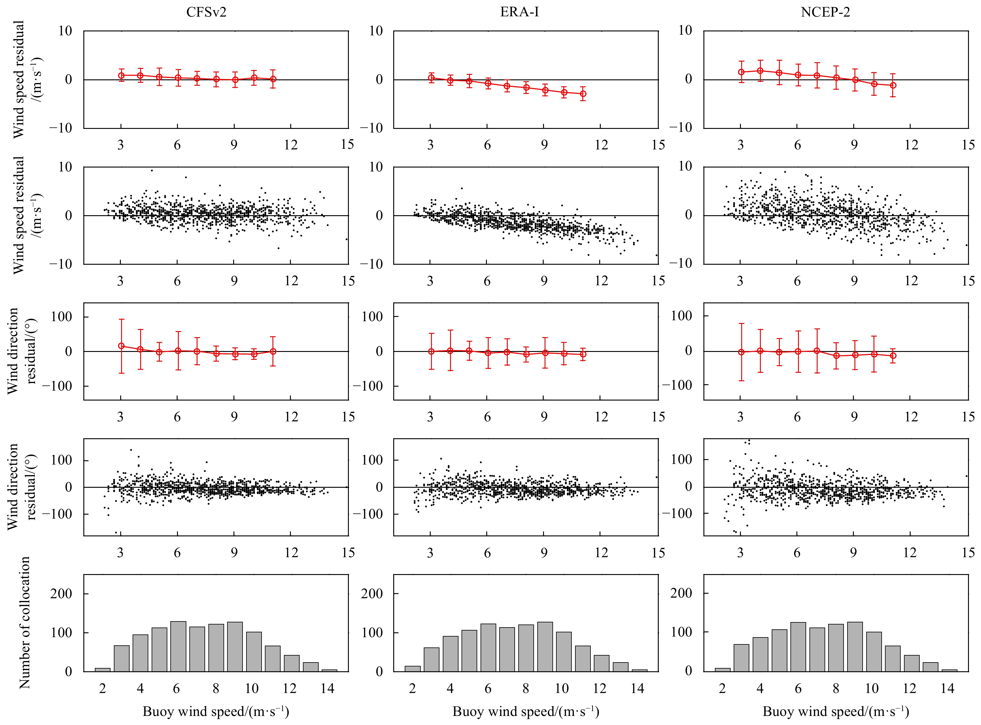
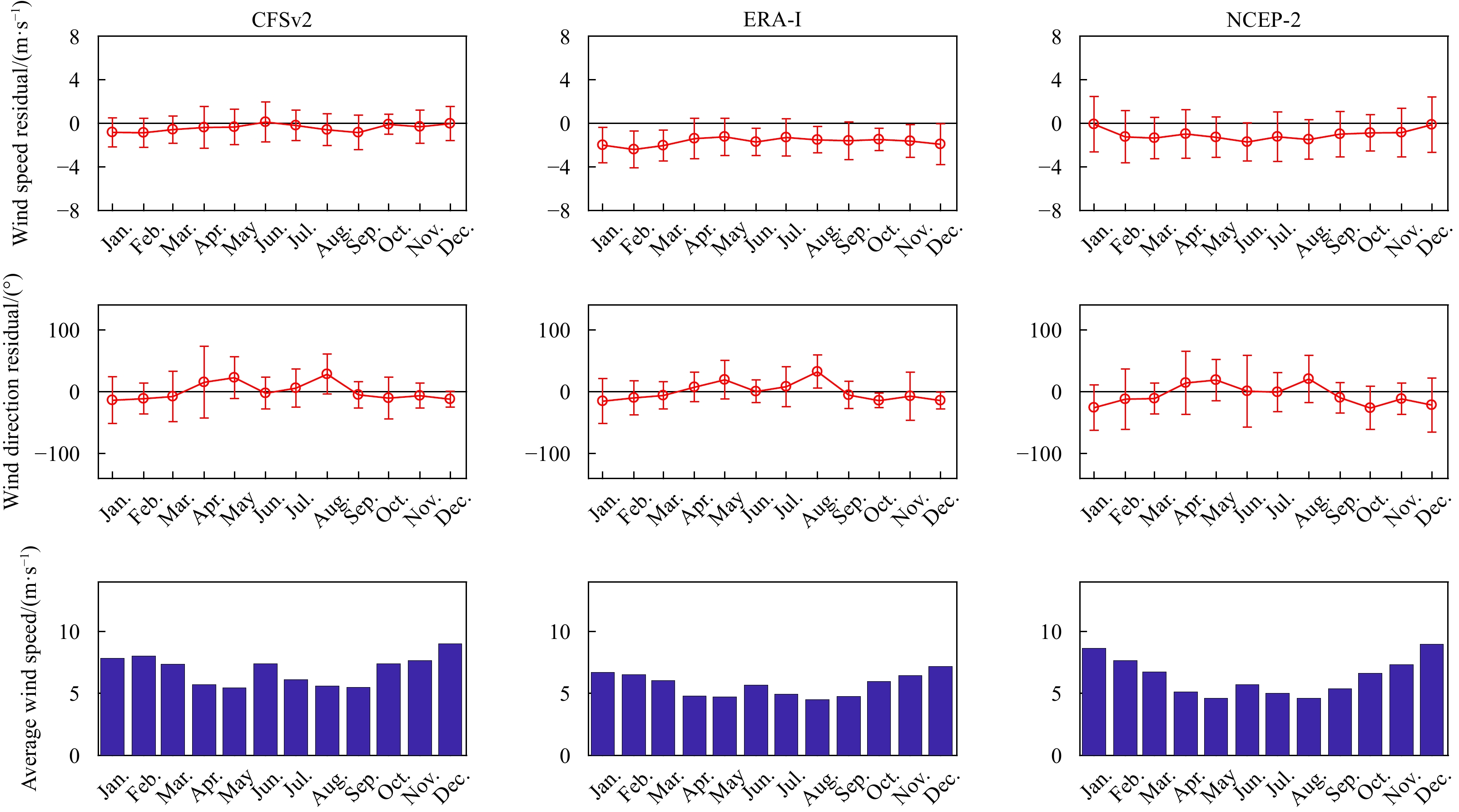
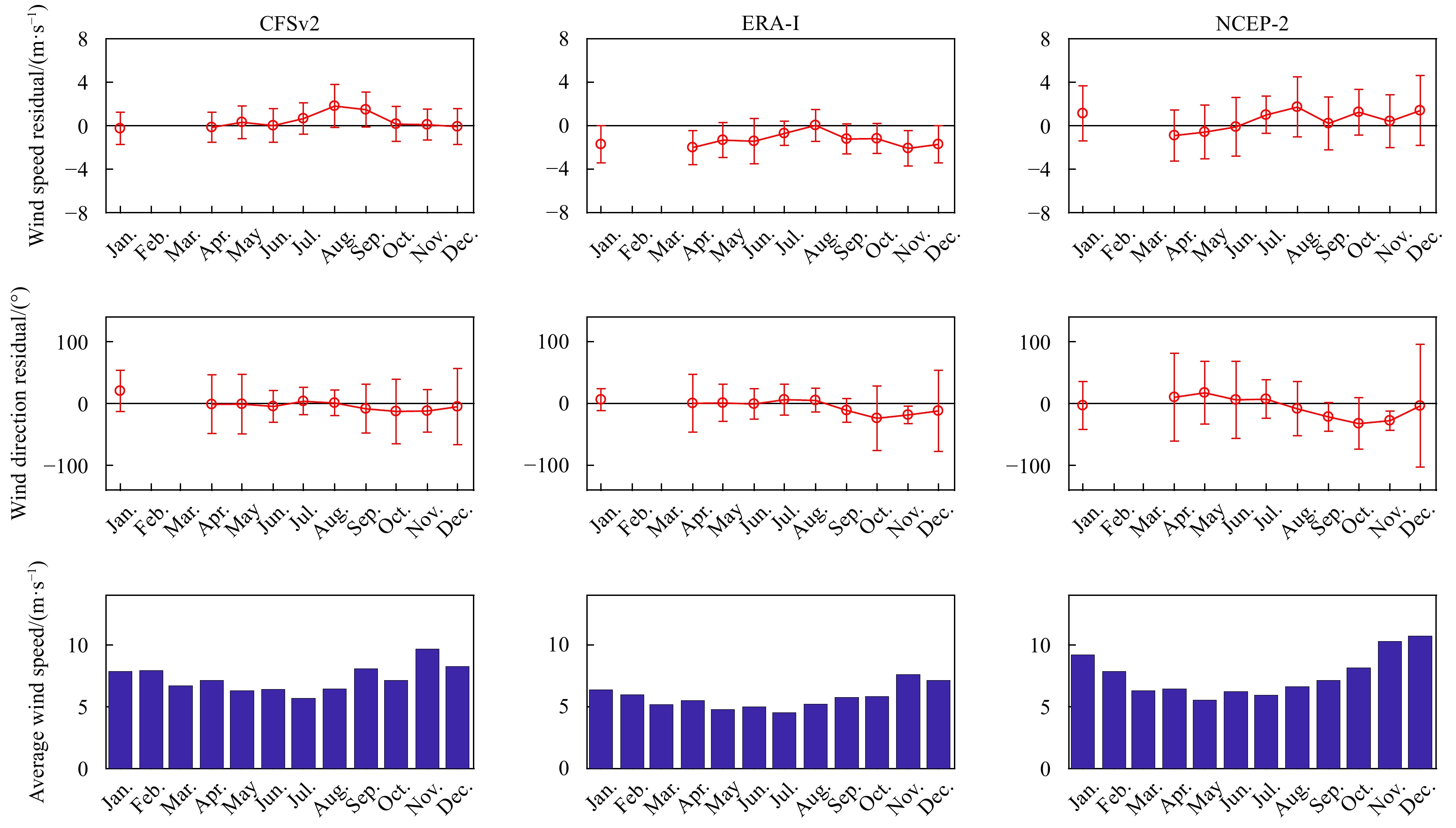
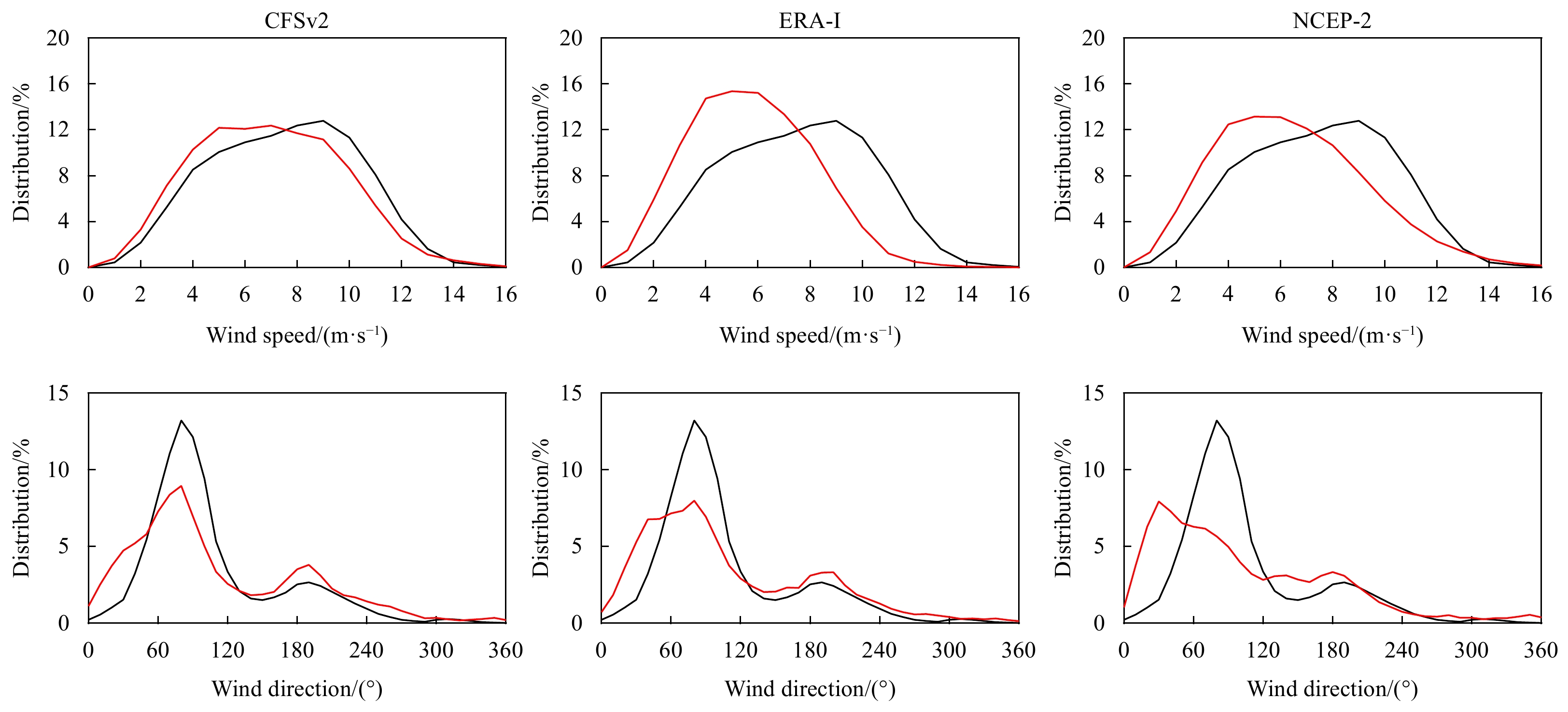
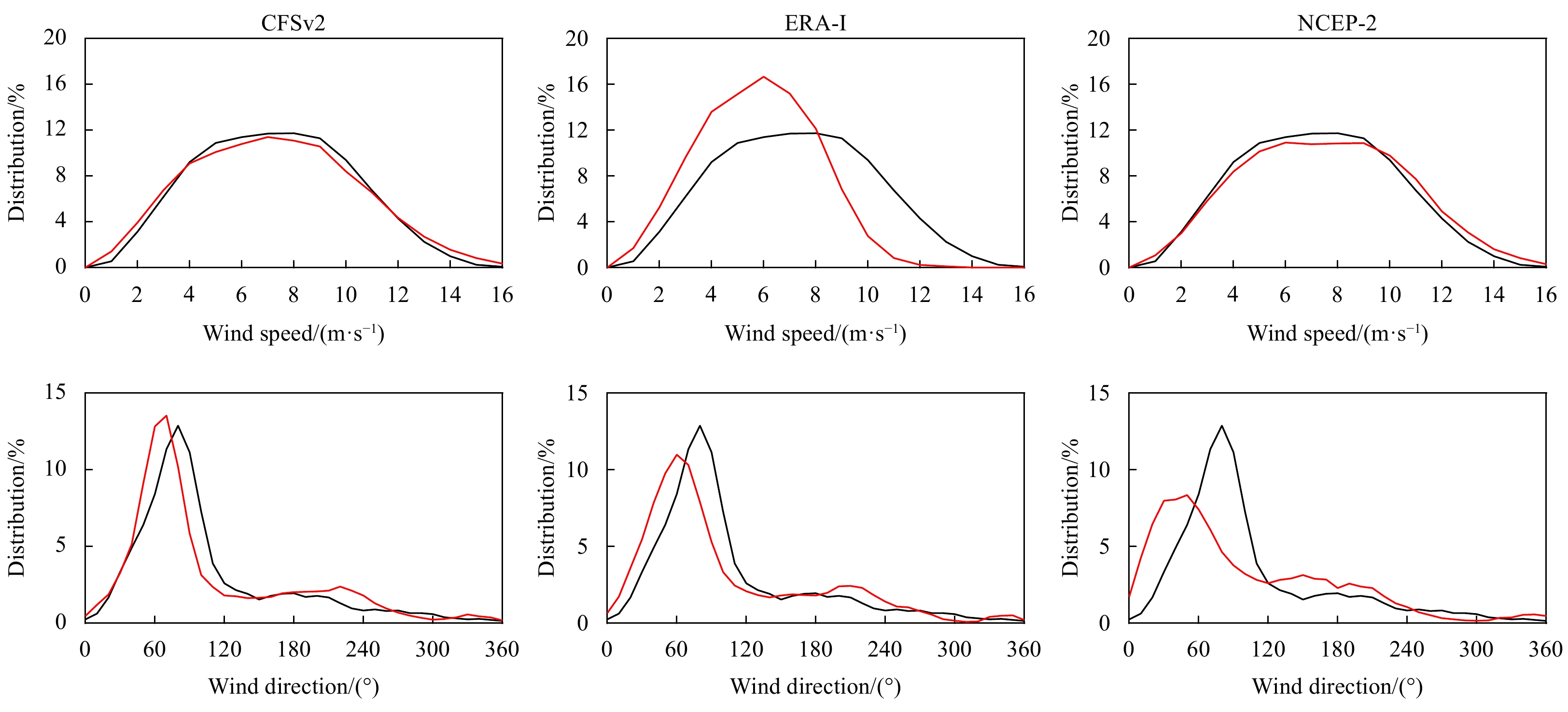
Three archived reanalysis wind vectors at 10 m height in the wind speed range of 2–15 m/s, namely, the second version of the National Centres for Environmental Prediction (NCEP) Climate Forecast System Reanalysis (CFSv2), European Centre for Medium-R...
Three archived reanalysis wind vectors at 10 m height in the wind speed range of 2–15 m/s, namely, the second version of the National Centres for Environmental Prediction (NCEP) Climate Forecast System Reanalysis (CFSv2), European Centre for Medium-R...


2021, 40(3): 70-83.
doi: 10.1007/s13131-021-1711-8
Abstract:
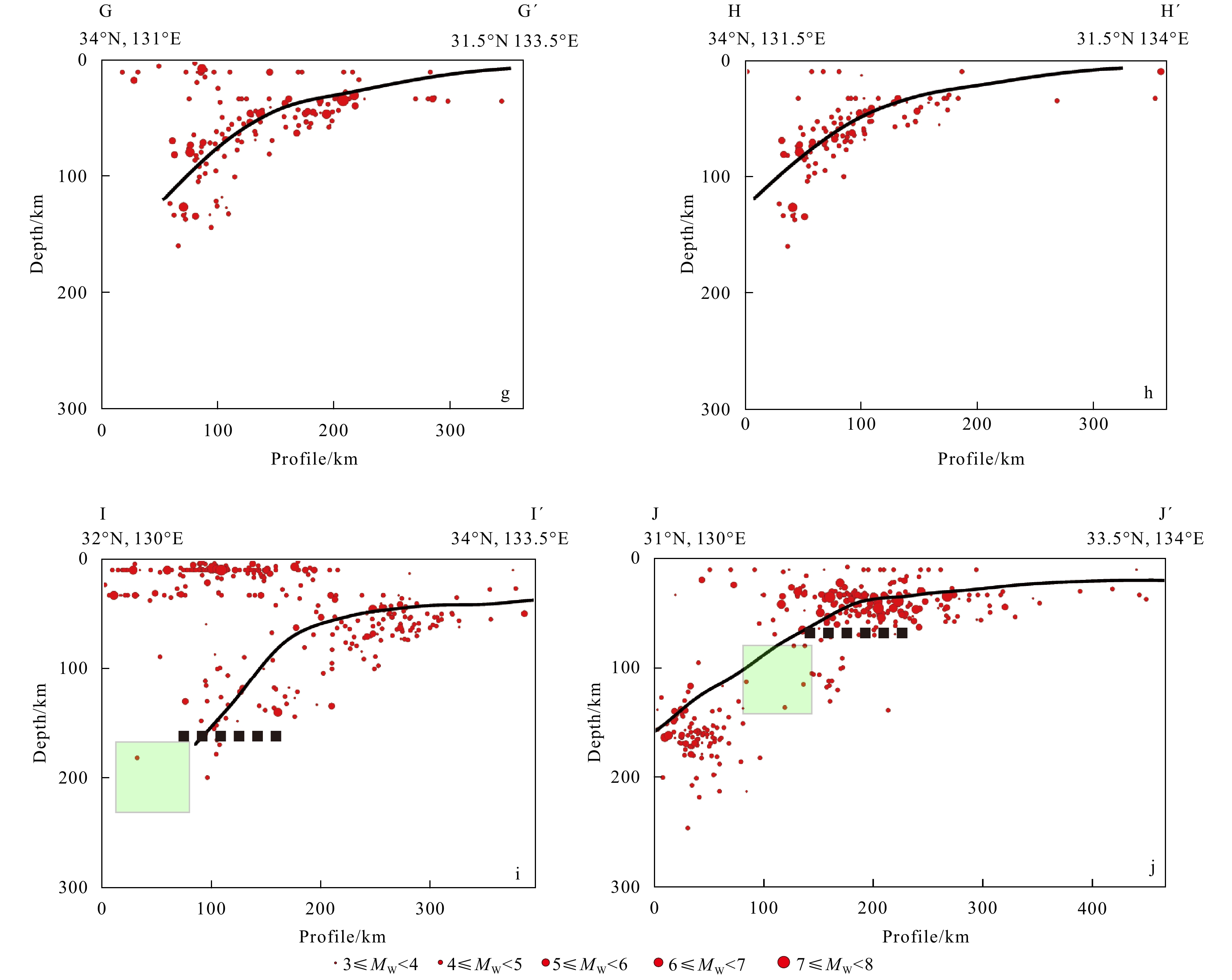
The Kyushu-Palau Ridge (KPR), a remnant arc on the Philippine Sea Plate (PSP), is subducting beneath the Kyushu, southwest Japan. Influenced by the subducting KPR, the Kyushu subduction zone corresponding to the KPR is significantly different from Sh...
The Kyushu-Palau Ridge (KPR), a remnant arc on the Philippine Sea Plate (PSP), is subducting beneath the Kyushu, southwest Japan. Influenced by the subducting KPR, the Kyushu subduction zone corresponding to the KPR is significantly different from Sh...


2021, 40(3): 84-93.
doi: 10.1007/s13131-021-1700-y
Abstract:
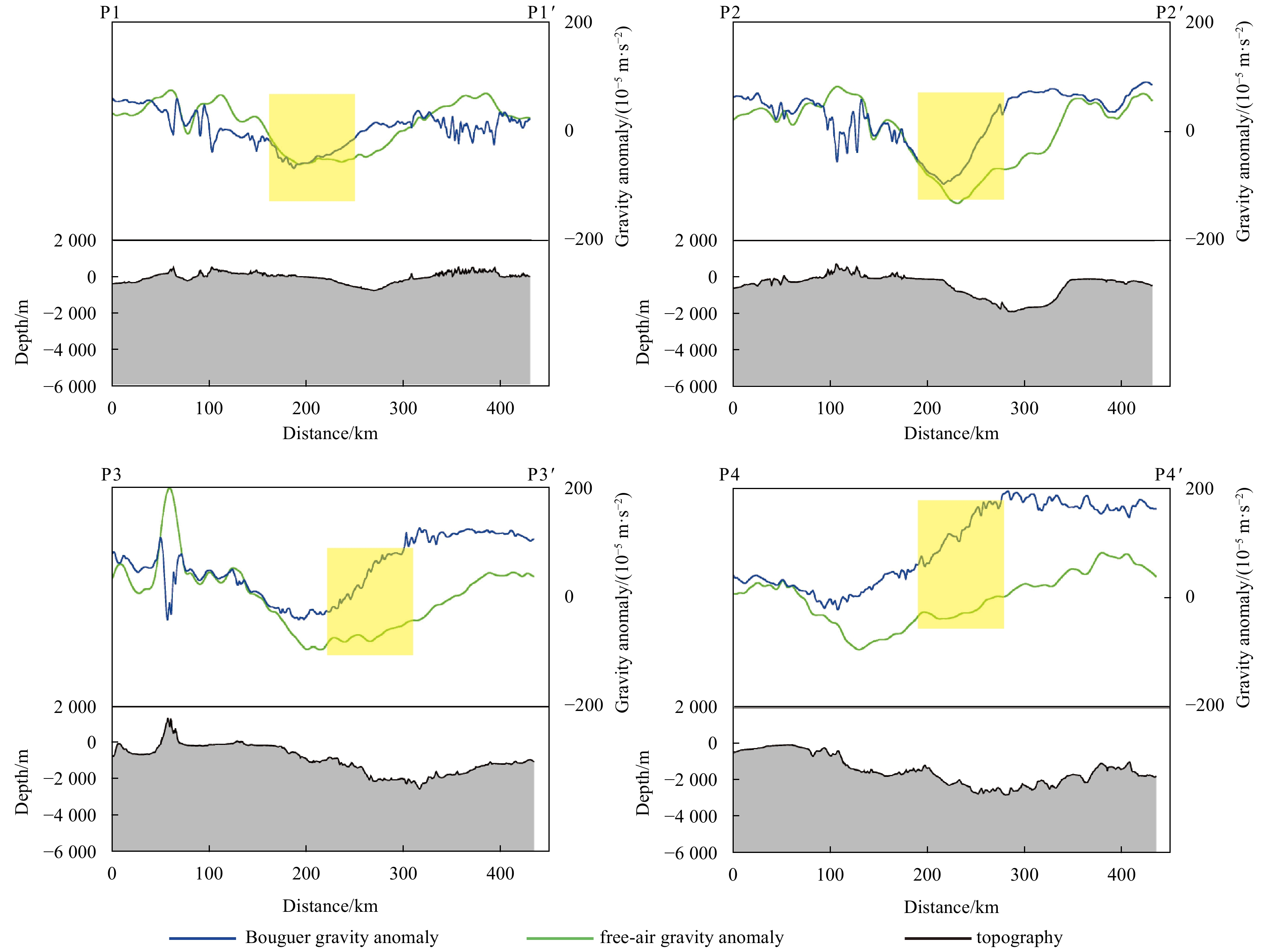
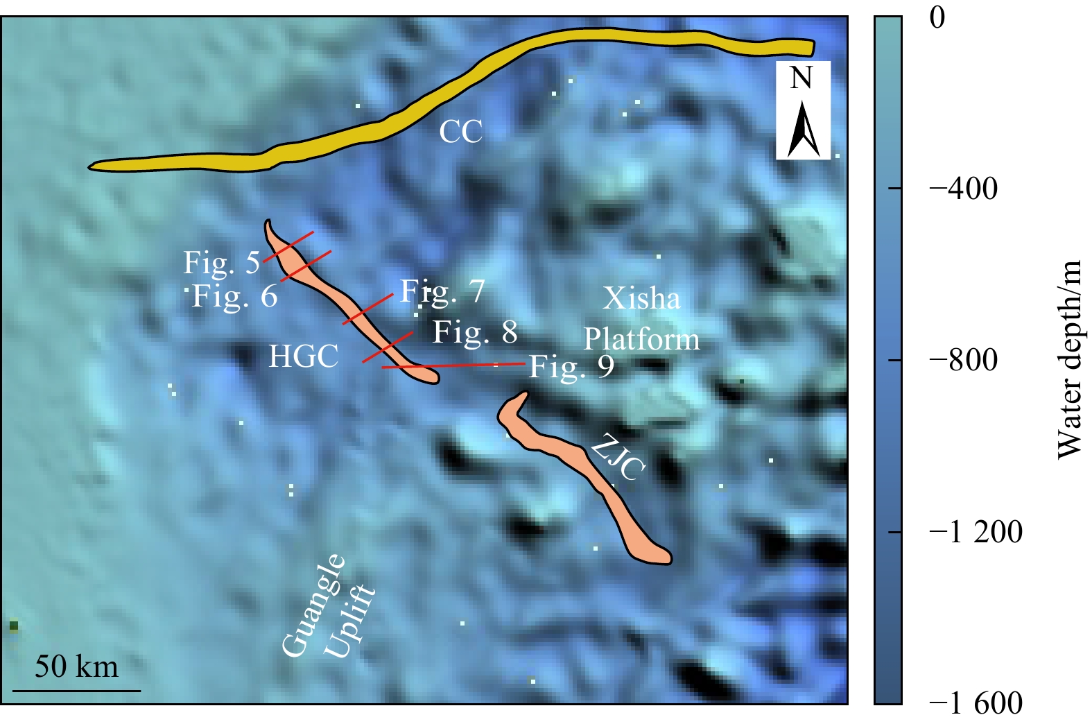
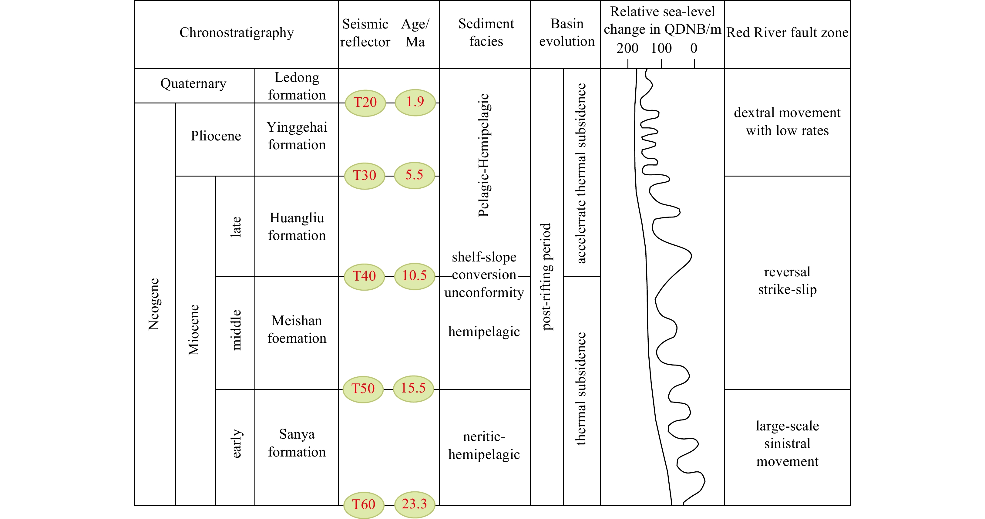
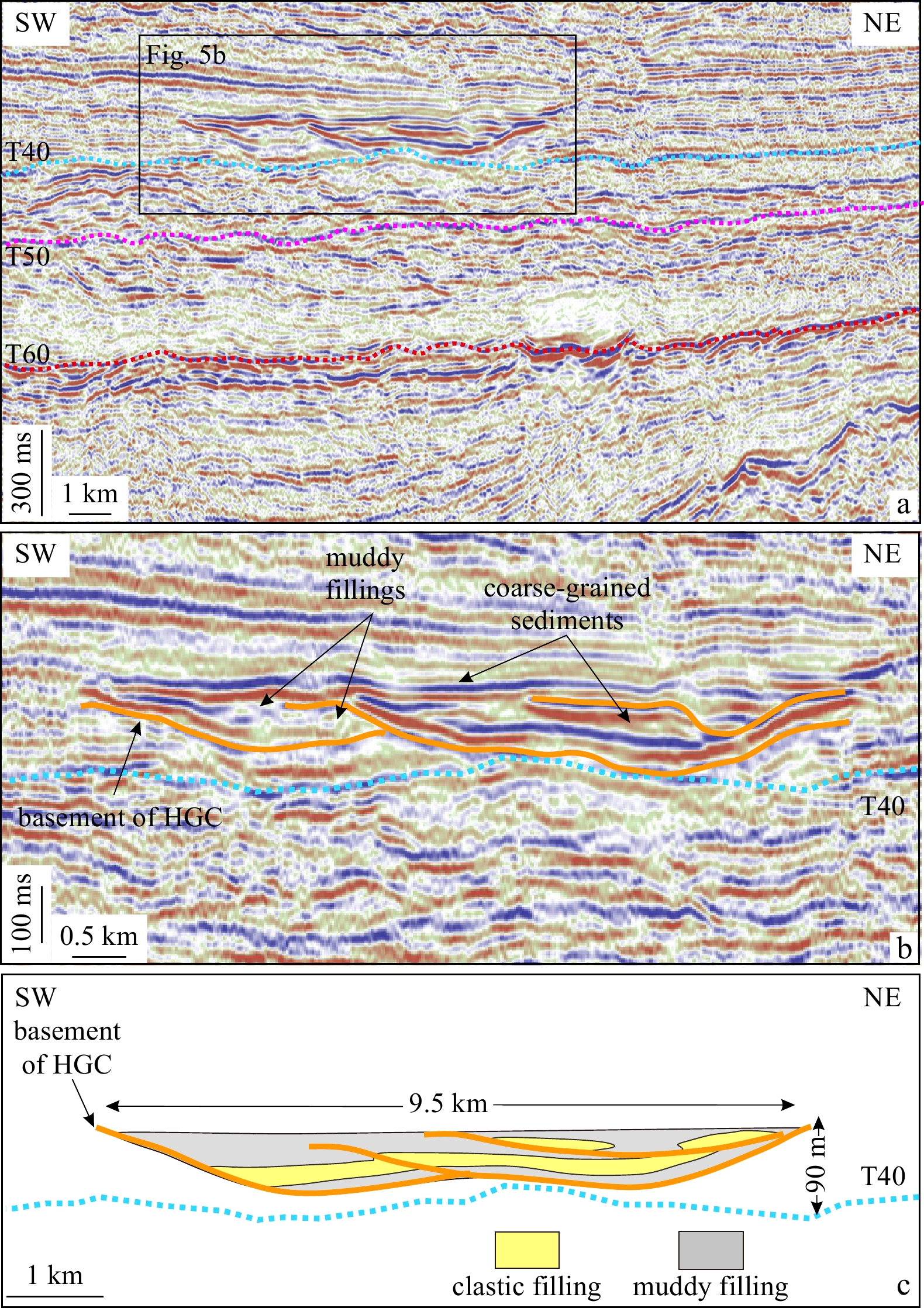
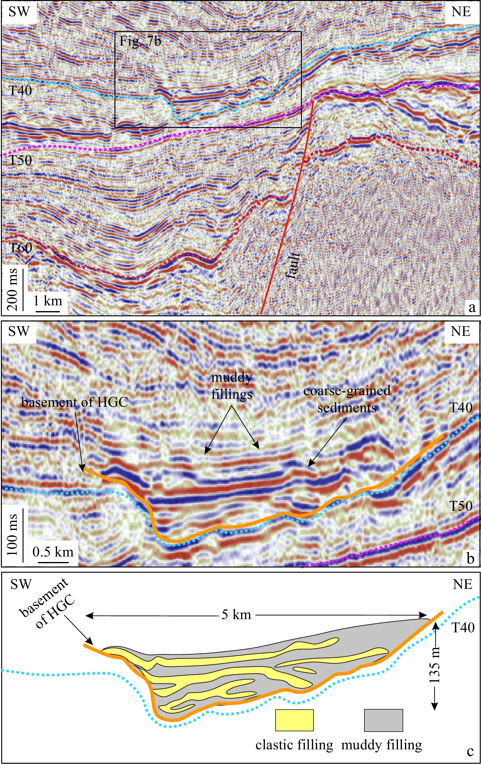
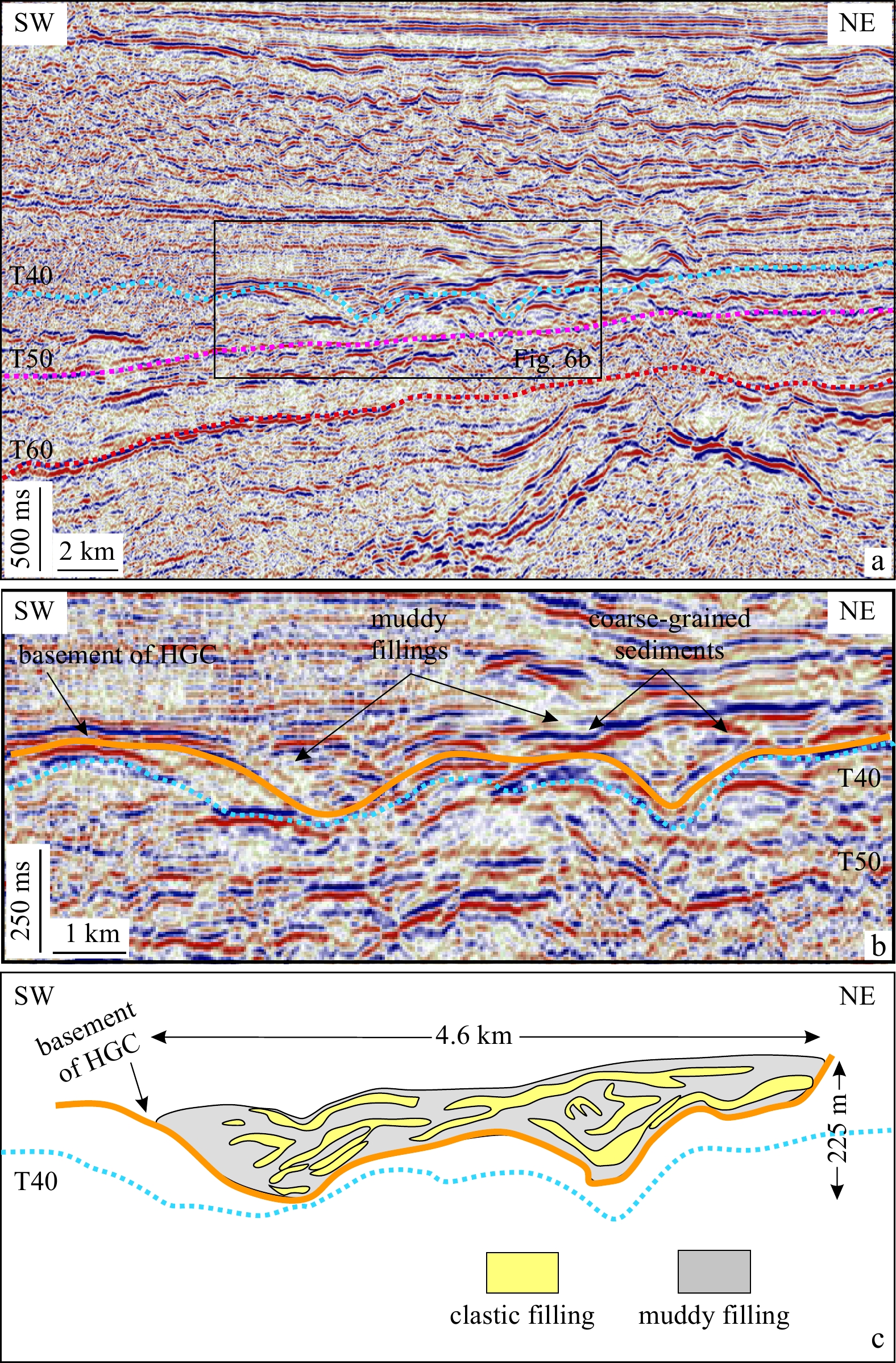
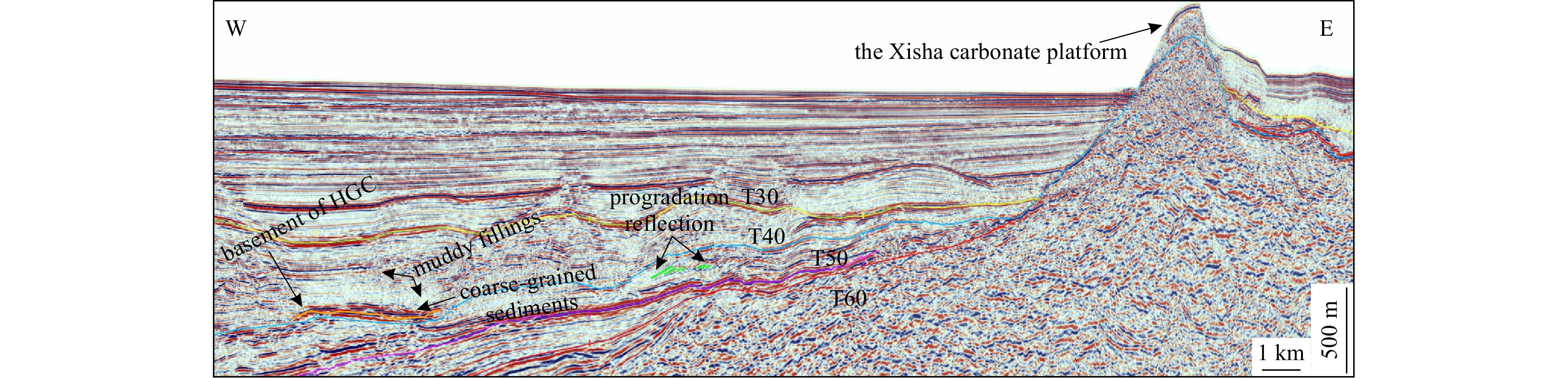
High-resolution multichannel seismic data enables the discovery of a previous, undocumented submarine canyon (Huaguang Canyon) in the Qiongdongnan Basin, northwest South China Sea. The Huaguang Canyon with a NW orientation is 140 km in length, and 2....
High-resolution multichannel seismic data enables the discovery of a previous, undocumented submarine canyon (Huaguang Canyon) in the Qiongdongnan Basin, northwest South China Sea. The Huaguang Canyon with a NW orientation is 140 km in length, and 2....


2021, 40(3): 94-111.
doi: 10.1007/s13131-021-1713-6
Abstract:
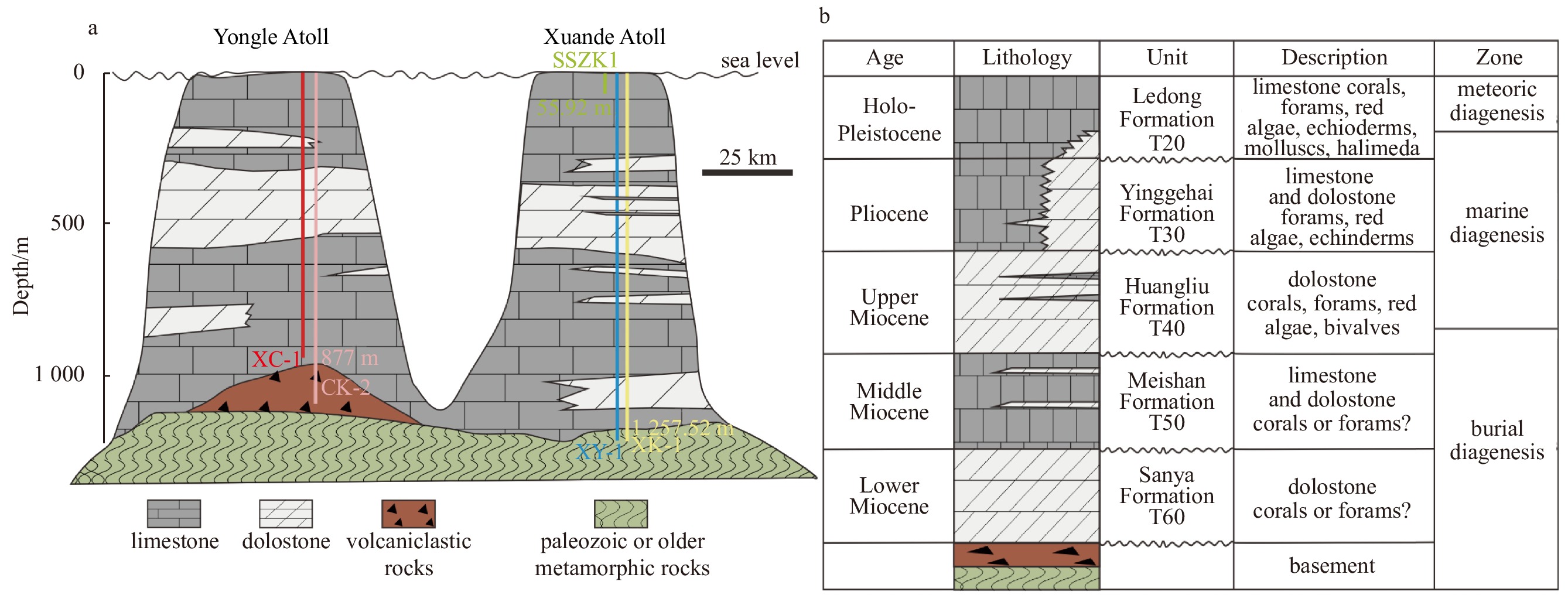
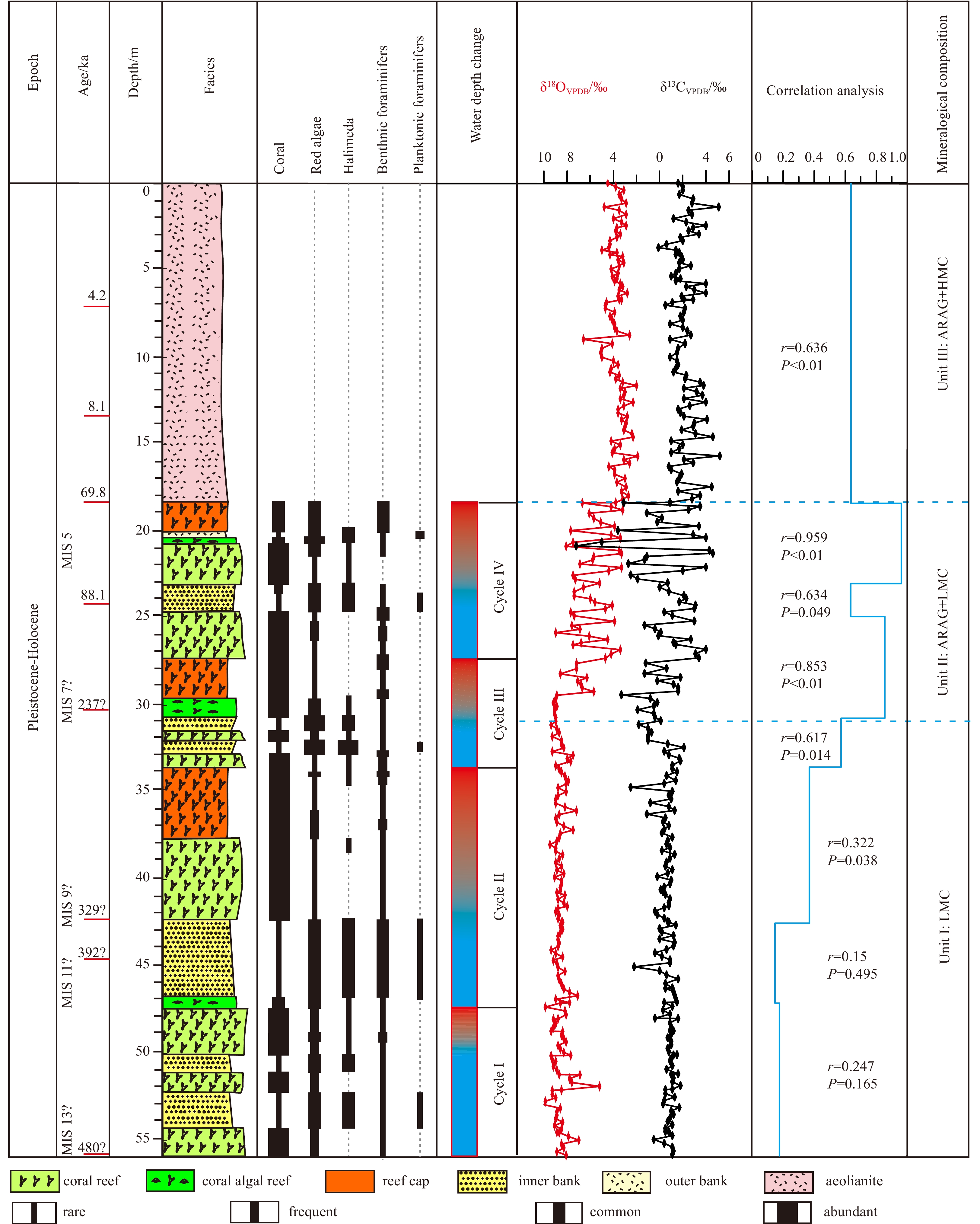
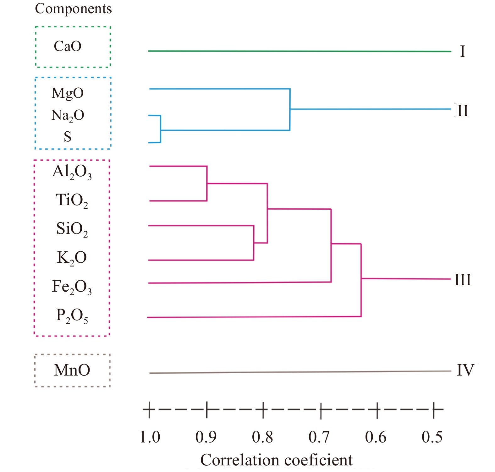
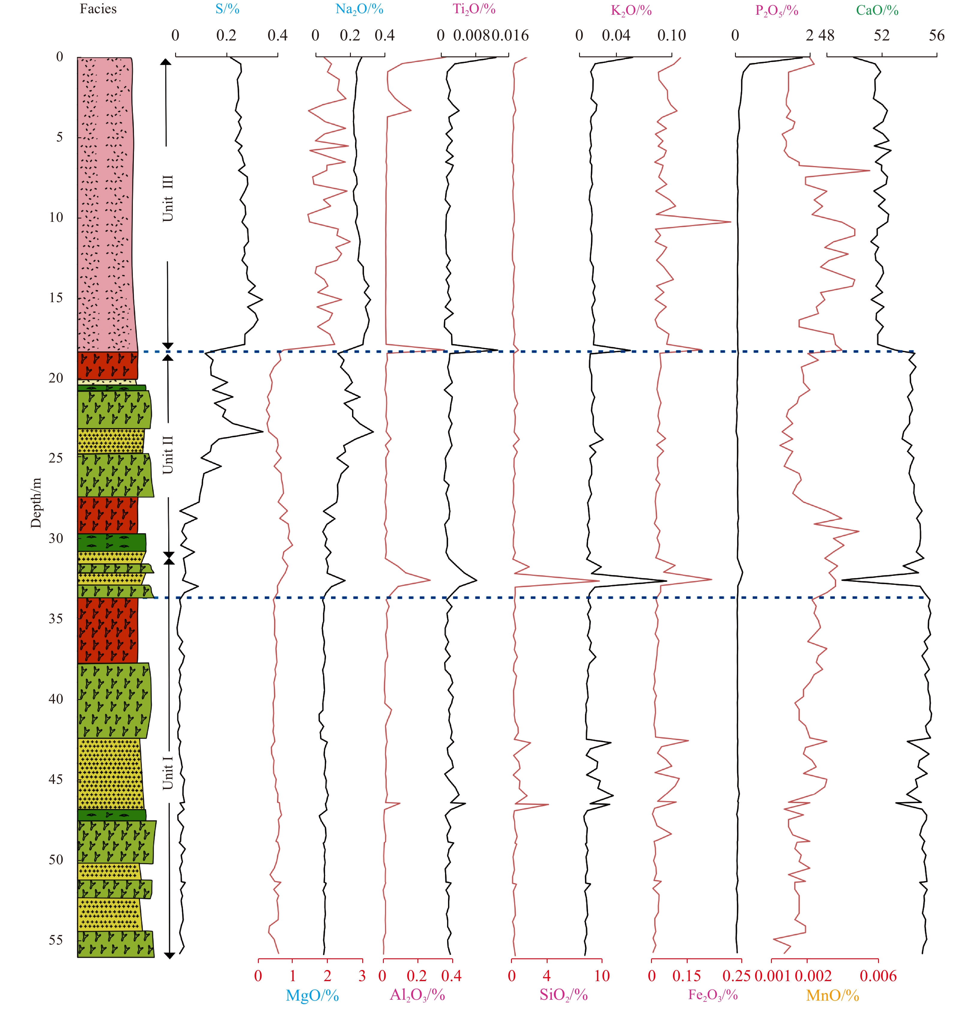
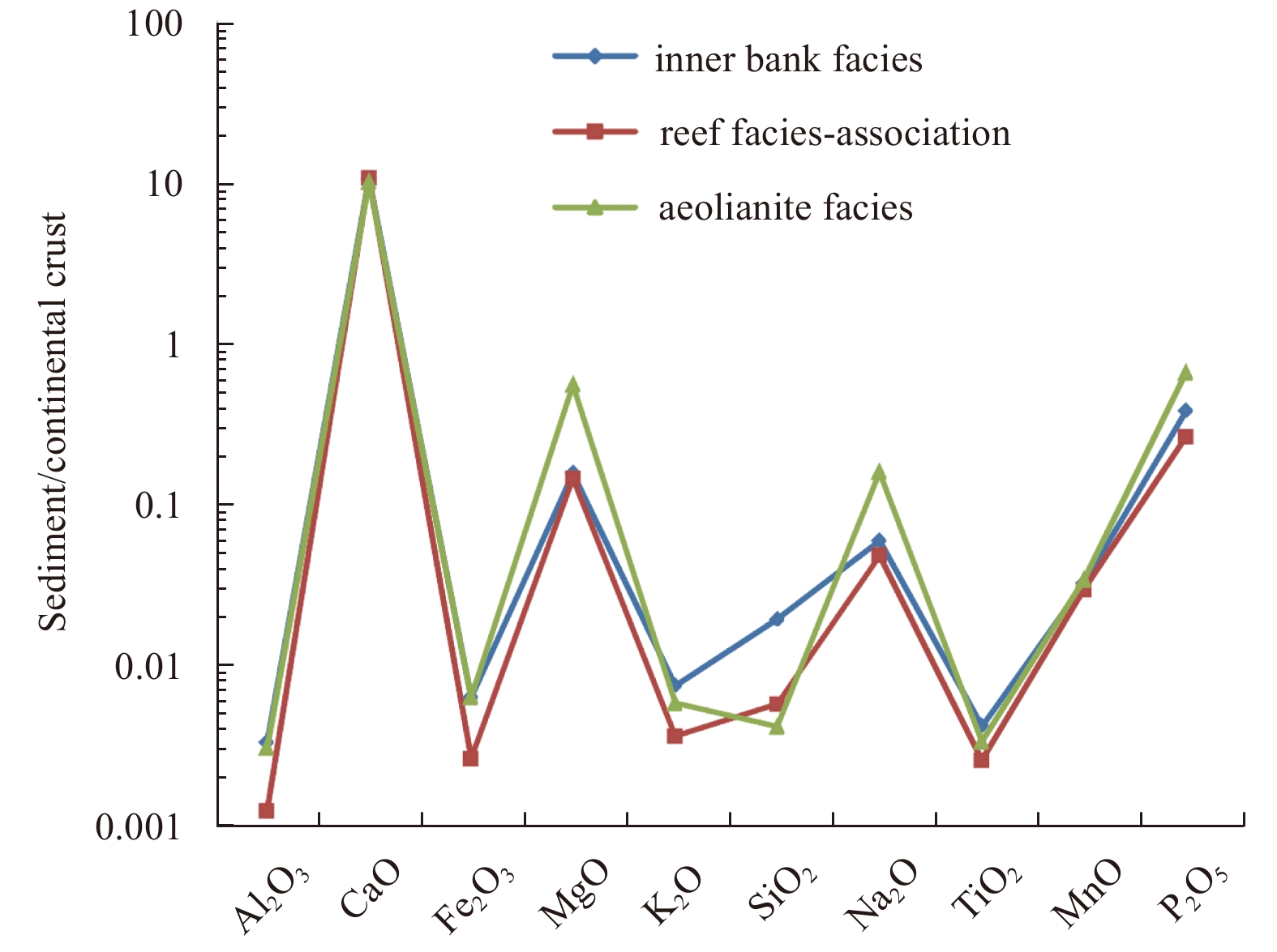
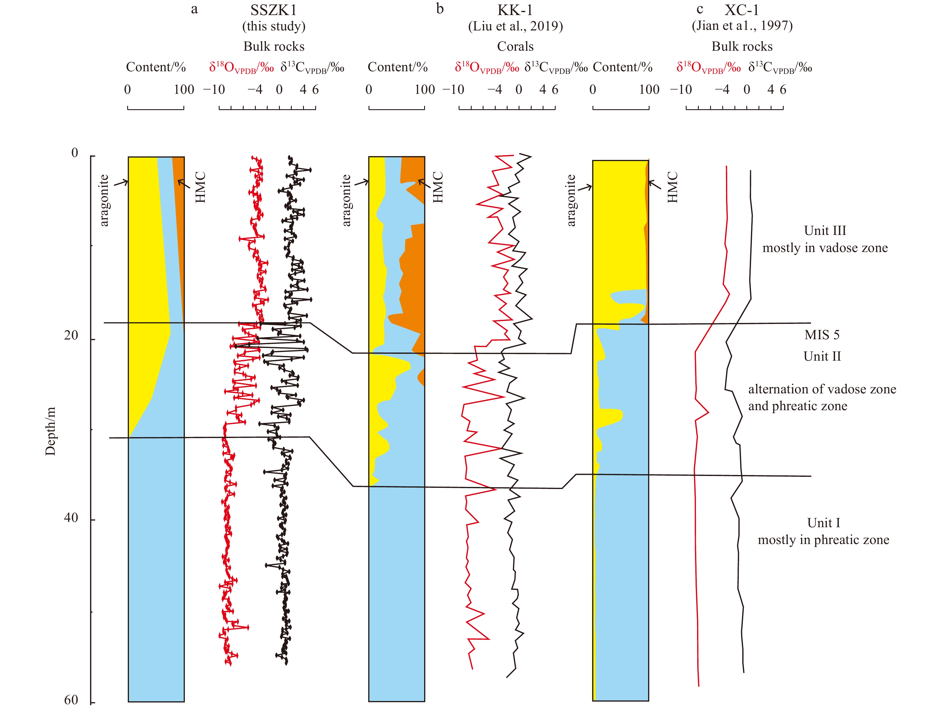
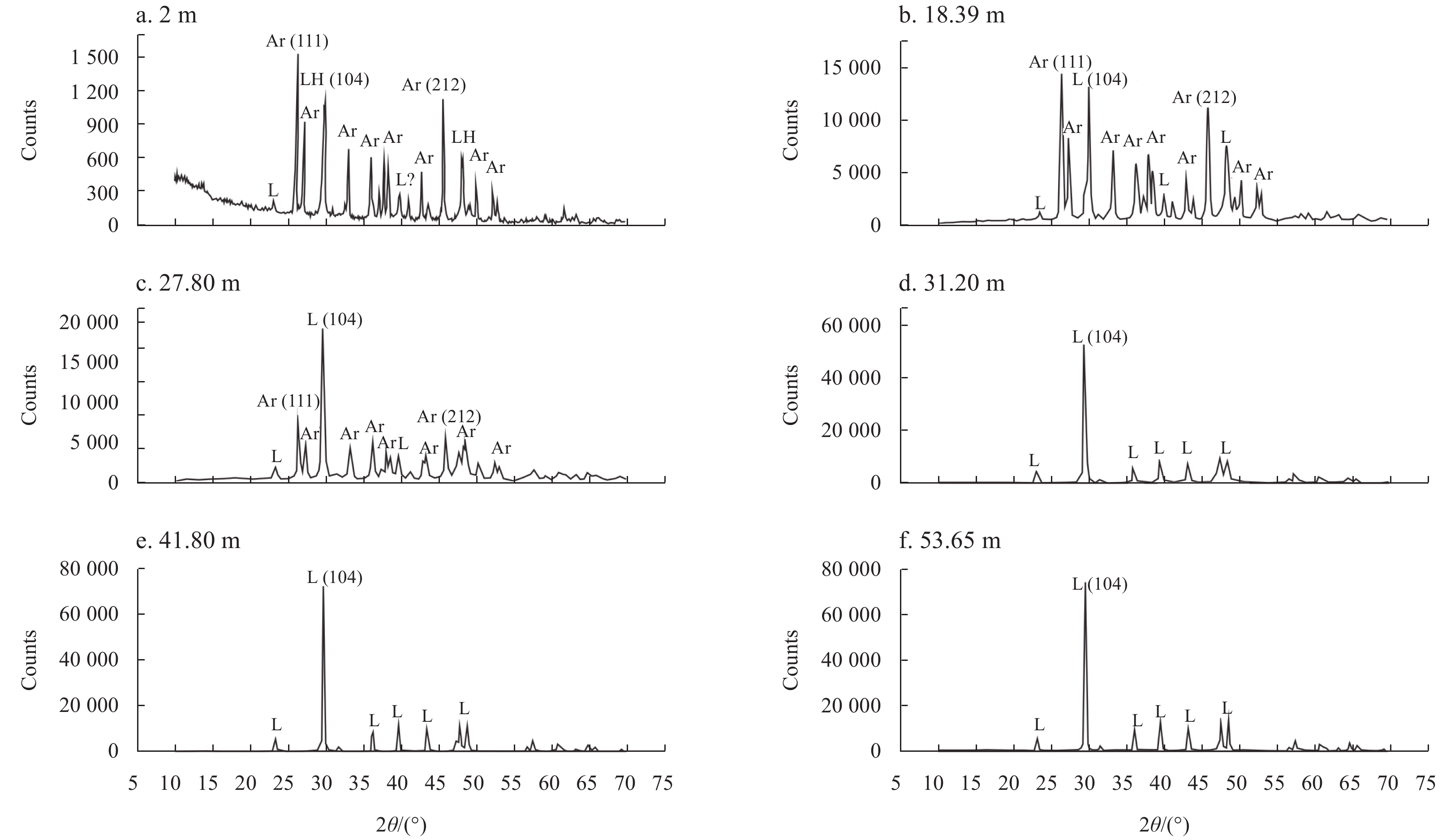
The late Quaternary shallow-water carbonates have been altered by a variety of diagenetic processes, and further influenced by high-amplitude global and regional sea level changes. This study utilizes a new borehole drilled on the Yongxing Island, Xi...
The late Quaternary shallow-water carbonates have been altered by a variety of diagenetic processes, and further influenced by high-amplitude global and regional sea level changes. This study utilizes a new borehole drilled on the Yongxing Island, Xi...


2021, 40(3): 112-121.
doi: 10.1007/s13131-021-1715-4
Abstract:
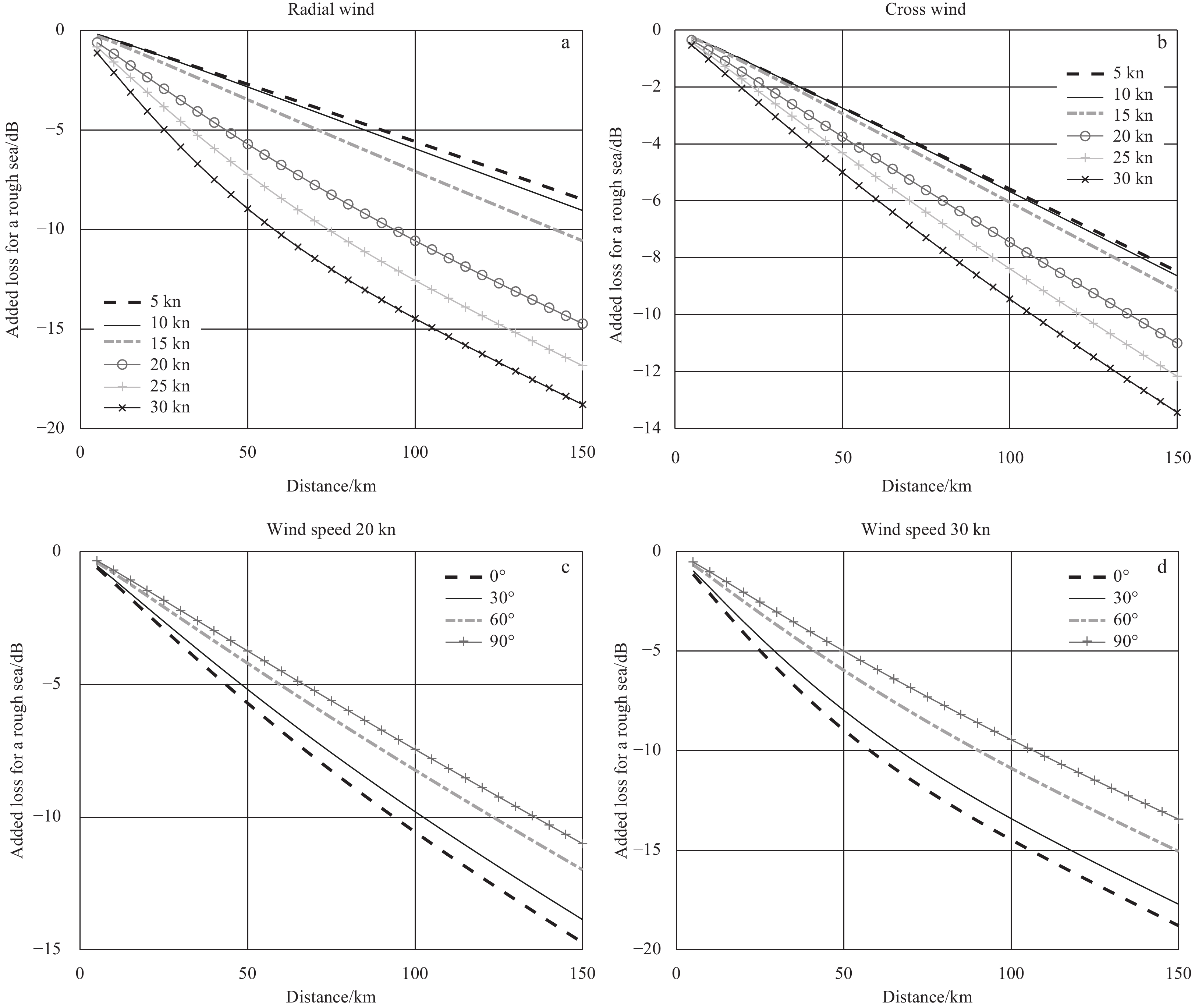
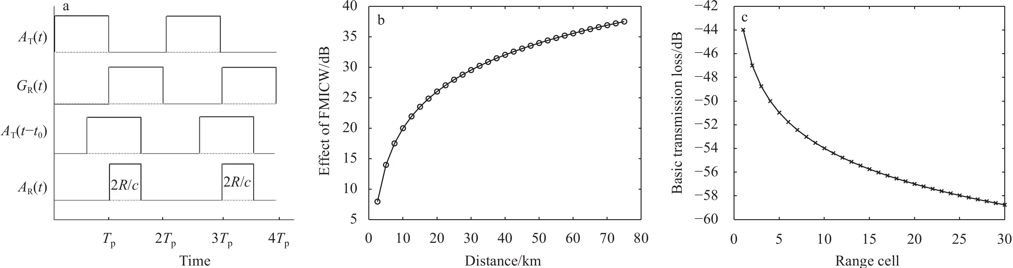
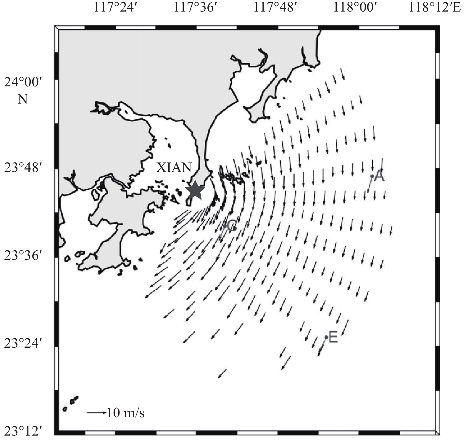
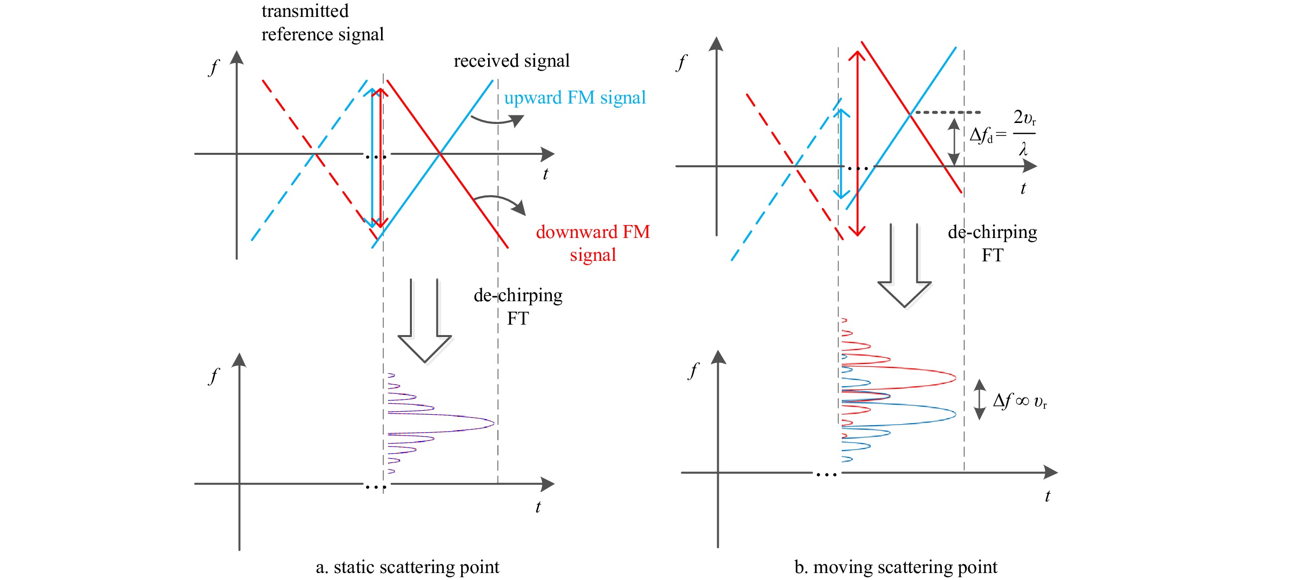
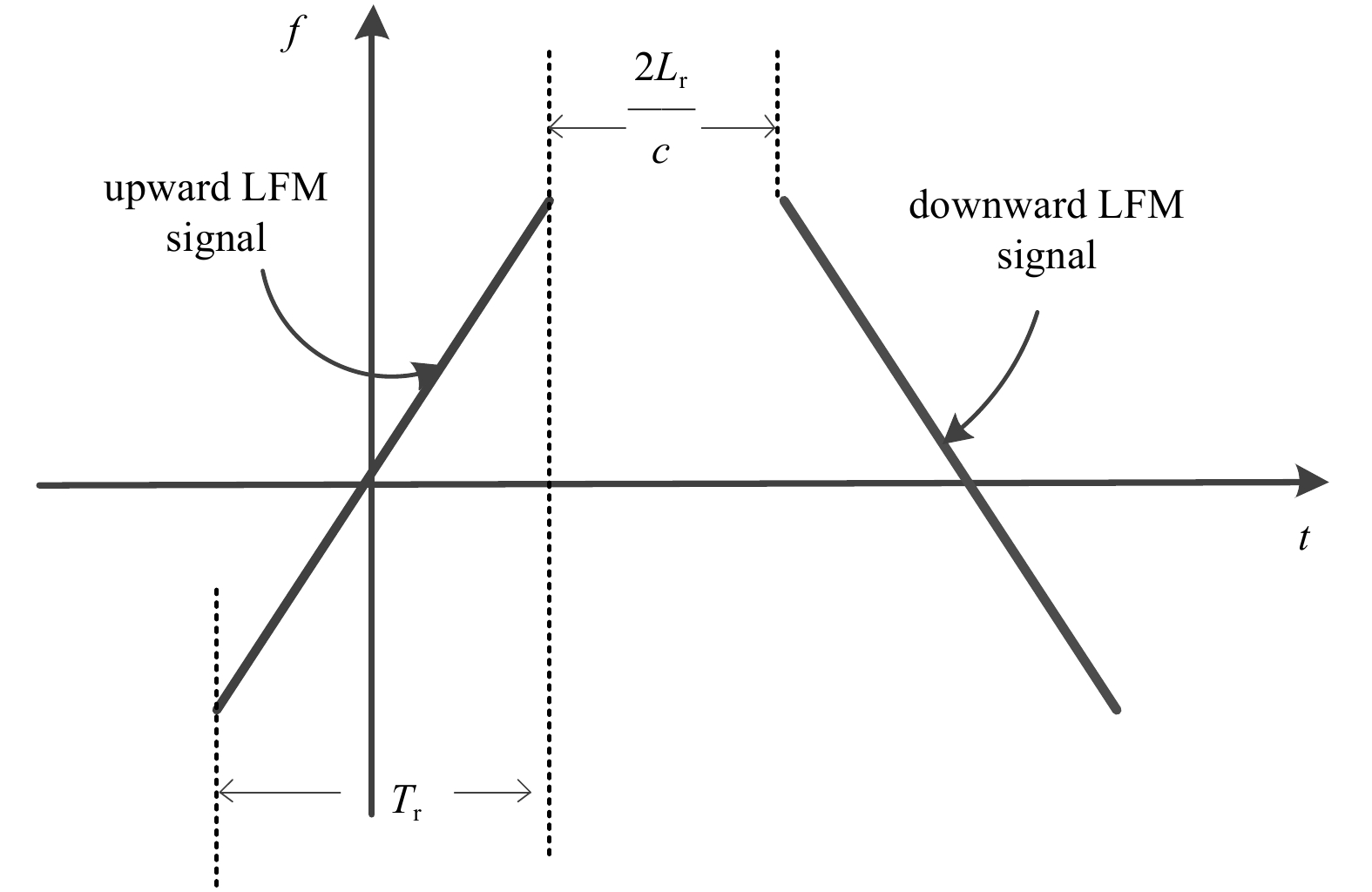
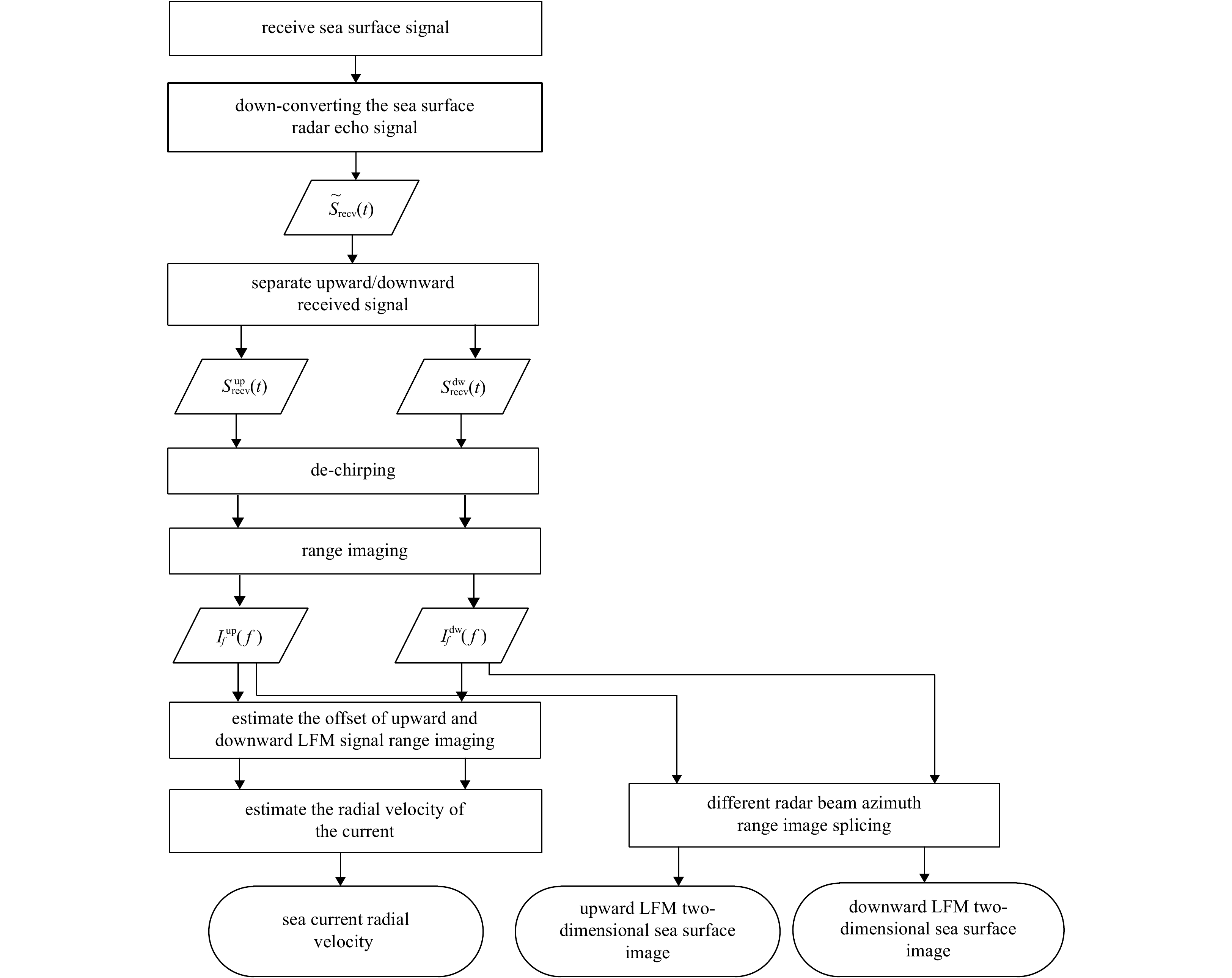
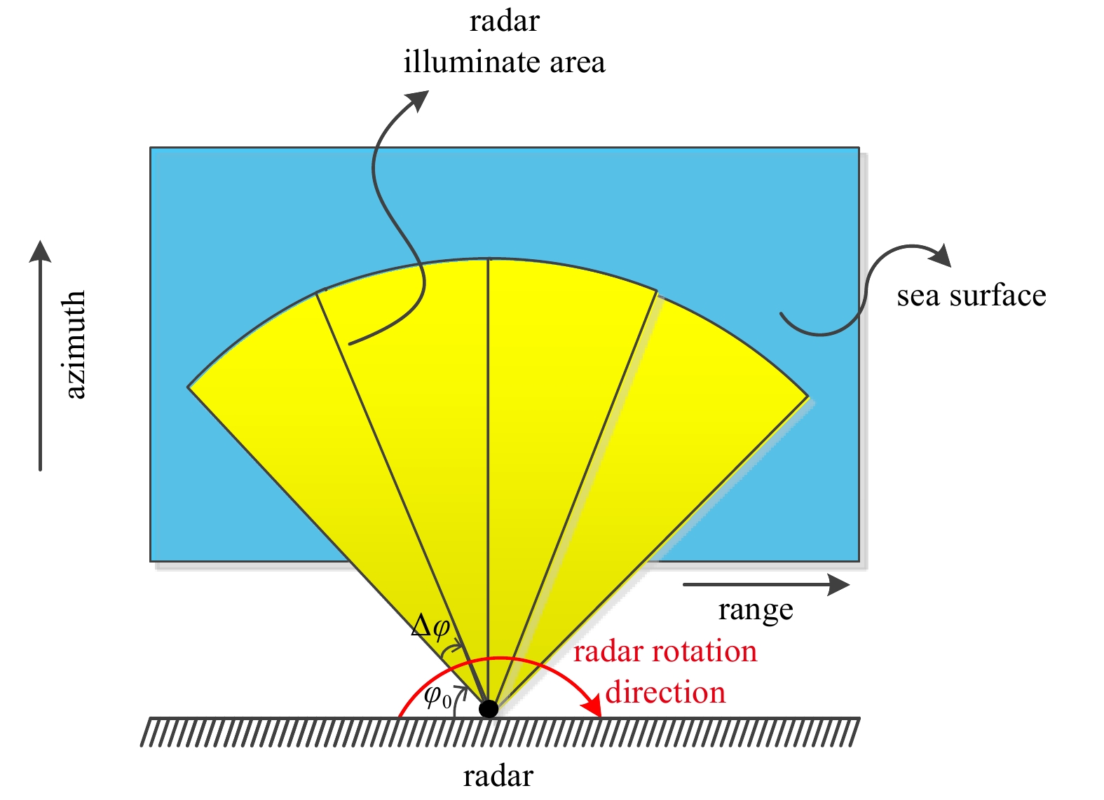
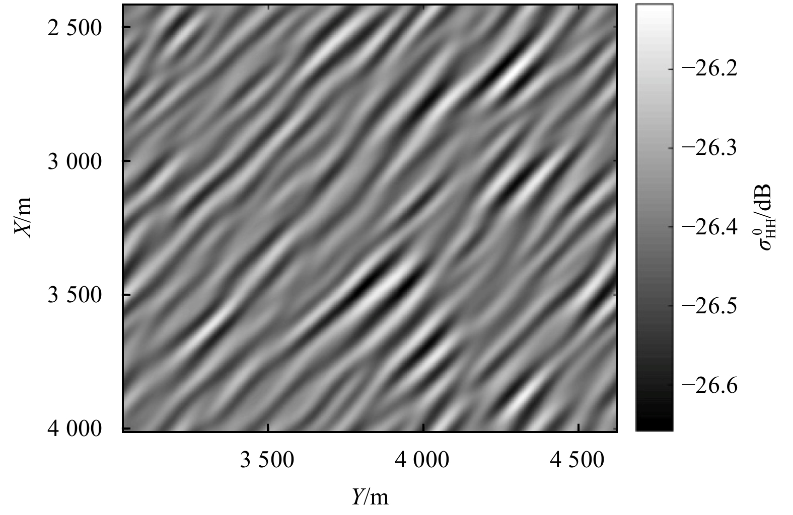
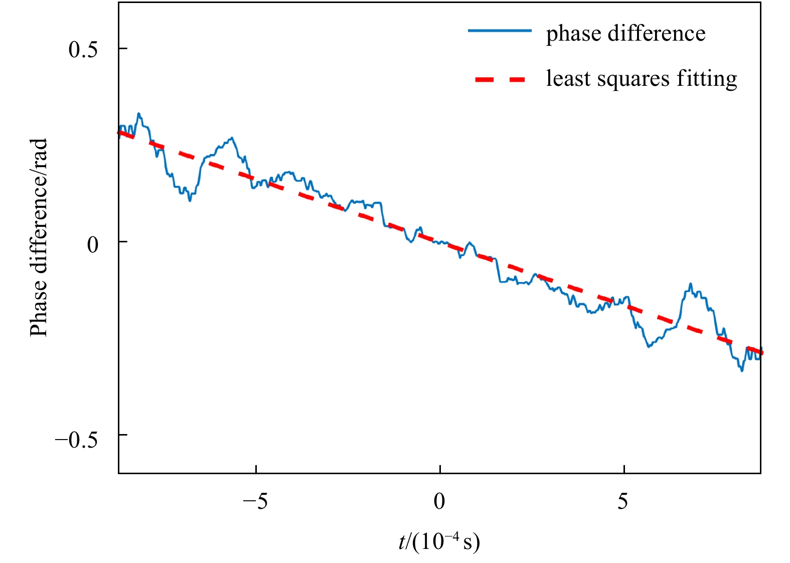
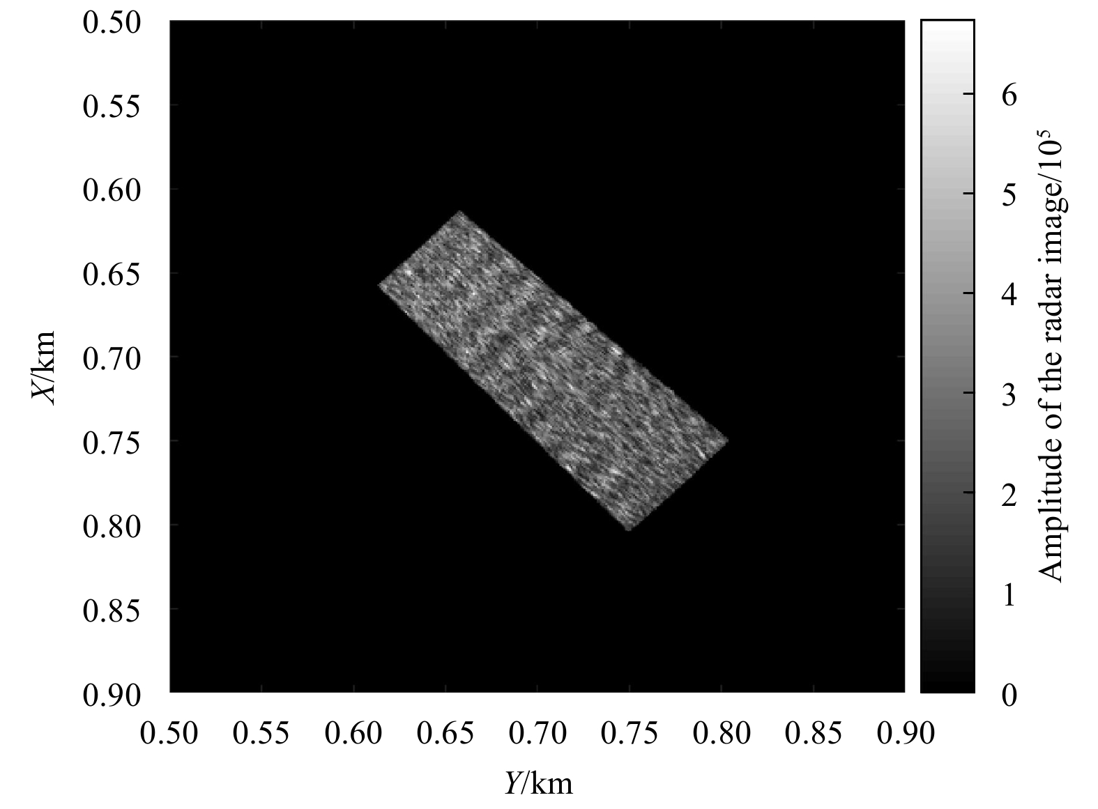
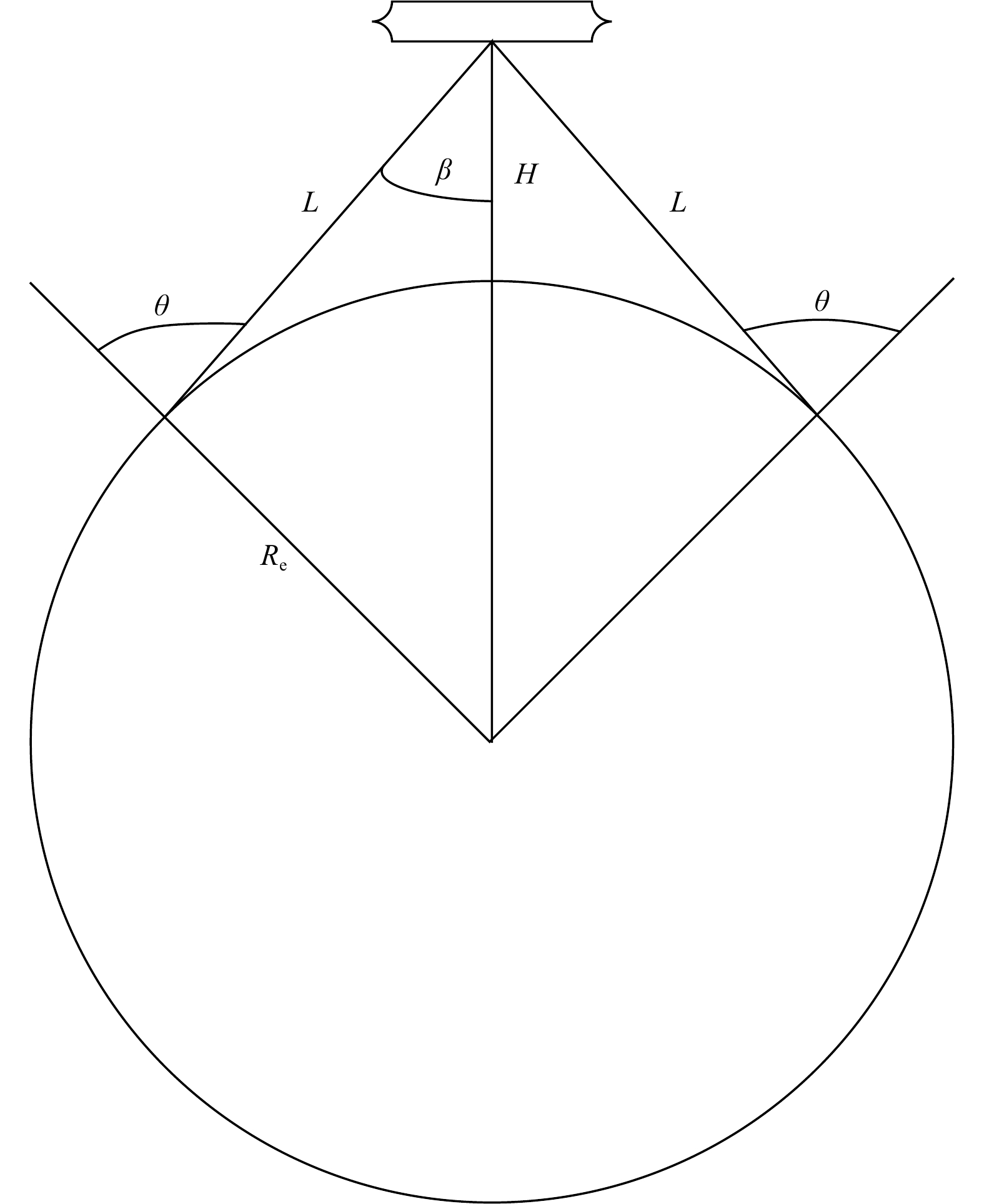
This paper proposes a multifunction radar that can not only measure sea currents but also perform sea-surface imaging. The fundamental aspect of the proposed radar comprises transmitting time-shifted up-and-down continuous wave linear frequency modul...
This paper proposes a multifunction radar that can not only measure sea currents but also perform sea-surface imaging. The fundamental aspect of the proposed radar comprises transmitting time-shifted up-and-down continuous wave linear frequency modul...


2021, 40(3): 122-133.
doi: 10.1007/s13131-021-1712-7
Abstract:
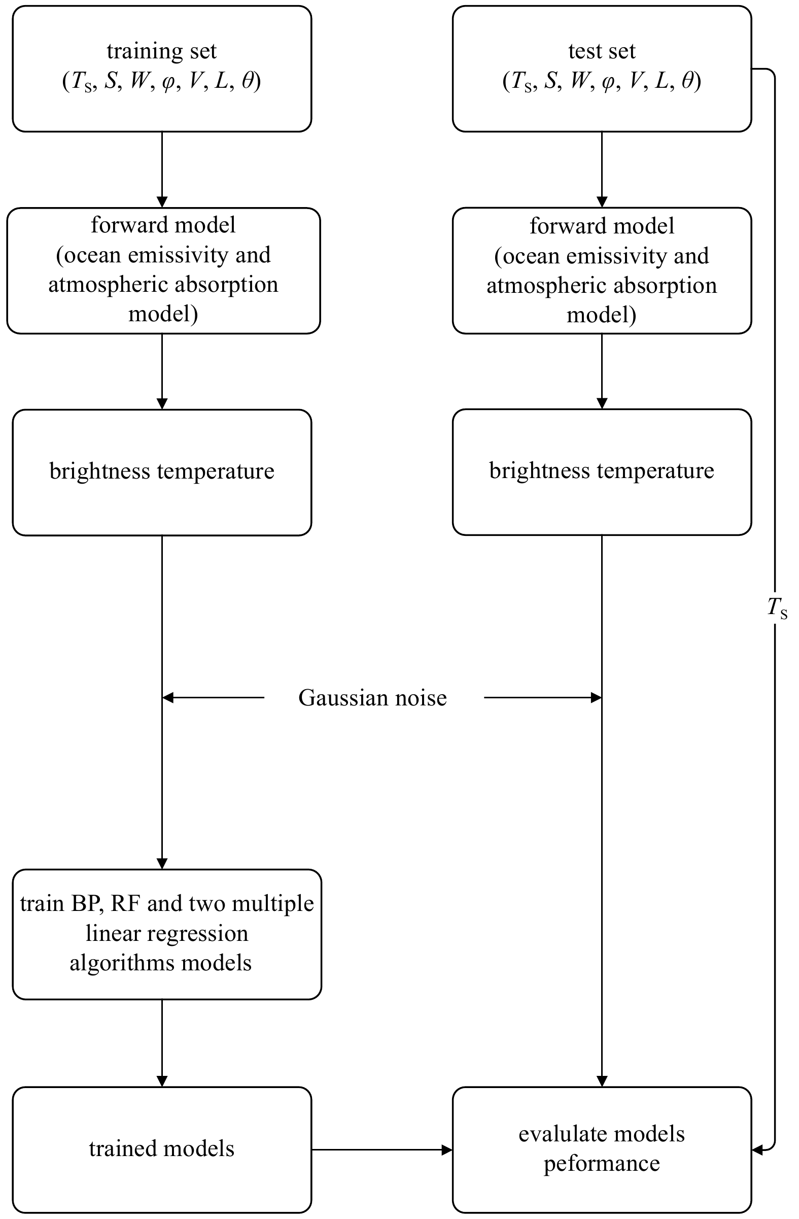
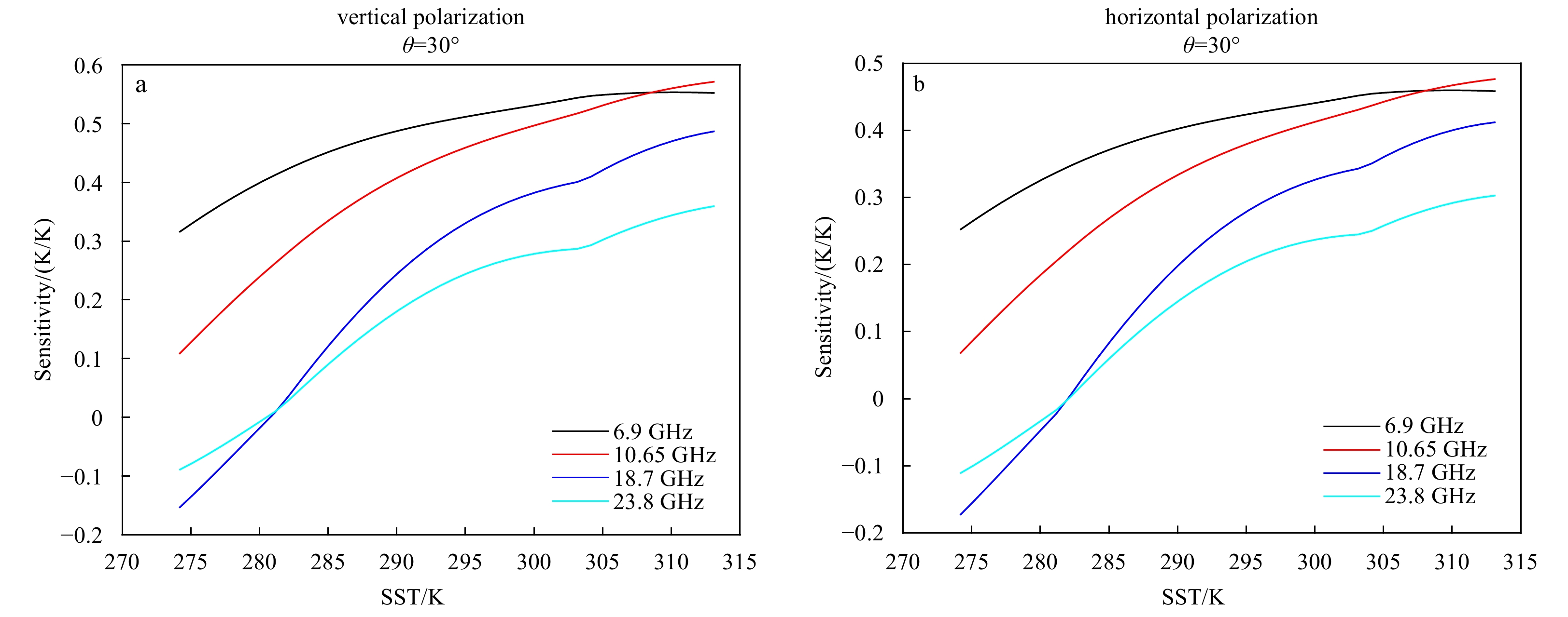
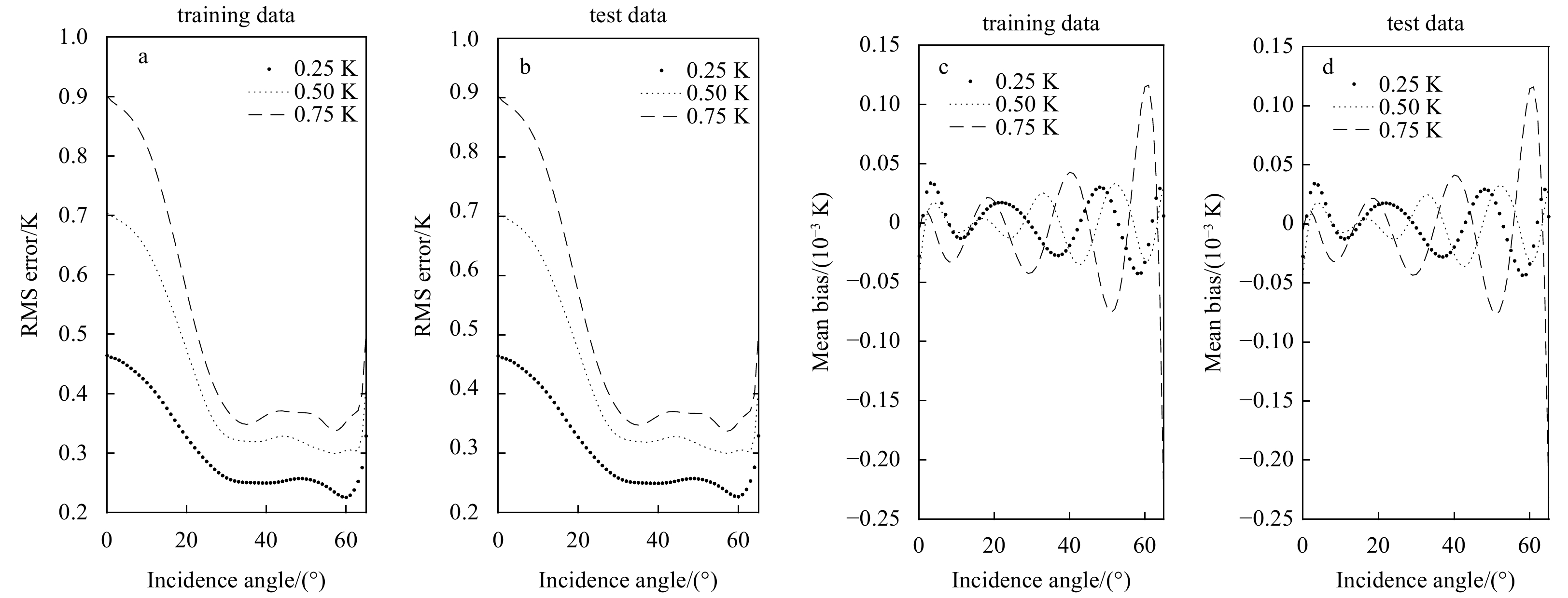
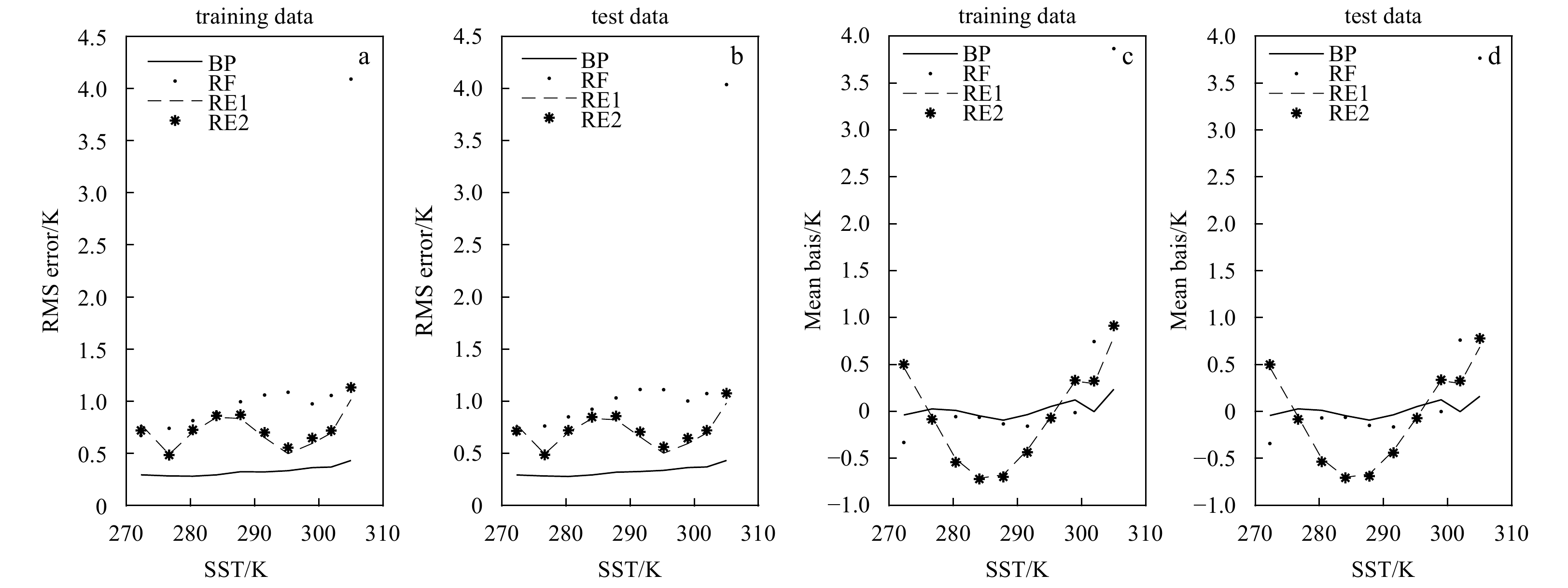
Compared with traditional real aperture microwave radiometers, one-dimensional synthetic aperture microwave radiometers have higher spatial resolution. In this paper, we proposed to retrieve sea surface temperature using a one-dimensional synthetic a...
Compared with traditional real aperture microwave radiometers, one-dimensional synthetic aperture microwave radiometers have higher spatial resolution. In this paper, we proposed to retrieve sea surface temperature using a one-dimensional synthetic a...


2021, 40(3): 134-141.
doi: 10.1007/s13131-021-1708-3
Abstract:
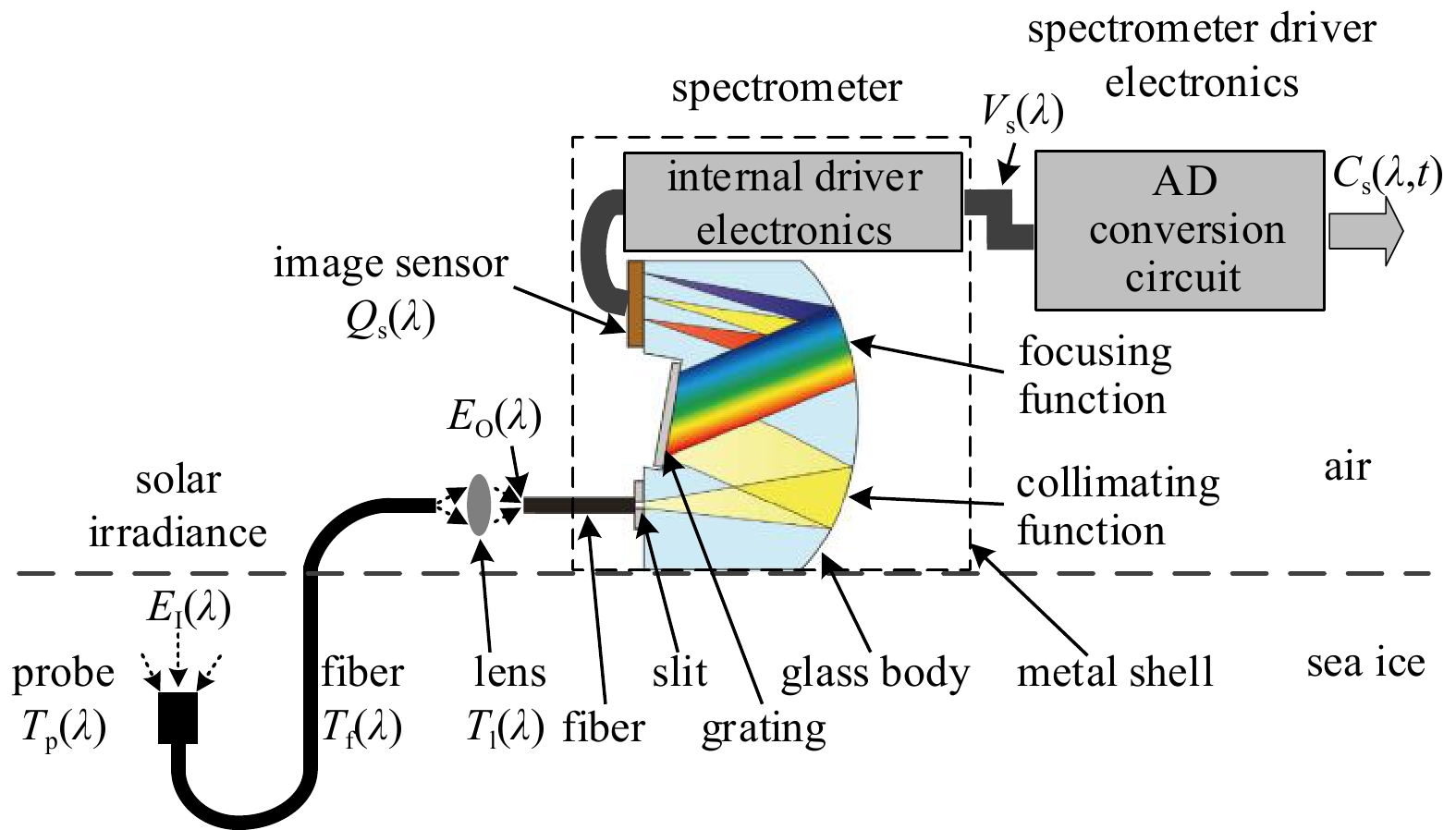
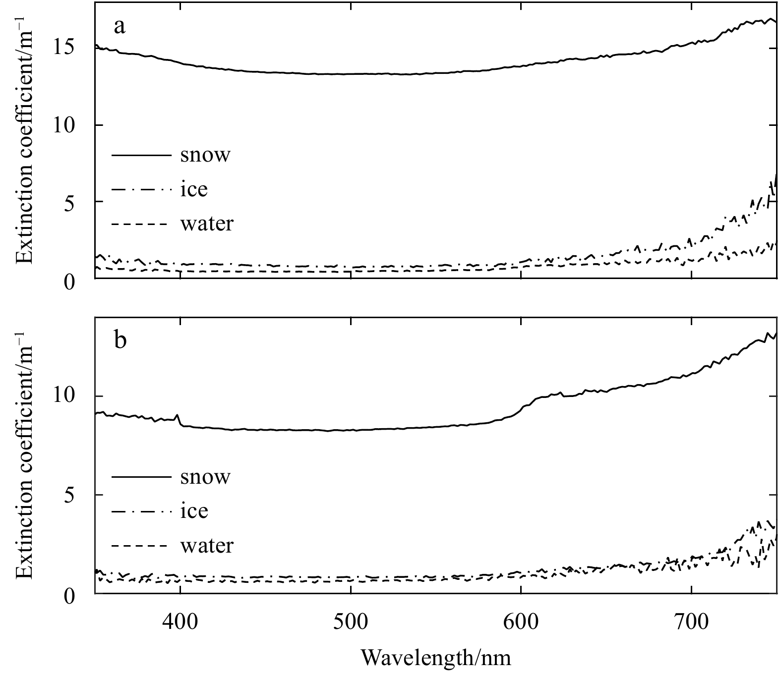
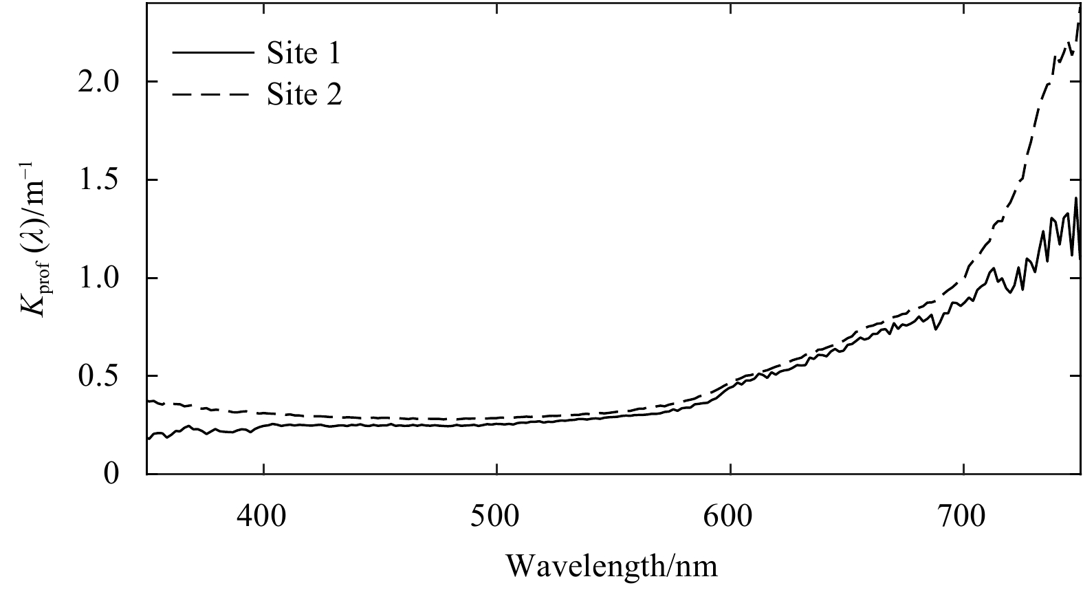
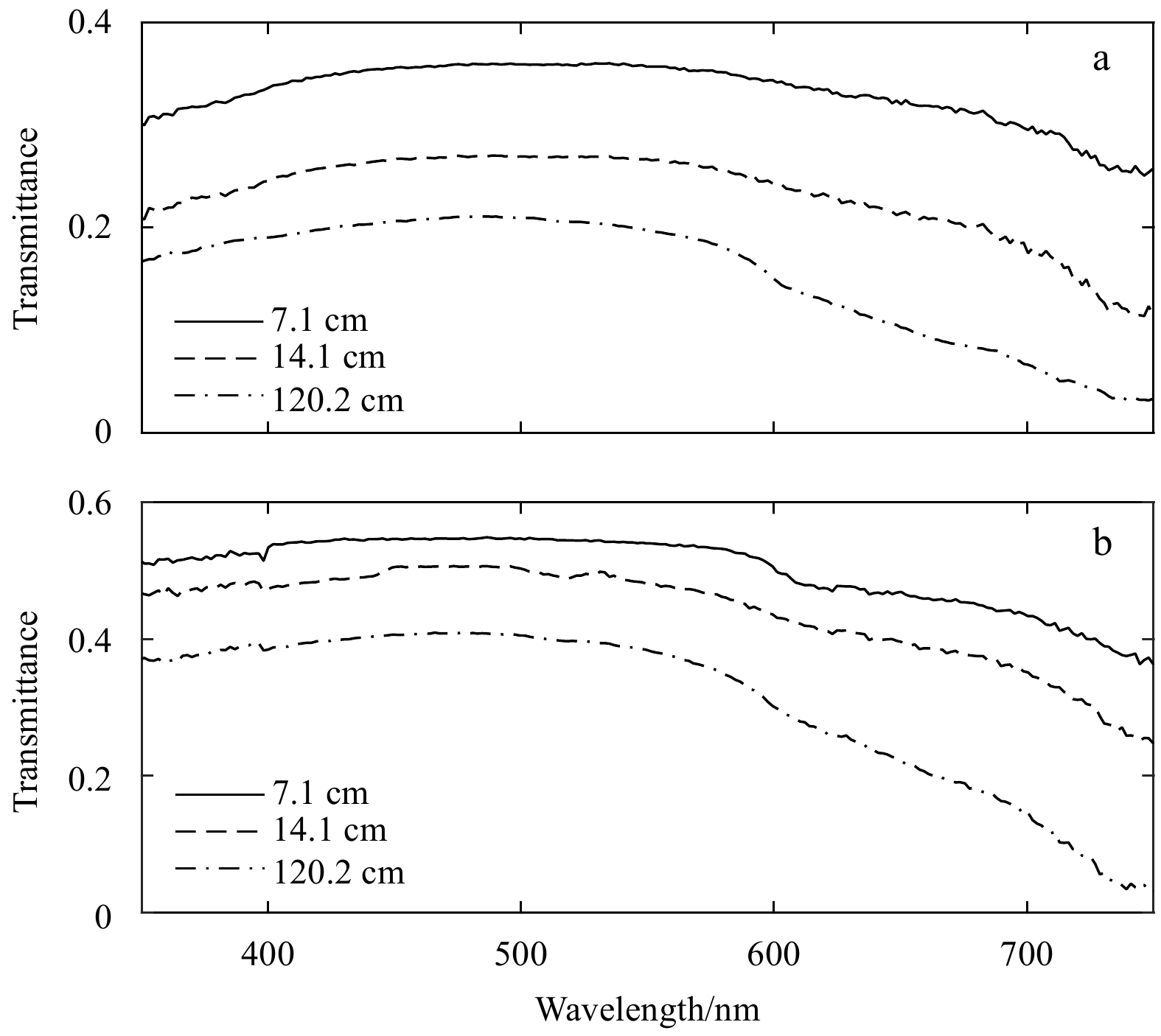
An irradiance profile measurement approach and profiling system were developed to measure the solar irradiance profile of the Arctic sea ice using fiber optic spectrometry. The approach involved using a miniature spectrometer to sense light signals c...
An irradiance profile measurement approach and profiling system were developed to measure the solar irradiance profile of the Arctic sea ice using fiber optic spectrometry. The approach involved using a miniature spectrometer to sense light signals c...


2021, 40(3): 142-152.
doi: 10.1007/s13131-021-1707-4
Abstract:
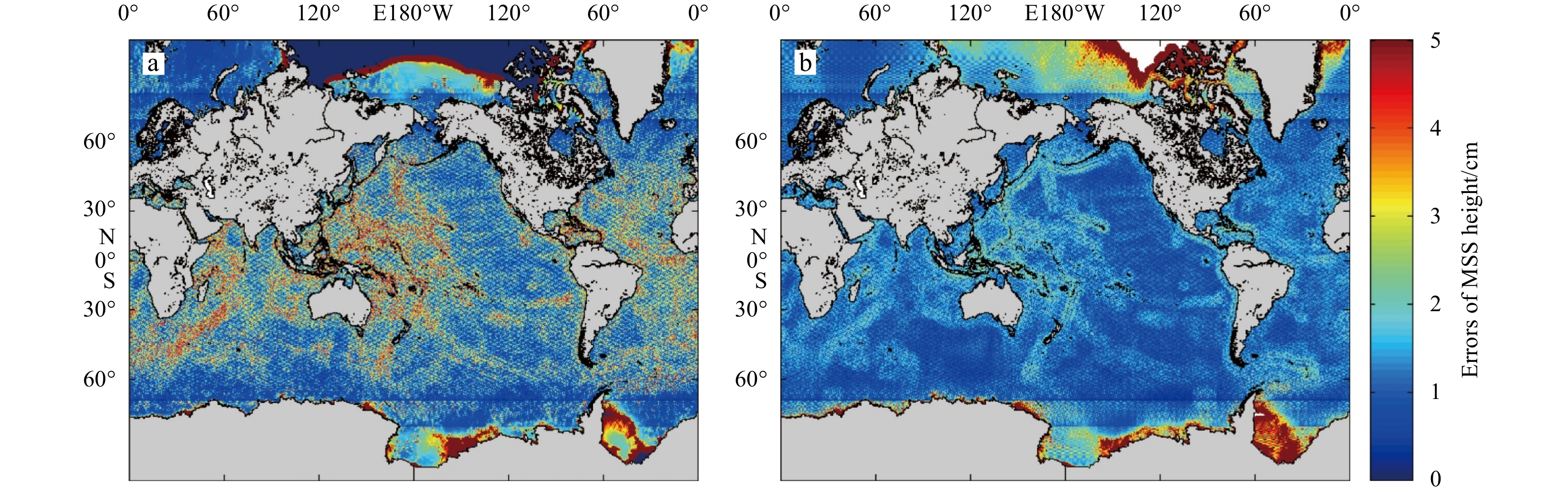
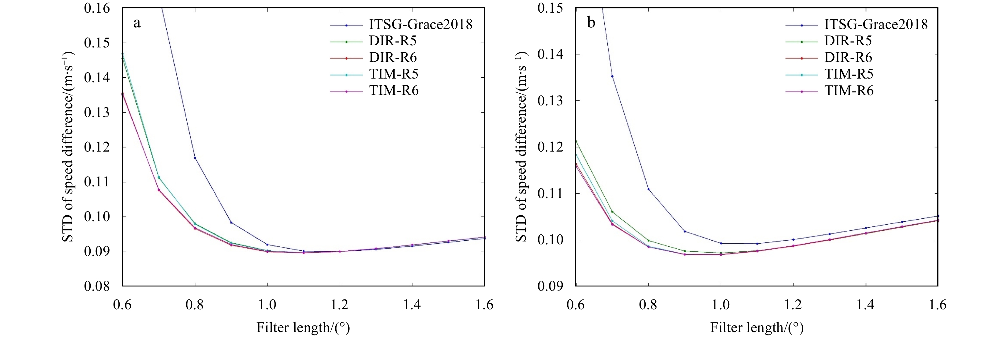
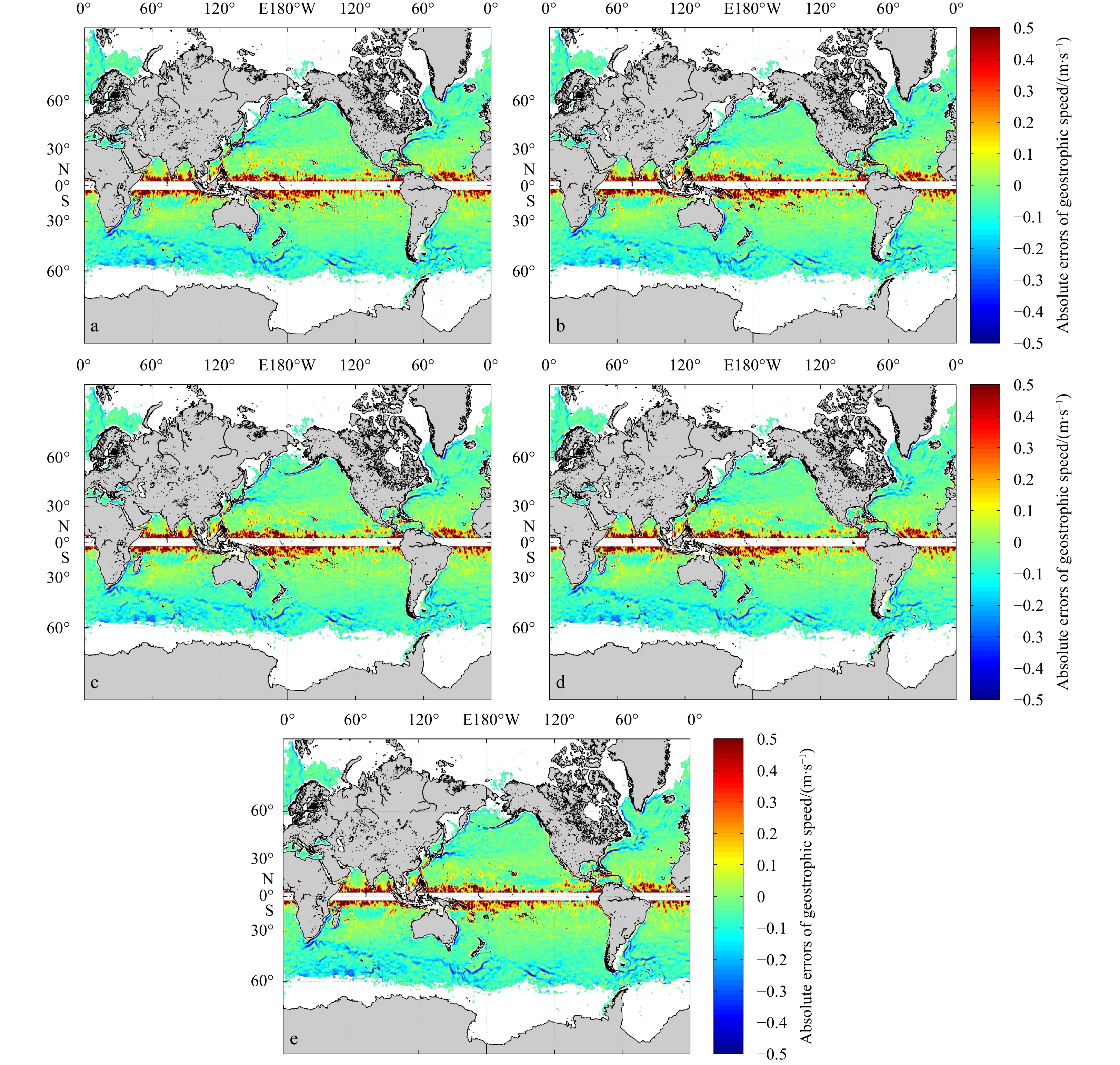
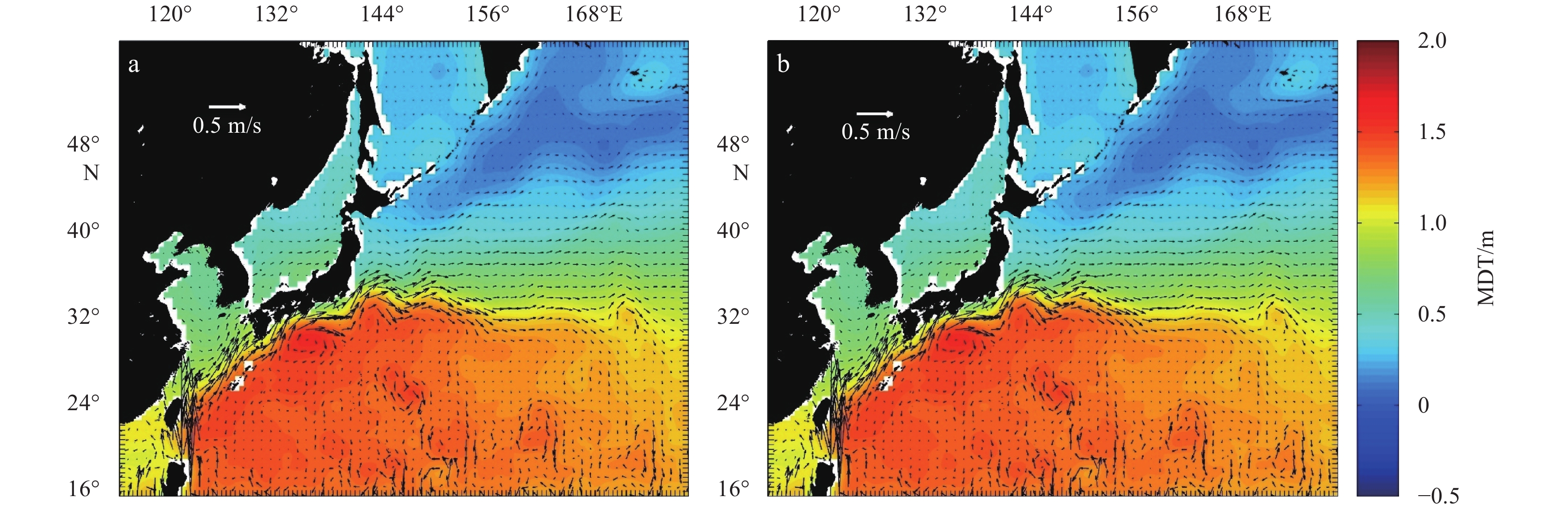
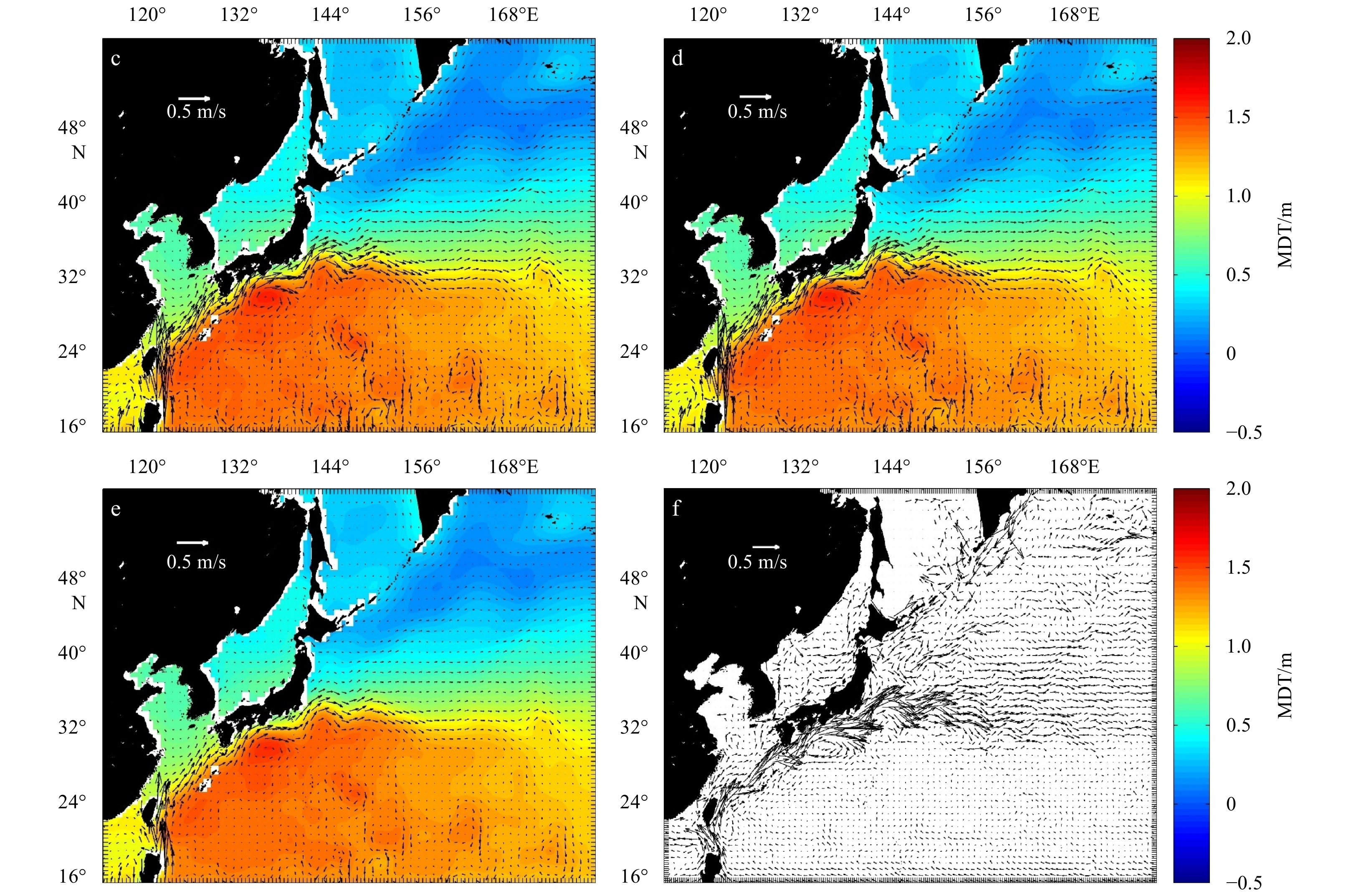
The new gravity field models of gravity field and steady-state ocean circulation explorer (GOCE), TIM_R6 and DIR_R6, were released by the European Space Agency (ESA) in June 2019. The sixth generation of gravity models have the highest possible signa...
The new gravity field models of gravity field and steady-state ocean circulation explorer (GOCE), TIM_R6 and DIR_R6, were released by the European Space Agency (ESA) in June 2019. The sixth generation of gravity models have the highest possible signa...


2021, 40(3): 153-166.
doi: 10.1007/s13131-021-1752-z
Abstract:
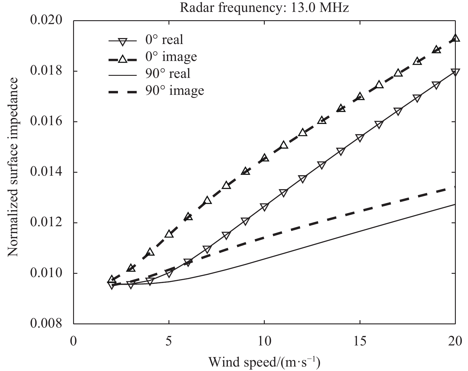
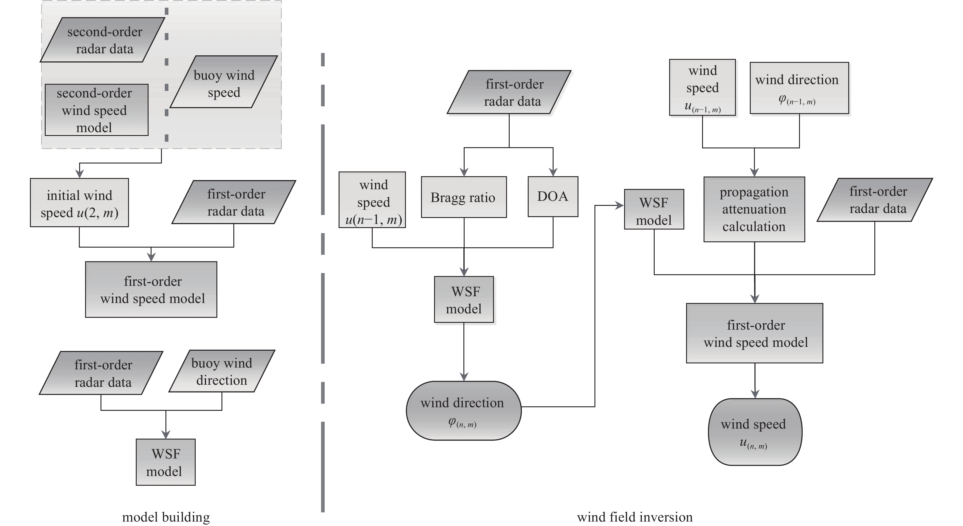
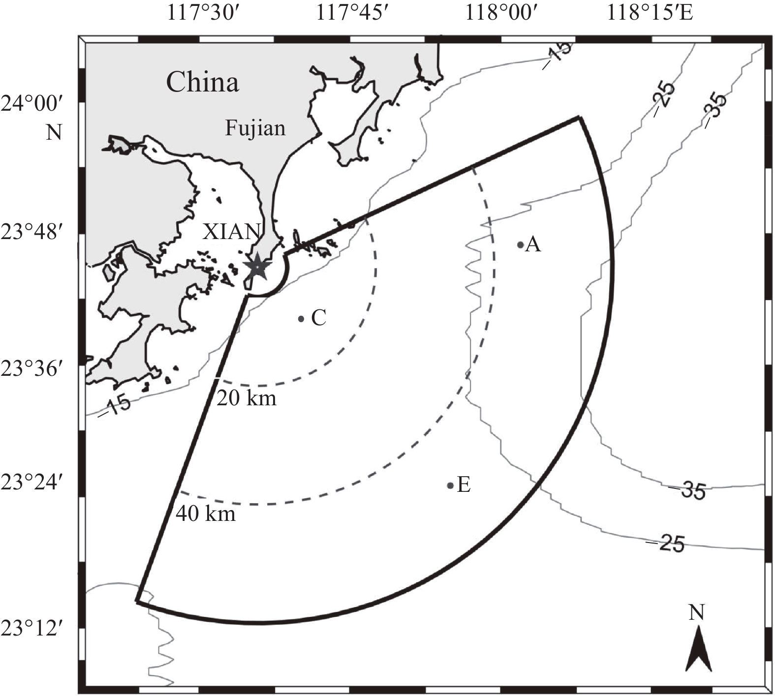
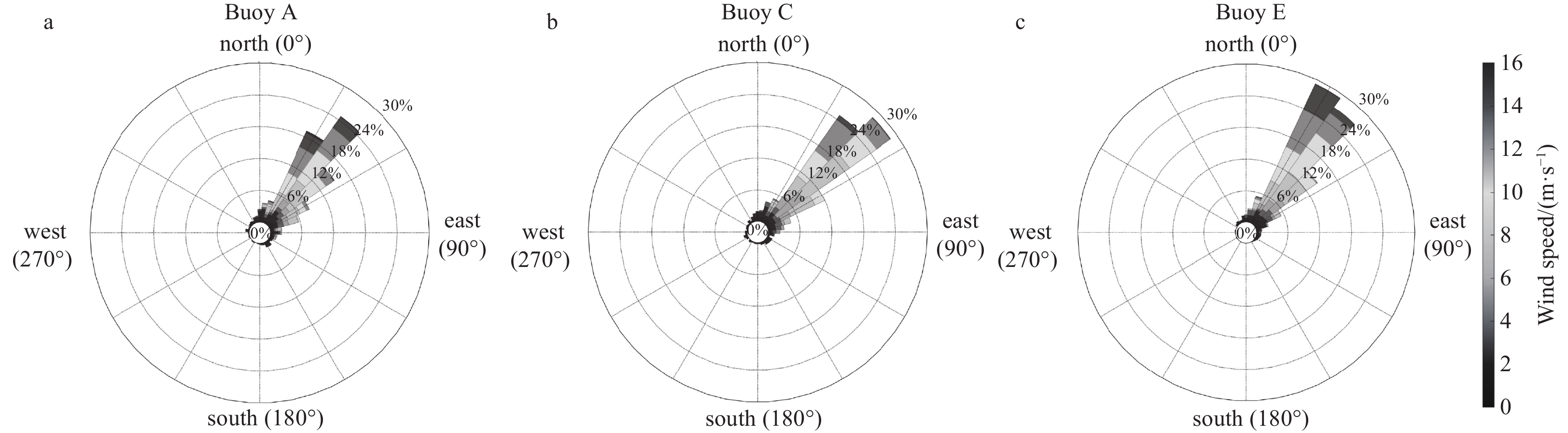
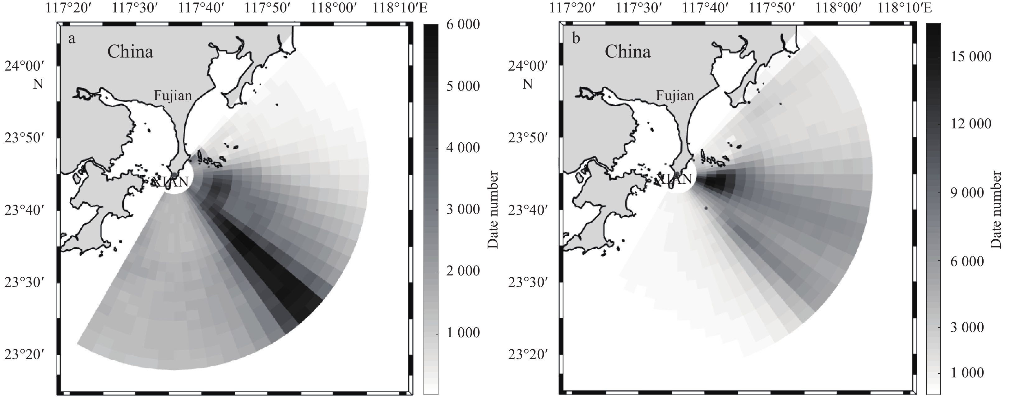
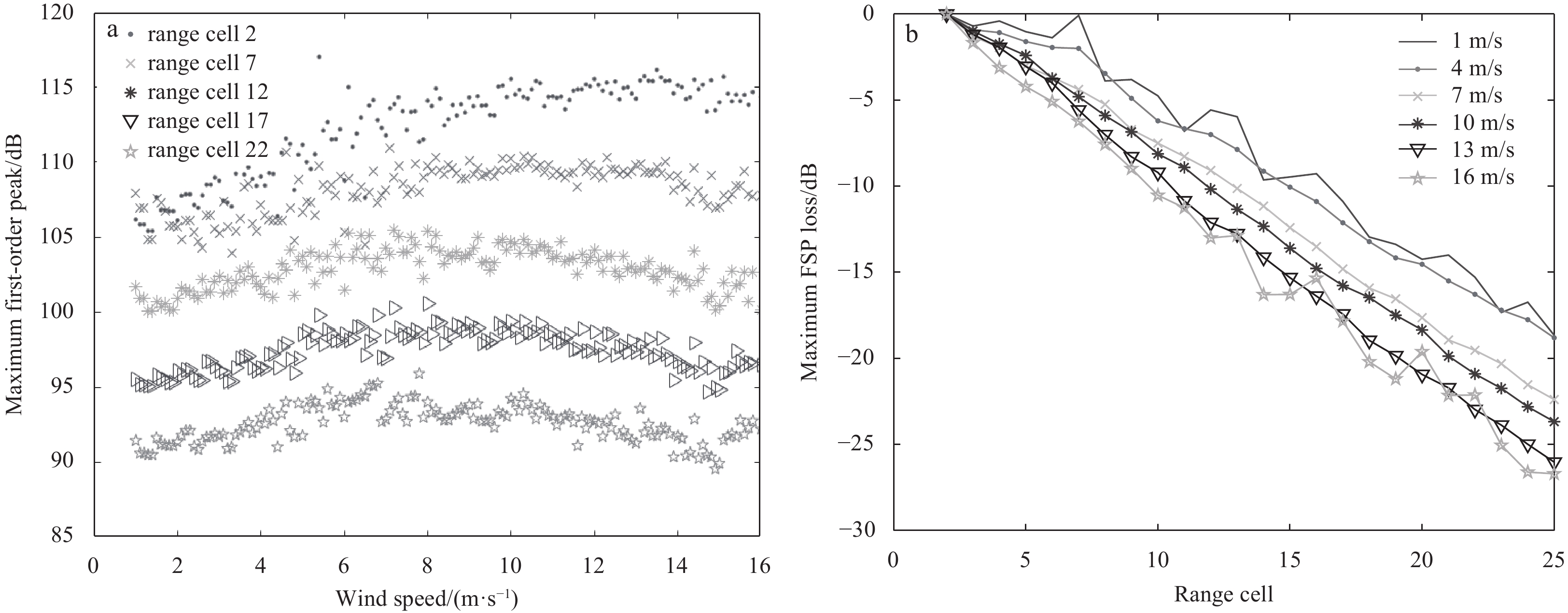
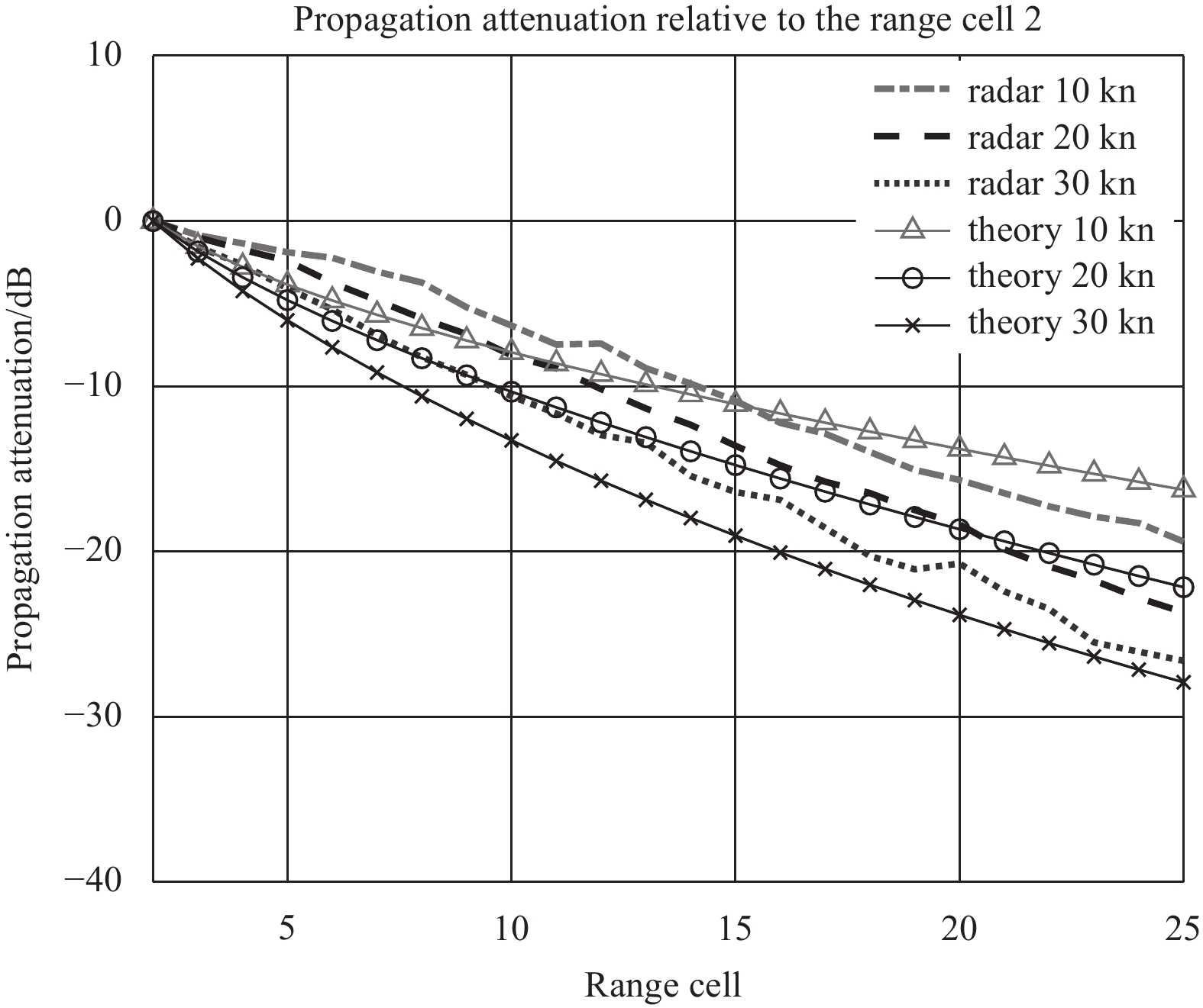
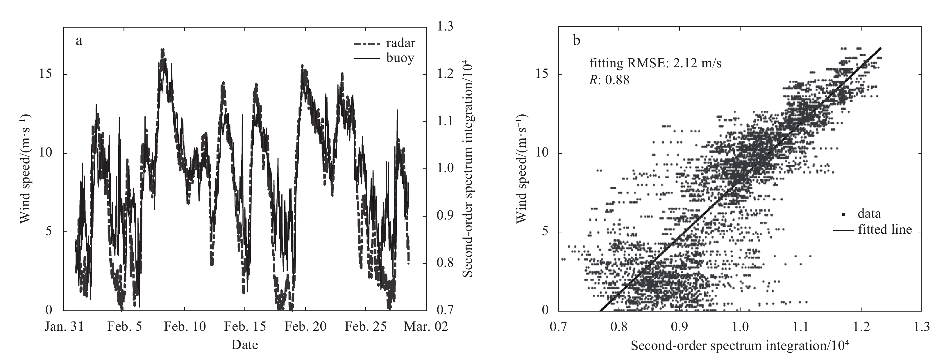
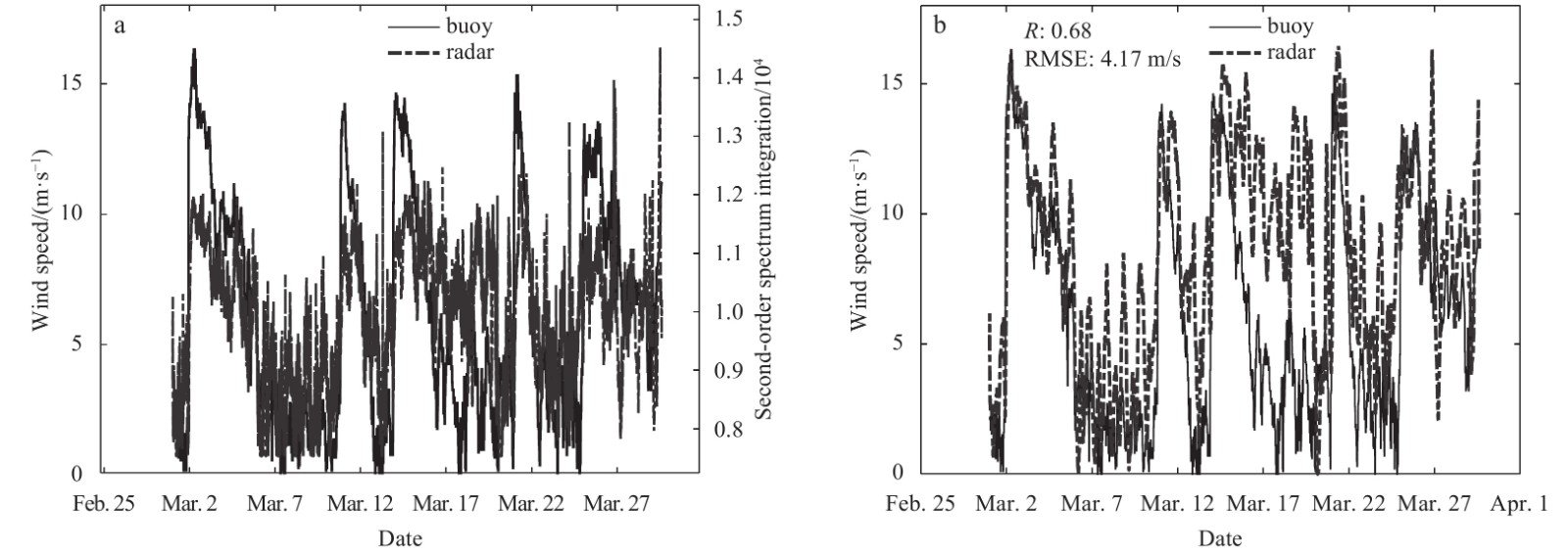
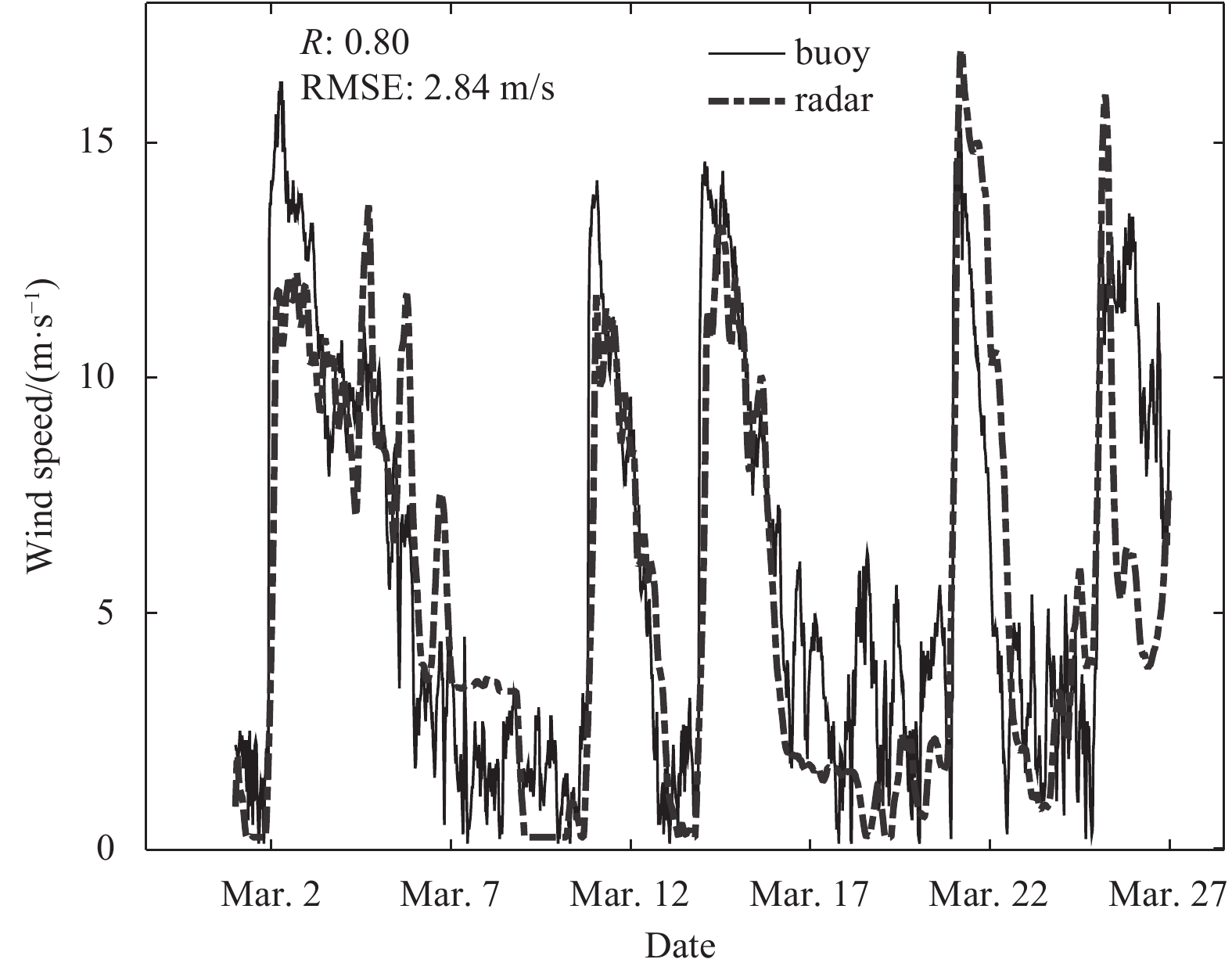
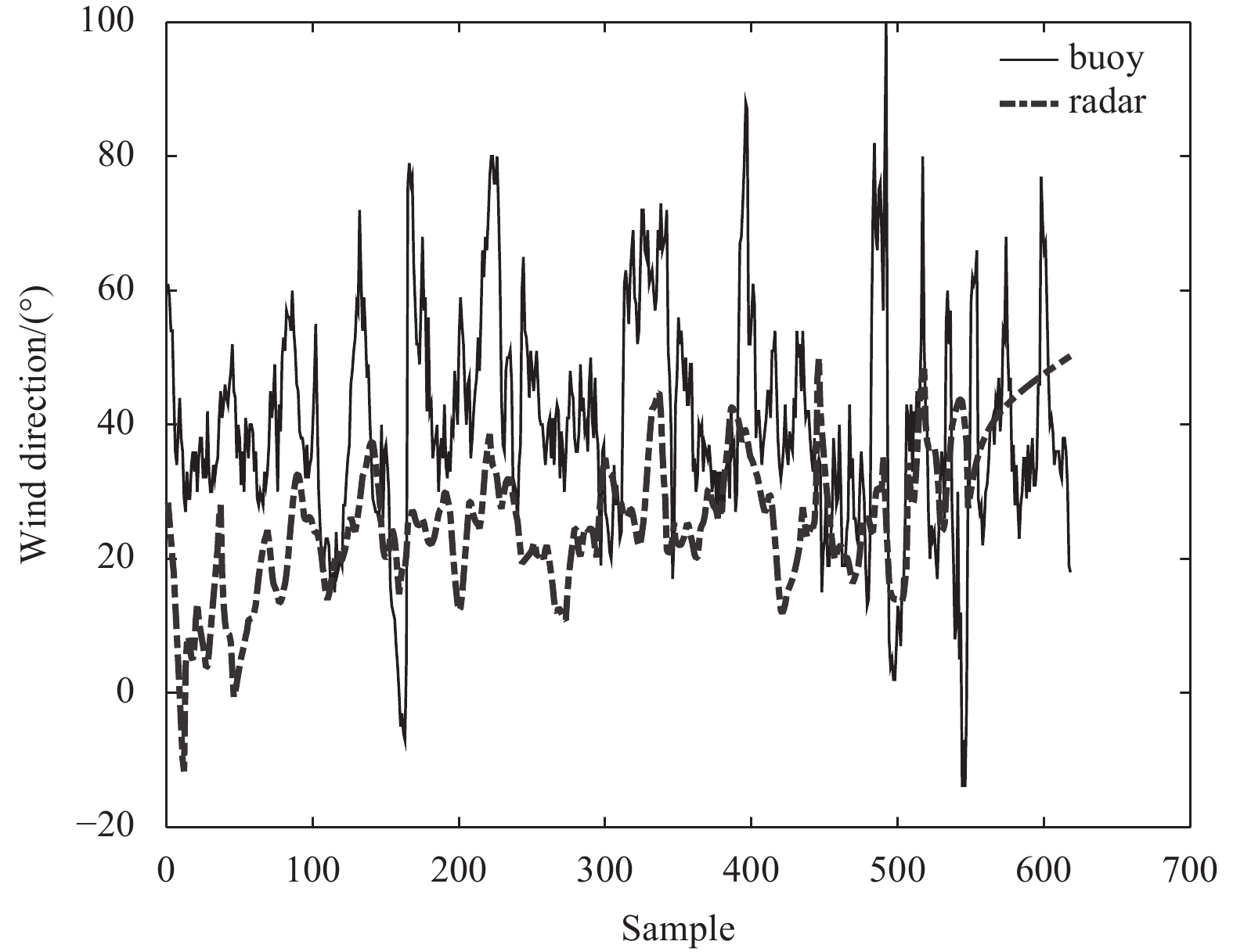
Mapping wind with high-frequency (HF) radar is still a challenge. The existing second-order spectrum based wind speed extraction method has the problems of short detection distances and low angular resolution for broad-beam HF radar. To solve these p...
Mapping wind with high-frequency (HF) radar is still a challenge. The existing second-order spectrum based wind speed extraction method has the problems of short detection distances and low angular resolution for broad-beam HF radar. To solve these p...