2020 Vol. 39, No. 8
Display Method:
2020, (8): 1-2.
Abstract:
2020, 39(8): 1-13.
doi: 10.1007/s13131-020-1617-x
Abstract:
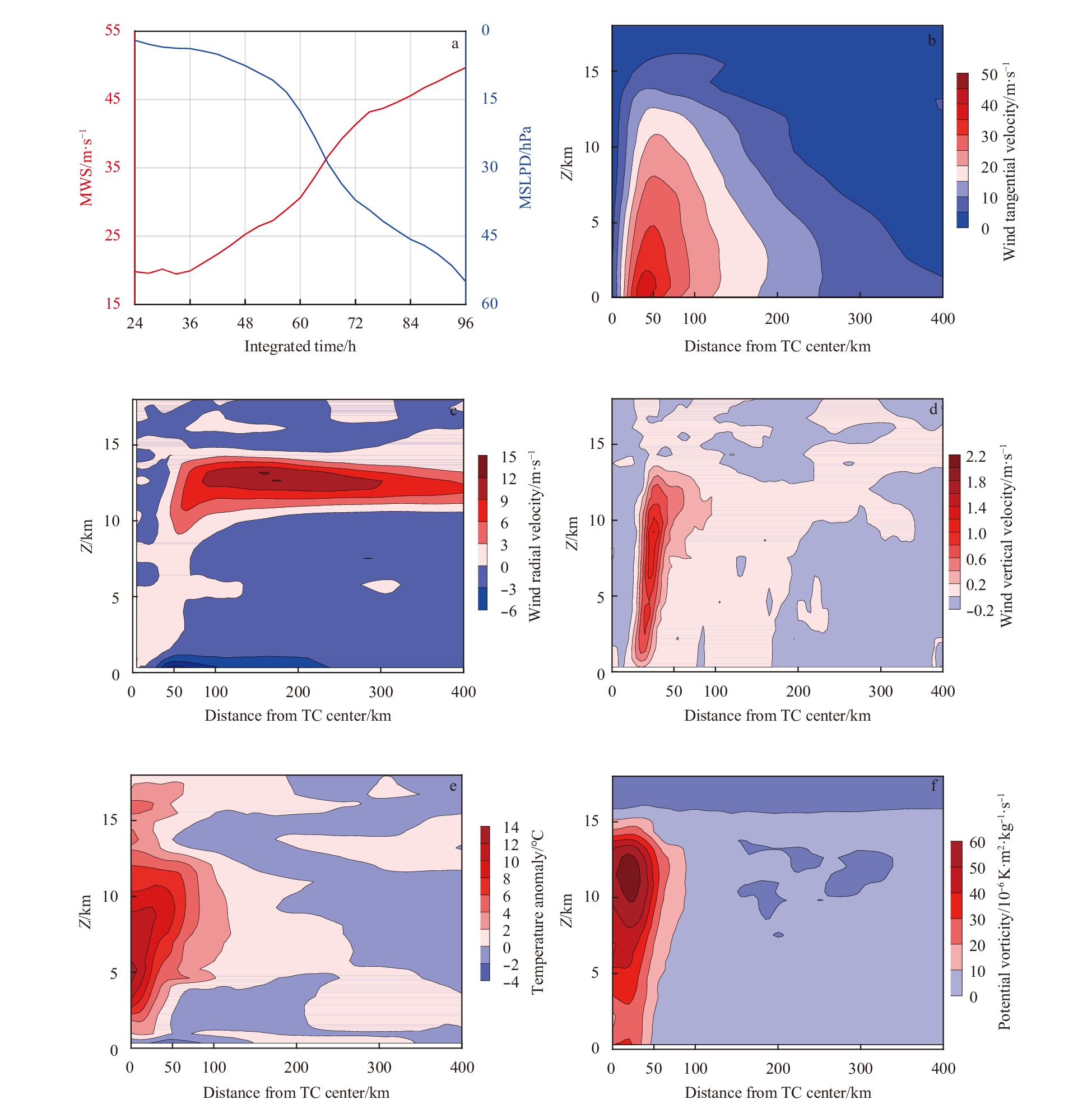
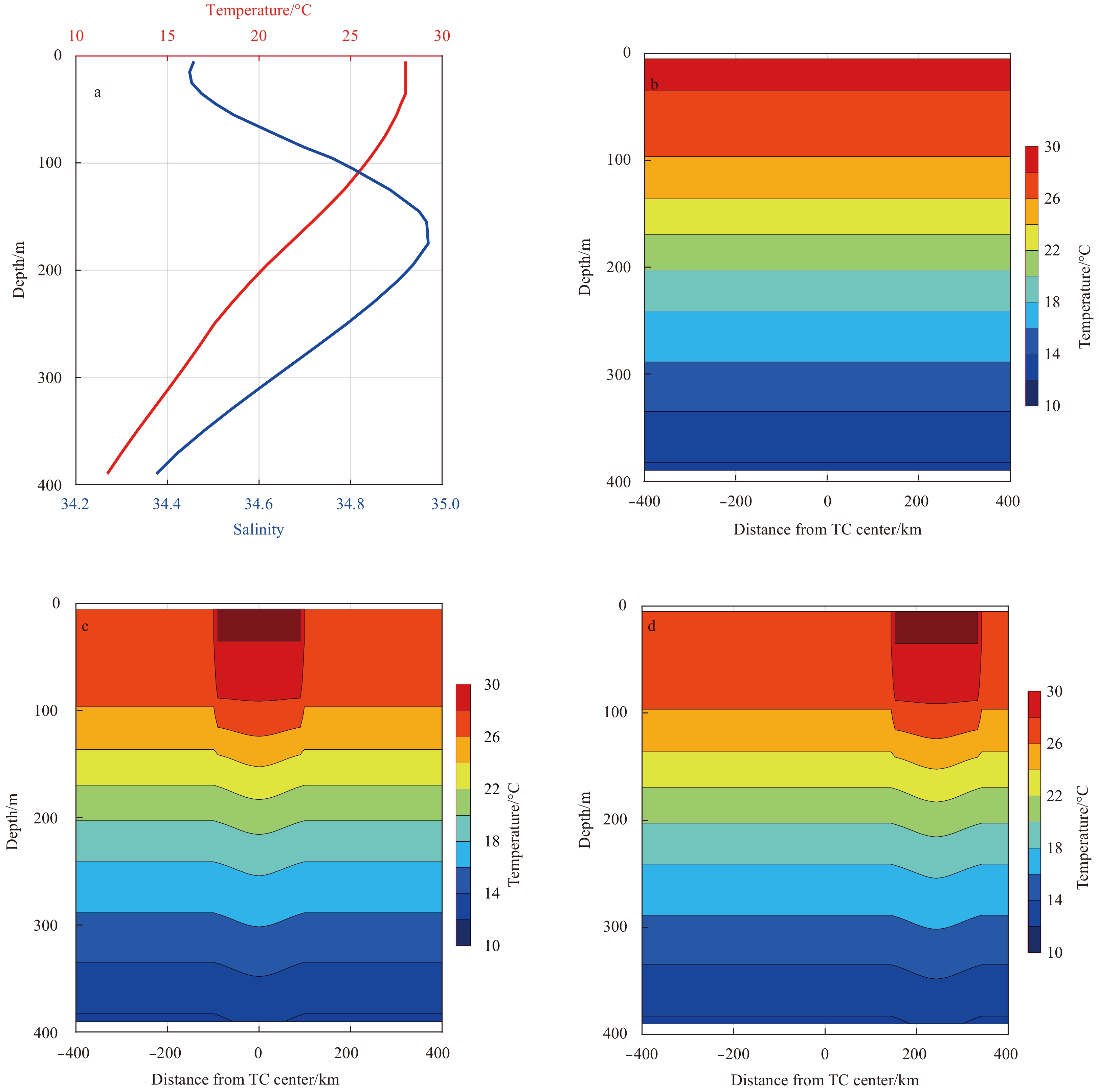
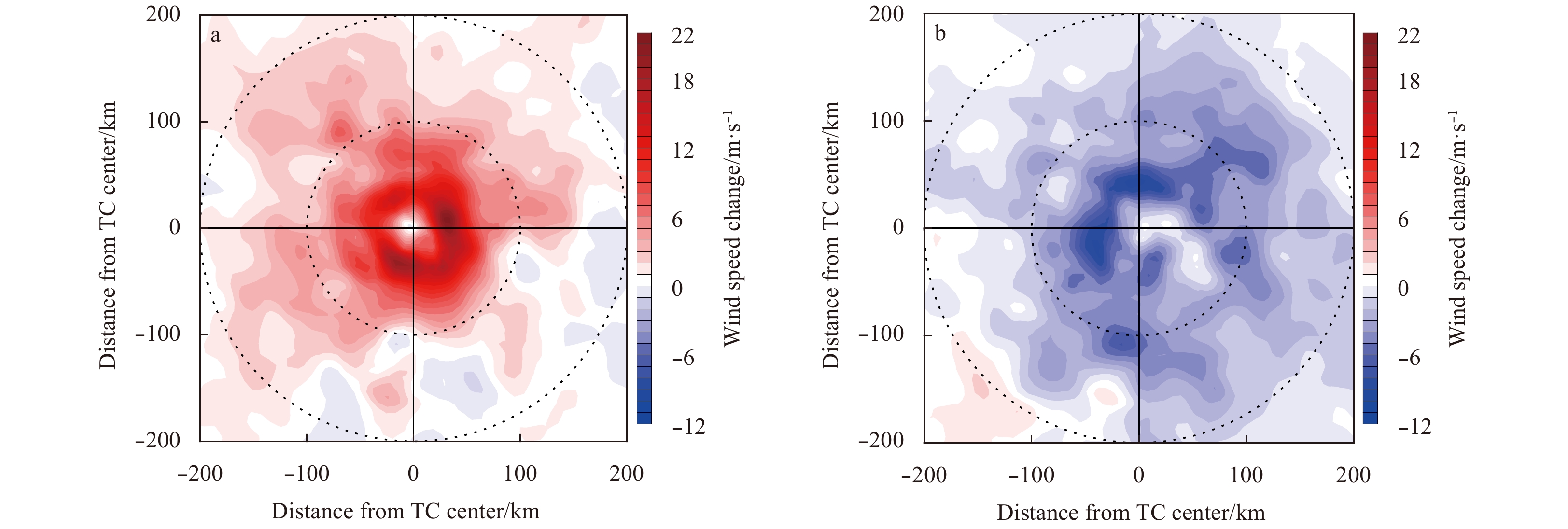
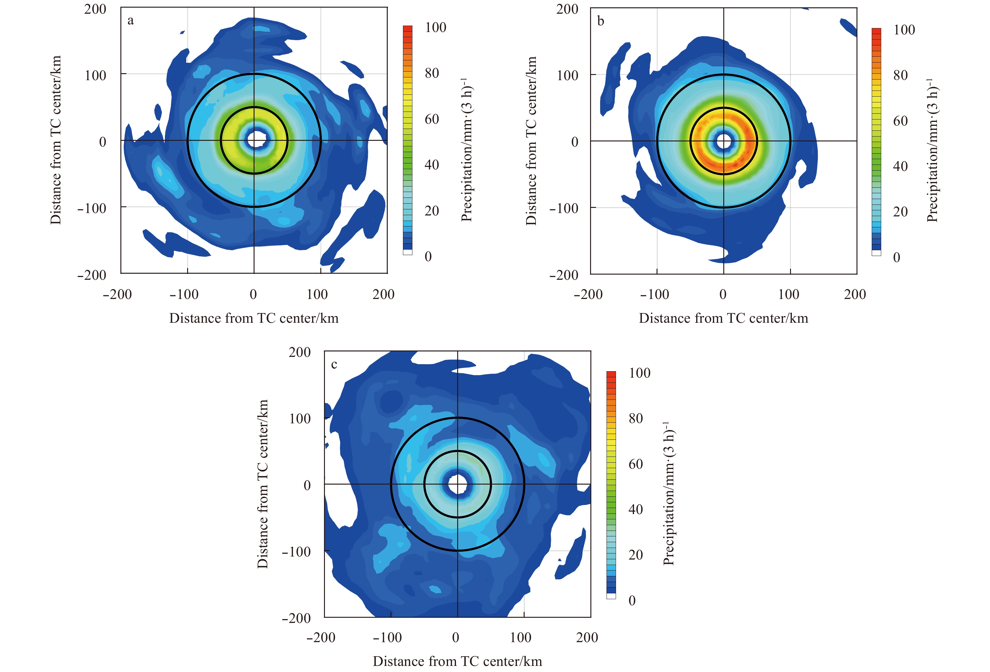
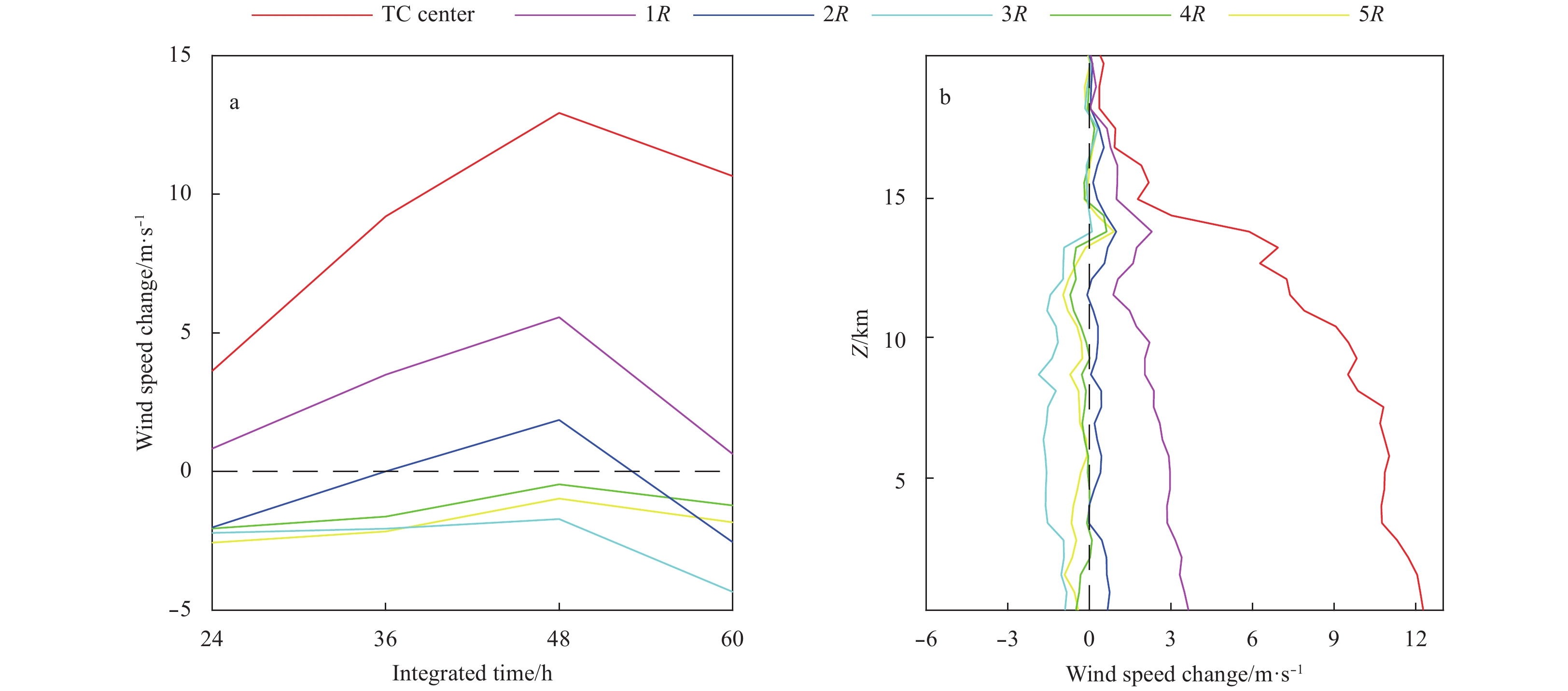
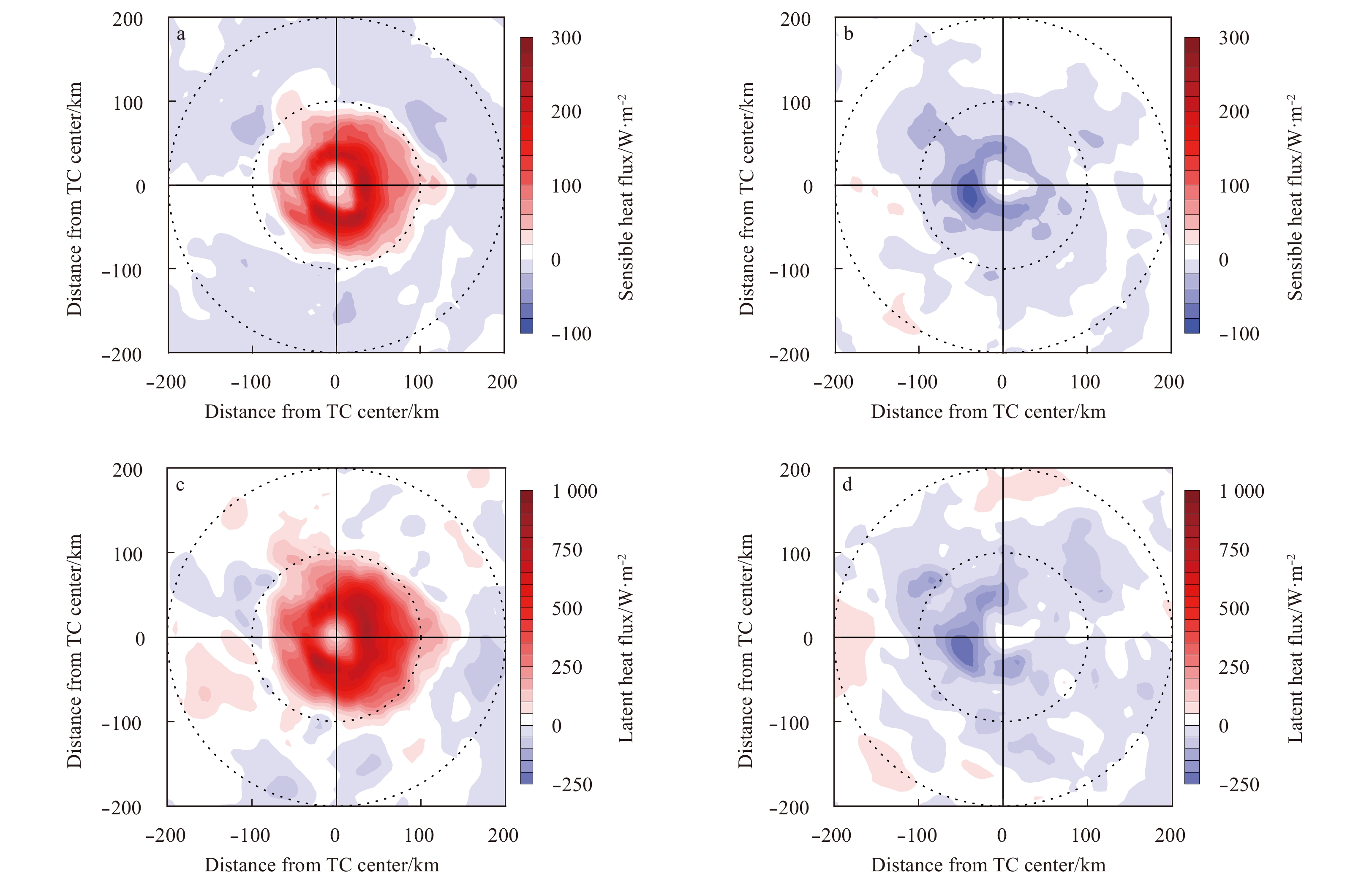
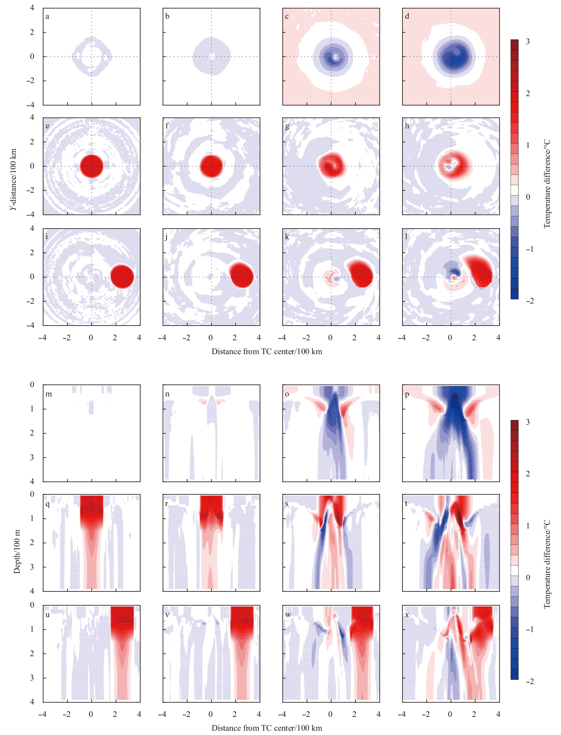
The spatial-temporal patterns of tropical cyclone (TC) intensity changes caused by the warm ocean mesoscale eddy (WOME) distribution are evaluated using two sets of idealized numerical experiments. The results show that the TC was intensified and wea...
The spatial-temporal patterns of tropical cyclone (TC) intensity changes caused by the warm ocean mesoscale eddy (WOME) distribution are evaluated using two sets of idealized numerical experiments. The results show that the TC was intensified and wea...


2020, 39(8): 14-23.
doi: 10.1007/s13131-020-1614-0
Abstract:
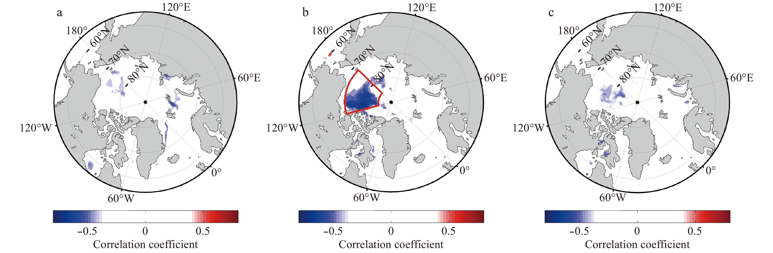
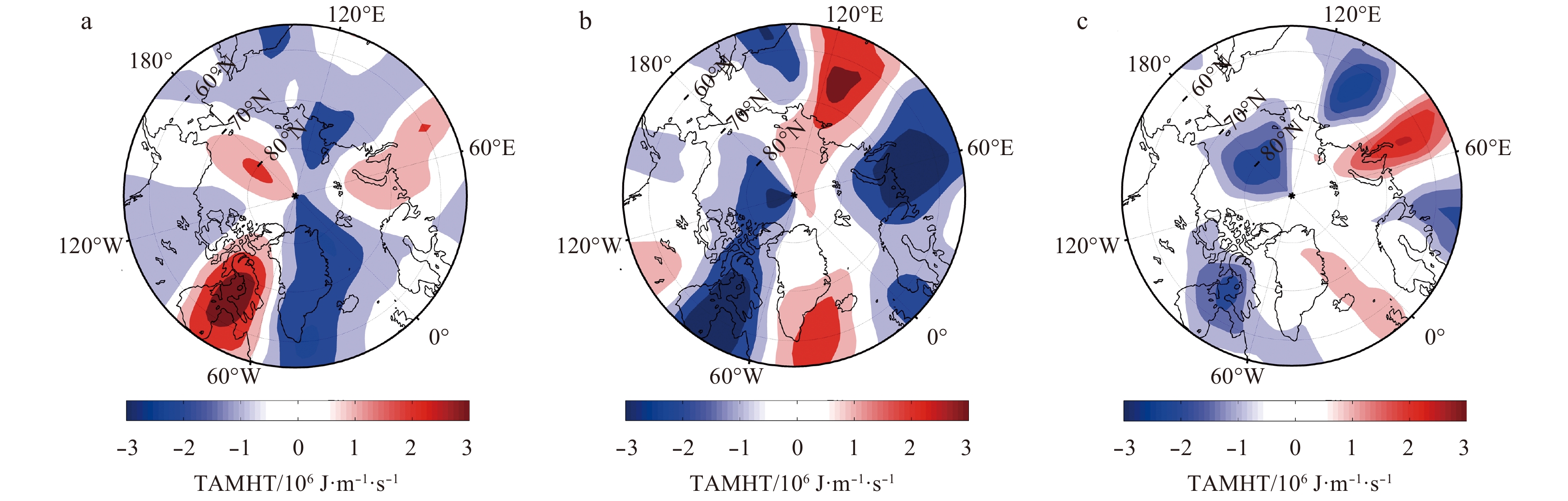
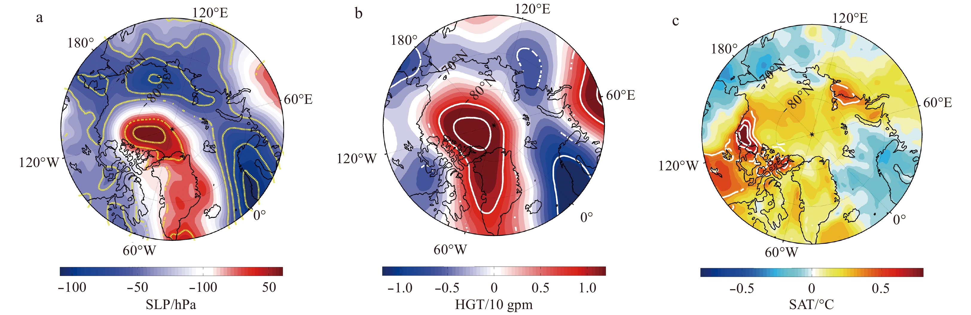
Based on the climatological reanalysis data of the European Center for Medium-Range Weather Forecasts and the Arctic sea ice data of the National Snow and Ice Data Center, the relationship between the Arctic sea ice area (SIA) and the interannual var...
Based on the climatological reanalysis data of the European Center for Medium-Range Weather Forecasts and the Arctic sea ice data of the National Snow and Ice Data Center, the relationship between the Arctic sea ice area (SIA) and the interannual var...


2020, 39(8): 24-33.
doi: 10.1007/s13131-020-1618-9
Abstract:
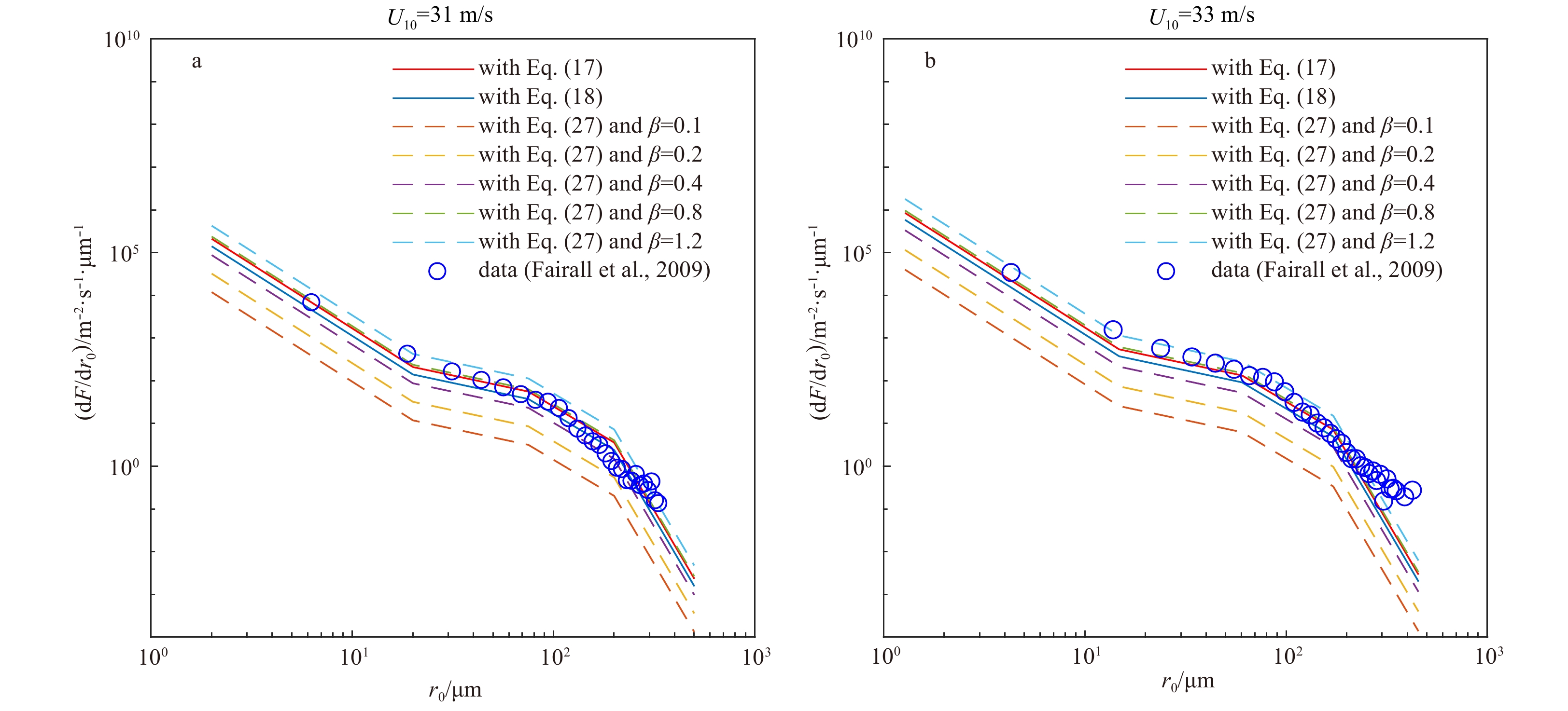
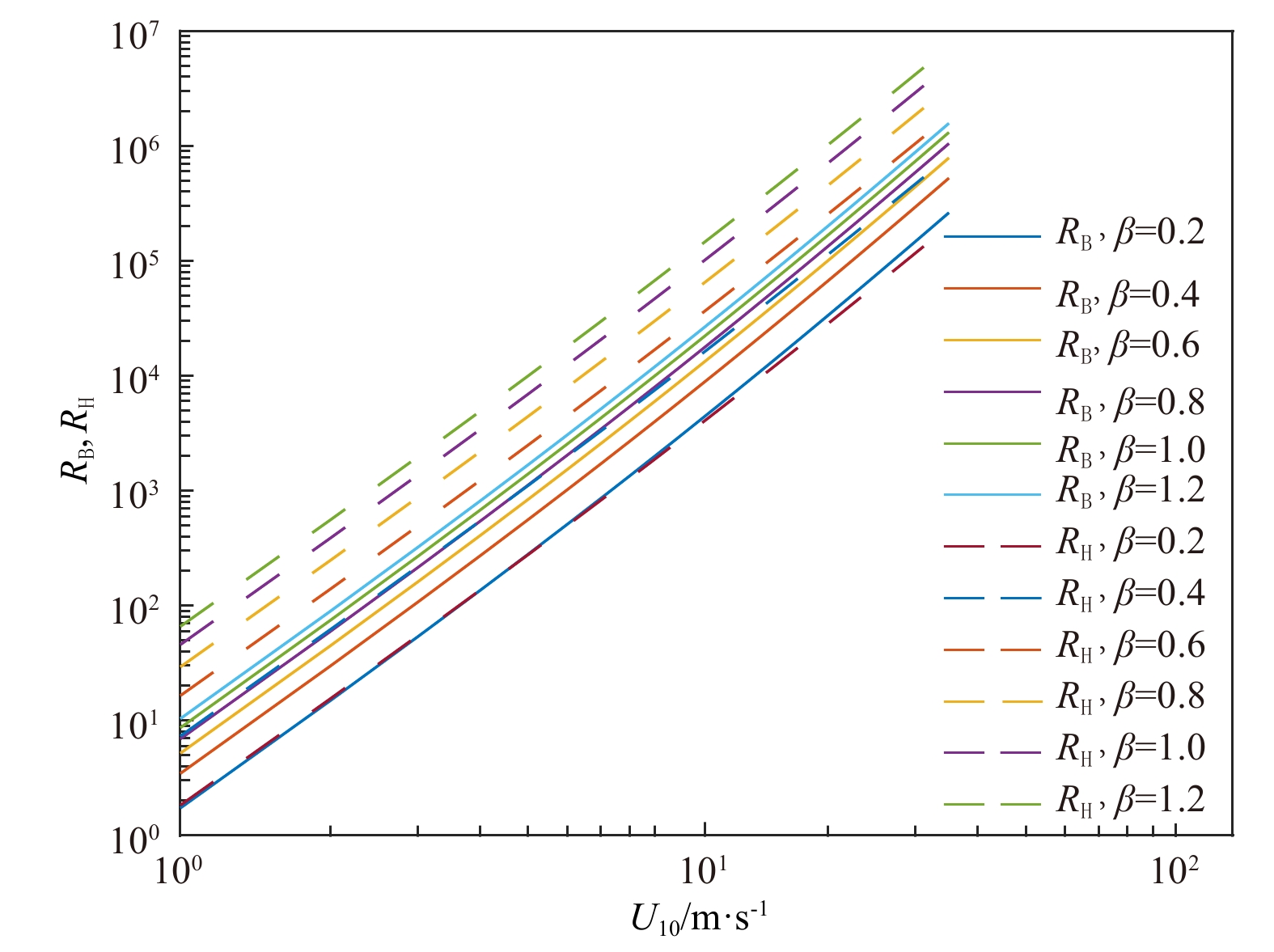
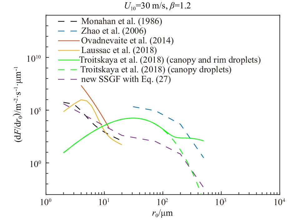
Sea spray droplets are produced by waves breaking on the sea surface, and they vary the transfer of energy between the atmosphere and ocean. The sea spray generation function (SSGF) is generally considered as a function of the initial radius of the s...
Sea spray droplets are produced by waves breaking on the sea surface, and they vary the transfer of energy between the atmosphere and ocean. The sea spray generation function (SSGF) is generally considered as a function of the initial radius of the s...


2020, 39(8): 34-42.
doi: 10.1007/s13131-020-1616-y
Abstract:
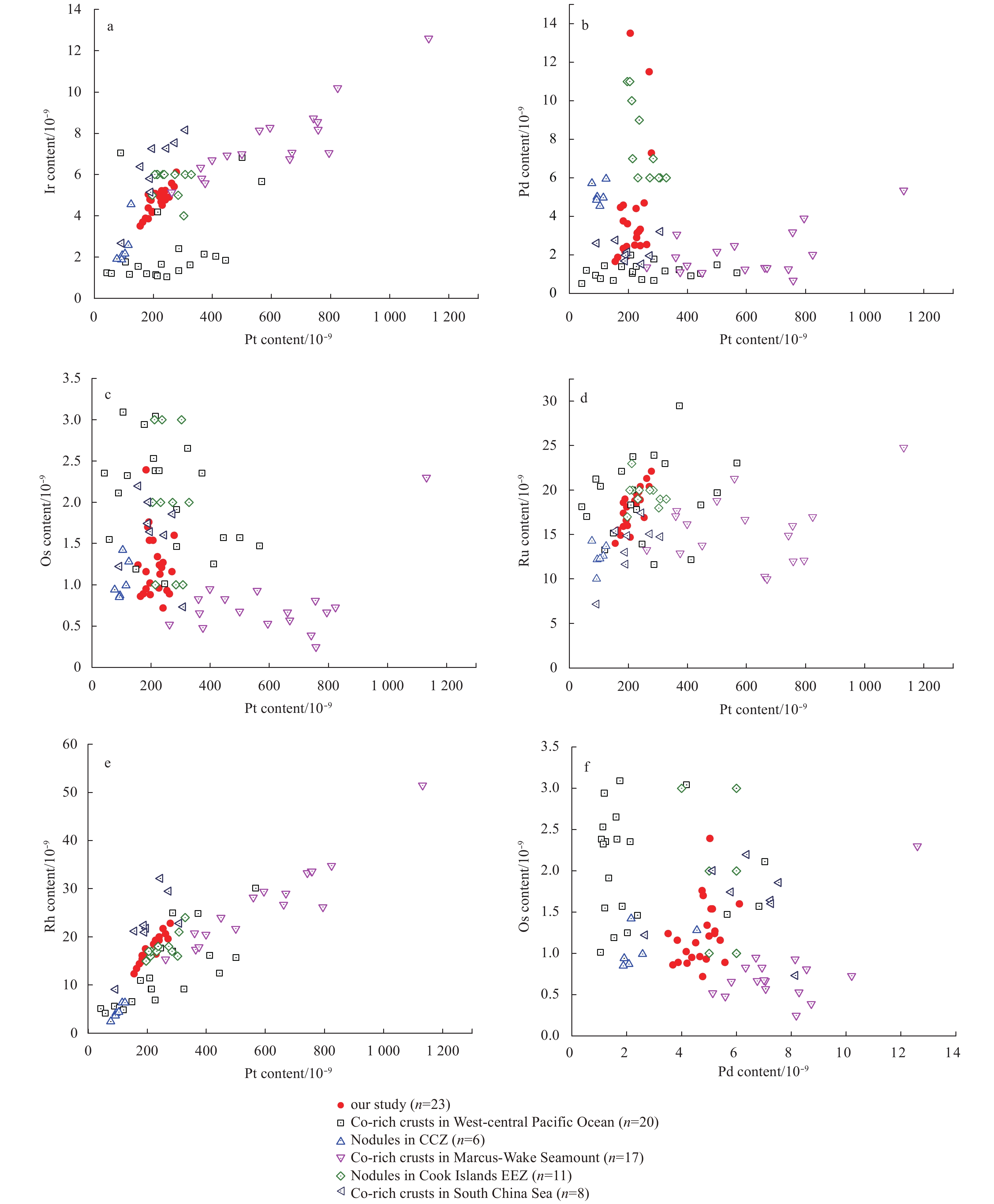
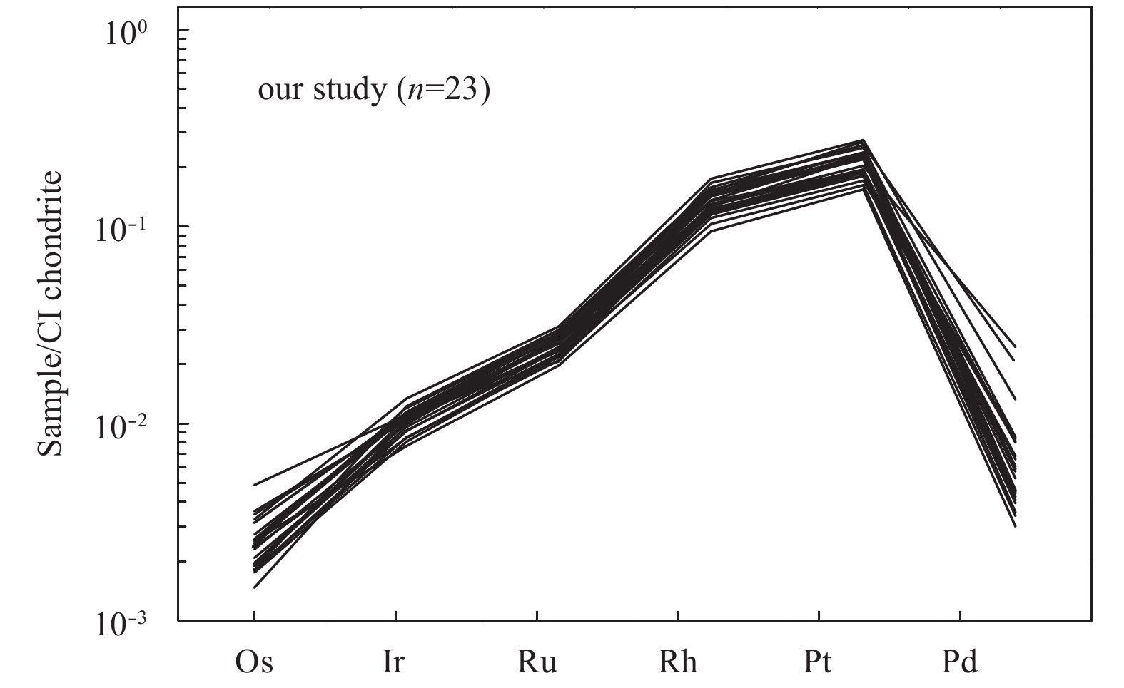
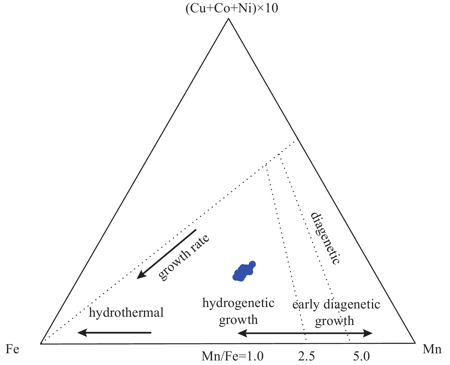
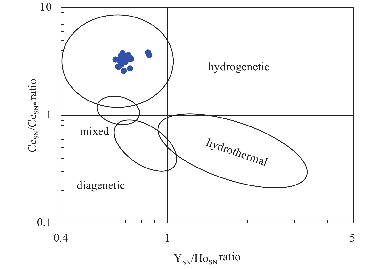
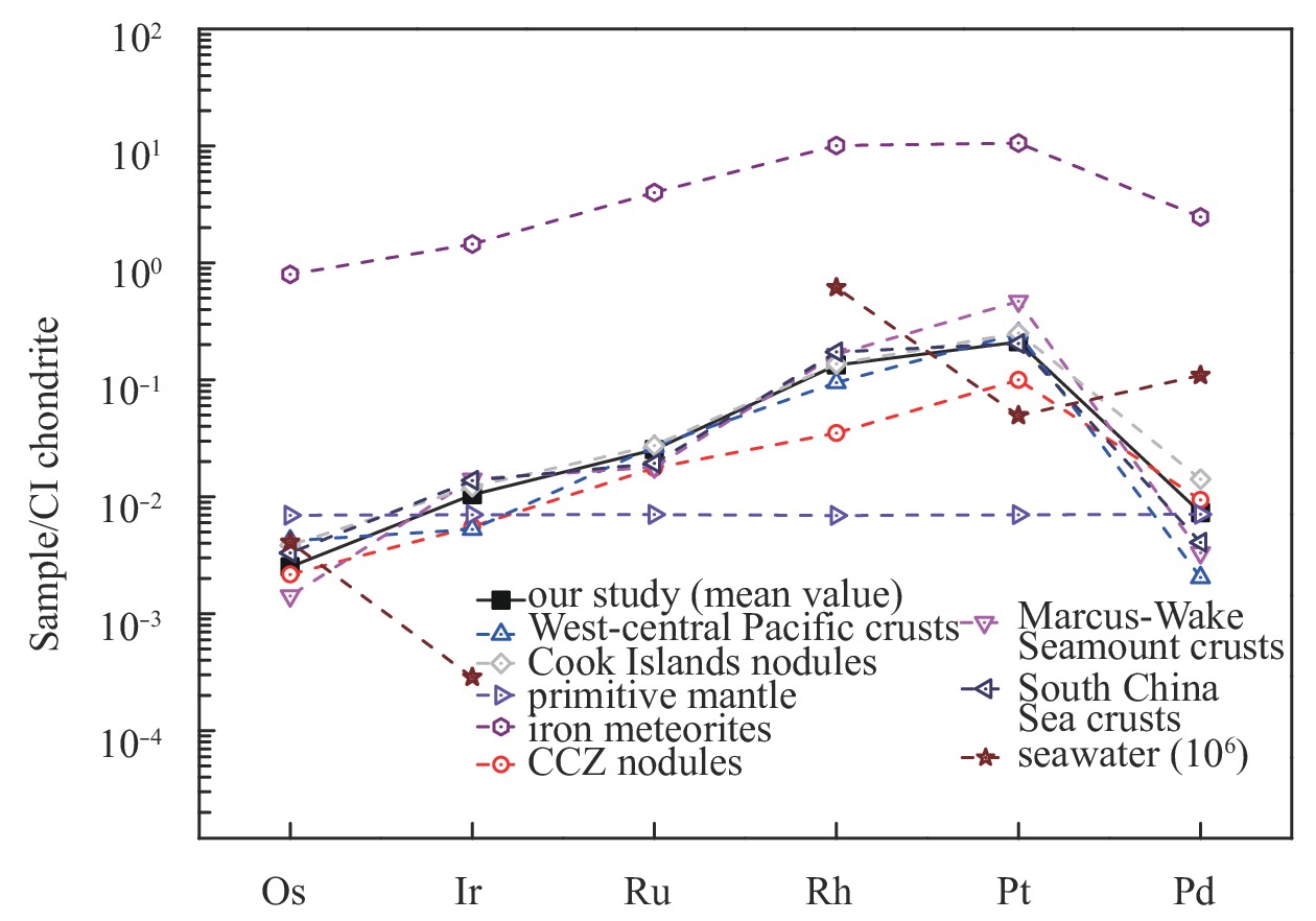
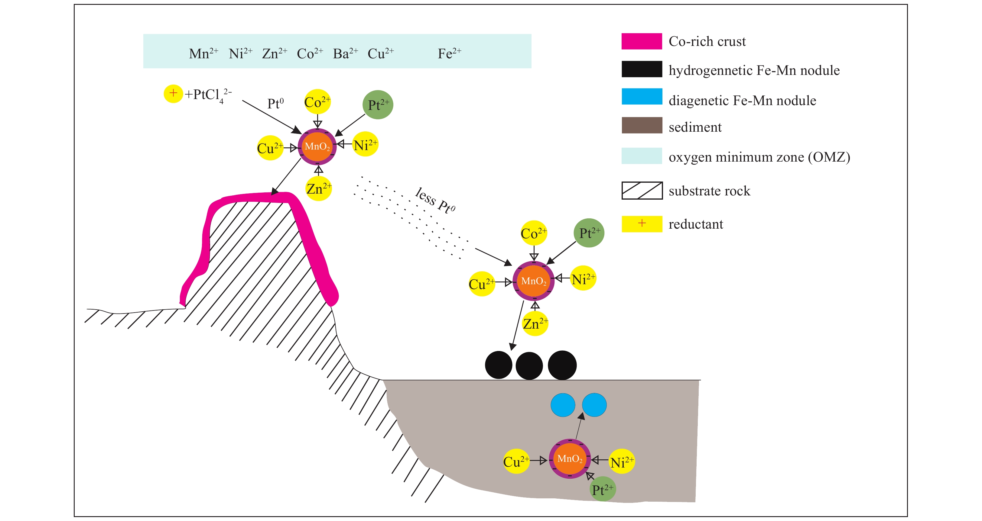
Polymetallic nodules and cobalt (Co)-rich crusts are enriched in platinum-group elements (PGEs), especially platinum (Pt) and may be important sinks of PGEs. At present, little information is available on PGEs in polymetallic nodules, and their geoch...
Polymetallic nodules and cobalt (Co)-rich crusts are enriched in platinum-group elements (PGEs), especially platinum (Pt) and may be important sinks of PGEs. At present, little information is available on PGEs in polymetallic nodules, and their geoch...


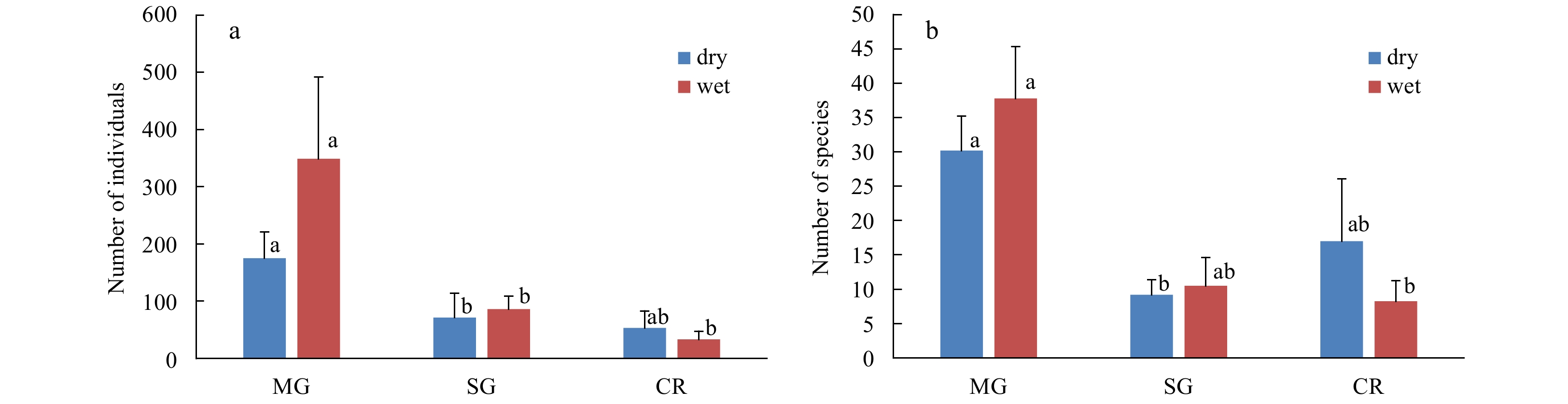
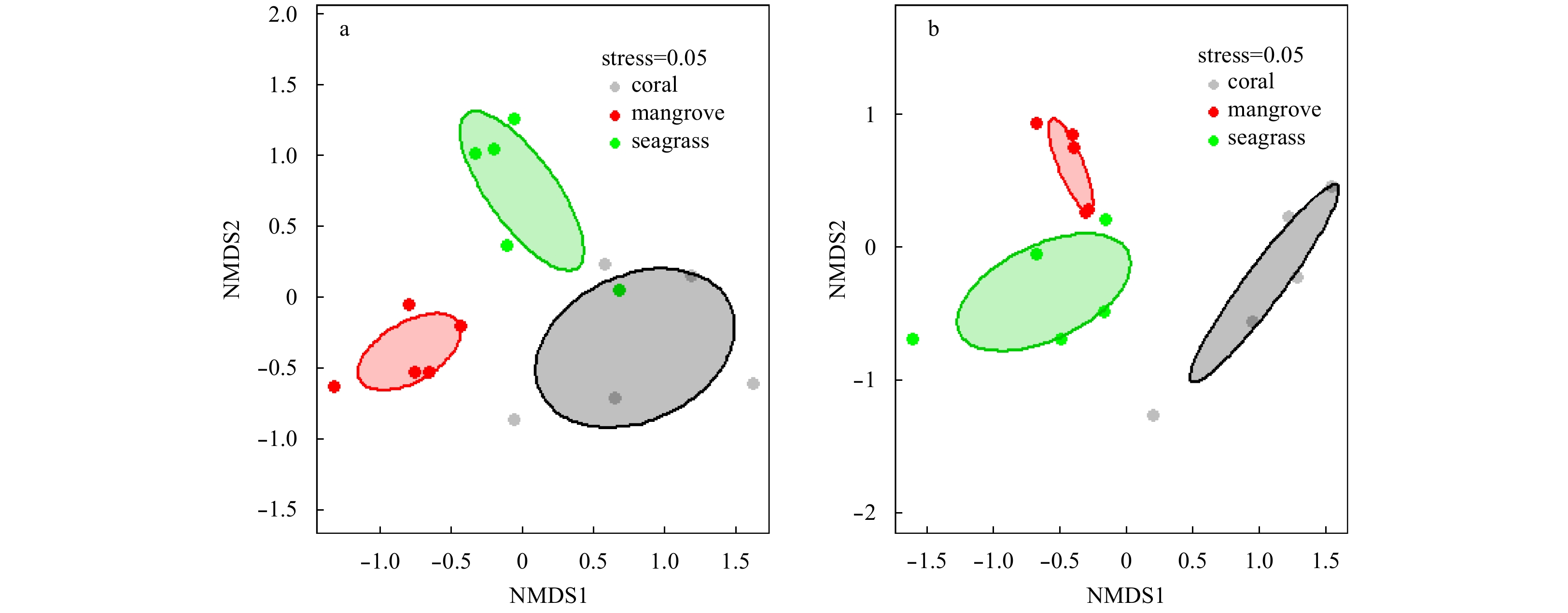
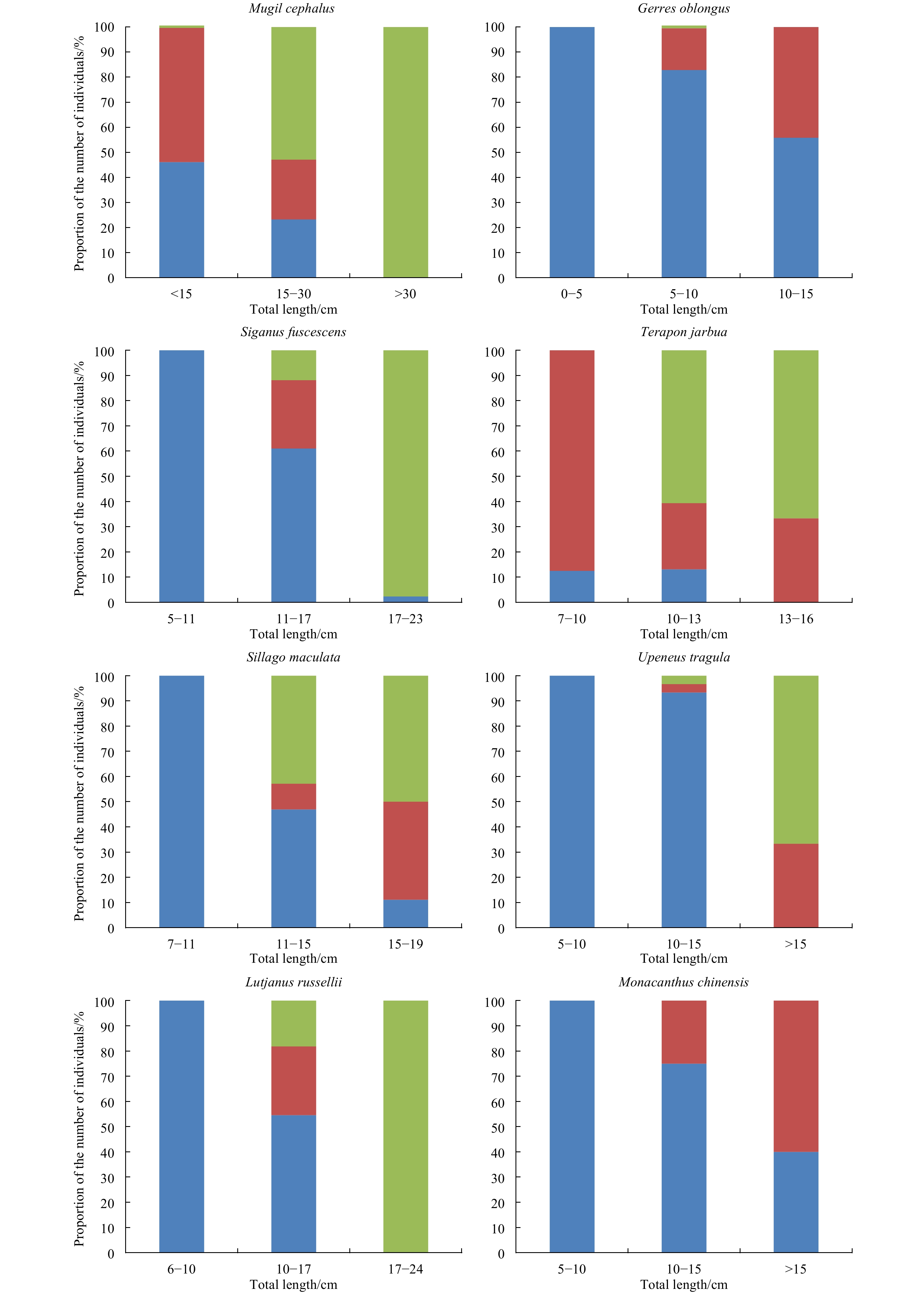
Connectivity of fish assemblages along the mangrove-seagrass-coral reef continuum in Wenchang, China
2020, 39(8): 43-52.
doi: 10.1007/s13131-019-1490-7
Abstract:
Understanding the connectivity of fish among different typical habitats is important for conducting ecosystem-based management, particularly when designing marine protected areas (MPA) or setting MPA networks. To clarify of connectivity among mangrov...
Understanding the connectivity of fish among different typical habitats is important for conducting ecosystem-based management, particularly when designing marine protected areas (MPA) or setting MPA networks. To clarify of connectivity among mangrov...


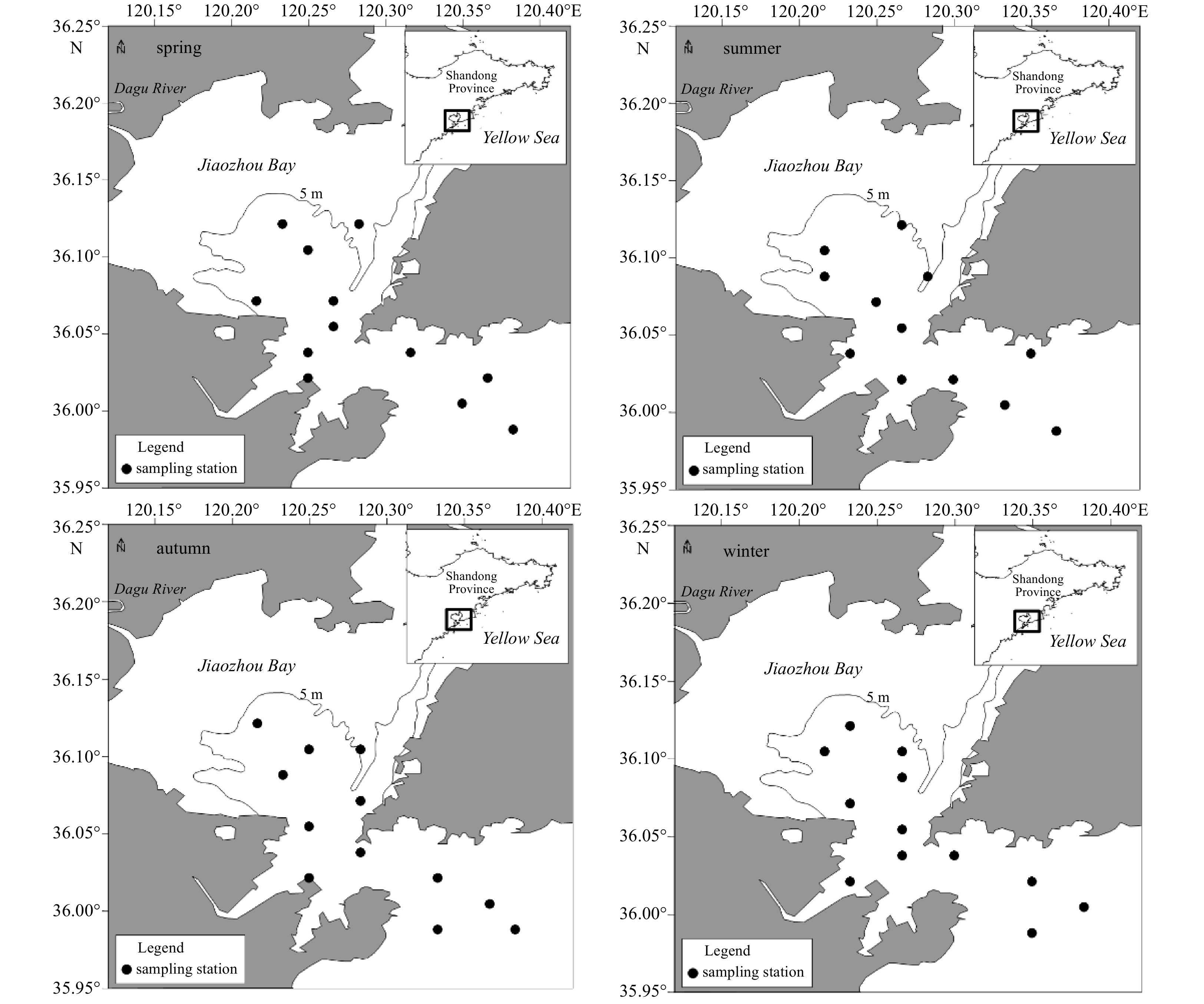
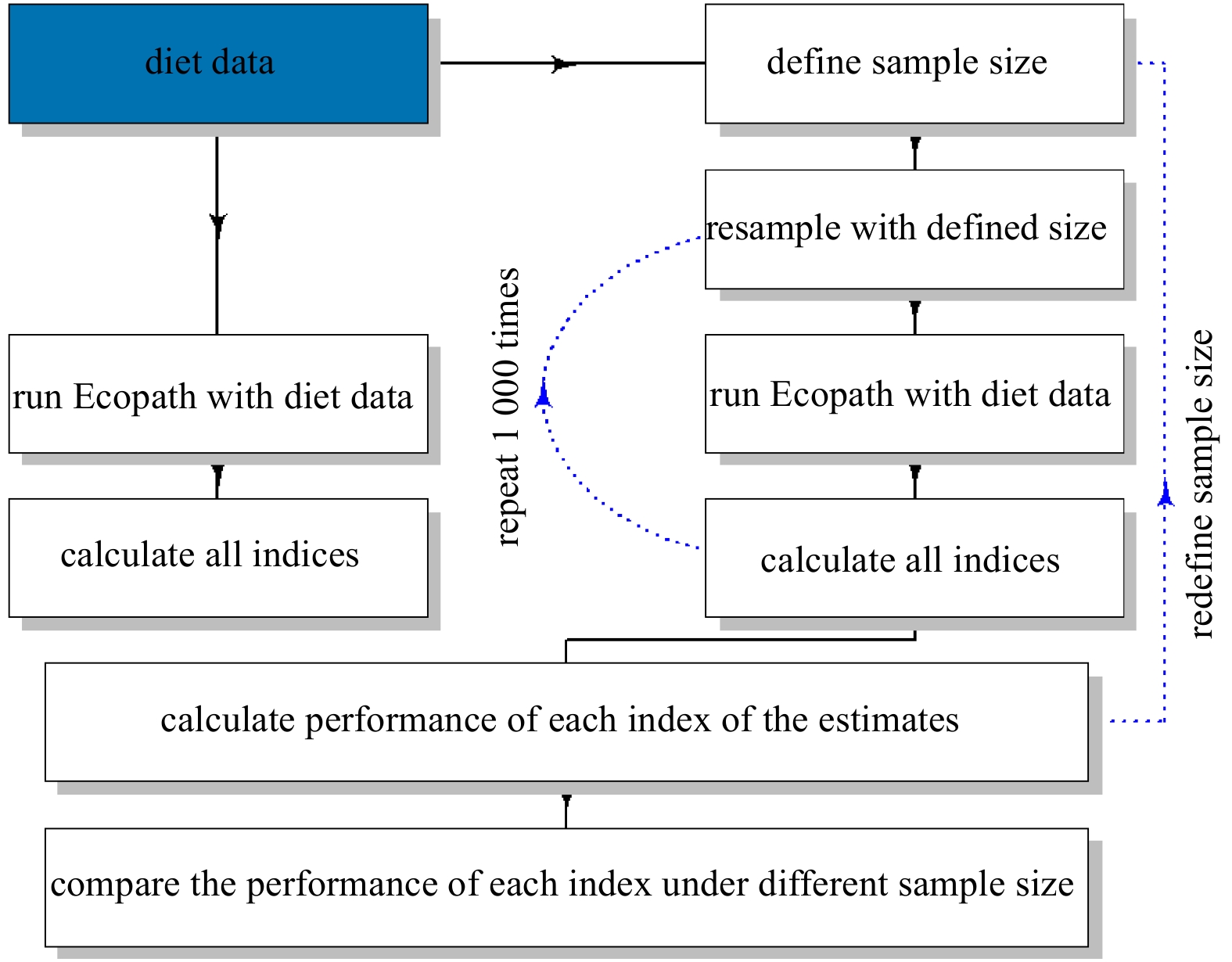
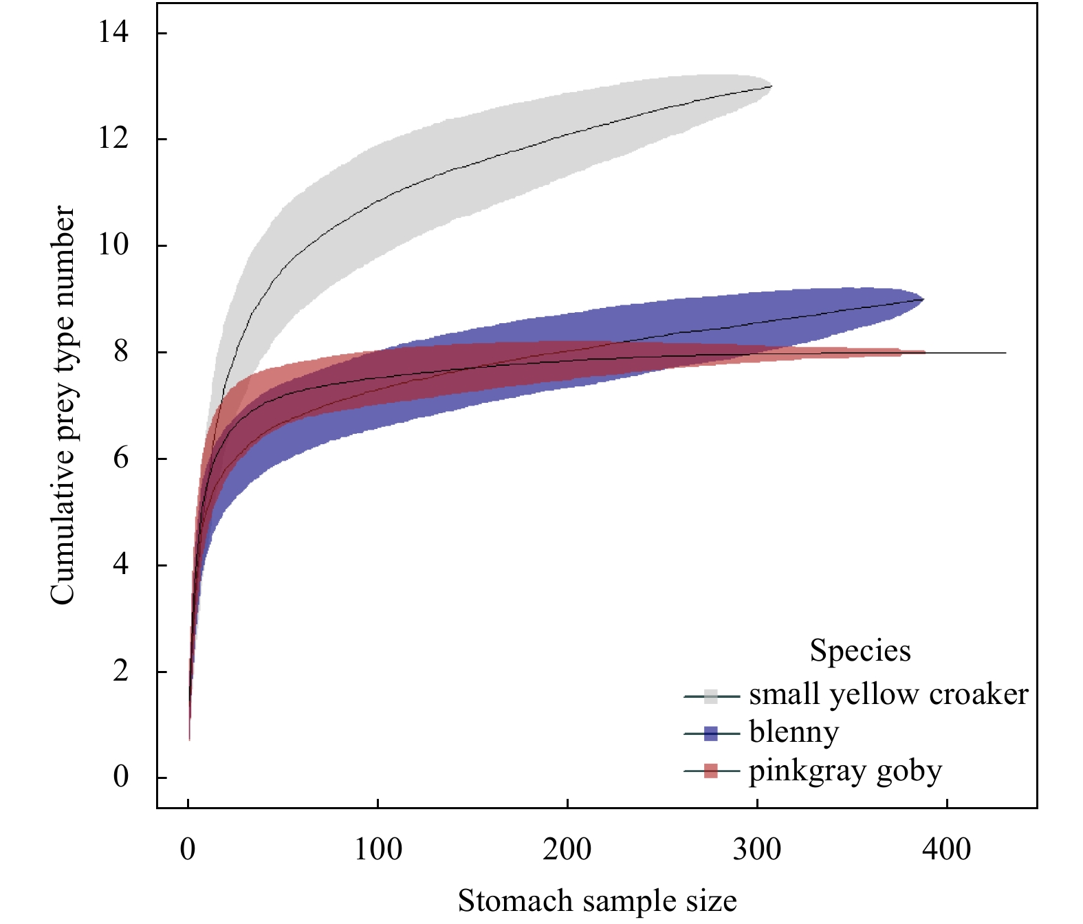
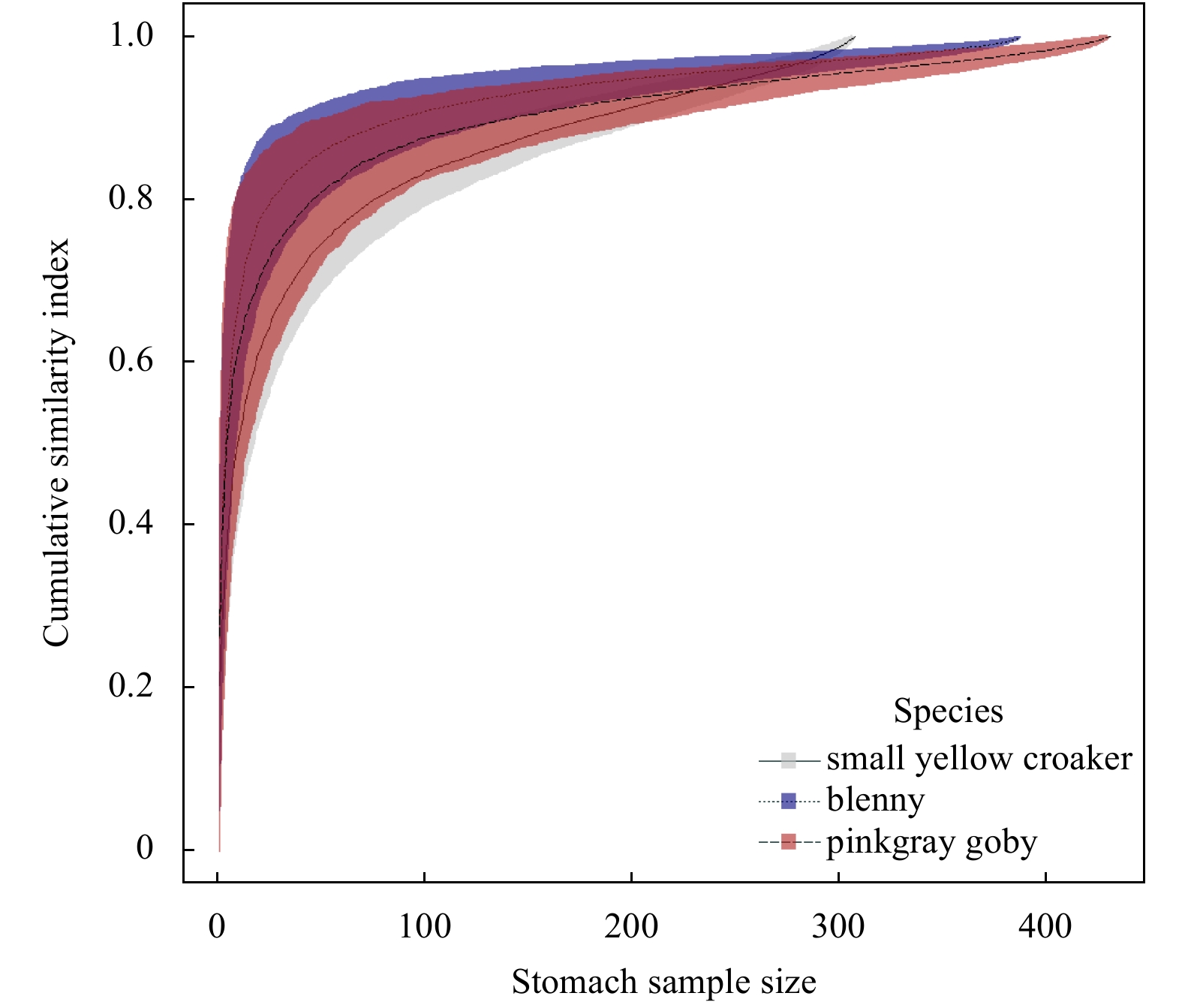
2020, 39(8): 53-61.
doi: 10.1007/s13131-020-1633-x
Abstract:
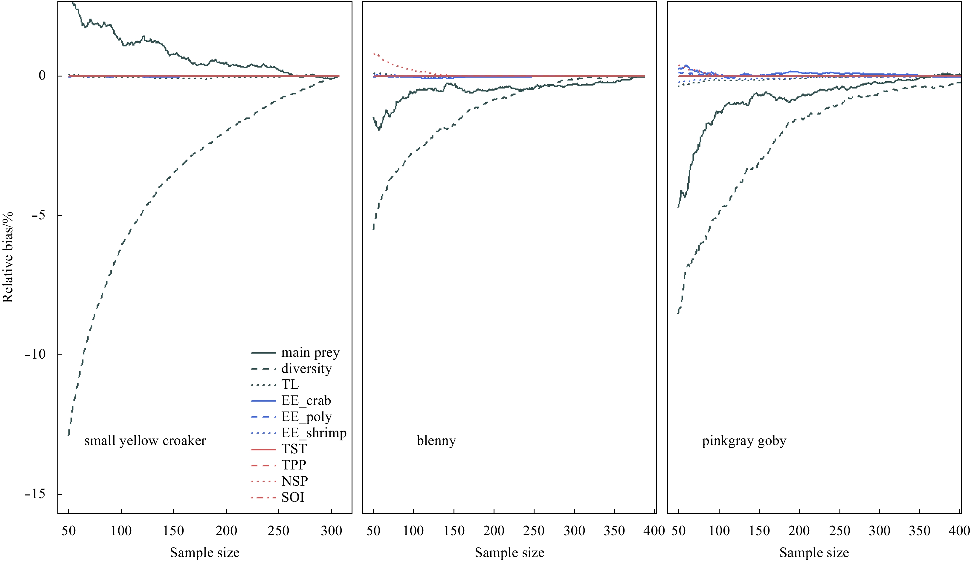
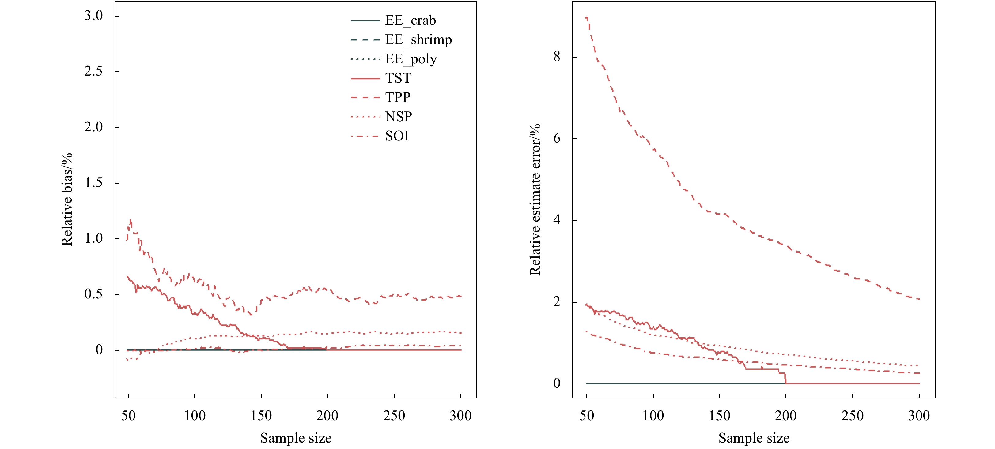
This study used Ecopath model of the Jiaozhou Bay as an example to evaluate the effect of stomach sample size of three fish species on the projection of this model. The derived ecosystem indices were classified into three categories: (1) direct indic...
This study used Ecopath model of the Jiaozhou Bay as an example to evaluate the effect of stomach sample size of three fish species on the projection of this model. The derived ecosystem indices were classified into three categories: (1) direct indic...


2020, 39(8): 62-70.
doi: 10.1007/s13131-020-1634-9
Abstract:
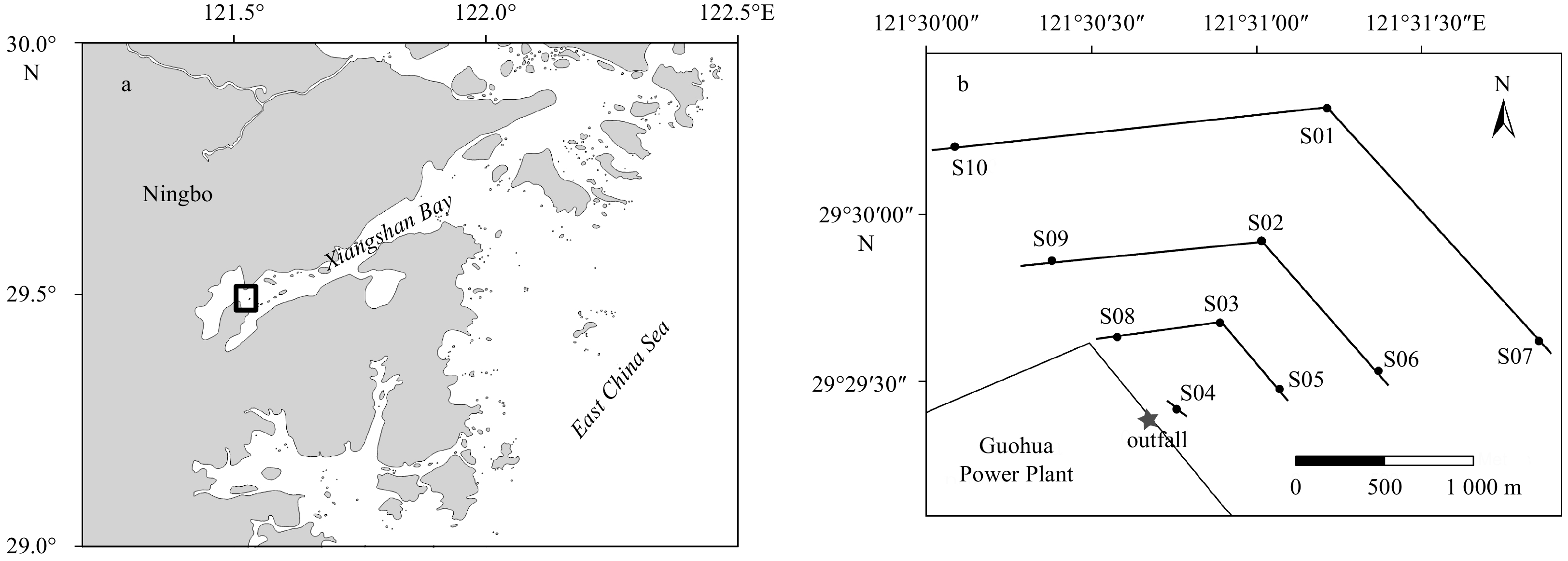
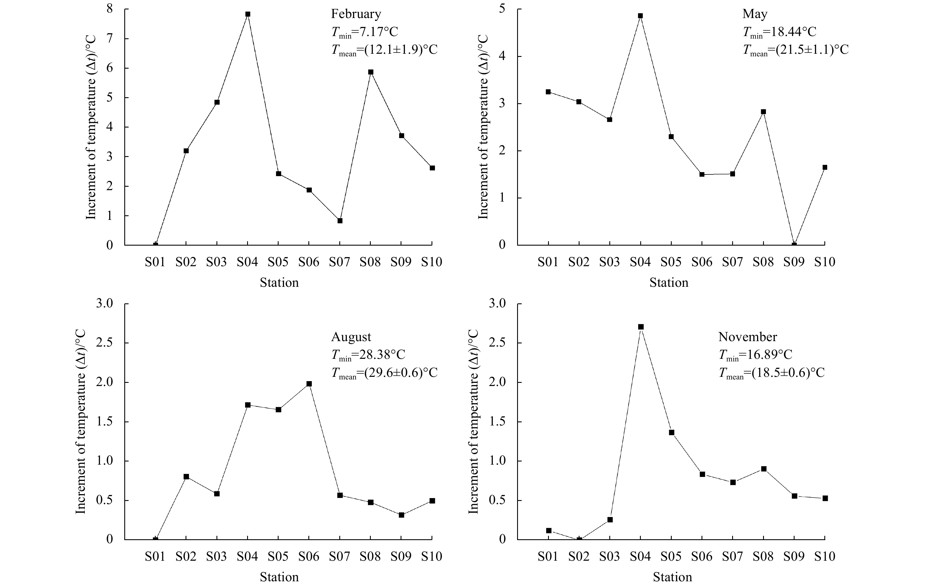
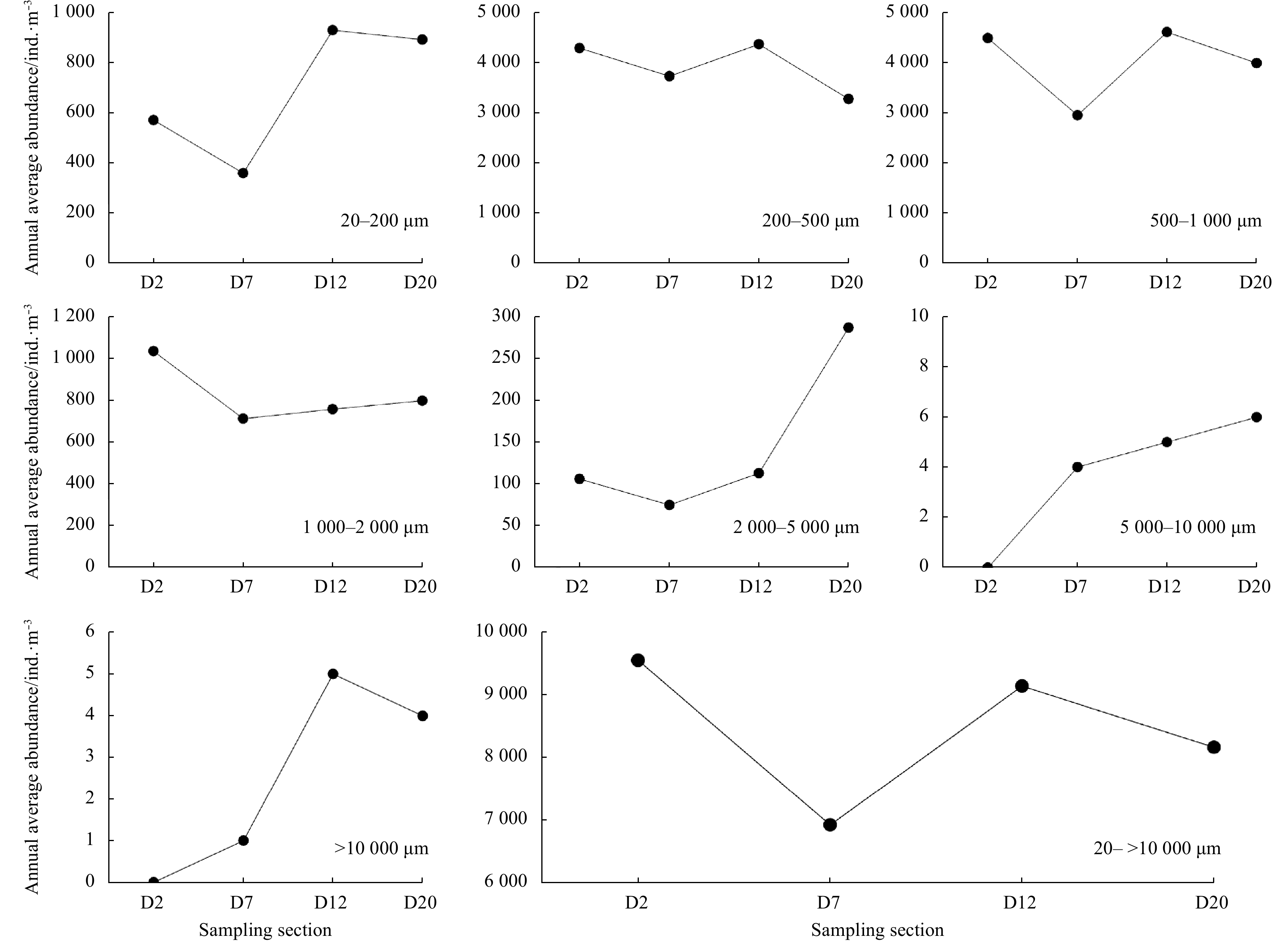
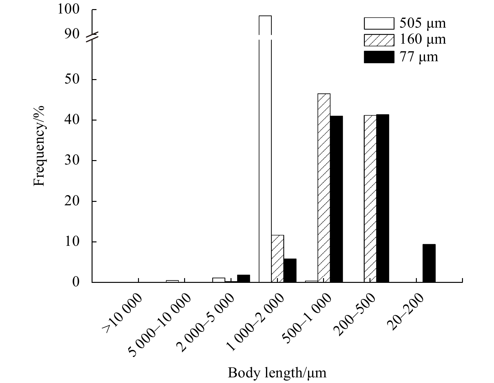
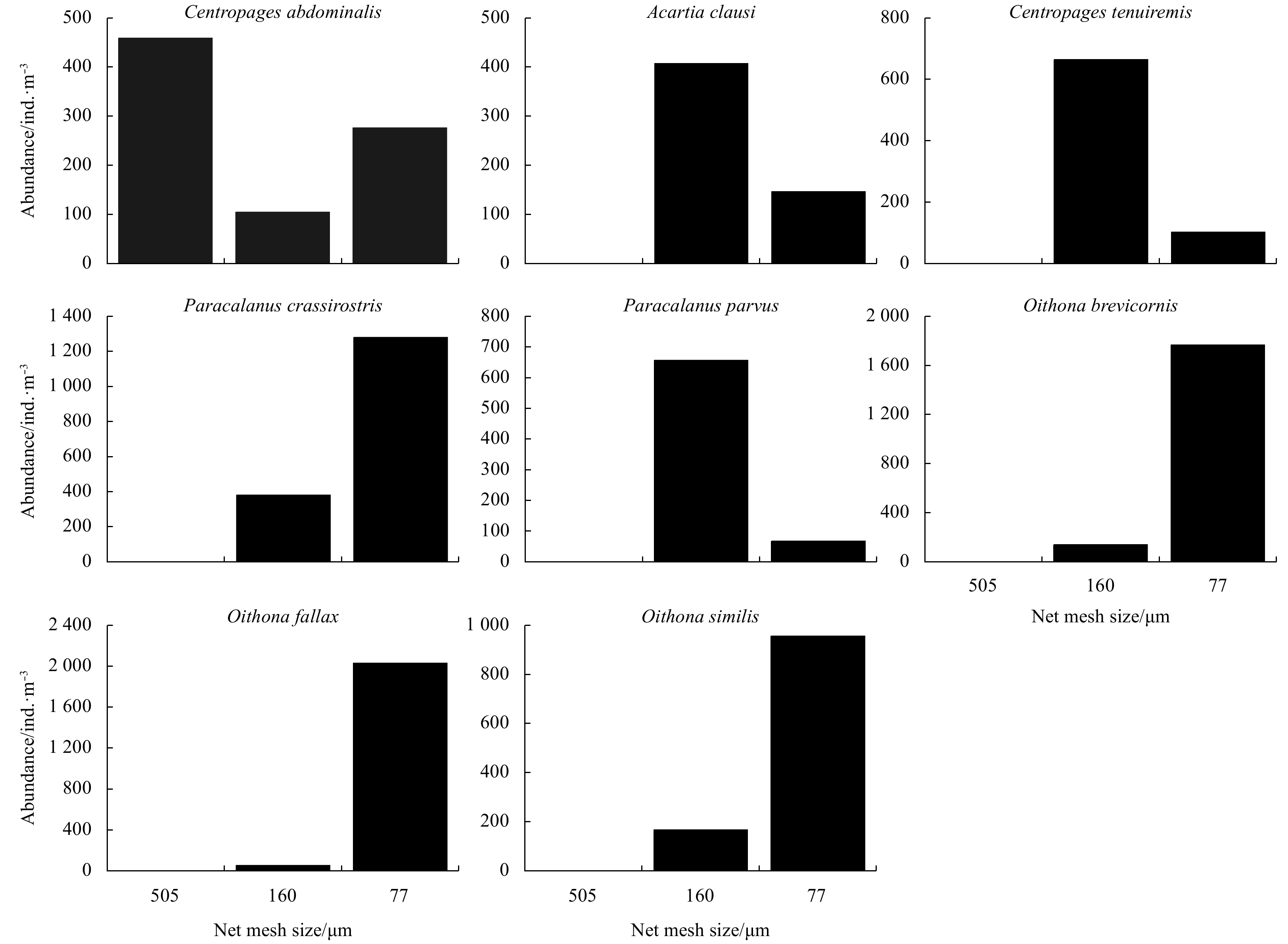
Zooplankton samples were collected using 505, 160 and 77 μm mesh nets around a power plant during four seasons in 2011. We measured total length of zooplankton and divided zooplankton into seven size classes in order to explore how zooplankton commun...
Zooplankton samples were collected using 505, 160 and 77 μm mesh nets around a power plant during four seasons in 2011. We measured total length of zooplankton and divided zooplankton into seven size classes in order to explore how zooplankton commun...
2020, 39(8): 71-78.
doi: 10.1007/s13131-020-1636-7
Abstract:
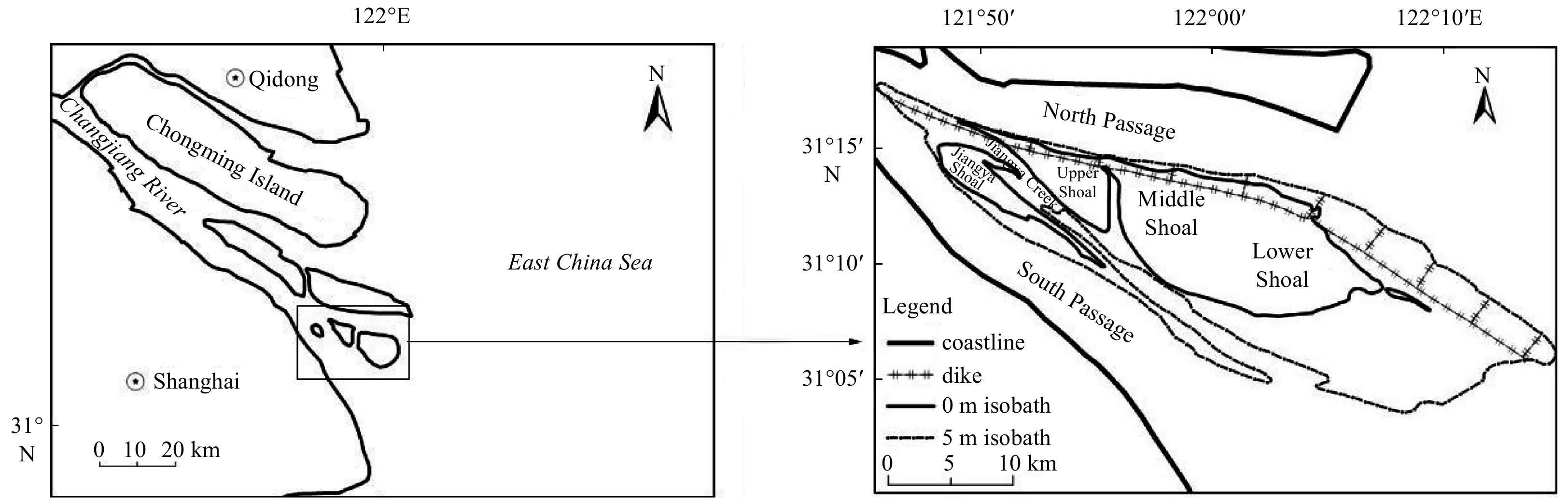
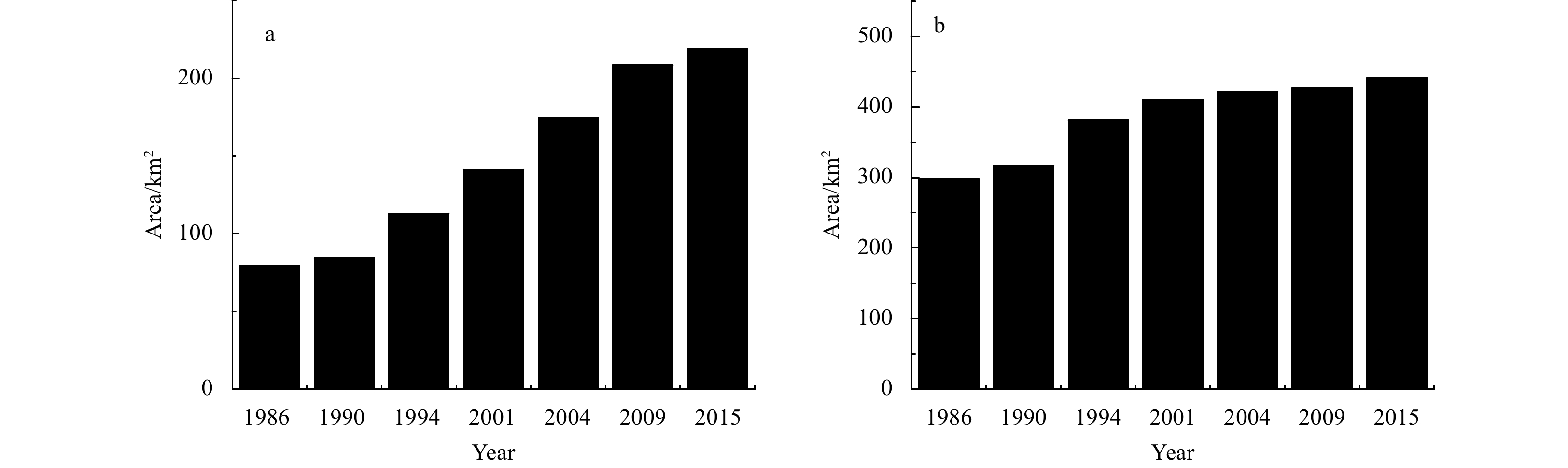
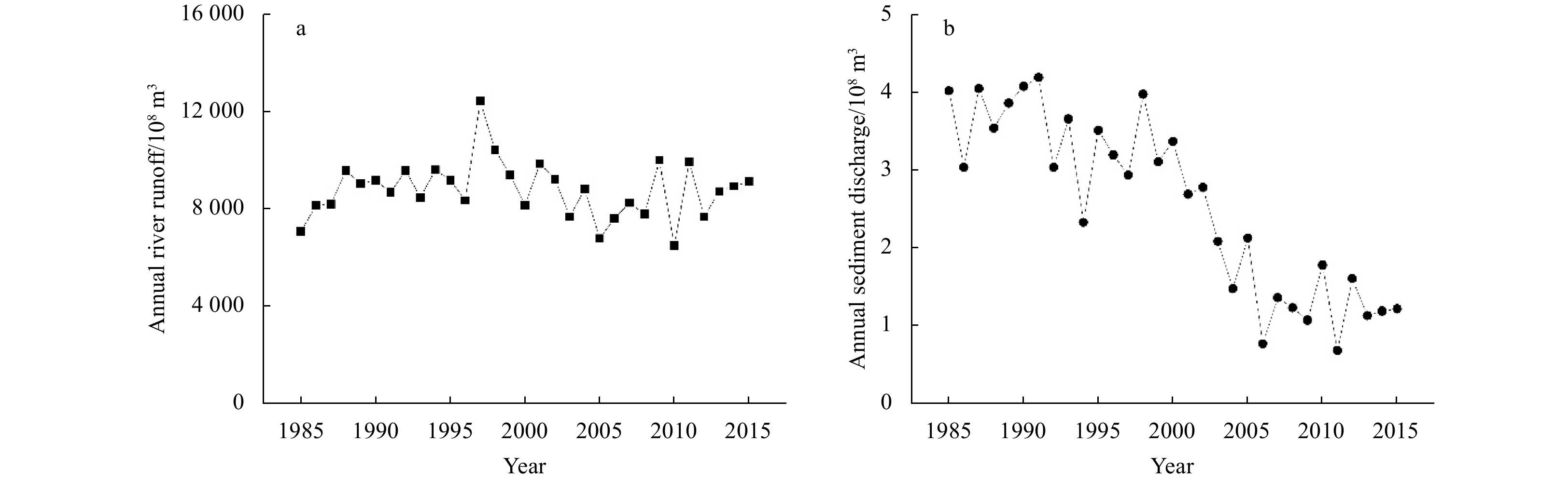
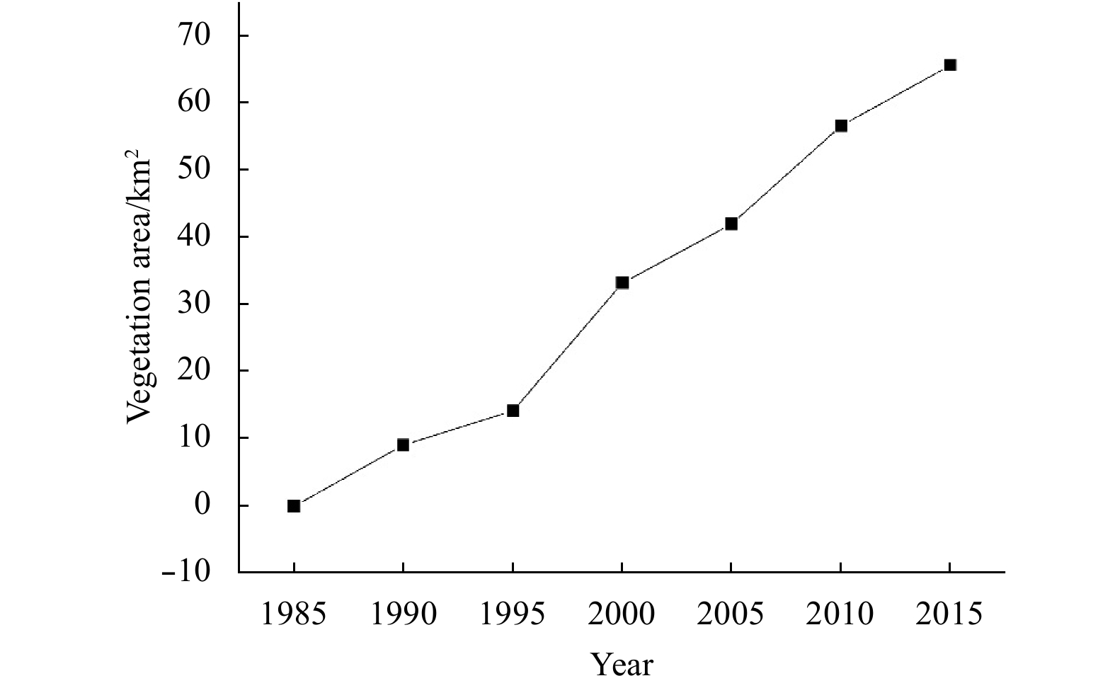
The evolution of the shoals and vegetation plays an important role in maintaining the stability of the river regime and the estuarine ecosystem. However, the interaction between the evolution of shoals and vegetation dynamic has rarely been reported....
The evolution of the shoals and vegetation plays an important role in maintaining the stability of the river regime and the estuarine ecosystem. However, the interaction between the evolution of shoals and vegetation dynamic has rarely been reported....


2020, 39(8): 79-87.
doi: 10.1007/s13131-020-1608-y
Abstract:
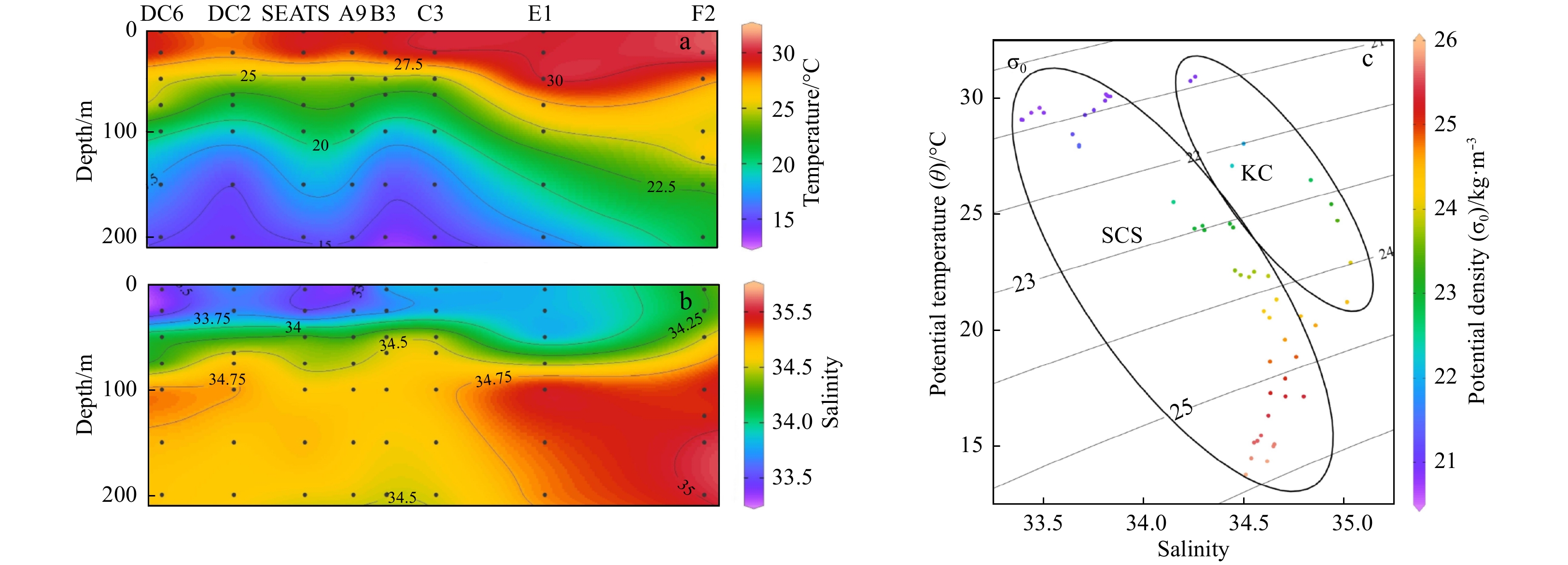
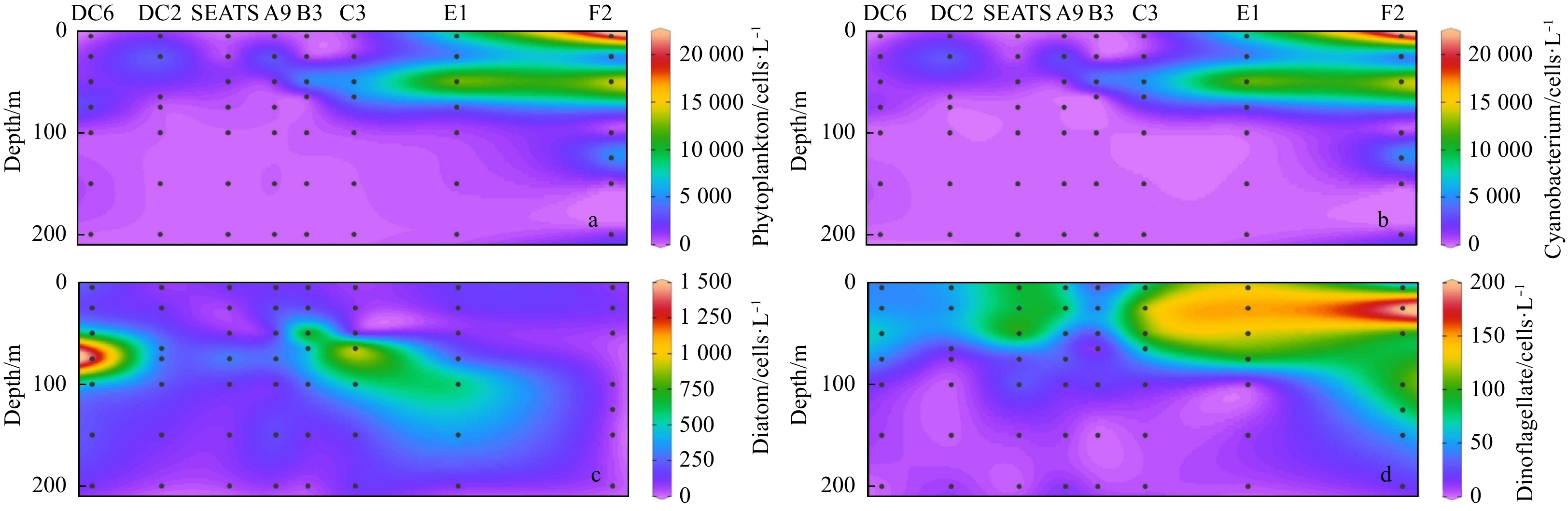
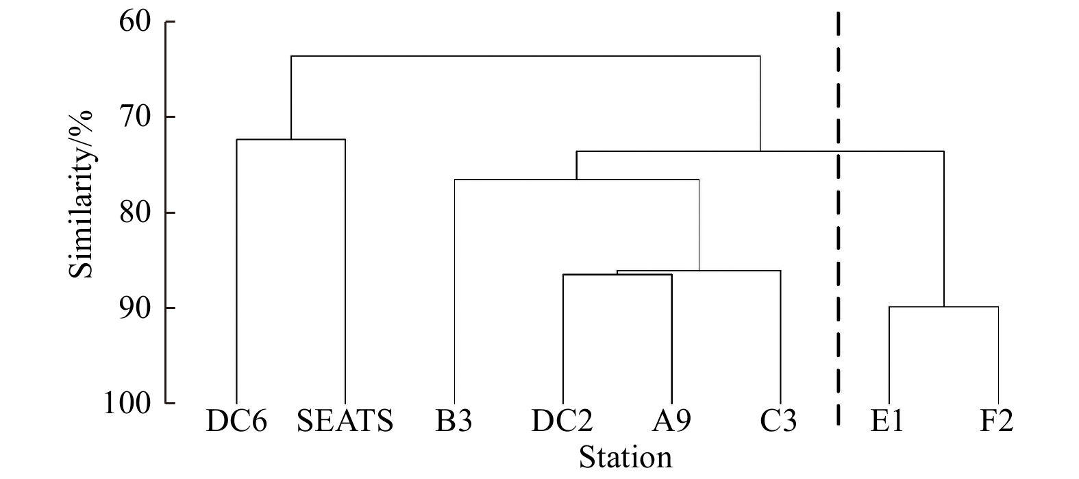
To further understand the effect of Kuroshio intrusion on phytoplankton community structure in the northeastern South China Sea (NSCS, 14°–23°N, 114°–124°E), one targeted cruise was carried out from July to August, 2017. A total of 79 genera and 287 ...
To further understand the effect of Kuroshio intrusion on phytoplankton community structure in the northeastern South China Sea (NSCS, 14°–23°N, 114°–124°E), one targeted cruise was carried out from July to August, 2017. A total of 79 genera and 287 ...


2020, 39(8): 88-95.
doi: 10.1007/s13131-020-1637-6
Abstract:
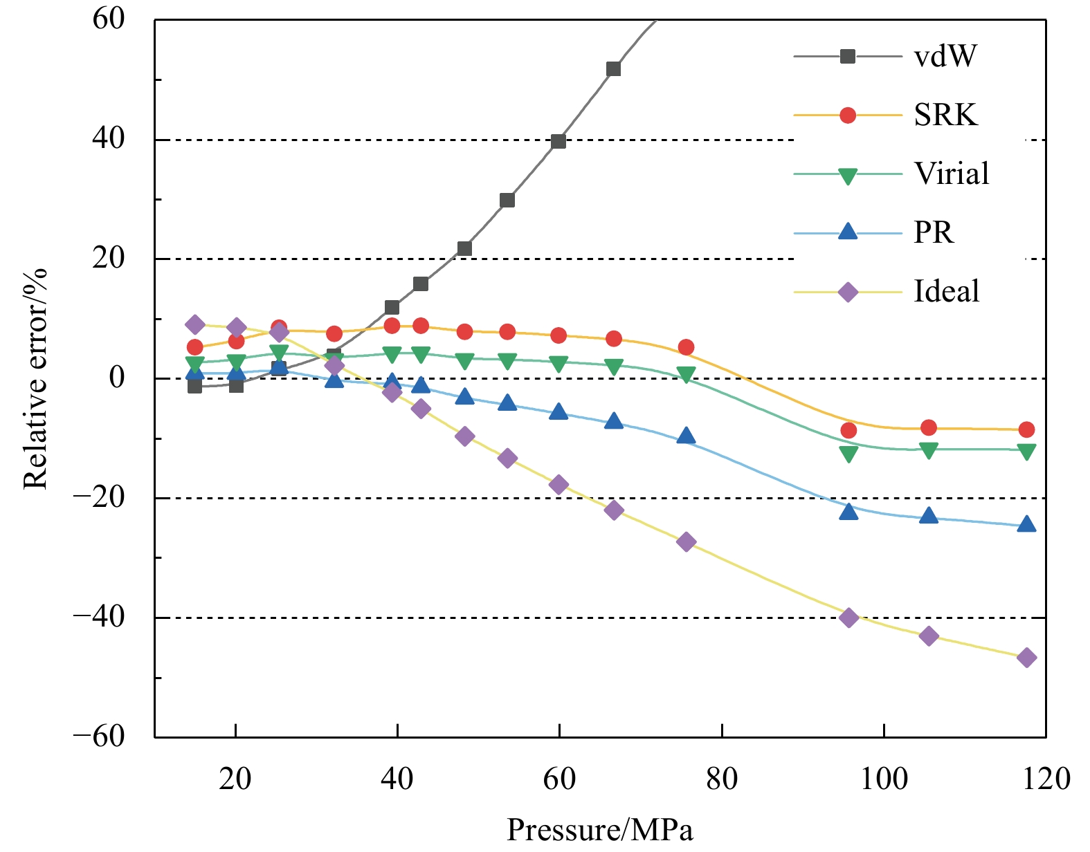
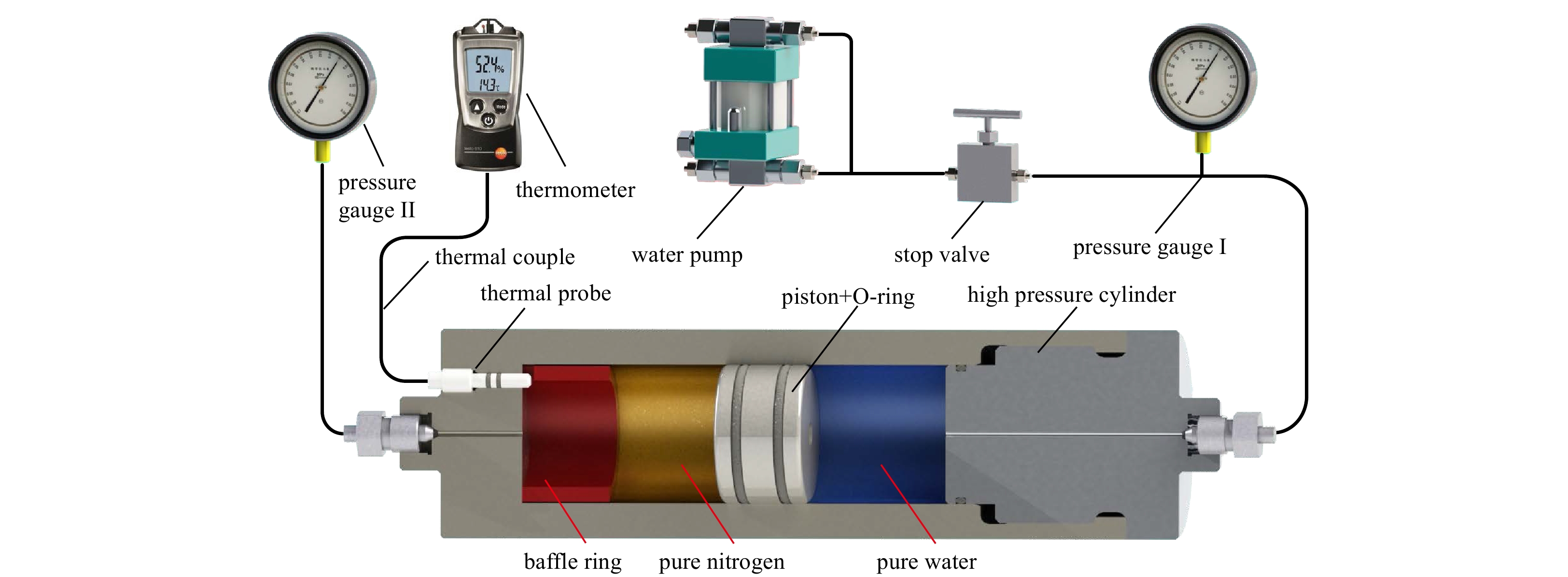
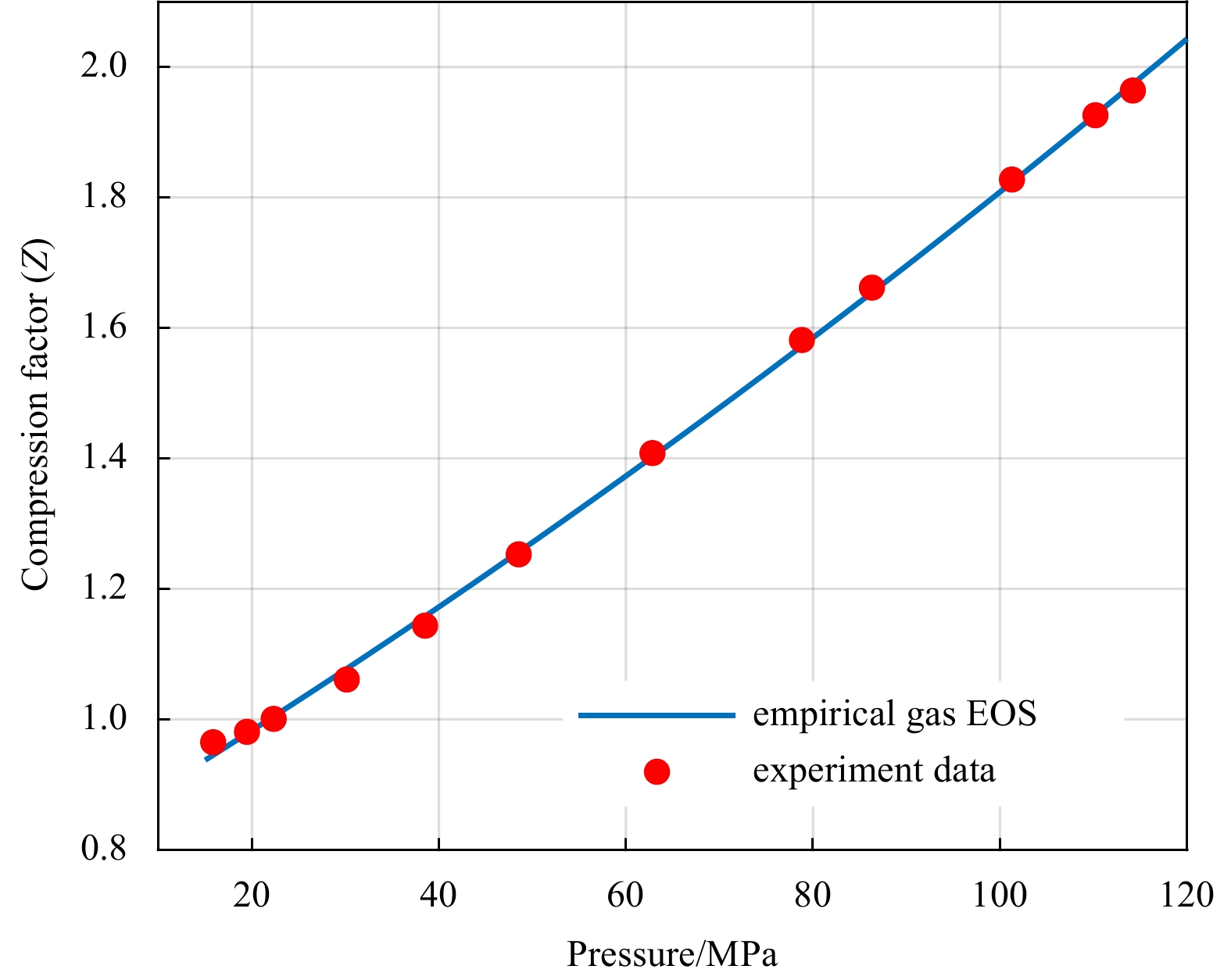
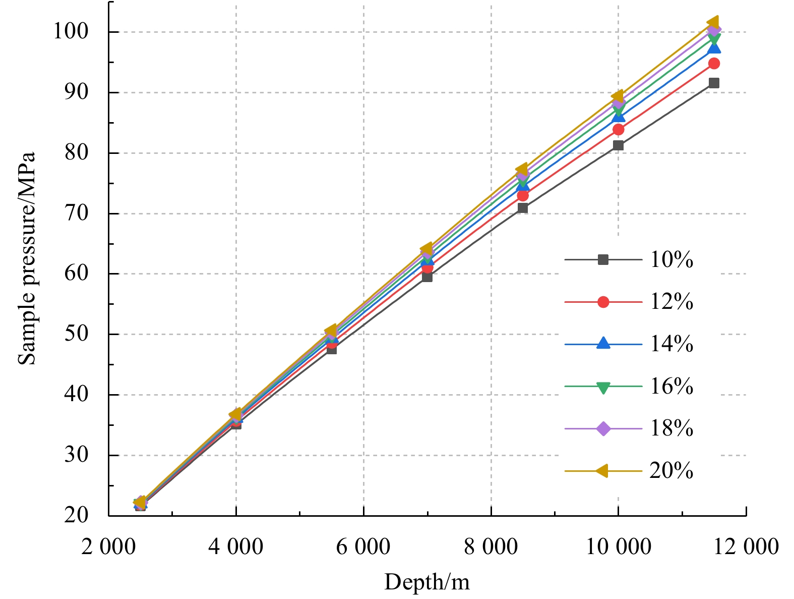
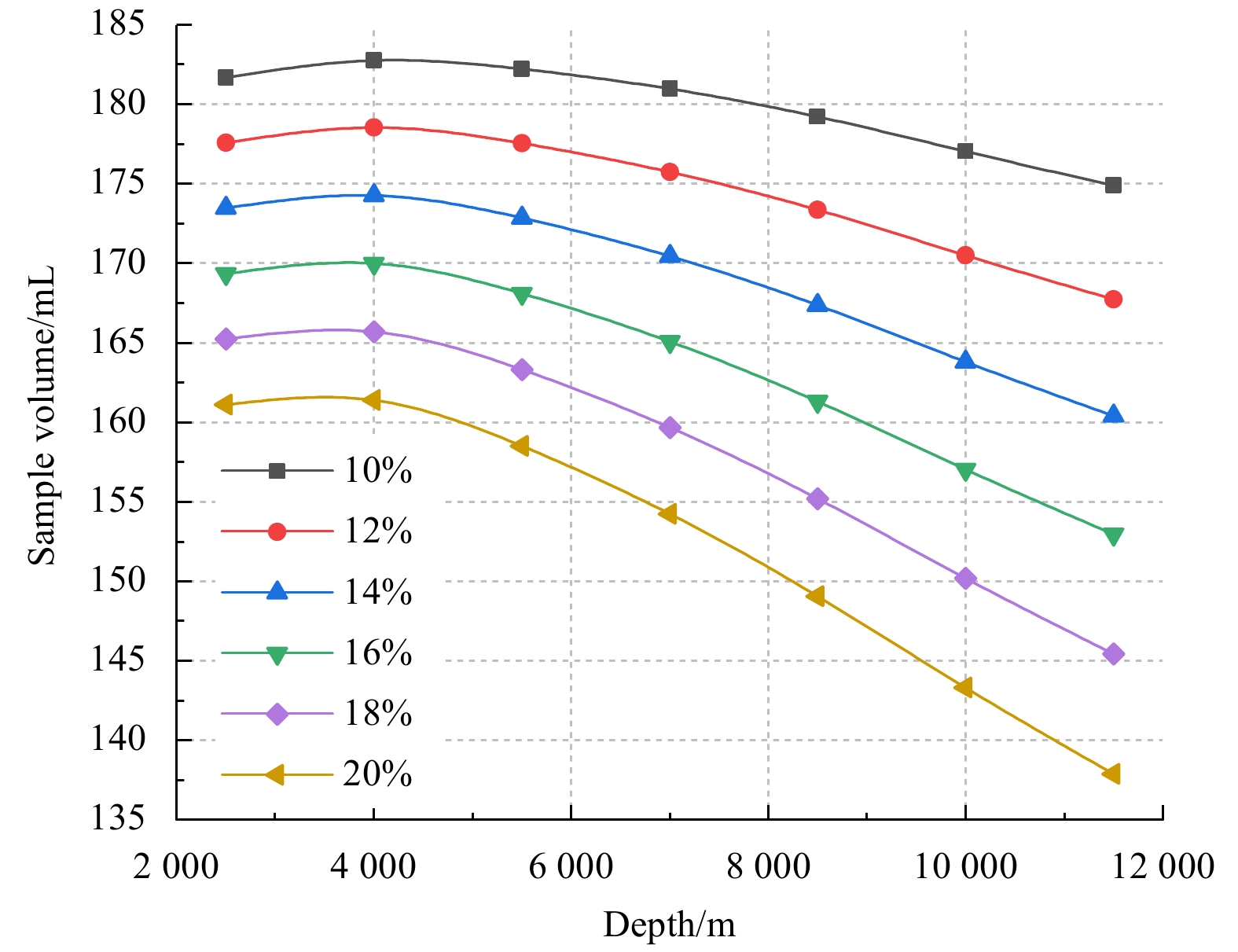
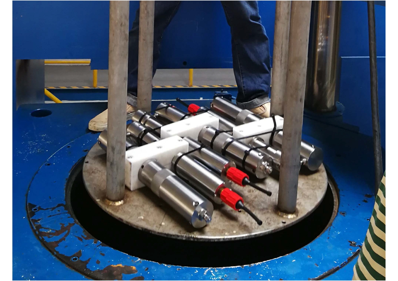
Compressed gas is usually used for the pressure compensation of the deep-sea pressure-maintaining sampler. The pressure and volume of the recovered fluid sample are highly related to the precharged gas. To better understand the behavior of the gas un...
Compressed gas is usually used for the pressure compensation of the deep-sea pressure-maintaining sampler. The pressure and volume of the recovered fluid sample are highly related to the precharged gas. To better understand the behavior of the gas un...


2020, 39(8): 96-102.
doi: 10.1007/s13131-020-1631-z
Abstract:
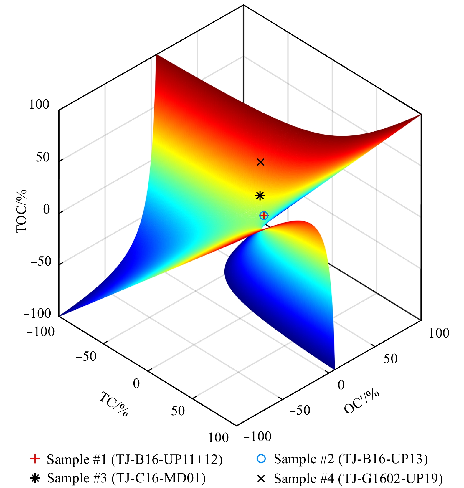
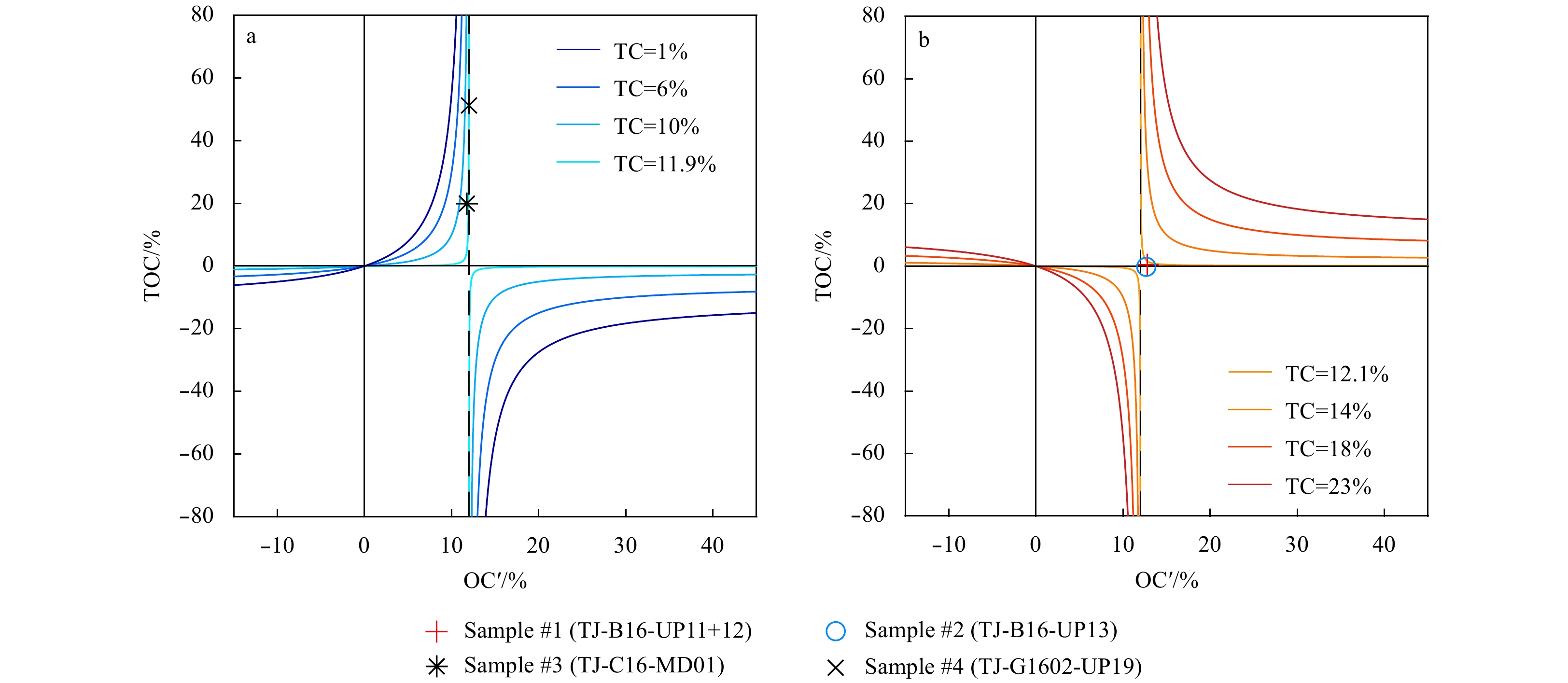
Organic and inorganic carbon contents of marine sediments are important to reconstruct marine productivity, global carbon cycle, and climate change. A proper method to separate and determine organic and inorganic carbons is thus of great necessity. A...
Organic and inorganic carbon contents of marine sediments are important to reconstruct marine productivity, global carbon cycle, and climate change. A proper method to separate and determine organic and inorganic carbons is thus of great necessity. A...
2020, 39(8): 103-112.
doi: 10.1007/s13131-020-1620-2
Abstract:
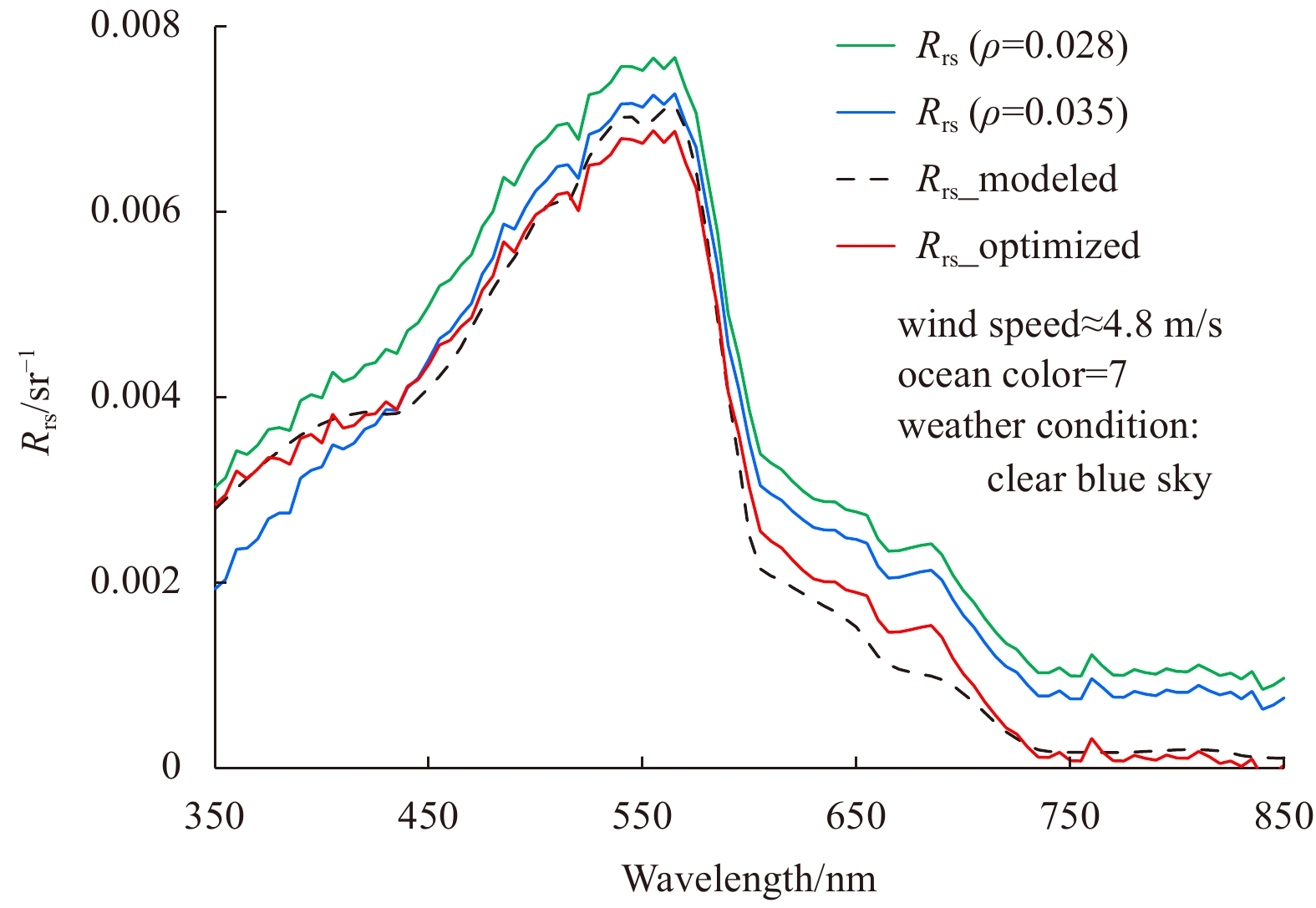
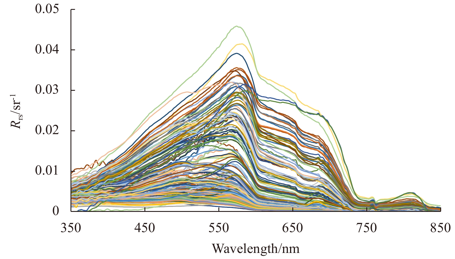
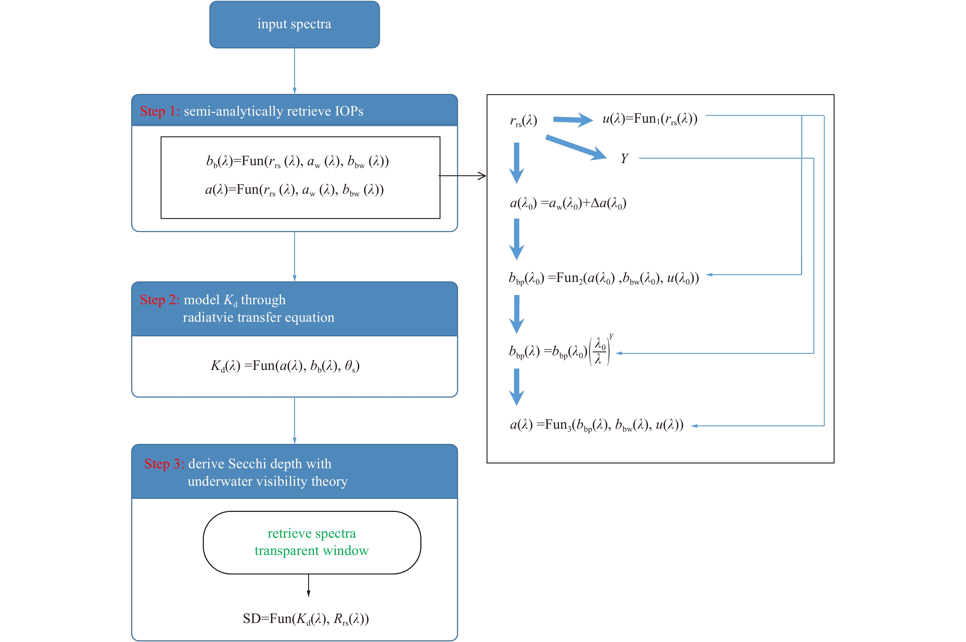
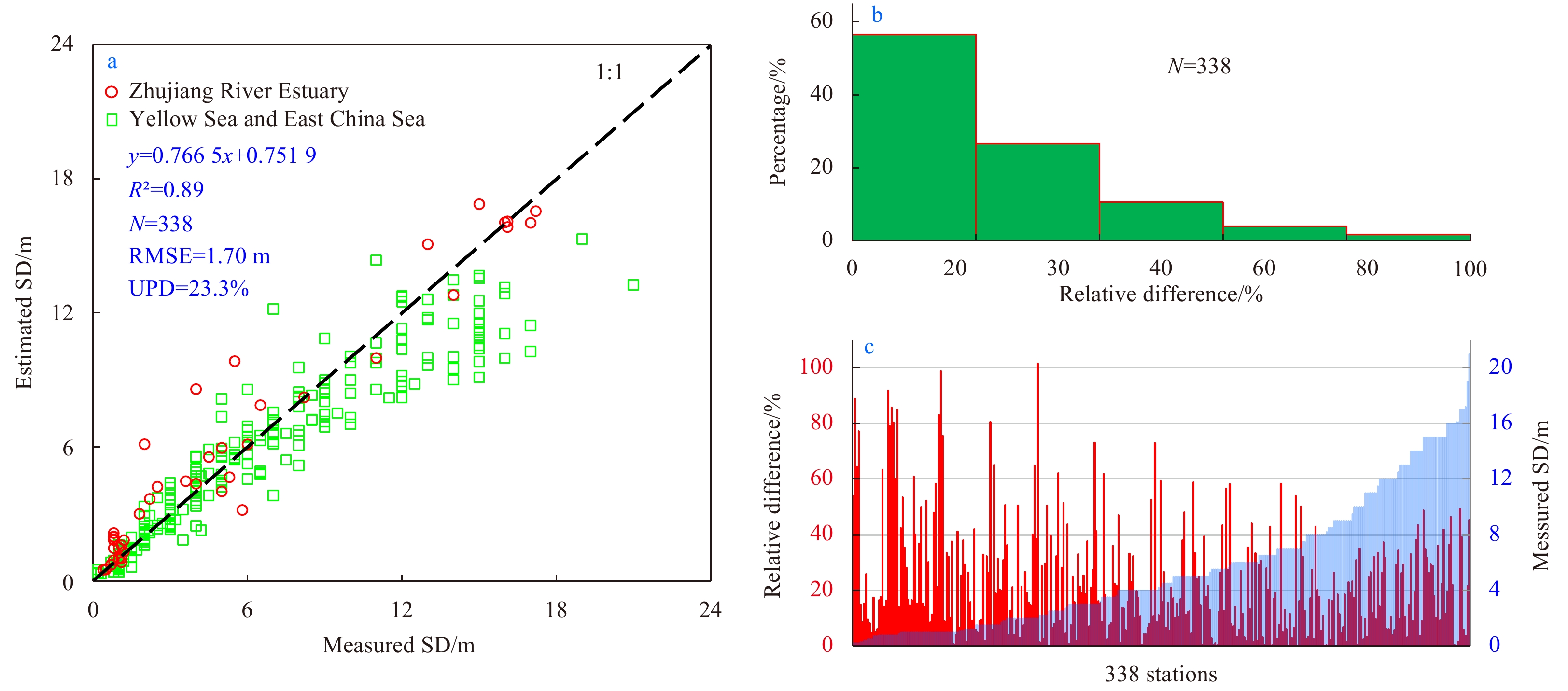
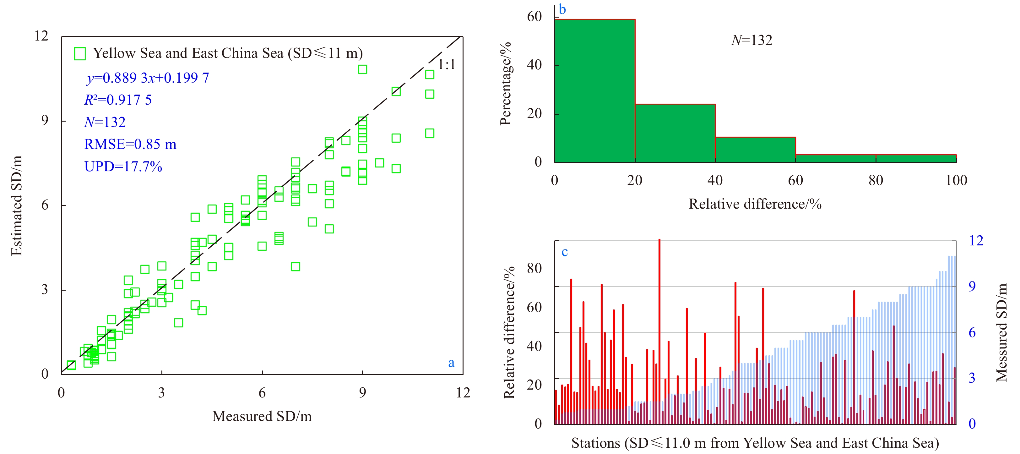
Secchi depth (SD, m) is a direct and intuitive measure of water’s transparency, which is also an indicator of water quality. In 2015, a semi-analytical model was developed to derive SD from remote sensing reflectance, thus able to provide maps of wat...
Secchi depth (SD, m) is a direct and intuitive measure of water’s transparency, which is also an indicator of water quality. In 2015, a semi-analytical model was developed to derive SD from remote sensing reflectance, thus able to provide maps of wat...


2020, 39(8): 113-120.
doi: 10.1007/s13131-020-1638-5
Abstract:
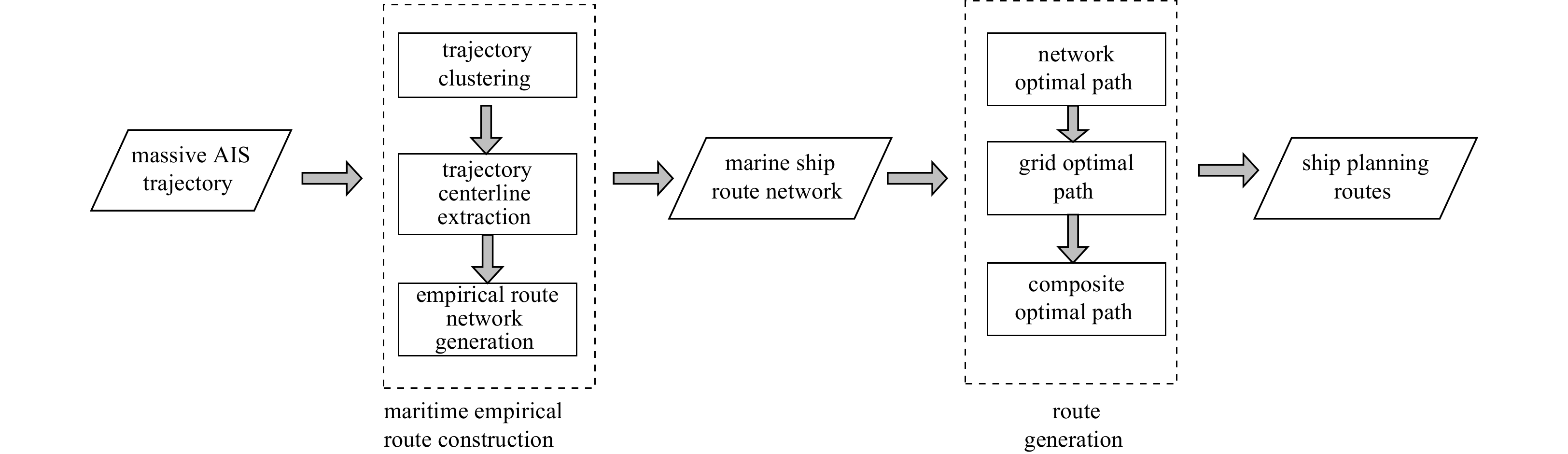
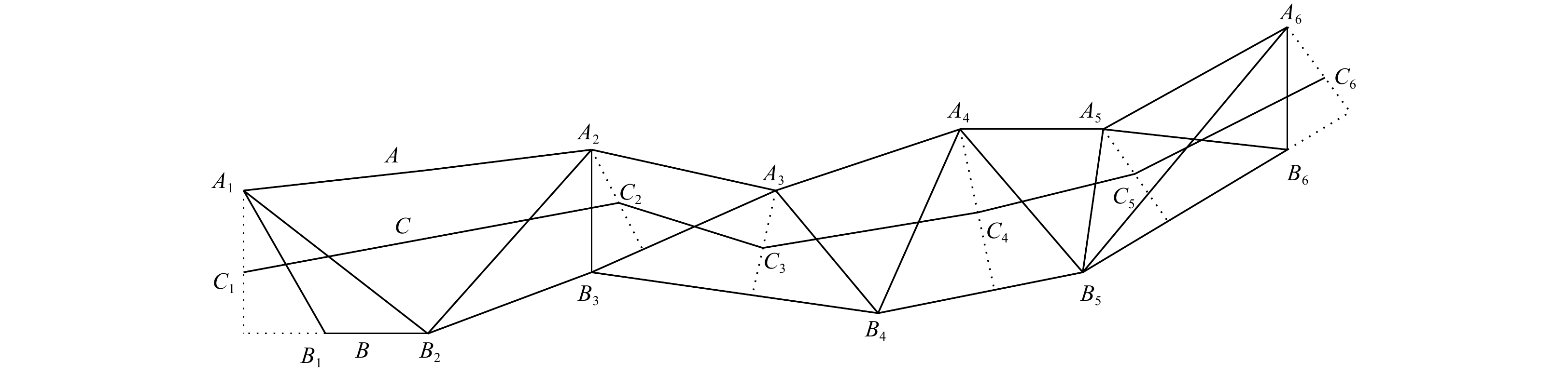
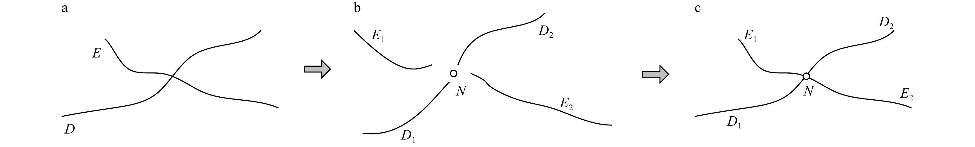
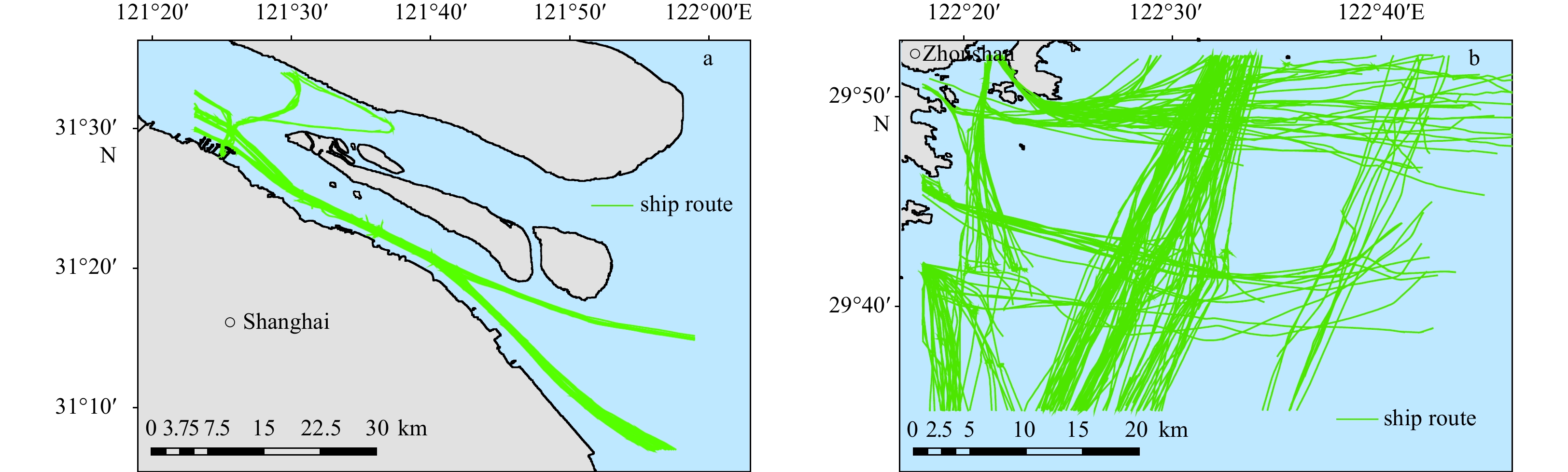
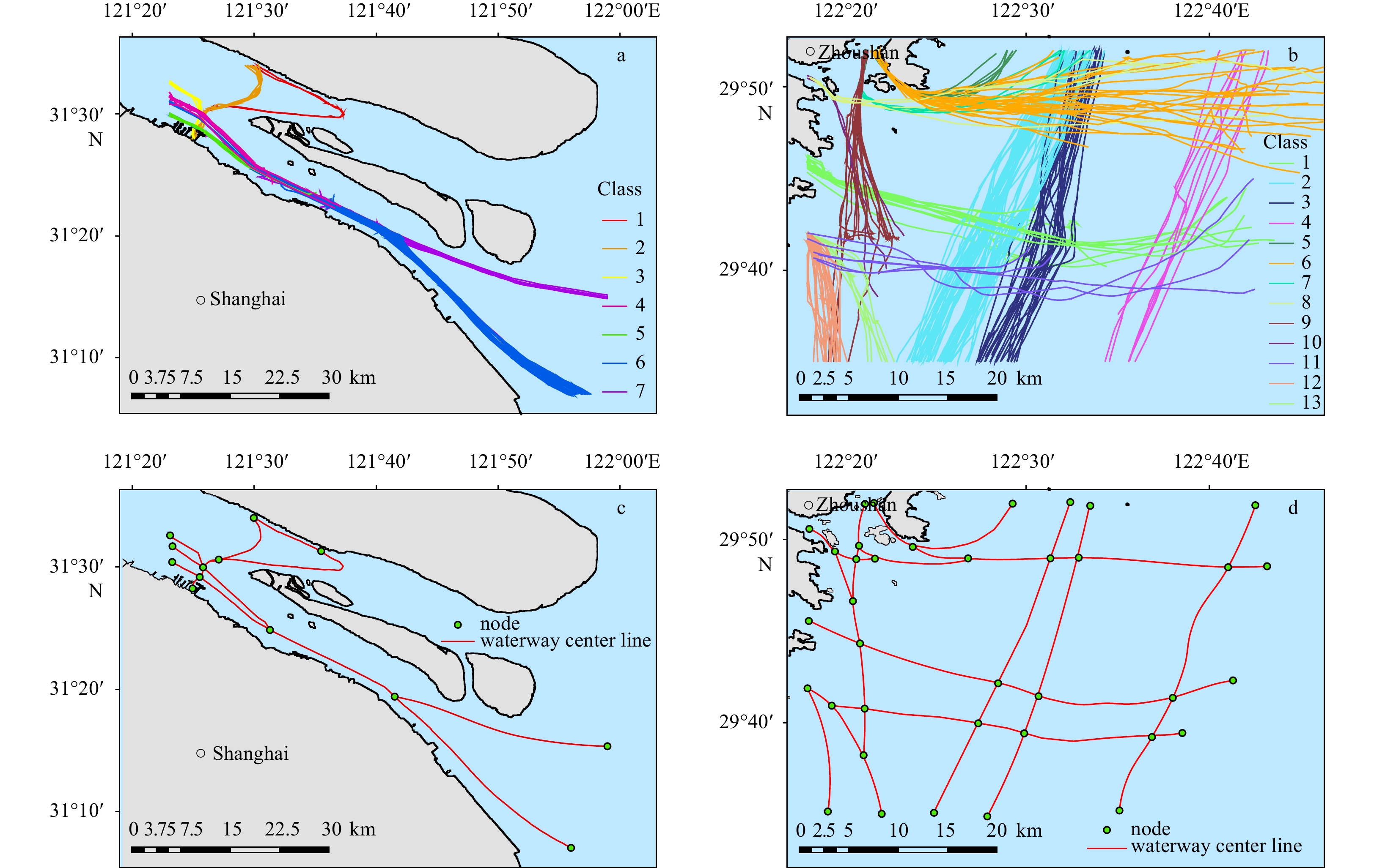
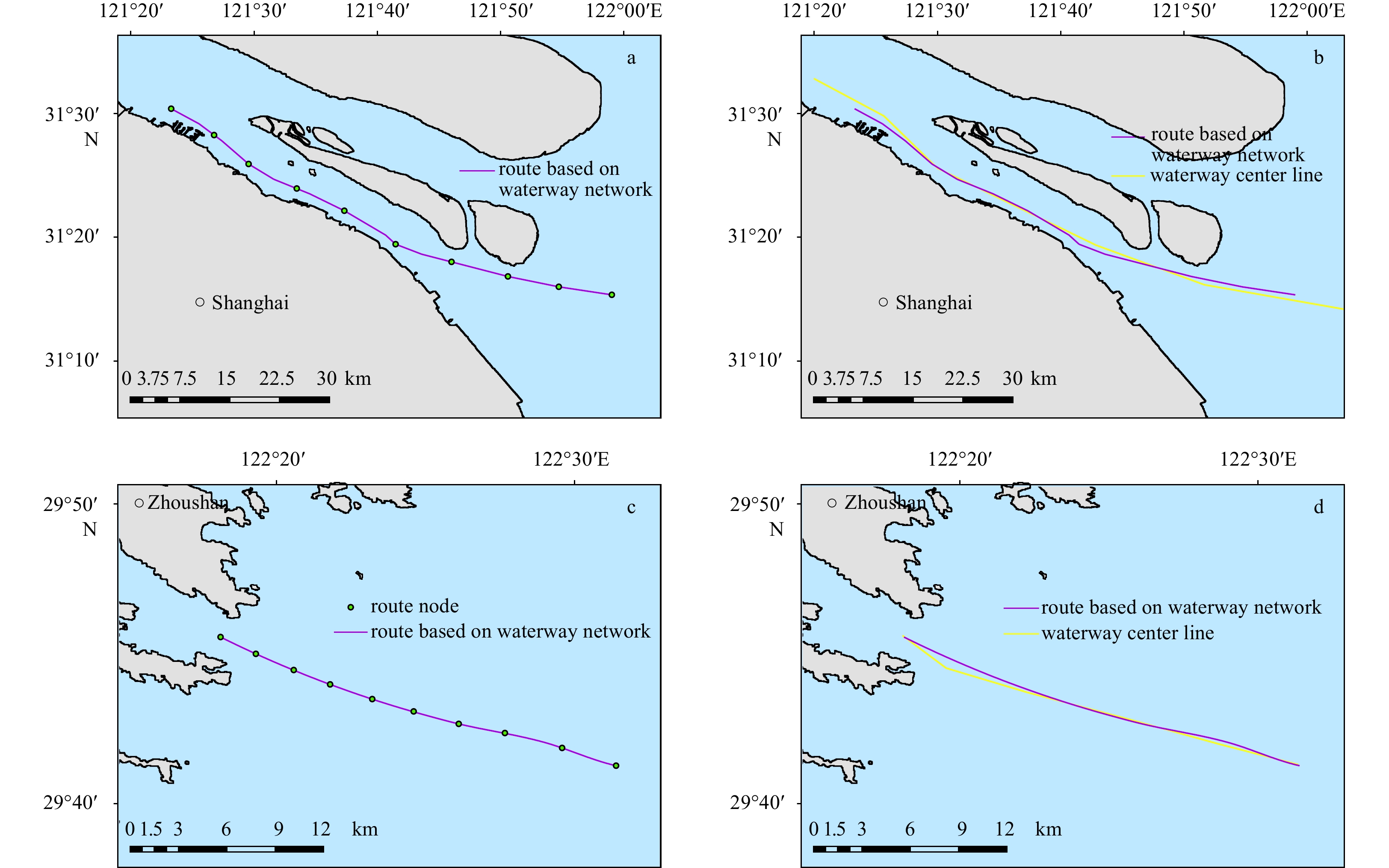
With the rapid development of the global economy, maritime transportation has become much more convenient due to large capacities and low freight. However, this means the sea lanes are becoming more and more crowded, leading to high probabilities of ...
With the rapid development of the global economy, maritime transportation has become much more convenient due to large capacities and low freight. However, this means the sea lanes are becoming more and more crowded, leading to high probabilities of ...